Most years after the De Anza Outdoor Club goes kayaking in Monterey on Spring break/and early fall quarter, we eat a little and head for Point Lobos, a few miles south of Carmel, for a short walk (.8 mile) and a longer hike (at least one of 1.4 miles).
Because Point Lobos is a reserve the number of cars that can enter at one time is limited.
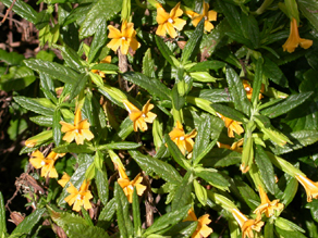
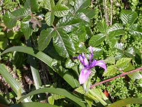
The trails have unobtrusive wire fences to keep people from walking and climbing all over and as a result there is lush growth of grasses, shrubs, wildflowers and poison oak. Staying on the trails and often walking only single file should keep you out of the poison oak, but beware, sometime it grows and hangs out of the tree branches overhead. Below: sticky monkeyflower and a photo of poison oak (with the set of three leaves) and iris.
The Department of the Interior notes that “during the past 5-year period, 3.2% of all injuries/illnesses reported by Interior Department employees have been cases of poison ivy, oak, or sumac. 1,070 of these 1,160 cases required medical treatment other than first aid or have resulted in a lost time illness.”
U.C. Berkeley tells us in a Wellness Report that the rash is a reaction to urushiol in the sap, stems, leave, even dead plants, that can survive on clothes, shoes, etc. “for months, even years and cause a reaction. Wear clean gloves when removing clothing and shoes. Wash clothes in a strong detergent and wipe off shoes.” If you get a rash, scratching it won’t cause it to spread but you should not scratch because it can cause infection. They also note that the rash can’t be spread from person to person, since “by the time the rash appears, the urushiol is gone.”
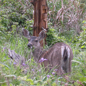
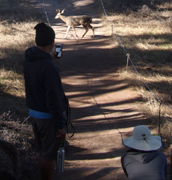
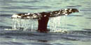
At Point Lobos there are sandy, pebbly and rocky beaches. Very visible wildlife includes Southern Sea Otters, Harbor Seals, California Sea Lions, gulls, white-crowned sparrows and cormorants. We’ve occasionally seen deer (like this one shown below eating just steps off the North Shore trail), white tailed Brush Rabbits, and occasionally Western Gray squirrels, Beechey ground squirrels and pelicans. Other residents include Pygmy Nuthatches, Chestnut-backed Chickadees, owls, coyotes, grey foxes, bobcats, raccoons, possums, skunks, badgers, and weasels. The Great Blue Herons nest in trees near Coal Chute Point. Brandt’s Cormorants and Black-capped Night Herons nest on Bird Island. Occasionally mountain lions come down from the hills beyond Point Lobos to hunt. Occasionally Northern Elephant Seals are haul out on shore temporarily. October to March you can find clusters of Monarch Butterflies.
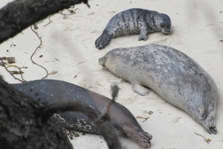
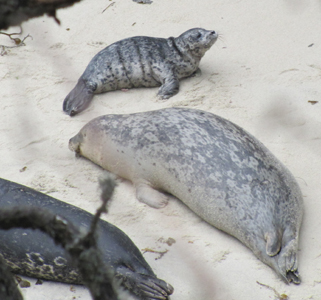
Below: seals on Bluefish Cove beach from our March 2014 trip. The pups are mostly born in April and May and can swim almost from birth
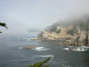
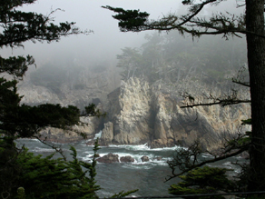
Some days the fog rolls in and sifts through the Monterey Pines. On foggy days you won’t be able to see far out to sea and watch whales migrating but on many of our hikes here we have seen them (as far as 3 miles offshore) with binoculars, December to mid-January on their southern migration and March to May on their return north.
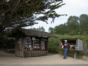
At the parking lot next to the trailhead for the Allan Memorial Grove there is a trailer with displays, an otter pelt, and postcards. A docent (volunteer) is there to answer questions. Restrooms are slightly up a trail to the left of and behind the trailer.
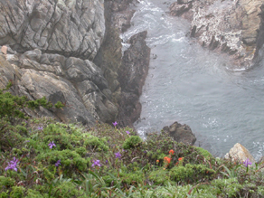
The peak of bloom of wildflowers is March and April. We are always struck by the spring colors. Some of the water is turquoise; the purple iris and red paintbrush dot the cliffs. There’s an abundance of rust colored algae on rocks and trees and grey stringy lace lichen on trees. The orange algae on the north side of trees/rocks on the Cypress Grove trail we walk does no harm to the trees.
J Smeaton Chase described paintbrush in 1911:
“It was here of a red so fierce and refulgent as to really require a new word to express it. The red poppy is a pale invalid beside this roistering gypsy. It pours out color, throbs with it, seems to shed it off like something palpable; and I can imagine that an essence or sublimation, too fine for our senses to perceive, goes up from each of these myriad blossoms, which could be kindled into flame, – the essential, elemental Red.”
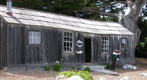
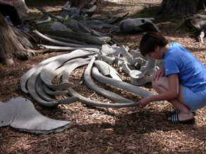
A short walk up the road from the Whalers Cove parking lot is the Whalers Cabin, (built by Chinese fishermen in the 1850’s) and Whaling Station museum, which is open as docent staffing permits. Displays outside include whale bones. Often they have a telescope for visitors to see, for example, seal babies on the rocks across the cove.
Picnicking is allowed at the areas with picnic tables which are marked on the map you can buy when you pay to enter the park (or see the link to a download at the end of this webpage). Fires, stoves and barbeques are not allowed.
This is not a park to be enjoyed merely by driving through. You can do that in less than ten minutes.
We always walk/hike the Allan Memorial Grove Trail, and the North Shore Trail including Cannery Point.
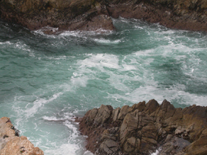
When we come during a storm in the winter we especially love to go out on the Sea Lion Point Trail to watch the huge waves break. If you do go at all close to the shore there truly are rogue waves that can knock you off your feet and sweep you out to sea, or at least get you soaked.
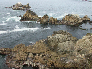
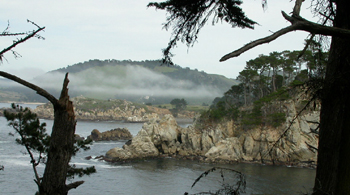
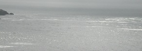
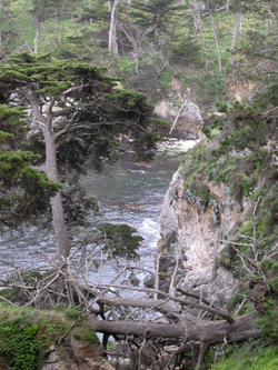
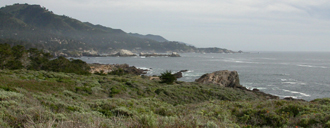
Most of the North Shore Trail has intimate coves like the ones shown above. The South Shore Trail has longer vistas like this photo taken from the Sand Hill Trail:
Trail map:
https://www.pointlobos.org/plan-your-visit/maps
Aerial photos of the coast are at: http://www.californiacoastline.org
Go there and search for Point Lobos, which got me to:
http://www.californiacoastline.org/cgi-bin/captionlist.cgi?searchstr=point+lobos
Details about the kayaking we do before these hikes are at:
Please read: