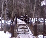
Yosemite valley has become a lake due to flooding many times in history and you can visualize the depth standing on Superintendent’s Bridge, which has a display that you can stand next to, showing the depth of the water during 5 major Yosemite valley floods.
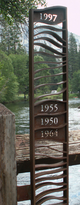
The water overflowed the bridge to these heights as measured from the bridge deck:
Dec. 11, 1937 2.7 feet
Nov. 18, 1950 3.9 feet
Dec. 23, 1955 4.1 feet
Dec. 23, 1964 3.8 feet
Jan. 2, 1997 5.3 feet
(If this display were to be removed, you can still visualize the depth of the water by seeing that a person 5 feet tall would be, in effect, under water during the 1997 flood.)
The locations of film footage are labeled in each of these videos (courtesy of the National Park Service)
Here is a video of floods in 1996 and 1997, :
and see 2017 flooding:
and 2018 flooding:
– – – – – – – – – – – – – – – – – – – – – – – – – – – – – – – – – – – – – – – – – – – – – – – – – – – – – – – – – –
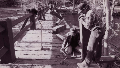
Below, a NPS photo of the bridge being rebuilt after the 1997 flood:
– – – – – – – – – – – – – – – – – – – – – – – – – – – – – – – – – – – – – – – – – – – – – – – – – – – – – – – – – –
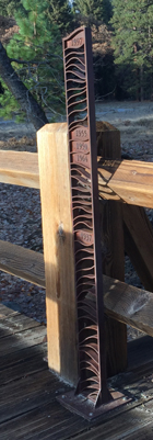
When you walk up the stairs onto to the bridge from the north, the metal sculpture is on the left hand side.
![]()
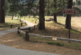
Cook’s Meadow hike (or walk) , has various maps and descriptions of routes to find Superintendent’s Bridge from the visitor center, free shuttle bus stops, from the path from Swinging Bridge and the parking lot along southside drive just before the chapel.
On your Cook’s Meadow walk, you may see a sign showing the depth of the water near a small parking lot during the 1997 flood:
How much water will there be in the Yosemite waterfalls?
How much water has been flowing the last few days?
To see the water flow at Happy Isles where the section of the Merced River that fills Vernal and Nevada falls enters the valley, click on this webcam link:
http://ca.water.usgs.gov/webcams/happyisles/
You can also find a Weekly Video & Image Archive.
How cold is the water in the Merced River in Yosemite valley right now? Scroll down at:
https://waterdata.usgs.gov/nwis/uv/?site_no=11264500
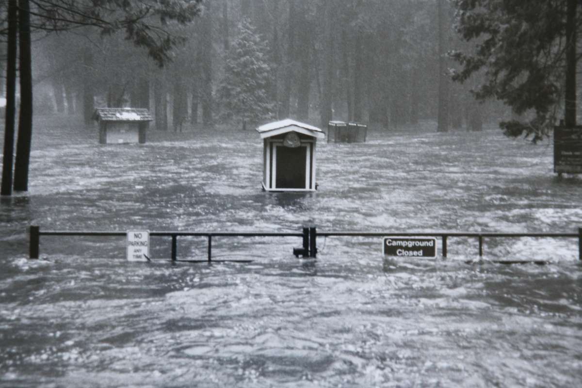
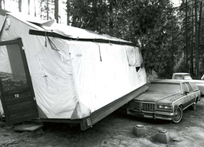
This park service photo above, of flooding during the 1997 flood, is from:
https://www.nps.gov/yose/learn/management/1997-flood-recovery.htm
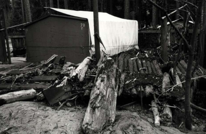
and here are more photos from the park service of the damage:
at Housekeeping camp
at employee housing in what was called Camp Six and is now the day use parking and round-about
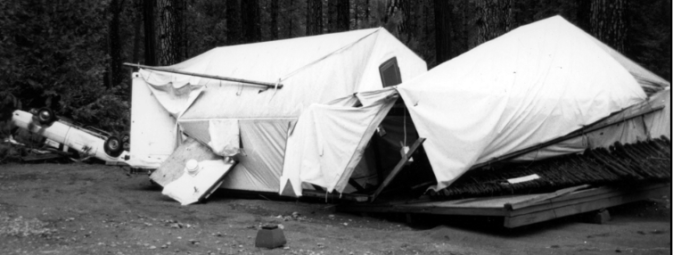
and another at Camp Six:
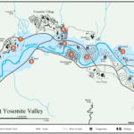
see a larger version of this Park Service map of the extent of flooding in east Yosemite Valley during the January 1997 flood
at Yosemite Valley spring runoff and flooding
![]()
DEPARTMENT OF THE INTERIOR
U.S. GEOLOGICAL SURVEY
ROCK FALLS IN YOSEMITE VALLEY, CALIFORNIA
https://pubs.usgs.gov/of/1992/0387/report.pdf
Says of the many quotes from John Muir ”His geomorphic theories and conclusions regarding the glacial and mass movement processes responsible for the formation of Yosemite Valley are still sound.”
It has historical accounts of results of flooding, including
“ . . . Floods may have caused some of the rock-fall effects evident
in early photographs of the valley. A rainstorm that began on January 2, 1862, and continued unabated for 4 days led to flooding of the Merced River that interrupted the attempted travel of James Hutchings to Yosemite. The specific effects of this storm in Yosemite were not directly observed but could well have caused rock falls. During the 1867 flood, Hutchings and his family were the only residents of the valley . . .
“On December 23, 1867, after a snow fall of about three feet, a heavy down-pour of
rain set in, and incessantly continued for ten successive days * * * throughout the
entire Valley * * * each rivulet became a foaming torrent * * * The whole meadow
land of the Valley was covered by a surging and impetuous flood to an average depth
of nine feet Bridges were swept away * * *.
“Immense quantities of talus were washed down upon the Valley during the storm,
more than at any time for scores, if not hundreds, of years * * *.”
![]()
The author of this webpage, (written as for my students), does not give any warranty, expressed or implied, nor assume any legal liability or responsibility for the accuracy, completeness, or usefulness of any information, product, or process included in this website or at websites linked to or from it. Users of information from this website assume all liability arising from such use.