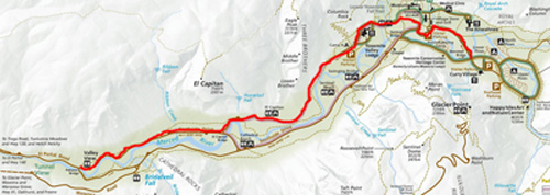
In the map below you can see roads leading to the Yosemite Village free day use parking lot, (also known as Yosemite Village Parking or Camp 6 parking area) at free shuttle bus stop #1.
and farther below find a close-up more detailed map and photo of parking rows and this roundabout (that is no longer used as a circular roadway / rotary / traffic circle)
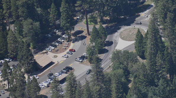
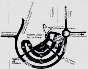
The parking lot is, in the map directly below, the black square with a white P in it, labeled as Yosemite Village Parking and the round-about is the tiny circle to the upper right of the black square.
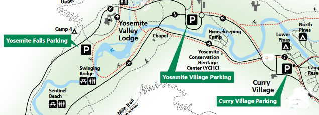
The parking lot / round-about is accessed via the one way road from Pines Campgrounds, Curry Village (briefly named Half Dome Village), Curry Village free day use parking lot, coming into the roundabout from the east.
After this one-way road section leaves the Curry Village / Pines Campgrounds area, it eventually bears left, goes past one side of the Ahwahnee meadow, and brings you to the round about that is no longer used as a circular road as you might be used to.
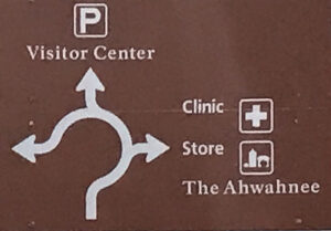
The first set of signs you will see (photo below) tells you:
Left Lane
Curry Village
Yosemite Valley Lodge
Right Lane
The Ahwahnee
Clinic
Yosemite Village
(The photo below shows two lanes for vehicles on the left hand side, two lanes for bikes/pedestrians on the right hand side of the photo.)
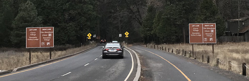
You should anticipate which lane you want to be in, and also anticipate that many people will not realize which lane they should be in and may change lanes suddenly or even come to a full stop in the roadway.
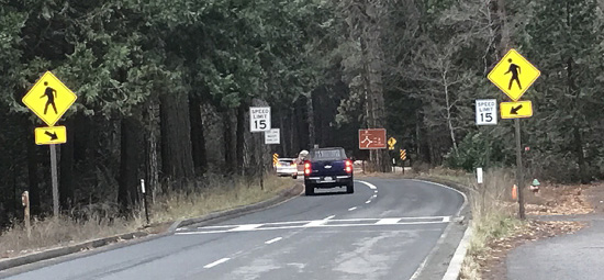
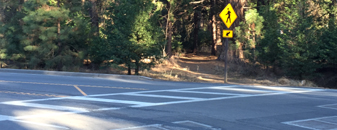
Past these signs, before the round-about, there are signs warning of a pedestrian crosswalk,
15 mile per hour speed limit signs, and another sign tells you that the Left Lane Must Turn Left (and go around one side of the former round-about)
If you want to go to the Yosemite Lodge, Camp 4 (Camp Four), Yosemite Falls free day use parking or back out of the park, you circle around the round about from either lane and continue on Northside Drive.
Northside Drive runs almost the length of Yosemite Valley as a one-way road, from east to west, as outlined in red on the map below:
OR use the two-way road directly to the north of the roundabout that goes past the back of the Village Store on the west, the garage on the east and to a “T” intersection with two-way Ahwahnee Drive, which can take you to the Medical Clinic, Church Bowl picnic area and the Ahwahnee Hotel (for awhile named the Majestic Yosemite Hotel). (When this roadway north of the round-about needs to be closed, traffic is “detoured through the day-use parking lot and back onto Village Drive by the garage.”)
You briefly enter the round-about and turn right, as shown in this sign showing the right lane route:
OR to go the the Yosemite Village Day Use Parking Lot, (Visitor Center on the sign above), use the right hand lane and either look for the driveway in that goes off the round-about, or the driveway in further down Northside Drive, past the free shuttle bus stop #1.
– – – – – – – – – – – – – – – – – – – – – – – – – – – – – – – – – – – – – – – – – – – – – – – – – – – – – – – – – –
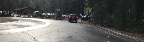
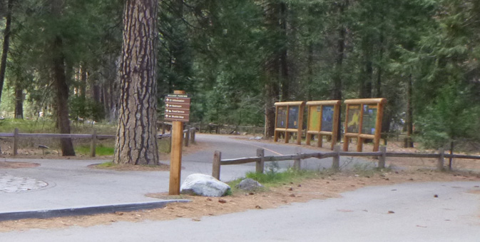
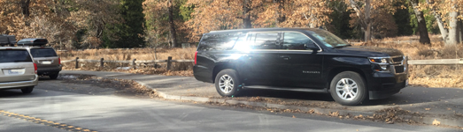
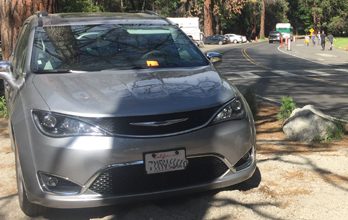
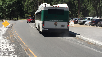
A photo of the roundabout with a truck entering from the one way road from the east, and the shuttle bus stop #1 driveway that you should not try to use for parking:
![]()
– – – – – – – – – – – – – – – – – – – – – – – – – – – – – – – – – – – – – – – – – – – – – – – – – – – – – – – – – –
The first entrance / driveway to the Village / Yosemite Valley Welcome Center day-use parking lot exits the not-really-a-round-about just past the north of the round about,
The car at the center/right of this photo is just turning into that first driveway:
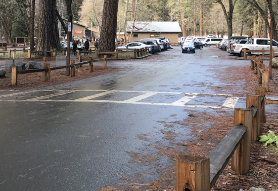
Just after you come in through the first entrance in the photo above,
the main section of this day use parking lot is to the left.
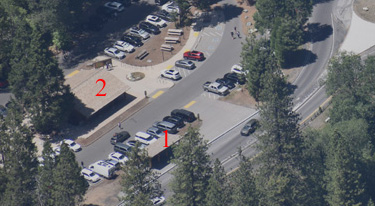
In the photo below the red letter 1 is the roofed shelter for shuttle bus stop #1, the red letter 2 is the restroom building:
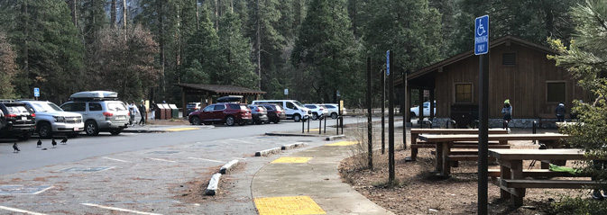
The photo below has the Yosemite Valley Free Shuttle bus stop #1 roofed area just to the left of center, a restrooms building on the right, and a long row of handicapped parking spaces and some picnic tables:
and just after you drive in through the first entrance, to your right there is a roadway to the main grocery and the new in 2024 Yosemite Valley Welcome Center
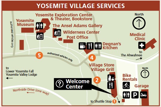
The map below, courtesy of the park service, shows the services just to the north of the
free day use parking lot (the letter P in the lower right corner of the map)
A second entrance is farther down Northside Drive, at the far left of this photo: (This entrance can be blocked by pylons when the lot is full.)
– – – – – – – – – – – – – – – – – – – – – – – – – – – – – – – – – – – – – – – – – – – – – – – – – – – – – – – – – –
RVs and trailers should not park in Yosemite Village free parking,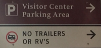
but should instead try to find parking at the Yosemite Falls parking lot. Or RVs and trailers should go to their campsite and park there and use the free shuttle bus, ride bikes, walk, stroll, hike to get around the east end of Yosemite valley.
– – – – – – – – – – – – – – – – – – – – – – – – – – – – – – – – – – – – – – – – – – – – – – – – – – – –
Take a photo on your smart-enough phone,
standing a bit away from where you parked,
so you will be able to find your vehicle.
When you get on a shuttle bus, (note the shuttle bus stop number) turn around briefly and look back in the parking lot to find where your vehicle is (to the right, left, straight ahead, how many rows back?) and you will be able to find it much more easily when you return it it after a day of sightseeing.
– – – – – – – – – – – – – – – – – – – – – – – – – – – – – – – – – – – – – – – – – – – – – – – – – – – –
Details about 24 hour towing within the park for some vehicles, propane service, minor emergency repairs, how to use your Auto Association card to get their help, and more are at Yosemite garage, car repairs and towing. At that page you will find a list of locations of Electric Vehicle (EV) charging stations at the various hotels, near campgrounds, the Welcome Center and more.
Yosemite Valley Welcome Center (Yosemite Village) has electric vehicle (EV) charging stations located in the parking lot on the east side of the Yosemite Valley Welcome Center. This station features four level 2 chargers. Chargers have a J1772 connector.
– – – – – – – – – – – – – – – – – – – – – – – – – – – – – – – – – – – – – – – – – – – – – – – – – – – –
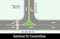
The round about and day use parking was previously accessible from Southside Drive via a two way road over Sentinel bridge, but there is longer a right turn on the section of Northside Drive to get to the Yosemite Village Parking or the round-about (or to the Ahwahnee Hotel, Medical Clinic, Village Store). This Northside Drive road section is now one way only, leading to to the Yosemite Lodge, Camp 4 and park exits.
People who do not follow signage often cause yet another preventable traffic backup.
Anytime there is a rockfall, one way roads can need to become two-way. All the signs, roadways, etc. shown at this webpage could change without notice, so take a look before you make any turns.
– – – – – – – – – – – – – – – – – – – – – – – – – – – – – – – – – – – – – – – – – – – – – – – – – – – – – – – – – –
At the back end (northwest corner) of this parking lot there is a short walk
(sometimes faster than waiting for a shuttle bus)
or bike path to the Village Store (biggest grocery)
and to
Degnan’s, Yosemite Exploration Center (formerly the main Visitor Center) / theater / bookstore, Ansel Adam’s gallery, museum, Post Office, etc. (you can find detailed descriptions about these facilities at free Yosemite Valley Shuttle bus.
The path looks like this as you go towards towards it in the parking lot:
– – – – – – – – – – – – – – – – – – – – – – – – – – – – – – – – – – – – – – – – – – – – – – – – – – – – – – – – – –
To the northwest of the Yosemite Village day use parking lot
there is a wide cross walk across Northside Drive
pedestrians can use to get to the parking area at Sentinel Bridge for a walk at Cook’s Meadow
But be prepared for drivers who do not stop for you,
even with such an obviously well marked crosswalk.
– – – – – – – – – – – – – – – – – – – – – – – – – – – – – – – – – – – – – – – – – – – – – – – – – – – – – – – – – –
Northside Drive runs almost the length of Yosemite valley, mostly one way. form east to west (the red line on the map below).
When you leave the day use parking to go elsewhere in Yosemite valley, or to leave the valley, you will be on Northside drive and you need to know which lane to be in (or your drive could be much longer than planned.)
You will be driving towards the intersection of Northside Drive and the road coming in from the left that goes over Sentinel Bridge and around the east end of Yosemite Valley. Please anticipate other drivers who were not sure which lane to be in and will change lanes suddenly or even stop in the traffic lane to consult a map.
You will be coming on Northside Drive as shown at the bottom of this map of the intersection:
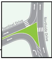
Be in the right hand lane (the straight ahead arrow at the bottom of the mini-map above) to leave Yosemite Valley (via either 140, 41 or 120), go to Yosemite Valley Lodge, Camp 4 (Camp Four), or the upper and lower Yosemite Falls trails and Yosemite Falls day-use parking lot.
Be in the left hand lane (the turn left arrow at the bottom of the mini-map above) to go to Housekeeping Camp, Curry Village, Curry Village Day-use parking and the Pines Campgrounds. Please note that as you bear left in this lane you end up crossing Sentinel Bridge in the left hand lane, rather than the right hand lane you are used to driving on. (There are barriers between the lanes along this stretch of road.)
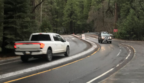
Here a view with a vehicle coming from Southside Drive across Sentinel bridge (right hand lane)
and a truck coming from Northside Drive on Sentinel Drive towards the bridge (left hand lane)
in what feels like the wrong lane to be in, even when you have done it quite a few times
(note the width and height of the barrier between the lanes):
See this map of the intersection of Sentinel Drive and Southside drive:
![]()
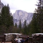
At the back of the parking lot, on the northern end, along a path to the Village store area, there have been displays of color photo trail maps
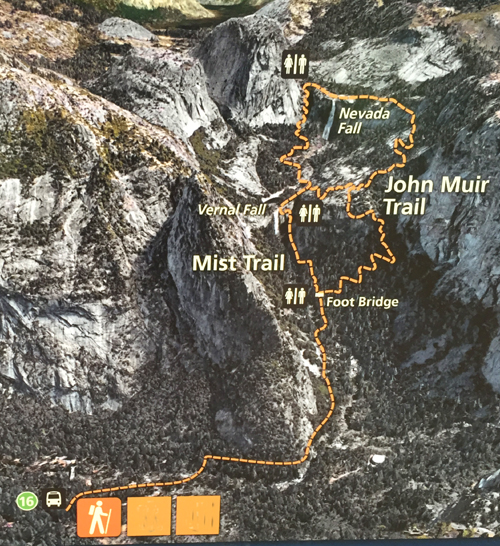
including this of the two ways to go to Vernal and/or Nevada Fall, (most people go up the Mist trail and down the John Muir trail and in winter only some parts of the trail may be open, see Mist Trail info.)
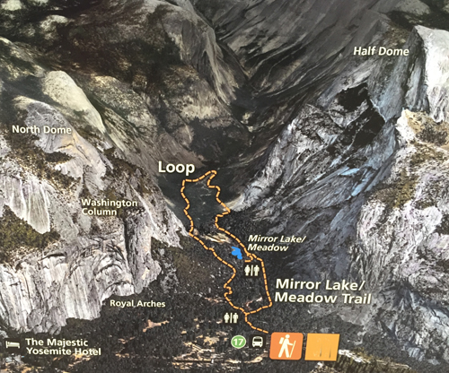
This shows the loop trail to Mirror Lake from shuttle stop #17 (but also see an alternative trail from the Ahwahnee (once temporarily named the Majestic Yosemite Hotel) about half way down the webpage at this map.
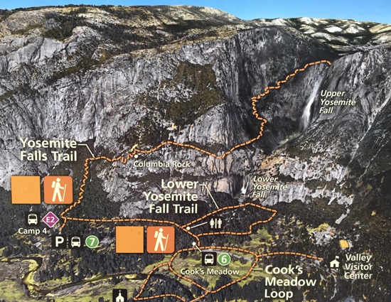
This shows the trails to lower Yosemite Falls from shuttle stop #6, the trail to Columbia Rock and on to the top of Upper Yosemite Fall, and the trail thru Cook’s Meadow.
If you take the lower section of the figure-8-ish Cook’s Meadow loop, you will cross a bridge with a display about the many times Yosemite Valley has flooded so badly it has become a lake.
See more color photo trail maps at a display in front of the Exploration Center (formerly the main valley Visitor Center).
– – – – – – – – – – – – – – – – – – – – – – – – – – – – – – – – – – – – – – – – – – – – – – – – – – – – – – – – – –
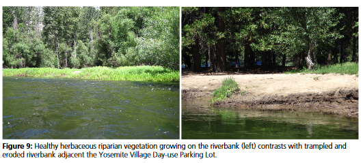
Please respect fencing designed to keep people from walking off of official pathways & trails and wearing out plants, killing wildflowers. Below, on the right, the eroded river bank below the Yosemite Village day use parking lot:
– – – – – – – – – – – – – – – – – – – – – – – – – – – – – – – – – – – – – – – – – – – – – – – – – – – – – – – – – –
Descriptions of each free shuttle bus stop
and ways to use the shuttle bus effectively, and save time,
find activities/trailheads/restaurants/showers
are at: Yosemite valley free shuttle bus.
– – – – – – – – – – – – – – – – – – – – – – – – – – – – – – – – – – – – – – – – – – – – – – – – – – – – – – – – – –
You might also want to read How to not collide with a deer,
Safe driving in rain and fog,
Prepare for winter driving,
and/or wildlife jams
Road trip advice and etiquette has ideas for limiting boredom, getting along on a road trip and some packing and safety tips.
Overnight lodging in Yosemite Valley
Swimming in Yosemite National park, including pools open to the public and notes about relatively safe and unsafe places to swim on rivers, etc.
– – – – – – – – – – – – – – – – – – – – – – – – – – – – – – – – – – – – – – – – – – – – – – – – – – – – – – – – – –
Cell phone service is NOT available in all parts of Yosemite.
It is usually okay in the vicinity of the Exploration Center.
Many years we got 4 bars for Verizon and 3 bars for AT&T near the Exploration Center, versus 2 bars for each at the Ahwahnee and 2 bars Verizon, 1 bar AT&T in Upper Pines campground, at the Yosemite Valley Lodge, Curry Village and some other locations in East Yosemite Valley.
The park service said: “Cell phone coverage in Yosemite is spotty . . . Cell service is often impacted during daily peak visitation by the large number of people trying to access limited service; if you have four bars of service, but you can’t get a signal, this is why . . . cell coverage depends on your phone, the cloud cover and other seemingly mysterious factors and is not always reliable. ”
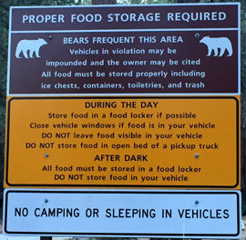
Bears do break in to vehicles in Yosemite National Park (potentially year-round) and food storage rules apply all over the park, as in this sign at a day-use parking lot:
You might find a dumpster in the parking lot.
![]()
In the photo above, the note on it says:
“Dumpster Full
This dumpster is full and has been wired shut to prevent black bears from accessing the overflow trash. Please do your part in protecting Yosemite wildlife by finding another dumpster to dispose of your trash. Thank you.”
PLEASE, when a dumpster is full don’t just leave your trash sitting next to it, find another dumpster.
__________________________________________
The National Park Service warns:
“Each year, Yosemite National Park welcomes over four million visitors. If you are planning to visit Yosemite, plan ahead and arrive early. In summer, expect extended traffic delays and extremely limited parking. Expect delays of an hour or more at entrance stations and two to three hours in Yosemite Valley . . . If you are planning to visit Yosemite valley by car for the day, arrive before 9 am, after which parking is usually full.
Parking is available at Yosemite Village, Curry Village (briefly named Half Dome Village), and near Yosemite Falls. If you find a parking space, plan to leave your car there; you will not be able to find another parking spot. Use the free shuttle to get around Yosemite Valley.
If you have lodging or campground reservations, park your car at your lodge or campground and use the shuttles to get around.
Once all parking in Yosemite Valley is full, you may be redirected to other areas (which will also have limited parking).”
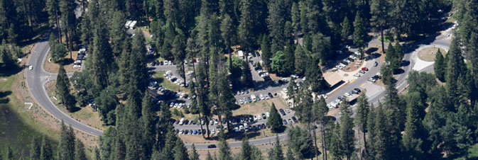
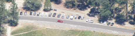
Here is a map of the three main Yosemite Valley day use parking lots,
each with a black box with the letter P in white in it.
__________________________________________
Almost all sides of all roads in Yosemite valley are closed to parking. There are a few turnouts and you can park along sections of some roads if you get there early enough.
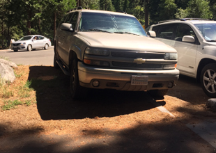
In December, when there were plenty of parking spaces in all the free day use parking lots, there were quite a few adults in this SUV that parked at the end of a roadway on the bike path, fully blocking the bike path:
Does this driver park on sidewalks at home? Did the adult passengers really not notice the height of the curb, to be able to tell the driver that they were perhaps not parked where they should be?
– – – – – – – – – – – – – – – – – – – – – – – – – – – – – – – – – – – – – – – – – – – – – – – – – – – – – – – – – –
When a helicopter needs to land in the Ahwahnee meadow across the road from Church Bowl, to pick up someone who needs to go to a bigger hospital, (or when a helicopter needs to land for Search and Rescue training) people are asked to stay on the restroom/picnic area side of the road, and traffic going through is briefly stopped.
Because you won’t know a helicopter is coming and won’t be able to move your vehicle fast enough, the entire meadow side of the road at Church Bowl is closed to any parking at all times, (even to get out and quickly take a picture or use the restroom).
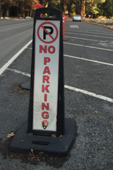
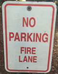
In this photo you can see a few parking spaces in a row alongside the restroom/picnic area side of the road and the stripes for no parking with big letters on the pavement that say NO PARKING, on the other side of the road:
When the stripes did not function to keep people from parking there, the park started setting out a row of red pylons and tall no parking signs, which people still ignore, as in the car at the top of this photo that drove between the pylons to park:
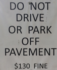
And on the far end of the Church Bowl restroom/picnic area side of the road, a car parked off the side of the road, not in a parking space, (off road behind a large rock meant to deter anyone from parking there) with a parking ticket with a minimum $130 fine (ticket under the windshield wiper) in this photo:
– – – – – – – – – – – – – – – – – – – – – – – – – – – – – – – – – – – – – – – – – – – – – – – – – – – – – – – – – –
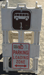
Putting on your emergency flashers when you pull into a free shuttle bus stop driveway does not turn it into a parking space for you, and when the shuttle bus arrives you will be honked at to move, as the red car below was:
Did they not see the two signs at the side of the shuttle stop driveway/shuttle parking space?
– – – – – – – – – – – – – – – – – – – – – – – – – – – – – – – – – – – – – – – – – – – – – – – – – – – – – – – – – –
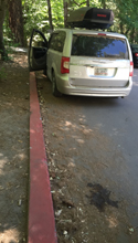
A red painted curb is a no parking zone anywhere in the U.S., (including Georgia, where this mini-van was from), and in national parks, in part because some red curbs mark the space an ambulance or fire truck would need to get by. Yes, no parking is allowed even if one family member stays in the vehicle while the other rushes in to shop:
– – – – – – – – – – – – – – – – – – – – – – – – – – – – – – – – – – – – – – – – – – – – – – – – – – – – – – – – – –
Each space in a parking lot is usually paved, has painted stripes and has a concrete beam your tires would hit to keep you from going too far (see the car on the right). In this photo, the driver of the SUV on the left decided to move into the dirt/plants to the side of a parking space at the end of a row, with tires slightly into the legal space already occupied by someone else. Ooops, tires partially in that space does not make it legal.
– – – – – – – – – – – – – – – – – – – – – – – – – – – – – – – – – – – – – – – – – – – – – – – – – – – – – – – – – –
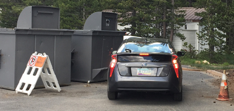
Did this driver from Arizona move the no parking a-frame sign over, or was it already moved over and he choose to ignore the sign, red cone, “No Parking” in large letters on the pavement and two giant trash dumpsters?
– – – – – – – – – – – – – – – – – – – – – – – – – – – – – – – – – – – – – – – – – – – – – – – – – – – – – – – – – –
And, yes the following signs are sometimes also ignored, “it’s just for a minute so it’s okay, right?”
![]()
__________________________________________
__________________________________________
Some park visitors have found themselves
spending a lot of time tracking down
where their vehicle was towed to,
or where their ice chest / cooler was taken
when a Ranger confiscated it
from their open pickup truck bed.
__________________________________________
__________________________________________
Top reasons to not speed in a National Park.
– – – – – – – – – – – – – – – – – – – – – – – – – – – – – – – – – – –
When Yosemite Valley flooded in 1997, this parking lot was called Camp six and had employee housing in large tent units. Here are photos of some of them after the flood waters receded:
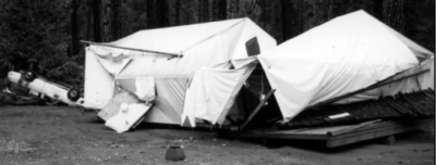
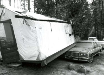
During the 1997 flood, according to the NPS, “Camp Six – 80 wood framed employee tent cabins and support facilities floated off their footings and destroyed attached underground gas and overhead electric utilities. Several contractors used this location as a construction staging area. Field offices, stockpiles of material, and equipment were extensively damaged. The concessioner stored seven tour tram vehicles in this area. Major engine damage occurred when they were submerged.”

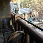
You have a number of lodging choices of where to stay overnight in Yosemite Valley in Yosemite National Park, including campsites or
wood-walled cabin without a bath; heated or unheated wood floored, canvas sided and roofed tent cabin; wood walled cabin with a bath
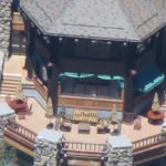
luxury or generic hotel rooms, suites with a bath
__________________________________________
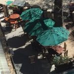
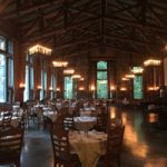
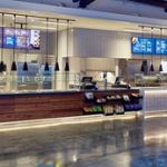
You can find basic to extravagant, (a few with a dress code),
casual, fast (grab and go)
or with table-side service,
indoor and outdoor food service
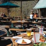
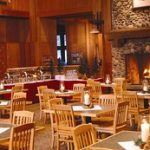
at multiple locations in Yosemite Valley, as well as four grocery stores
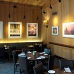
all of which are served by the Yosemite valley free shuttle bus.
The author of this webpage, (written as a reading assignment for my students), does not give any warranty, expressed or implied, nor assume any legal liability or responsibility for the accuracy, completeness, or usefulness of any information, product, or process included in this website or at websites linked to or from it. Users of information from this website assume all liability arising from such use.