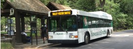
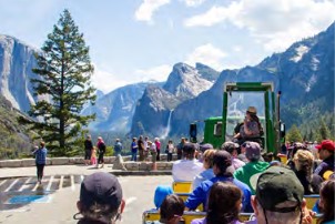
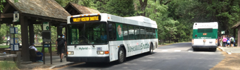
Yosemite National Park has free year-round shuttle bus service,
(no ticket or reservation required)
mostly in eastern Yosemite Valley,
with stops at most major sites of interest, all overnight accommodations and some trailheads.
The eastern end of Yosemite valley, where the free shuttle busses operate, is about a mile wide. The entire valley is about seven miles long.
Use of the shuttle bus is not required (some national parks, such as Grand Canyon and Zion have long roads that were once scenic drives that you can only access now by shuttle bus).

This webpage describes the main year-round routes, and has maps of the areas at the bus stops, as well as a few trail maps from some of the stops.
Plus, below the list of stops and what you can find at each,
you will find
hints to save time using the shuttle bus,
best bus stops for and/or links to the following Yosemite Valley activities:
art classes, bike rentals, bike paths, campsite availability, grocery store, hikes and their trailheads (start of the trail), horseback riding, ice skating, free and fee internet access, laundromat, lost and found, photo walk, rafting, Ranger talks/walks/evening programs, restaurants & cafeterias / pizzerias / grill / deli, rock climbing lessons, places to get a shower, ski / snowboard / snow shoe walk, picnic, stargazing, swimming,
and links to local weather and air quality reports.
AND notes about
the best bus stops to use for overnight accommodations, day use parking
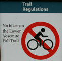
and see: Which bus stops to use to see waterfalls
using the free Yosemite Valley shuttle bus to find hikes and walks in and from Yosemite valley
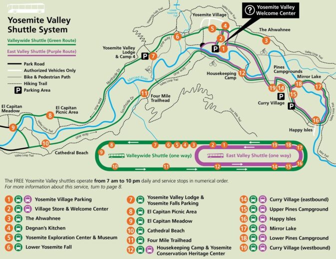
For many years all the free shuttle buses drove the same route, with stops in numerical order, all day.
Now there are two routes.
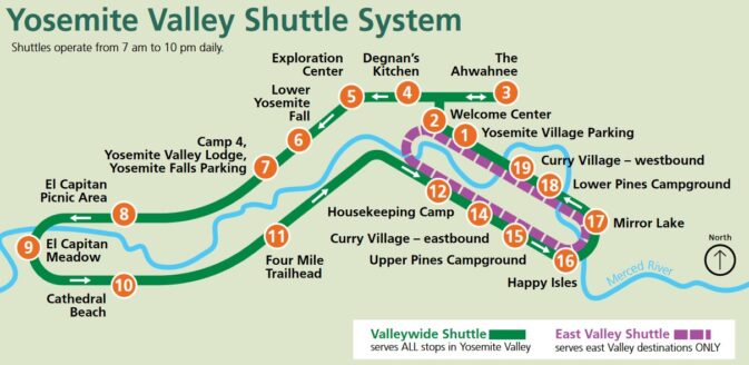
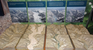
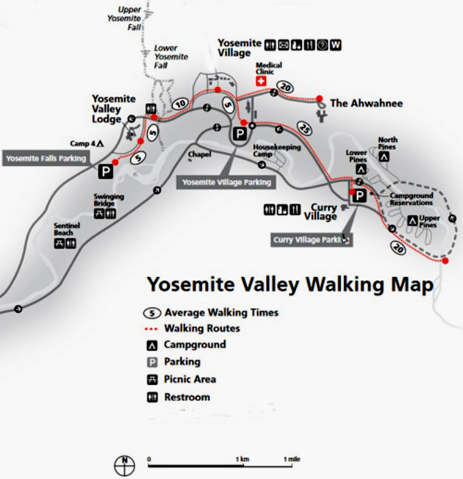
Here is a new map, courtesy of the park service:
and the park offered this version in the Yosemite Guide:
The shuttle buses usually run during government shutdowns.
Please note that occasionally some stops can be out of service, sometimes for months, due to construction, road repairs, or storm damage.
When stops need to be closed for repairs / upgrades,
there can be new, temporary stops in the vicinity.
Watch for signage (and the bus driver will tell people about changes.)
The Yosemite Guide newspaper
might also announce:
![]()
– – – – – – – – – – – – – – – – – – – – – – – – – – – – – – – – – – – – – – – – – – – – –
The two Yosemite Valley free shuttle bus routes are:
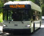 Valleywide shuttle: referred to as the Green Route
(in green on the maps above and loop below).
This green route serves all stops in Yosemite Valley, including lodges, food service, campgrounds, and trailheads. Buses are often scheduled to arrive every 22 to 32 minutes from 7 am to 10 pm, with a total round-trip time of approximately 1 hour and 30 minutes.
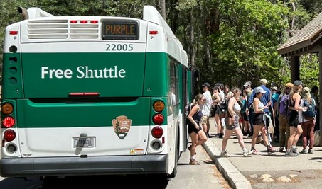
East Valley shuttle: referred to as the Purple Route
(in purple on the maps above and loop below).
This purple route is limited to Yosemite Village, Curry Village, Pines campgrounds, and trailheads in eastern Yosemite Valley. Buses are often scheduled to arrive every 8 to 12 minutes from 7 am to 10 pm, with an approximate total round-trip time of 50 minutes. (Despite being named the East Valley Shuttle, it does not stop at every bus stop in the east end of Yosemite valley.)

Be sure to note that the Village stop at the largest grocery store, #2, is served by both routes and you need to notice which bus you are getting on. If you get on the wrong bus you will have a loooooong ride to your intended destination.
(From grocery store stop #2 the East Valley shuttle Purple Route heads first to Housekeeping Camp, then towards Curry Village.
From grocery store stop #2 the Valley-wide shuttle Green Route heads first for the Ahwahnee Hotel, then back out to Yosemite village and eventually to Yosemite Lodge and other stops at the west end of Yosemite valley and all other stops, a round-trip time of 1.5 hours.)
And note that occasionally (rarely) one of these two routes will not be in operation.
– – – – – – – – – – – – – – – – – – – – – – – – – – – – – – – – – – – – – – – – – – – – –
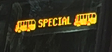
A few buses may have a “special” sign at the front indicating they are for a tour and not open to the general public.
– – – – – – – – – – – – – – – – – — – – – – – – – – – – – – – – – – – – – – – – – – – –
These other public transportation routes do not all run all year:
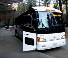
In the winter there is a free bus to the Yosemite ski resort (Badger Pass) for
(fee) ski/snowboard (free or very low cost) snow shoe walk with a Ranger naturalist
that has a more strict schedule than the main year-round valley free shuttle bus.
Some winters the Badger Pass Ski Area Shuttle Bus runs all week, some years only Friday, Saturday, Sunday. (Look for a shuttle schedule link )
The winter free bus leaves (most years) at 8:05 a.m. from bus stop at Curry Village, in front of the Stoneman building. (No pickup at the campground, but this first pickup is only about two blocks (if on foot) away from the campground.) Shortly after that (8:10 a.m.) from a covered bus stop adjacent to the garage in Yosemite Village , then (some years) from the Ahwahnee Hotel at shuttle stop #3 (8:15) and last early morning pickup from the Yosemite Lodge hotel Porte Cochère at the front desk (covered driveway in front of the hotel (8:30).
Some years there is a second set of mid morning pickups.
There is a free shuttle that provides service from the Mariposa Grove Welcome Plaza (near the park South Entrance) to the Mariposa Grove. This is the primary way to get to the Mariposa Grove. The shuttle can operate starting no earlier than April 15 and ending no later than November 30, but dates vary from year to year, especially in spring (due to conditions). The welcome plaza has about 300 parking spaces and may fill up by late morning. (Note that the Mariposa Grove transportation service can be discontinued temporarily, for example “due to icy road conditions, a winter weather advisory, and freezing overnight temperatures in the forecast”.)
(Fee) tours include the usually open air valley floor tour (also known as the Green Dragon),
Glacier Point tour, Grand Tour, hikers bus from the valley to Tuolumne/various trailheads along the way/and back
and a bus that runs around stops at Tuolumne Meadows in the summer
– – – – – – – – – – – – – – – – – — – – – – – – – – – – – – – – – – – – – – – – – – – –

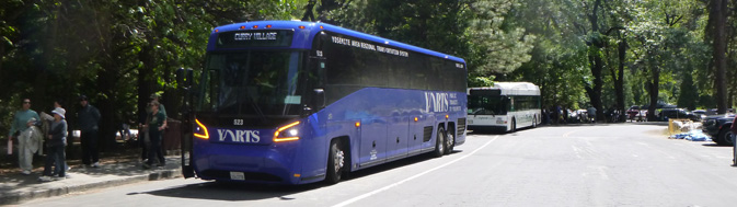
YARTS (fee), public transit to Yosemite valley/Tuolumne Meadows/Wawona from many nearby places in California. Info on the YARTS bus to and from Yosemite via Sonora, Fresno, Merced, Mariposa, El Portal, Mammoth Lakes, Le Vining, Tuolumne Meadows and more call 1-877-98YARTS. (subject to some routes being closed due to mudslides or forest fires).
YARTS bus stops, routes, consult the interactive map which includes nearby RV parks. The Yosemite valley YARTS stops are often at the same bus stop/ or next to/near some bus stops for the free valley shuttle.
“Buses are air-conditioned, bike friendly, wheelchair accessible, and equipped for rider comfort.”
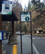
At the stops, look for the blue sign with white lettering,
![]()
the same logo as on the sides and/or front of most of the YARTS buses.
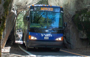
Yes, the YARTS buses can fit through the Arch Rock Entrance:
Connections to Greyhound buses, Amtrak Railroad passenger service and local airports are available.
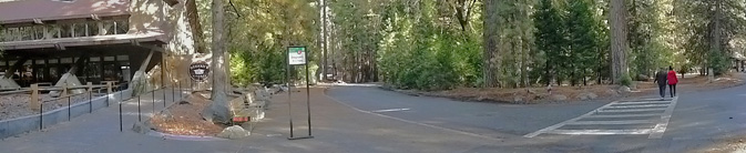
Some of the valley free shuttle bus stops are also YARTS stops, such as stop #7 pictured below:
![]()
People used to be able to drive around Yosemite valley and find small parking lots at each of the visitor centers, trailheads (the start of a trail), stores, restaurants, etc. When the valley became crowded, (especially crowded in warm months), the park got rid of most of the parking lots for park visitors at the visitor centers, etc. (with the exception of a few parking spaces for people with a handicapped permit).
People are now asked to, in effect, Park and Ride: park their car at their campsite or hotel or one of three large day use parking lots, leave it there, and ride the shuttle, ride bikes or jog / hike / walk / stroll.
Exceptions to the shuttle routes / service can include:
when road repairs are being done
or during the winter in snowy/icy conditions (when some road sections might be closed),
or when a bus is too full for more passengers.
Once people understand the route(s) the buses use, they can switch buses at a couple of major stops to cut a half hour or more off the time needed to get to their destination. Plus, the best stops for some activities, the best stop to start a particular hike and the best stops for some overnight accommodations (shortest walk from the bus to your hotel room / campsite) are not completely obvious.
The most current route map for the free Yosemite Valley shuttle bus is in the Yosemite Guide newspaper which you will be offered a copy of as you enter the park, or you can print in advance of your vacation.
I suggest you print a copy and use it to reference the descriptions below of what you can find at each stop.
(Map below courtesy of NPS)
Here are stops described below at this webpage:
Note that road construction, rock slides, excess snow, (yes snow, even in April) can affect the times/routes.
__________________________________________
You will be less frustrated with the bus
arrivals and departures if you understand that:
The Yosemite valley main shuttles run every eighteen to 22 or 32 minutes,
depending on the time of day,
and depending on traffic (usually from 7 a.m. to 10 p.m.).
In seasons other than summer, buses sometimes run every 30 minutes.
They are not on a strict schedule, such as city bus systems. If traffic is heavy, they might be slower than the 18 – 32 minutes intervals. When they can not hire enough bus drivers, they can be as slow as every half hour or hour.
Sometimes two or three buses can arrive at a bus stop right after each other. Sometimes one of the multiple buses arriving at a stop may let off passengers and drive off without picking up any, due to needs for space onboard at a following stop.
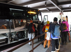
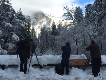
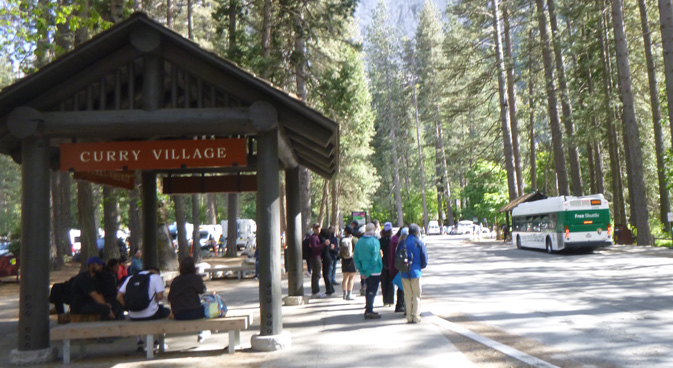
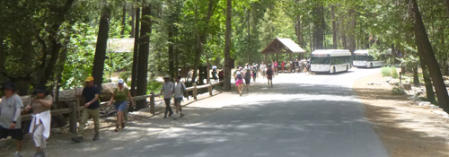
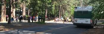
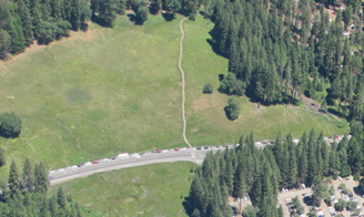
Lines sometimes form before the shuttle arrives at a designated stop:
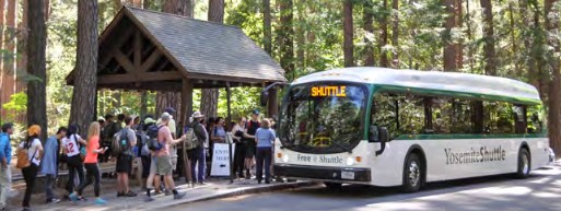
![]()
Bus logistics and courtesies
– – – Most drivers prefer you
wait until everyone has finished getting off before you get on,
the same as any transit system in the rest of the world.
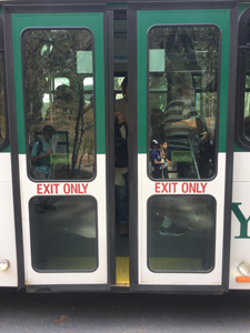
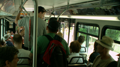
Everyone should exit the bus at the rear door and
enter the bus at the front door, as people are doing in this photo:
No one should get on at the back EXIT ONLY doors unless the driver says it is okay.
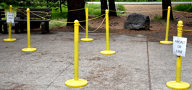
Because the lines can get a bit long, and some people try to crowd on before others who have been waiting longer, you might find ropes and stanchions as an organizer for the line, with signs for which end to enter the lines and which end will get on the bus first.
– – – Most bus drivers prefer you exit from the back, but will sometimes tell passengers they can exit any door. OR, if you ask politely, the bus driver might let you and your huge backpack / stroller exit from the front where you got on instead of going all the way to the rear exit, but be sure to ask before the last moment.
– – – Please take the baby out of the stroller and fold up the stroller.
– – -You can wear your ginormous backpack or put it in your lap, but it shouldn’t have a seat for itself if the bus is crowded.
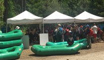
– – – No inflated rafts, tubes, etc. are allowed, but are okay DE-inflated if they fit on your lap. (An inflated raft is too big to fit down the aisle and it’s wet, sandy and or dirty and gets others on the bus dirty. Either sew a large drawstring bag or buy a duffle bag or large backpack big enough to fit each fully deflated raft/your lifejackets in. It won’t be much bigger than a big backpack that others might be carrying on the bus. See Yosemite Valley rafting advice.)
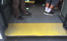
– – – You can’t stand next to the driver. Everyone standing in the aisle must be behind the yellow line near the front of the bus:
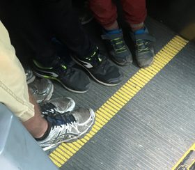
You can stand off-side of the main isle at the back step, but just not in the area where the back doors open/close, yellow in the picture below:
(Code of Federal Regulation Title 49, section 393.90 is where the stand behind the yellow line / bar rule can be found.)
– – – Keep children under control. Running or horseplay on the bus, including standing on the seats, can be dangerous.
– – – All the free Yosemite shuttle buses are accessible with wheelchair lifts and tie‐downs . Maximum size for wheelchairs on shuttle buses and tour buses is 24 inches wide x 46 inches long with a weight limit on tour buses of 750 pounds. Bus drivers will help passengers on and off buses or notify them of stops. If you need assistance, ask the bus driver.
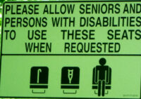
Even without a sign telling you, you should give up your seat as appropriate:
– – – Any time usage is high, especially on a summer afternoon, standees need to move to the back to let more people on. (No, not contorting your body to fit as crowded in as in parts of China where people are reportedly literally face to face.)
– – – As you know from other transit systems, conversations, both in person, over the phone (if you can get reception) and whatever it is you are listening to on headphones should be at a low volume for everyone’s sanity.
– – – If, for example, someone uses two seats on a crowded afternoon, or is yelling into their cell phone, there is no good reason to confront them or argue with them, no matter how rude or obnoxious they are. You are in a tight, reduced space and others don’t want to share your conflict.
Let the bus driver deal with rude or obnoxious passengers.
Hey, you are on vacation, and the ride will be short.
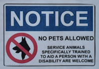
– – – no pet dogs (or any pets) are allowed on the shuttle buses (or on trails).

And Yosemite park says: “pets must be restrained on a leash not more than six feet long or otherwise physically restrained.”
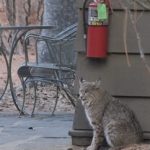
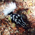
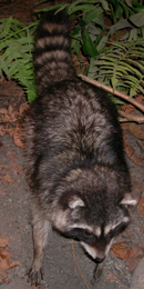
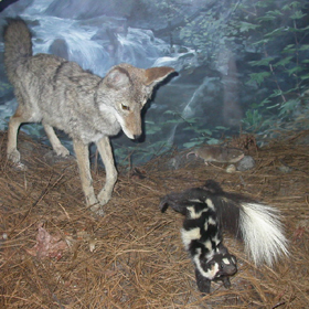
You can find wild animals anywhere in the park and do not want your dog to personally meet one of them, such as this bobcat on a patio at a Yosemite hotel, or this coyote walking just outside the fence at a Yosemite swimming pool, or even more fun, picture your off leash dog wanting to greet a skunk, such as this one on the grounds of a Yosemite hotel (photo courtesy of Harold (Harry) Bradbury):
![]()
(Below the next section of this webpage: The bus stops usually are (list of stops)
are tricks to save time using the shuttle bus,
notes about bus stops for overnight accommodations,
bus stops for Yosemite Valley activities,
notes about bus stops for people not staying overnight in Yosemite Valley – day use only,
and info about other park buses outside of Yosemite Valley.
In answer to questions: The Yosemite Valley free shuttle bus does not go to Half Dome, little Yosemite Valley, Vernal Fall, Nevada Fall, Taft Point, Columbia Rock or Sentinel Dome
(and you can not drive to them, you must hike to them)
but the shuttle does go to many places you can photograph Half Dome.
Illilouette Fall is not visible from any road; it’s only visible by hiking on steep trails.
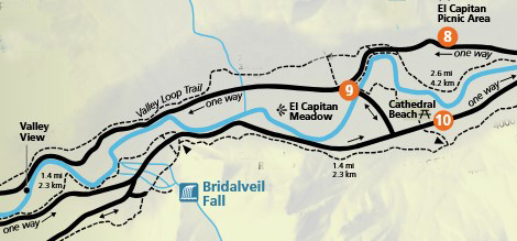
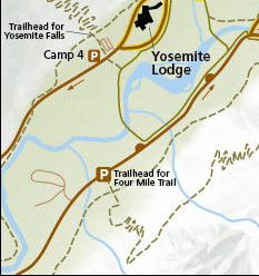
The Yosemite Valley free shuttle bus does not make a stop near Bridalveil Fall. You must drive to near it and walk to it or hike to it, (the closest shuttle stops are 9 and 10 on the Green Route) but the shuttle does go to a few places you can photograph Bridalveil Fall.
Here, a map of the closest shuttle bus stops to Bridalveil Fall:
__________________________________________
![]()
The bus stops usually are:
________________________________________________
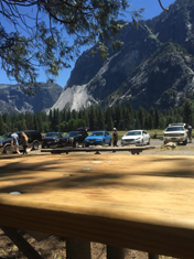
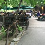
1) Yosemite Village parking (Valleywide Shuttle AND East Valley Shuttle) at a turnout just off of the roundabout (that is no longer used as a circular roadway / rotary / traffic circle), is a large Day Use parking lot (see map). This day use parking lot is also known as “Camp Six”. It is just south of Yosemite Village, about a five minute walk to the services listed at stop #2 below.
In the photo below the red letter 1 is the roofed shelter for shuttle bus stop #1, the red letter 2 is the restroom building:
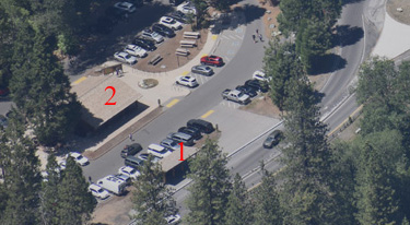
In the photo below, free Yosemite Valley shuttle stop number one is under the roof at the back almost center. The restrooms building is the brown one to the right hand side of the photo behind the picnic tables:
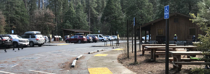
The Welcome Center is a short walk through a parking lot. The biggest Yosemite grocery is just beyond it.
It can often be faster to walk north to the Valley Exploration Center & theater, museum, Wilderness Center, Post Office, Ansel Adams Gallery and Village restaurants than to wait for a bus, especially during high usage times. (See descriptions of these services at stops 2, 4 and 5 below).
Pedestrians should be careful to watch out for drivers who are confused about the round-about (see map) that is no longer used as a circular roadway / rotary / traffic circle and are not watching for pedestrians.
In the photo below of a bus at stop #1, you can see, in the foreground, a red truck entering the round-about from the east, (the direction of the Pines campgrounds and Curry Village).
![]()
Drivers might also want to consult the Parking and traffic jams in Yosemite valley tips and tricks.
________________________________________________
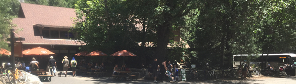
2) Yosemite Village, (Valleywide Shuttle AND East Valley Shuttle)
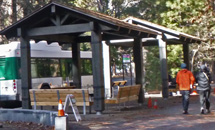
in the photo below, the roofed bus stop and bus pictured above are to the left,
the biggest Yosemite grocery store (Village Store) is to the right:
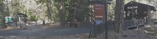
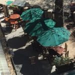
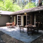
The Village Grill (not open all year) is to the right of the Village Store:
(Google street view (photo you can rotate) of the Village Grill deck – outside seating).
Yosemite Village menus, and see restaurant details.
The main store has the biggest selection of food and gifts, toys, Yosemite logo clothes.
It has some of each type of food you might expect at a grocery at home including prepared main dishes, sandwiches, prepared salads with a dressing packet, snacks, deli items, diary, bakery items, frozen foods, cooking gear and much more. (You will find a bigger selection of lower cost, sometimes fresher produce in larger grocery stores near home, so bring your own.)
See also a list of usually stocked over-the-counter medications and toiletries.


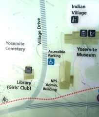
map below with Village Store (main grocery) location and bus stops 1, 2, 4 and 5 (white numbers in the orange circles) courtesy of NPS
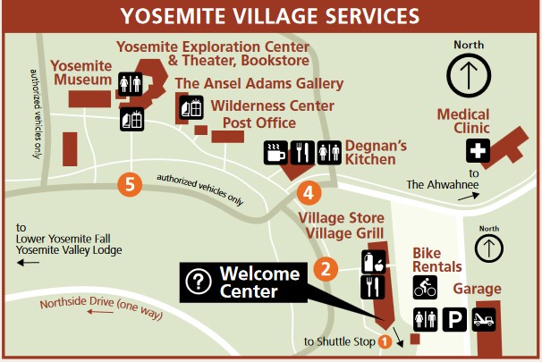
![]() This icon shows where restrooms are located in the map above.
This icon shows where restrooms are located in the map above.
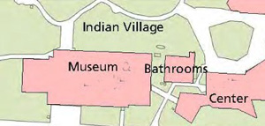
The restroom at the upper left of the map above is located
between the Museum and the Exploration Center in a separate building:
There was previously a Sport Shop at the end of the building where the
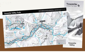
Welcome Center (visitor info center) is now
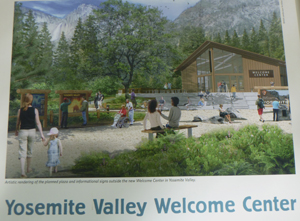
At the Welcome Center you can pick up free Yosemite Valley (and outside of Yosemite valley) trail maps:
Detailed info about the new Yosemite Valley Welcome Center.
With the Sport Shop gone, visitors still have the Mountain Shop at Curry Village, (not always open all year) near stop 14, with a large selection of outdoor gear and dehydrated food. Where to rent and return bear canisters
Next to the store used to be the Art Activity Center with lessons and programs “for artists of all ages and abilities.” These programs were moved to the Happy Isles Visitor Center, shuttle stop 16. The Happy Isles location will usually be open late March through October.
Behind the store and across the back parking lot and across a road is the small Village Garage (see lower right corner of the map above). Details about 24 hour towing within the park, propane service, emergency repairs, how to use your Auto Association card to get their help, (scroll down for) electric vehicle (EV) charging stations locations and more are at Yosemite garage, car repairs and towing.
There is no bus stop for the Yosemite valley Medical Clinic (see upper right hand corner of the Yosemite Village Services map above) but it is a short walk from the main grocery store on the road to the Ahwahnee Hotel. Hours can change, but usually open M-F 9-5 (additional weekend hours some summers, for example, 9 a.m. – 7 p.m. seven days a week, walk-ins until 6:30 p.m.) closed major holidays and when the doctor is out of town, and sometimes when the doctors must be out (due to Radiography Training, or . . .) Registered Nurse on duty to provide nursing advice. They can do a “limited array of lab tests, basic X-rays” (they can be without X-ray capability from time to time due to staffing limitations), urgent care such as “illness evaluation and treatment (colds, flu, and infections) and injury care (fractures, sprains, strains, cuts, abrasions)”. They no longer have a dental clinic. The rear emergency entrance is accessible to wheelchairs.
Parking at the Medical Clinic is only for customers, no day use parking is allowed. Medical Clinic Phone: 1 (209) 372-4637.
For 24 hour/seven days a week ambulance service call 911, (or 9-911 from a Yosemite hotel room, but please verify this when you check in).
Read current Yosemite Medical Clinic details, including hours open, services offered and methods of payment.
The medical clinic does not sell over-the-counter medications, but you can buy them at the main Yosemite Valley grocery, including, but not limited to, brand name and some generic, (adult and in some cases children’s) pain relief, allergy, stomach upset, cough syrups and lozenges, first aid supplies, and lots more. The list got a bit long for this webpage so I moved it to: Over-the-counter medications and toiletries available in Yosemite.
This Yosemite valley Medical Clinic is not a full hospital. The nearest, with 24 hour / 7 day a week emergency care, is John C. Fremont hospital in Mariposa, at least an hour drive from Yosemite valley. http://www.jcf-hospital.com/ From Yosemite on highway 140, just as you enter Mariposa, take a hard right hand turn on Smith road, then after about a half mile, a right on Hospital Drive. The long driveway to the emergency room is a left turn just before the main hospital buildings. Their webpage says: “Air ambulance service is available to rapidly transport critical patients who need specialized care.”
See a map of Historic Old Yosemite Village, including buildings existing around 1925 and still standing in 1956, (with a “laundry and Chinese help quarters,” and dynamite storage).
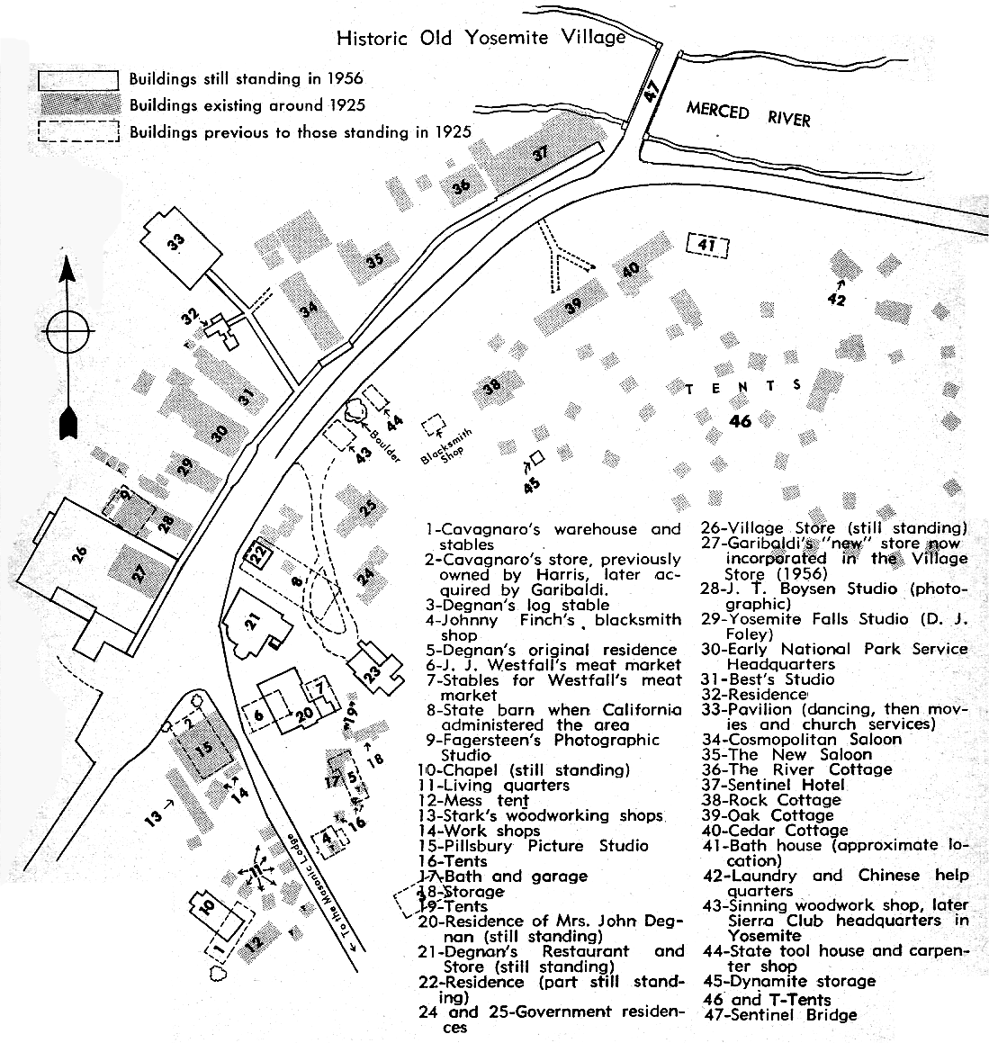
________________________________________________
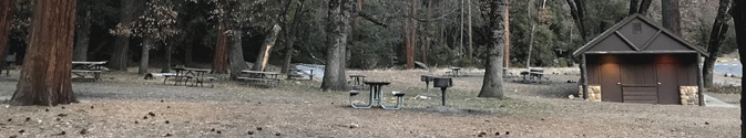
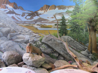
About half-way between stops 2 and 3 is Church Bowl, picnic area with restrooms, water (one of the few picnic areas with potable drinking water) and picnic tables with views of the Ahwahnee Meadow and Glacier Point:
This next photo is from the Merced River Plan (look for page H-27), showing where 114 Ponderosa and 117 Cedar trees will be removed to restore views towards Half Dome at Church Bowl . . .”large trees help buffer the impact, and potential damage, of rockfall by absorbing some of the force and rock debris. Most of the trees currently obscuring the view are outside of the rock fall zone, on the south side of the road and not effective in protecting any structure. No trees on the north side of the road within the rockfall hazard zone will be removed.”
When a helicopter needs to land in the Ahwahnee meadow across the road from Church Bowl, to pick up someone who needs to go to a bigger hospital, (or when a helicopter needs to land for Search and Rescue training) people are asked to stay on the restroom/picnic area side of the road, and traffic going through is stopped. Because you won’t know a helicopter is coming and won’t be able to move your vehicle fast enough, the entire meadow side of the road at Church Bowl is closed to any parking at all times, (even to get out and quickly take a picture or use the restroom).
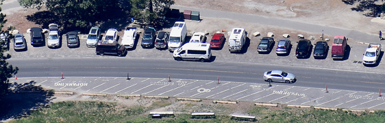
In this photo you can see a few parking spaces in a row alongside the road and the stripes for no parking on the other side of the road:
And also note
“Ahwahnee Meadow, El Capitan Meadow, Big Meadow, and Tuolumne Meadows are
closed to kite flying regardless of size. This restriction is necessary to ensure the safety of low flying aircraft being used in SAR (Search and Rescue), medical, fire, or other emergency situations.”
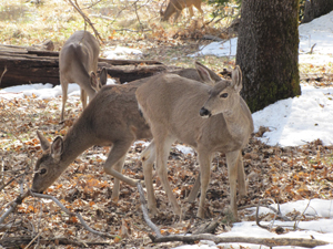
Deer can often be seen in the Ahwahnee Meadow
at times of the day when there are few people:
________________________________________________
3) The Ahwahnee Hotel (Valleywide (green) Shuttle only) bus stop is just out into the parking lot, not under the cover of the porte-cochere (roofed driveway by the hotel main entrance).
Below, the view from the free shuttle bus stop looking toward the Ahwahnee porte-cochere (covered entrance), notice the end of the white bus under the covered entrance towards the right hand side of the photo. (The YARTS sign you see in the photo is covered up or removed when YARTS does not stop there.)
You can find a map with the shuttle stop,
the Sweet Shop with the chocolate truffles,

restaurants (and a link to the menus),
descriptions and pictures of rooms, cottages, suites, balconies
and much more at Ahwahnee hotel map.
The schedule for free one hour tours of the hotel can be found in the the park newspaper Yosemite Today, which you usually receive a copy of when you enter the park, or you can download / read before your trip.
People who go from the Ahwahnee Hotel to the Village (main grocery, Degnan’s deli/loft/cafe/kitchen) should get off the bus at stop #4. Or for the Exploration Center, theater, bookstore, Ansel Adams Gallery, should get off the bus at stop #5. But after your exploring, to return directly to the hotel, if you get on again at stop 4 or 5 you will have a long ride. Instead, get on at stop 2, opposite the biggest grocery in the park, for a much shorter ride. (Be sure to look for a Valley-wide (green) shuttle instead of the East valley (purple) shuttle. Both stop at stop #2, but only the green shuttle goes directly to the Ahwahnee Hotel.)
________________________________________________
4) At the corner of Degnan’s (Deli / Loft / Cafe / Kitchen) in Yosemite Village, right across the street from the north end of the Village grocery store and Village Grill complex. (Valleywide green Shuttle only)
In the photo below, on the right, there is a shuttle bus at stop 4:
and here, people walking in the crosswalk from shuttle bus stop 4 (at center of photo)
to the Village Store and shuttle bus stop 2 (just visible at the right hand side of the photo):
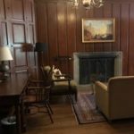
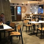
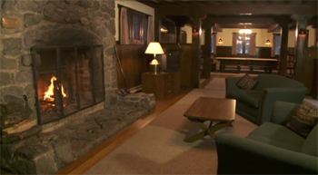
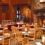
The upstairs Loft at Degnan’s has a large fireplace in season:
![]()


Find Menus of Yosemite Village restaurants
and see restaurant details.
Google maps 360 degree street view of stop 4.
________________________________________________
5) Yosemite Exploration Center, theater, bookstore and Museum (formerly named the Valley Visitor Center), (Valleywide green Shuttle only).
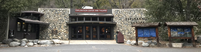
There are no longer two shuttle stops across the road from each other,
 only one stop on the north side of the roadway (the bus stop on the left in the photo above).
The Bookstore is inside the Exploration Center:
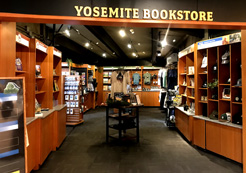
with maps, books, postcards, posters, calendars, clothes (with discounts for Yosemite Conservancy donors).
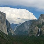
You can take a photo that looks like the one on a Yosemite postcard / t-shirt / poster you bought at the Yosemite Conservancy Bookstore:
Places to take photos of Half Dome, Bridalveil Fall, Clouds Rest, El Capitan, Yosemite Falls and Staircase Falls.
The park offered this description of the Yosemite Exploration Center:
“There is a new exhibit in the lobby called Yosemite Now that is aimed at piquing visitor’s curiosity and observation skills and what current science is happening in the park. This interactive space has some projecting microscopes and dozens of curios to explore to help visitors go deeper in their understanding of the natural world. Yosemite Conservancy staff will be stewarding this space along with the bookstore offerings. For directing visitors who are seeking NPS rangers, the esteemed Interpretation staff is now found at the Welcome Center” (near shuttle stops #1,2 and 4) . . . for orientation and trip planning needs.”
In the Yosemite Valley Exploration Center there are history, geological and nature displays.
A Yosemite Conservancy magazine has pictures of the “Climbing and Stewardship” educational exhibit in the Exploration Center.
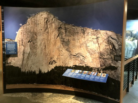
“The exhibit begins with a 9-by-12-foot image of El Capitan, stitched together from more than 2,000 photos and overlaid with climbing routes. The huge photo prompts a question: How can an exhibit capture big-wall climbing in the confines of the visitor center? After all, an average ascent of 3,000-foot-tall El Capitan takes three to five days! The exhibit team landed on key themes, including climbing history, life on the wall, techniques, safety and stewardship. . . . Where do big-wall climbers sleep? What tools are necessary for a safe and successful climb? The exhibit includes gear from past and present, such as a heavy-duty “haul bag” and a portaledge — a suspended platform climbers set up as a cliffside camping spot. In addition to featuring photos, stories and historical artifacts, the exhibit invites visitors to learn the basics of climbing techniques and terminology, and to test out their problem-solving skills, just like climbers do on a wall.”
Here is the 9 foot by 12 foot display of climbing routes on El Capitan:
This sketch John Muir made of his hang-nest is at the back section:
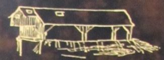
You can find the location of his hang nest / cabin along the path to lower Yosemite Fall.
One or two films often play every half hour in the theater behind the main building. (usually Mon.- Sat. 9:30 a.m. to (last film) 4:30 p.m. (Sunday sometimes first showing at noon). (Occasionally closed due to needs for seasonal onboarding meetings, or other work.) Watch Yosemite – a Gathering of Spirit by Ken Burns
To the right as you face the Exploration Center building is the Ansel Adams Gallery “We represent many contemporary artists and rotate exhibitions of their work approximately every 6 weeks”
At the Ansel Adams gallery, an exhibition by Charlotte Gibb
includes a view from Ahwahnee hotel room 504, which, the artists says she took with the “longest lens in the camera bag” . . . while sipping morning coffee in my bathrobe”. “This photograph holds the distinguished honor of being my best photo made while being completely lazy.”
and then next to the right as you face the Exploration Center, the Wilderness Center, (open spring to fall for backcountry permits and bear canister rentals, with displays on pre-trip planning, minimum impact and Yosemite’s wilderness).
Further to the right is the U.S. Post Office.
To the left as you face the Yosemite Valley Exploration Center is the Yosemite Museum (Indian Cultural Museum)/store.
Restrooms are located a little behind and between the Indian Cultural Museum and the Exploration Center:
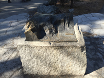
In front of the Indian Cultural Museum is a cross‐section of a Giant Sequoia tree that visitors can touch
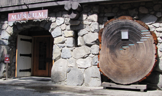
and a re-creation of an umacha, a Miwok and Paiute cedar bark house.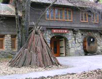
Museum exhibits are listed including links to some displays after an exhibit has closed.
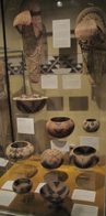
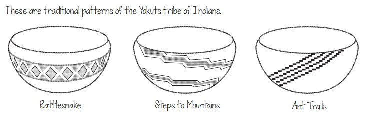
see also Yosemite Basketry weaving, function, design.
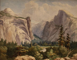
The valley museum occasionally features paintings and watercolors.
For example, one summer, paintings by Chris Jorgensen, such as shown in the photo, (courtesy of the National Park Service), below:
Go to NPS museum list
and search for Yosemite National Park.
The Indian Cultural Exhibit, (which interprets the cultural history of Yosemite’s Miwok and Paiute people from 1850 to the present) Village of the Ahwahnee, is behind the visitor center, with a Chief’s House, sweathouse, ceremonial roundhouse, acorn granaries, bark houses and more. Sometimes staff present programs about Ahwahneechee skills and culture.

Part of the Indian Cultural Village behind Yosemite Museum in Yosemite Village:
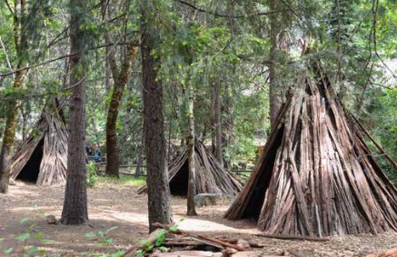
The NPS notes: “The Ceremonial Roundhouse, the Sweat House, and the Chief’s House in the Indian Cultural Village are closed to public entry. These restrictions are necessary to protect the spiritual sanctity of these structures still used by the Southern Sierra Miwok and other affiliated tribes.”
_______________________________________________
Even when the Exploration Center or the Welcome Center is closed (early morning or overnight or during government shutdowns) you can find a lot of info about trails, with color aerial photos with trails marked at two displays outside the Exploration Center, to the right in the photo above.
And / or you can download an App with “information about park services and programs, as well as an interactive map designed to help visitors locate iconic features, scenic spots, trailheads and amenities. . . Most app content can be downloaded before arriving in the park and used offline in areas of limited cell service”
![]()
_______________________________________________
Cell phone service is NOT available in all parts of Yosemite.
It is usually okay in the vicinity of the Exploration Center.
Many years we got 4 bars for Verizon and 3 bars for AT&T near the Exploration Center, versus 2 bars for each at the Ahwahnee and 2 bars Verizon, 1 bar AT&T in Upper Pines campground, at the Yosemite Valley Lodge, Curry Village and some other locations in East Yosemite Valley.
The park service said: “Cell phone coverage in Yosemite is spotty . . . Cell service is often impacted during daily peak visitation by the large number of people trying to access limited service; if you have four bars of service, but you can’t get a signal, this is why . . . cell coverage depends on your phone, the cloud cover and other seemingly mysterious factors and is not always reliable. ”
_______________________________________________
Across the street from the Yosemite Valley Exploration Center (right across the street from stop #5)
across from the Valley Administration Building, is the 2 story ranger dormitory, Rangers Club.
Photo on the right is from when it was under construction (completed in 1920, it included a garage and woodshed).
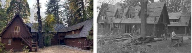
This housing is not open to the public, but you can watch a video
or take a look at a Yosemite Conservancy article 100 Years of the Ranger’s Club.
________________________________________________
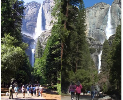
6) At the end of the loop path to the base of lower Yosemite Fall (almost all relatively flat walk, one mile (1.6 kilometers) round trip). (Valleywide green Shuttle only)
At the bus stop, near the bus stop, and at the restrooms/picnic area a bit up a path to your to your left, you will find maps of the lower Yosemite Fall loop trail, or actually more a path/walkway, to the base of lower Yosemite Fall. (Note where on the map below it says: “the dotted portion of trail is not wheelchair accessible.” This is because of a short, steep grade near the viewing area, the last 180 feet include a slope of 13.8%.)
Here is the view down to the Lower Yosemite Fall Viewing Area as seen from the trail to the top of the fall
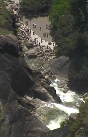

The river is in blue, loop trail is in brown, the bridges over the river are in tan, the main road (Northside Drive) at the bottom of this picture of the map is in gray. Shuttle bus stop #6 is in the lower right hand corner of this map. There are restrooms and picnic area (no grills) next to the restrooms .
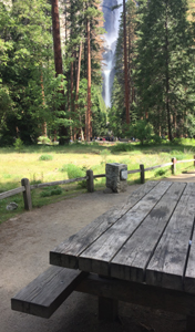
Some of the picnic tables have great views of Yosemite Falls, the tallest waterfall in North America (2,425 ft):
Along this walk you can find the location of John Muir’s hang nest (cabin he built in a tree) At that webpage you can read warnings about the real dangers of trying to swim in the pool at the base of the fall. Suggest you try swimming at a beach at Swinging Bridge instead, see stop #7 or swim at a beach at Housekeeping camp, stop #12.
The NPS notes: “Choosing to leave the trail and scramble in boulders below waterfalls can have a costly outcome. Is getting closer really worth the risk?”
 Please walk your bike on this path/trail, even though it is paved.
From the far west pathway (or from the Yosemite Lodge) along this loop trail, here is the view of Yosemite Falls
This may be one of the best views of Yosemite Falls most people get. But there are many more Yosemite Falls photo locations.
A bronze relief map along the western trail section depicts the watershed that drains into Yosemite Falls and shows the trails.
I suggest to people that they stop when walking on the pathway to Lower Yosemite Fall, look at the upper fall, imagine it with full flow in the winter and then imagine the wind catching and holding the flow. Conservationist John Muir, who built a cabin in a tree near the base of Yosemite Falls, wrote about a winter storm when this happened and he counted to 190 before the wind stopped holding the water. Read what he wrote about the experience at:
Upper Yosemite Fall held stationary in mid-air.
Yosemite Nature Notes video about Yosemite falls
A quick walk you should not miss is in the vicinity. (Or it can be a long walk if you start the Cook’s Meadow loop from here.) At shuttle bus stop #6, looking across the road at a cross walk near the bus stop, you can see a meandering path leading to a pedestrian bridge over the river (Superintendent’s Bridge).
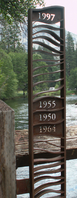
When you first step up the stairs onto to the bridge, on the left hand side, there is a metal sculpture showing the depths of the water various years Yosemite Valley has flooded. It is amazing to stand on the bridge and see when Yosemite valley became a lake. Yes, the entire bridge, up to and over the hand rail, has been under water during flooding in 1937, 1964, 1950, 1955, and 1997. Read more at: Yosemite floods display on Superintendent’s Bridge
(If this display were to be removed, you can still visualize the depth of the water by seeing that a person 5 feet tall would be, in effect, under water during the 1997 flood.)
________________________________________________
7) Yosemite Valley Lodge / Yosemite Falls parking lot day-use parking lot
(Valleywide green Shuttle only), stop 7 is no longer right across the inner hotel road from the hotel office, but farther down towards the day-use parking lot, near the Laurel Building.
It might have not only one of the free shuttle busses at it, but also a YARTS (fee) bus:
(Previously there were 2 stops for the Lodge and the parking lot.)
This stop is the closest to (across the main road -Northside Drive- from) Camp 4 (Sunnyside) walk-in campground with shared campsites and shared food lockers,
The NPS notes “The area immediately west of Camp 4, known as Wahhoga, is closed to all entry except members of the associated tribes and their invited guests. This restriction is necessary to prevent disruption to events and ongoing activities as that area is still in use by the Southern Sierra Miwok and other affiliated tribes. The Ceremonial Roundhouse, the Sweat House, and the Chief’s House in the Indian Cultural Village are closed to public entry. These restrictions are necessary to protect the spiritual sanctity of these structures still used by the Southern Sierra Miwok and other affiliated tribes.”
and the closest to the trailhead to Columbia Rock / Upper Yosemite Falls. See this map of Camp 4 .
Upper Yosemite Fall hike has details. Camp Four to Columbia Rock is 2 miles (3.21 kilometers) round trip, 1,000 feet (304 meters) elevation gain. Camp 4 to top of Yosemite falls is 7.2 miles (11.59 kilometers) round trip, 2,700 foot (823 meters) elevation gain.
The trailhead for the Upper Yosemite Falls hike and the largest boulder within the campground, Columbia Boulder, (or Big Columbia), which has the “world’s most famous boulder problem” – the route named “Midnight Lightning” are on the far side of the campground. There is fascinating reading on how climbers can avoid injuries/stay alive, by YOSAR (Yosemite Search and Rescue) Ranger John Dill, at: climbing advice
A short walk from stop 7 is Swinging Bridge (which does not swing anymore) and a good swimming area (in season) with shallow and deep water, sandy beaches and views of Yosemite Falls.
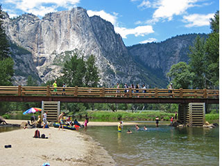
Across the bridge is a large picnic area with tables, grills and accessible vault toilets (bring your own water or purify some from the river). Some of the picnic tables have views through the trees of Yosemite Falls.
See details at: swimming in Yosemite including thunderstorms, bacteria in the water, safety issues, favorite beaches, swimming pools with lifeguards.
Yosemite Lodge, just across the road from the hotel lobby, tour desk, restaurants, gift shops.
Map of Yosemite Lodge showing the swimming pool, bike rentals pick-up area, small grocery:
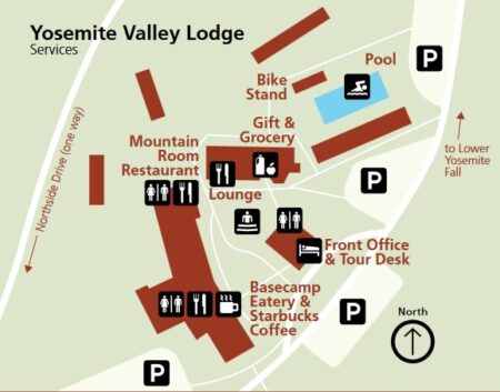
![]() This icon shows where the three restrooms are located in the map above.
This icon shows where the three restrooms are located in the map above.
See current larger map with the pool, restaurants, restrooms, ATM, and shuttle stop
Guests of the Yosemite Lodge and people who are not guests at the lodge can rent a bike there. Rentals are often offered at the Lodge for a longer season than at Curry Village. To pay and arrange for a rental go into the lobby and find the tour desk. Pick up the bike near the pool.
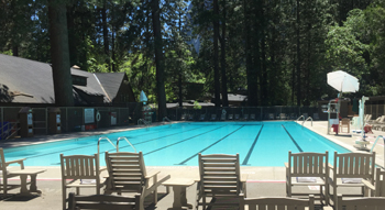
Lodge guests swim for free and people who are not guests at the Lodge can swim in the pool for a fee:
See also: Swimming in Yosemite National Park.
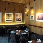
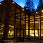
People who are not guests at the Yosemite Lodge can dine at the lodge. Details and photos of the Mountain Room, Mountain Room Lounge, Starbucks (formerly the coffee corner) and Base Camp Eatery (formerly the Food Court) are at the Yosemite valley restaurants page along with links to menus.
Cooking in/around Yosemite Lodge rooms is not allowed, but there is a picnic area, with picnic tables, fire grates, a swimming beach a short walk from the hotel, see map to Swinging Bridge at swimming in Yosemite National park and another nearby picnic area, with restrooms, picnic tables but without fire grates, across Northside Drive from the Lodge.
________________________________________________
8) El Capitan Picnic area (Valleywide (green) Shuttle only)
(in the vicinity of El Capitan)
________________________________________________
9) El Capitan Meadow (Valleywide (green) Shuttle only)
________________________________________________
10) Cathedral beach (Valleywide (green) Shuttle only)
________________________________________________
11) Trailhead to the Four Mile Trail (Valleywide (green) Shuttle only). (The Four Mile trail is partially or fully closed in winter, and usually reopens in March or April.)
People going back to Yosemite Valley Lodge Hotel & day use parking lot / Camp 4 after using the shuttle to go the El Capitan stops (8,9,10) could find that it is faster to get back to the hotel and Camp 4 by getting off at stop 11, walking east along Southside Drive and go across Southside Drive to Swinging Bridge Picnic area, and then going across Swinging Bridge and north to the Yosemite Lodge / Camp Four.
Likewise, anyone staying at the Lodge / Camp 4 or parked at Yosemite Falls Day Use parking who used the bus to go to the trailhead for the Four Mile Trail, could find it faster to walk that same route to get back.
________________________________________________
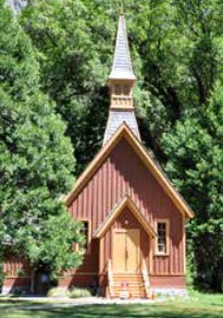
There is no longer a bus stop at Sentinel Bridge / chapel
A bus stop to access it is Yosemite Village day use parking (stop 1)
From the bridge go across southside drive to the Yosemite Chapel
Park Service rules about permits for Weddings & Commitment Ceremonies in Yosemite National Park, with links to wedding locations/ rules for their use in Wawona, Glacier Point, Tuolumne, Big Oak Flat and in the valley including using the Chapel
Take a 3D tour of the Yosemite Chapel: (click on the small circles to move around and into the building)
And no, you can’t photograph the wedding using a drone “the use of drones is prohibited while visiting the park and should not be utilized at any time. ”
Near sunset you will find lines of photographers on Sentinel Bridge waiting to see if Half Dome turns gold or pink.
and if the water is flat enough, the reflection of Half Dome in the Merced River, as in the NPS photo below:
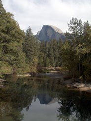
See more places to get a photo of Half Dome.
The parking lot just north of Sentinel Bridge is one of the best places to take pictures of moonbows (lunar rainbows during a full moon in spring) on upper Yosemite Fall.
The often recommended Cook’s Meadow loop or figure eight walk / stroll can include this bridge.
________________________________________________
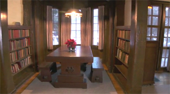
12) Housekeeping Camp /YCHC – Yosemite Conservation Heritage Center (formerly LeConte Memorial Lodge) (Valleywide Shuttle AND East Valley Shuttle)
YCHC has a library, children’s corner, displays, occasional programs. (Not always open in the off-season.)
Photographer Ansel Adams was a caretaker for the LeConte Memorial Lodge for a few years. (The Ansel Adams gallery is near the Exploration Center at shuttle stop 5 .)
Across the road from bus stop 12 you will find Housekeeping Camp, (open more or less April to October, weather permitting) with showers and laundromat – the laundromat is usually open through the winter even when housekeeping units are not open. To find the laundromat, bear left when you enter the Housekeeping parking lot.
Map showing Housekeeping Camp, the biggest beach, the pedestrian bridge over the river to other swim beaches, laundromat and showers
Details about, and photos of Housekeeping Camp accommodations are at Yosemite valley overnight accommodations.
See details about swimming in the river at: swimming in Yosemite including thunderstorms, bacteria in the water, safety issues, favorite beaches, swimming pools with lifeguards.
________________________________________________
About half way between stop 12 Yosemite Conservation Heritage Center (formerly LeConte Memorial Lodge) and stop 14 Curry Village is employee housing.
27 “one- and two-story structures providing housing and shared common spaces and a wellness center.”
________________________________________________
There is no longer a bus stop at the winter season ice rink
 pay to skate near stop 14. The Yosemite Ice Rink can be closed due to mechanical issues resulting in insufficient ice, or storm damage to the ice surface or mechanical issues with the Zamboni.
There is no longer a bus stop at Curry Village recreation rentals
Pay to rent a raft near stop 14 or most years pay at any Yosemite Valley hotel tour desks/kiosks.
Some years your raft rental pickup was at Curry Village recreation rentals
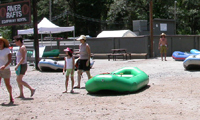
some years, farther down the road.
If you have your own raft, Curry Village recreation rentals was the closest place to walk with your raft to the river, but now you might want to have a foldable luggage cart. More info is at: Yosemite Valley Rafting Advice
________________________________________________
________________________________________________
14) Curry Village parking (eastbound) (across the road from stop 19).
(Valleywide Shuttle AND East Valley Shuttle)
In the picture below we see stop number 14 on the left and stop number 19 on the right, with a bus.
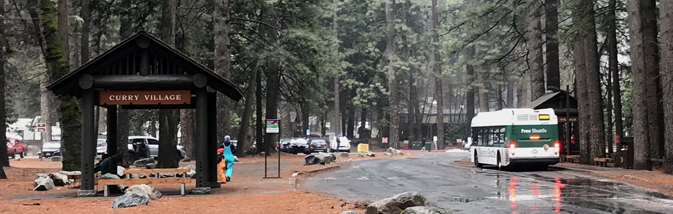
On some maps this day use and Curry Village guest parking lot is named Apple Tree Orchard Visitor Parking.
Google maps street view (photo you can rotate) of part of the Curry Village parking lot.
If you will be parking here, see the map of the Curry Village day use and guest parking lot.
There is advice at Parking and Traffic Jams in Yosemite valley tips and tricks.
Here is a map of services, restaurants, and the front desk (front office) where you go to check in for any reservation at Curry Village.
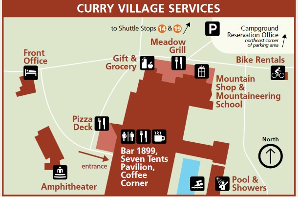
A 365 day a year shower house and summer swimming pool (blue rectangle on the map above) are the right up the service vehicles only road from the main parking lot.
![]()
Guests at Curry Village swim and use this main shower house for free and people who are not guests at Curry Village can swim in the pool and use the main shower house for a fee
See also: Swimming in Yosemite National Park.
Guests at Curry Village and people who are not guests at Curry Village can book a tour, pay to rent a bike or a raft, or pay for ice rink use/ skate rental at the little Tour Kiosk between the front office and Stoneman Cottage, (with the lights above the sign saying Ice Skating, in the winter photo above).
If you want to rent a raft, rental reservations in advance are advised, up to 80% of rafts are reserved the day before and the park service limits the total number of rafts rented each day and the number of rental rafts on the river at any time is limited.
This photo of bike rentals pick-up area is taken from the direction of the Curry Village guest parking lot.
![]()
Parts of some winters the ice rink is only open Friday / Saturday. The permanent ice rink was removed winter 2016-2017 and replaced with a seasonally installed portable ice rink which promptly flooded in heavy rains and was closed, at first temporarily, then it did not reopen. It was moved back to it’s original location for winter 2017-2018. It was closed part of February 2019 due to a huge, long snow storm that closed all roads in and out of Yosemite Valley for days. Sometimes when it first opens there are no lights for evening skating for awhile until they can be installed. Always subject closure due to mechanical issues with the Zamboni. You buy tickets to ice skate, and if you need them, to rent skates (helmet is usually available and usually free), at the tour kiosk near the Curry Village room registration office (see map above).
and at the Curry Village website, a map of the kiosk, cabins, pool, restrooms, grill, lounge, Mountain Shop and Mountaineering School, parking
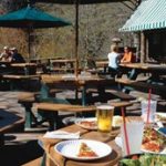
People who are not guests at Curry Village can dine there. Hours / basic descriptions of food services at the Curry Village Pizza Deck, Seven Tents Pavilion, Coffee Corner, Meadow Grill, and Curry Village Bar (not all of which are open all year, opening and closing dates can vary depending, in part, on weather)
The Mountain Shop at Curry Village, about equidistant between stop 14 and the main office, has a large selection of outdoor gear and dehydrated food. Where to rent bear canisters
Details about, and photos of Curry Village accommodations, including Cabin 819 and Stoneman Cottage two-story rooms, are at Yosemite valley overnight accommodations.
Lots of details to make your stay in a Curry Village tent cabin more fun are at: Yosemite valley tent cabins tips and tricks
________________________________________________
When the shuttle bus leaves stop 14, it goes around the Happy Isles loop road to stops 15, 16, 17 and 18, then back to Curry village at stop #19.
After a major snowfall or due to ice, the buses do not run to stops on the Happy Isles loop road.
If you had come from any of the stops 1,2 etc. and wanted to go back to one of those stops, you should not get back on the bus at stop 14, but should instead get on the bus across the road at stop #19 for a faster ride.
Again, in the picture below we see stop number 14 on the left and stop number 19 on the right (with one of the free shuttle buses at the bus stop).
________________________________________________
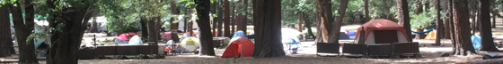
15) Upper Pines campground, (Valleywide Shuttle AND East Valley Shuttle)(across the road towards Curry Village from the campground) and near the backpackers trailhead parking lot, across the road from the end of the first loop of campsites. When you head into Upper Pines from stop 15, please don’t walk right through Upper Pines campsites 26, 27, 28 etc, at the end of the first loop after you get off the bus, please walk between the campsites and/or around the ends of the loops.
________________________________________________
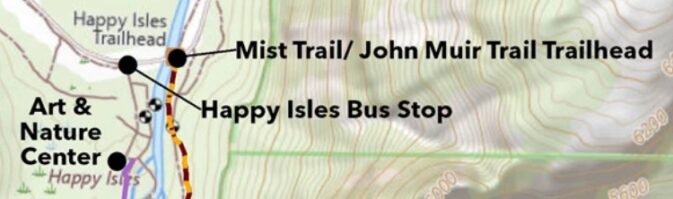
16) Happy Isles (Valleywide Shuttle AND East Valley Shuttle)
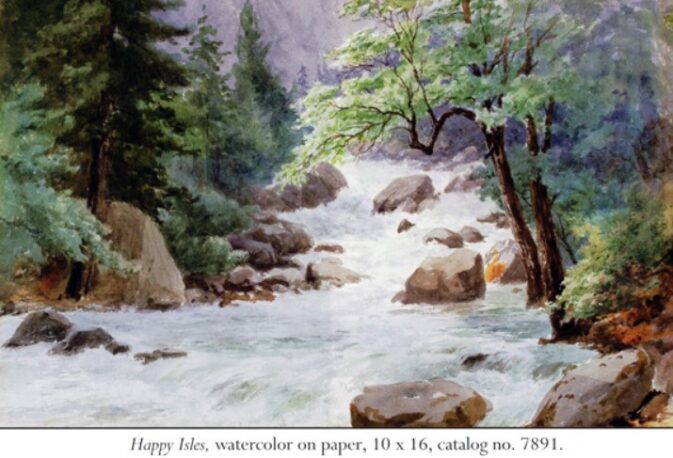
(Watercolor above by Chris Jorgensen )
On the bus stop side of the river there are restrooms, a nature center, Art Activity Center with lessons and programs “for artists of all ages and abilities, usually open late March through October), and a fen (marsh).
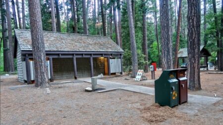
In the photo below, the restrooms are on the left and bus stop is at the right:
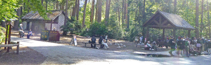
in the photo below, the restrooms are again on the left and the shuttle bus stop is on the right:
In the photo below we see people walking away from the shuttle bus stop towards the Happy Isles bridge and two shuttles at the bus stop:
and below, people walking across the Happy Isles Bridge:
after you cross cross the large bridge you can turn right to get to the trailhead for the mist trail (dotted red and yellow line on the map above) and the rest of the John Muir Trail including to Vernal Fall, Nevada Fall, Half Dome and . . . Mount Whitney.
In the photo below, on the right we see people going across the bridge, and on the left, the trailhead (start of the trail):
Summer Junior Ranger Walks often start at Happy Isles.
The Happy Isles Visitor Center (usually not open in the winter) is up a side trail on the other side of the river from the popular John Muir trail and can be easily overlooked, but it is well worth a stop. From the bus stop you would go up a trail alongside the river or the side-road behind the shuttle bus stop.
It has natural history exhibits including the animals pictured below, tree and geology explanations.
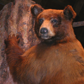
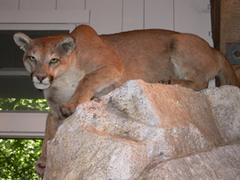
There is a great interactive display with the voices of animals including bear, mule deer, raccoon, mountain lion, ringtail, bobcat, coyote, chipmunk, ground squirrel and more. You can put your paw up next to an impression of an animal paw and compare:
Nearby are short trails focusing on the Happy Isles environment: forest, river, talus slope and the fen (marsh).
Webcam of the river at Happy Isles
There is an outdoor exhibit on the geologic story of rockfalls in Yosemite. A multitude of photos from the October 2008 rockfalls above Happy Isles that eventually closed 233 Curry Village cabins, etc. and 43 staff housing units
Yosemite Valley rockfalls has year-in-review rockfall reports starting with 2008, and rockfall safety tips from the Wilderness Safety Action Team.
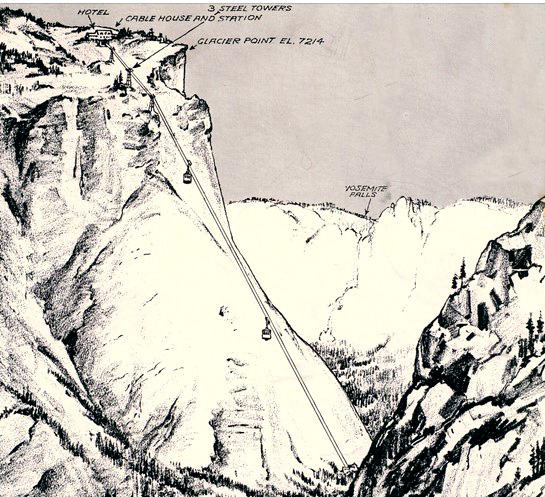
In the 1930s an aerial tramway was proposed from Happy Isles to Glacier Point:
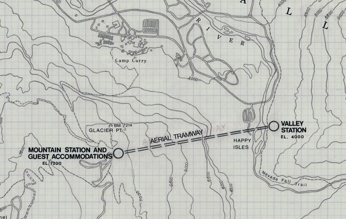
The proposed tramway and steel towers as it would have been seen from the Nevada Falls trail:
________________________________________________
17) Mirror Lake junction (Valleywide Shuttle AND East Valley Shuttle)(service sometimes ends earlier than other stops).
The path to Mirror Lake from this stop is steep in parts, but wheelchair accessible.
The map below shows the loop trail to Mirror Lake from stop #17 (but also see an alternative trail from the Ahwahnee at stop 3 shown about half way down the webpage at this Ahwahnee hotel map).
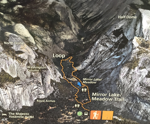
Five routes to Mirror Lake are described at Mirror Lake trails and maps.
________________________________________________
North Pines campground and stable no longer has it’s own bus stop. You can no longer ride horses in Yosemite Valley, go instead to the Wawona stable. At Wawona is also where you can pay for a horse-drawn stage ride.
“From approximately late May through September, a daytime kennel is available at the Yosemite Valley Stable, stop #18. You must provide written proof of immunizations (rabies, distemper, parvo, and bordetella) from your veterinarian. Dogs under 20 pounds may be considered if you provide a small kennel. No food is allowed, due to wildlife management concerns. Because of limited kennel space, advanced reservations are highly recommended. Contact 209.372.8326 for more information.” And all this is subject to change.
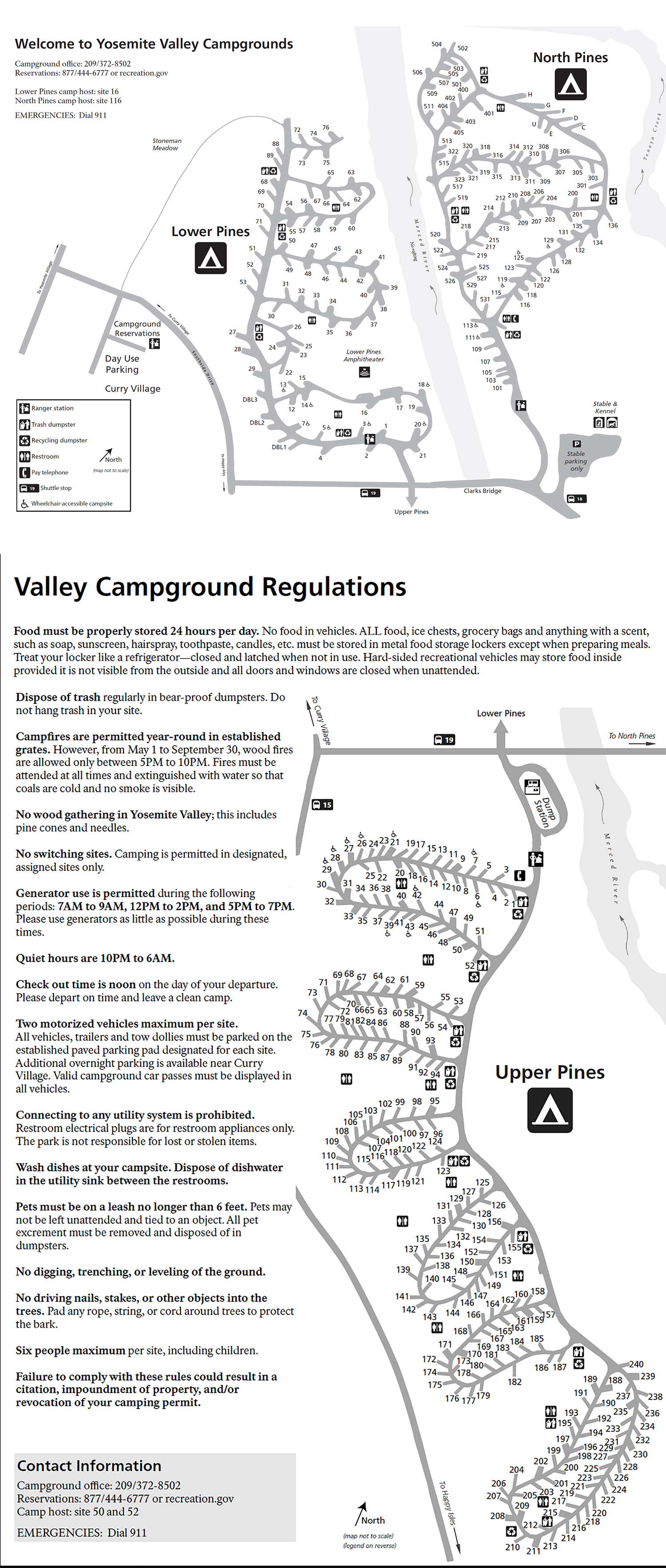
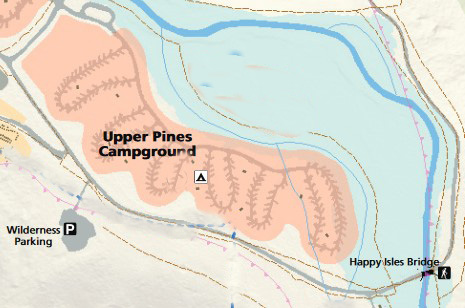
map of Upper, Lower and North Pines campgrounds in Yosemite Valley
________________________________________________
18) Pines campground (Valleywide Shuttle AND East Valley Shuttle)at the entrance to Lower Pines, which has three double campsites.
(Upper Pines campground entrance is across the road, North Pines campground is up the road and over a bridge.
map of Upper, Lower and North Pines campgrounds
________________________________________________
19) Curry Village (westbound) (at the main parking lot)
(Valleywide Shuttle AND East Valley Shuttle) (right across the road from stop 14)
In the picture below we see stop number 14 on the left and stop number 19 on the right with a bus at that stop.
descriptions of facilities at stop 19 are at the stop 14 description above at this webpage.
________________________________________________
![]()
To save time using the shuttle bus:
The Valley wide shuttle bus goes to stops 1 through 19 in that order all day 7 a.m. to 10 p.m. in the summer). The East Valley bus also goes in numerical order all day as well, but to fewer stops.

Here is a map of the two Yosemite bus routes stops at the east end of the valley, with the overnight accommodations, to help you make sense of the time saving tricks below:
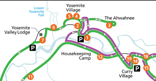
If you had come from the Pines campgrounds, Curry Village or Housekeeping Camp and got off at the main store in Yosemite Village at stop #2 it would be a mistake to get back on the wrong bus at the stop you got off at if you want to go directly back. If you did you would need to ride a major section of bus route and it could take you an extra hour or longer to get back. Be sure you notice whether the bus you get on is a Valleywide Shuttle OR an East Valley Shuttle.
Below is a picture of a bus at stop 2, with people walking across the street to the store:
If you had come from the Pines campgrounds (stop 18) and stopped at a Curry Village restaurant or store (stop 19) and wanted to go back to the campground it would be a mistake to get back on the bus at the stop you got off at. Again, you should cross the street and get on a bus (stop 14) with a shorter ride one less half hour or more to your destination.
Below is a picture of the two bus stops at Curry Village parking, stop number 14 on the left and stop number 19 on the right, with the bus stopped at it.
Coming from the big Yosemite Village day-use parking lot at stop #1, or from Curry Village, Housekeeping Camp and the pines campgrounds to most destinations in Yosemite Village, (Degnans, Post Office, Ansel Adams gallery, Wilderness Center, Visitor Center, museum) it makes more sense to get off at the main store (stop 2) and walk to the main valley Visitor Center, Degnan’s or the Post Office, etc. than to stay on the bus and ride all the way to the Ahwahnee Hotel (stop 3) and back, unless you need some of the chocolate truffles at the Ahwahnee Sweet Shop.
Guests at the Lodge or Ahwahnee and campers at Camp 4 who go Curry Village for ice skating, or rent a raft will have a much longer ride back if they get on at the stop they got off at, they should cross the road at Curry to the other bus stop for a shorter ride back.
People who go from the Ahwahnee Hotel to the Village (main grocery, Degnan’s deli/loft/cafe/kitchen) should get off the bus at stop #4. Or for the Exploration Center, theater, bookstore, Ansel Adams Gallery you should get off the bus at stop #5. But after your exploring, to return directly to the hotel, if you get on again at stop 4 or 5 you will have a long ride. Instead, get on at stop 2, opposite the biggest grocery in the park, near the Visitor Center for a much shorter ride. ( Be sure to look for a Valley-wide shuttle instead of the East valley shuttle. Both stop at stop #2.)
Given how long the wait can be for a bus in the winter it can be faster to walk between the Ahwahnee and the main store/Degnans than to wait for a bus, especially of you just saw a bus leave the Ahwahnee stop.
To go from Housekeeping Camp to the main grocery store in the Village, or to the main Visitor Center and /or Exploration Center, it can be faster to walk than to take the bus. Use the pedestrian bridge (near unit #48) over the river and follow the trail. See the Housekeeping Map
or if you use the bus, get on at stop 12 across the road from Housekeeping Camp, and get off at 14 and transfer to 19, so you will not need to ride the bus all the way around the loop to the pines campgrounds / Happy Isles / Mirror Lake / North Pines.
If you parked at the Yosemite Village Day Use parking lot and want to go to stop #16 to see Happy Isles or do a Vernal Falls, Nevada Falls or a farther hike, you should be careful to get on one of the East Valley shuttles NOT a Valleywide.
The park service estimates the average walking time (walking directly with no stops for photo taking, to look at scenery/birds, etc.) between bus stops to be:
stop 7 (Yosemite Falls / Yosemite Lodge parking lot) to stop 5 (Yosemite Exploration Center) the walk is 20 minutes. And since the only bus to get on at the Lodge – a Valley Wide -runs the entire length of the route to El Capitan and back, to get to the visitor center or exploration center, the walk could be much faster than taking the bus
stop 1 (Yosemite Village Day use parking lot) to stop 5 (Yosemite Exploration Center, Wilderness Center, museum, Ansel Adams Gallery) the walk is five minutes, and to the biggest grocery, Degnan’s restaurant, the Welcome Center it is such a short walk, that using the bus takes you much more time.
stop 1 (Yosemite Village Day use parking lot) to stop 3 (the Ahwahnee hotel) 25 minutes
stop 1 (Yosemite Village Day use parking lot) to stops 14 & 19 (day use parking in Curry Village) the walk is 25 minutes
stops 14 & 19 (in Curry Village) to stop 16 (at Happy Isles) the walk is 20 minutes
Notes about bus stops for overnight accommodations
Guests at the Yosemite Lodge in buildings Aspen, Dogwood, Tamarack, Elderberry, Cottonwood, Willow and Manzanita might find that getting off at shuttle stop 6 (Yosemite Falls) is a shorter, and more scenic walk back to their room than getting off at the Lodge stop #7.
Laurel, Juniper and Hemlock are closer to stop 7.
Guests at the Ahwahnee who use the shuttle should get off at stop #4 if they are heading for the main grocery store, Degnan’s Kitchen, Welcome Center,Wilderness Center or museum/Exploration Center/theater. If they want to return directly to the Ahwahnee they should not get back on any purple route East valley shuttle, or the green route Valleywide shuttle at stops 4 or 5, or they will be taking a long ride. They should instead get on an Valleywide (green) Shuttle at stop 2 or 1 for a more direct ride.
Curry Village canvas tent cabins numbered in the 1100s, 700s and 600s are closer to stop 15 than to the Curry Village stops #14 and #19.
map of Upper, Lower and North Pines campgrounds
Campers in Upper Pines campground in the higher numbered campsite loops (188 – 240 and 158 to 187) will find that it is a much shorter walk from the Happy Isles stop 16 to their campsite than from the Upper/Lower Pines campground stop 18 at the west end of the campground. This makes these campsites the best for a short walk back after a Half Dome or Mist Trail hike that took a bit longer than you expected and ended after the buses are running.
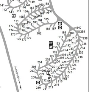
Campers in Upper Pines and Lower Pines might find the stop at #15 gets them to their campsite faster than riding all the way to Happy Isles, the stop at the end of the road to Mirror Lake, past North Pines then finally getting off at stop 18 at the entrance to Lower Pines.
(If you are heading into Upper Pines from stop 15, please don’t walk right through Upper Pines campsites 26, 27, 28 etc, at the end of the first loop after you get off the bus, please walk between the campsites and/or around the ends of the loops.)
Campers in the higher numbered sites in Lower Pines (60s 70s, 80s, etc.) will often find when there are lines for and waits for space on the buses at Curry Village, it is more pleasant (and sometimes faster) to walk to their sites, using the boardwalk across Stoneman Meadow.
– – – – – – – – – – – – – – – – – – – – – – – – – – – – – – – – – – – – – – – – – –
People at the valley backpacker’s walk-in (for camping the night before and/or after a backpack trip, wilderness permit required are told “you may park for 15 minutes at the entrance to the backpackers’ campground (in the back of North Pines Campground)” to unload gear, and then walk back out and “park overnight at the trailhead parking or at Curry Village day use parking.”
In spring in snowy years, the trail from the back end of North Pines (and over the footbridge) to the backpacker’s walk-in can be flooded with ankle deep or deeper water.
You might find it more convenient to park as directed at Curry Village day use parking, grab your gear and make sure there is no food / toiletries / scented fish bait / old french fries under the seats in your vehicle, get on nearby shuttle bus stop 19, then get off at the Ahwahnee stop #3, (maybe making a stop at the largest Yosemite Valley grocery at stop 2 on the way).
You will find it is a slightly shorter walk from the Ahwahnee bus stop through the parking lot, then make along a paved back road to backpacker’s walk-in campground than from the back end of North Pines IF you can find the way on the back road, but you have a topo map, Yosemite Valley map in the park newspaper, right? And you won’t need to move your vehicle back and forth.
The Ahwahnee stop (#3) would also be a much shorter bus ride from backpackers walk-in to and from the main store, the cafeteria at the Lodge or to visit friends at Camp Four.
Food choices at the Ahwahnee Bar (less dinner dress code than the dining room)
Chocolate truffles / a multitude of trail snacks are located in the Sweet Shop, across the lobby from the bar. Hotel map.
– – – – – – – – – – – – – – – – – – – – – – – – – – – – – – – – – – – – – – – – – –
![]()
Here, a topographical map with greater detail of the Merced river and meadows in eastern Yosemite valley:
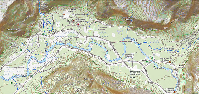
Find topographical maps at National Map.gov
Here are the bus stops for things to do in Yosemite, the following Yosemite Valley activities:
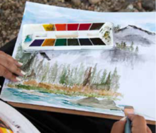
(small fee) art classes The Art Activity Center has lessons and programs “for artists of all ages and abilities”, usually open late March through October, at Happy Isles (stop 16). At that webpage also see Art Retreats: “These overnight workshops, formerly called art adventures, give you the chance to spend several days immersed in Yosemite’s natural beauty as you explore a specific art medium and learn from an expert.”
The Yosemite Conservancy also offers private art classes which you need to book in advance. “Whether you’re planning for a class field trip, a youth program, corporate outing, or a family vacation, our art programs are a fun, accessible way to get to know Yosemite. Spend a couple of hours exploring nature through drawing, painting, pastel, or sketchbook journaling — choose the activity that fits your group!”
The Yosemite Conservancy also offers free online art lessons, including Leaf Printing, watercolor, charcoal, mosaics and “scratch art. . . . “Color a Yosemite scene. Have you always wanted to see a purple Half Dome? Or a polka-dotted bear? Now’s your chance! Download park-themed coloring pages. . .”
includes a drawing of Half Dome and two bears (and more drawings) that you can download as a JPEG or PDF.
You can buy a Yosemite poster or art work online from the Yosemite Conservancy
To get a permit for a backpack trip, either arrange in advance or go to the Wilderness Center, (open spring to fall for backcountry permits and bear canister rentals) or in winter when it is closed, go to the Welcome Center.
or go to an out-of-Yosemite-Valley permit station,
To report a Bear incident or sighting, call the Save-A-Bear Hotline at 1 209-372-0322 or e-mail yose_bear_mgmt@nps.gov
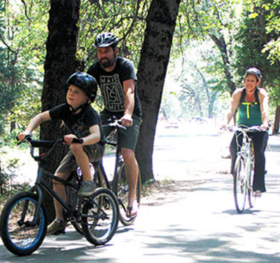
Bike rentals, helmet included in the price, are at Curry Village (see map at stop #14) and the Lodge (next to the pool, see map at stop #7), and at a stand some years located next to the Village Store, spring through fall, some years as late as November. Sometimes bike rentals shut down for the winter season but reopen briefly for a holiday weekend if the weather is nice. Find a way to bring our own bike, rentals are (ALL of the following is subject to change) as of late 2023, (higher prices some previous years) $40 Full Day, $30 Half Day. (With an attached trailer $75 Full Day, $55 Half Day.) Most years they say that bike rentals start at 8 a.m., last bike out at 3:45 p.m. and bikes need to be back in by 4:45 p.m.; (“Hours may vary based on the weather”) with your own you can ride early and late into the day. Reservations only available, and often required, for ADA bikes (“hand-crank bicycles, and tandem bicycles for visually impaired guests”).
When weather might close down bike rentals, there could be an announcement:
Rental bikes must stay in Yosemite valley and they do not allow you to ride them on all roads that you can ride your own bike on.
There are more than 12 miles of surfaced bike paths on the valley floor and even in the winter the weather is sometimes good enough to ride or rollerblade. You can ride on paved roads (if you obey traffic laws), but not on dirt trails, on paths closed due to spring flooding or the paved pathway to lower Yosemite Falls. Please walk your bike at the Yosemite Falls pathway or lock it up at the trailhead.
Yosemite Search and Rescue would like to remind you: “California law requires riders under 18 to wear helmets. Helmets are optional for bicycle riders 18 and over but they are an outstanding idea, inexpensive, and in many cases are the difference between a minor headache and life-altering or life-ending injuries. Unfortunately, when one observes bicycle operations in the Valley, the majority of adult bike riders, and even some children, opt to skip the helmet. Once the crash occurs, it’s too late to reconsider your decision to skip the helmet.”
This quote is from front country biking accident.
– According to a report in the American Journal of Surgery, riders with helmets were less likely to die from their injuries, and less likely to break facial bones, and have 52 percent lower risk of severe traumatic brain injury. Unfortunately, less than half of the millions of Americans who ride bicycles wear bicycle helmets. Those who do wear them are more likely to be white, female and insured. (In Australia, Finland, New Zealand, Dubai, parts of Canada and many other places, bicycle helmets are mandatory in all states and territories for all ages.)
The Yosemite Conservancy offers a bike share, with bikes available at campgrounds. “Visitors can use a mobile app to unlock a bike . . .”
Photos of over a hundred Yosemite birds at a Audubon website
You can download a Bird Checklist which lists all the common and uncommon birds in Yosemite, with bar graphs indicating the “relative abundance of a species in suitable habitat at a given time of year.” And find a listing of special status birds (endangered, species of special concern . . .).
and see Yosemite Valley overnight accommodations.
Cell phone service is NOT available in all parts of Yosemite.
It is usually okay in the vicinity of the main visitor center.
Many years we got 4 bars for Verizon and 3 bars for AT&T near the main visitor center, versus 2 bars for each at the Ahwahnee and 2 bars Verizon, 1 bar AT&T in Upper Pines campground, at the Yosemite Valley Lodge, Curry Village and some other locations in East Yosemite Valley.
In Feb and May 2022, we got 2 bars for Verizon and 1 bar for AT&T at almost all east Yosemite Valley locations including the Ahwahnee, in Upper Pines campground, Happy Isles, at the Yosemite Valley Lodge, Curry Village and at Yosemite Village locations such as the grocery and Visitor Center.
The park service said: “Cell phone coverage in Yosemite is spotty . . . Cell service is often impacted during daily peak visitation by the large number of people trying to access limited service; if you have four bars of service, but you can’t get a signal, this is why . . . cell coverage depends on your phone, the cloud cover and other seemingly mysterious factors and is not always reliable. ”
Outside of Yosemite valley, at the Tuolumne Grove, Olmstead Point and Badger Pass were 1 bar Verizon, zero bars AT&T. Glacier Point and the top of Half Dome often have 3 bars Verizon, 2 bars AT&T.)
It is much faster for most people to walk to the chapel from Yosemite Village day use parking or from the Lodge or Housekeeping Camp than to ride the bus from those places.
Reservations are recommended for rock climbing lessons
See a list of Climbing route closures
You can’t walk your dog everywhere or let him run un-leashed anywhere. Pets are not allowed on unpaved trails, but are okay on paved roads and most paved bike paths. Dogs and all other pets “must be restrained on a leash not more than six feet long or otherwise physically restrained.”
Many Electric vehicle (EV) charging stations are located in Yosemite Valley. See a list (scroll down) at Yosemite garage.
There are no gas stations in Yosemite valley. You can pay 24 hours with your credit or debit card at El Portal (30 minutes from Yosemite valley), Crane Flat (30 minutes from Yosemite valley) or Wawona (about an hour from Yosemite Valley) stations. (Rarely the gas pumps are not available, for example when Mariposa County inspects the fuel tanks a downtime of 2 or 3 hours can be expected and when Fuel bank systems are being upgraded stations will not be open for business on the day of installation. When repairs are needed, downtime can be days “pending the arrival of replacement parts.”)
To go to a grocery store you have many choices. The main store in Yosemite Village (stop 2) has a larger selection, but the grocery at Curry Village, Housekeeping or the Lodge might be closer to where you are staying and the bag of ice in your lap will be less likely to melt as much. The Ahwahnee has basic sundries, snacks/trail food and chocolate truffles. For hours each is open check the park newspaper
– – – – – – – – – – – – – – – – – – – – – – – – – – – – – – – – – – –
The Yosemite valley stable no longer offers horseback riding, you need to go to Wawona, usually May to early September. This is also where you can pay for a horse-drawn stage ride.
Hotels You have a number of lodging choices of where to stay overnight in Yosemite Valley (wood walled cabin without a bath / heated or unheated wood floored, canvas sided and roofed tent cabin / cabin with a bath / luxury or generic hotel rooms, suites or campsites).
wood-walled cabin without a bath, canvas tent cabin, wood walled cabin with a bath
Hotel room with a bath
Ice skating start at stop 14 or 19.
Free internet access / WiFi
is available at Degnan’s Kitchen (when not too many people are trying to use it). Subject to change, in the past it has been fee, not free and recently one webpage says it is free and another says it is fee . . .
and at the tiny Yosemite Valley branch of the Mariposa County Library in the historic Girls Club building across a road from the main Visitor Center area. See the bottom left corner of the map below. The library is often only open a few days a week and usually not open on weekends. It has WiFi free on your device and usually two operable computers. Current hours, subject to change, (scroll down)
You will find much easier access at whatever concession services facility is allowing people to pay for access (occasionally the Lodge).
(Guests at Curry Village, the Lodge and the Ahwahnee have free internet access, but not at all locations at those hotels. They might find a note in their reservation: “Please be aware that Wi-Fi can be limited due to the remote area. Please download any information prior to your arrival.” OR “Please be aware that we have mountain Wi-Fi. Please download any information prior to your arrival.”)
“From approximately late May through September, a daytime kennel is available at the Yosemite Valley Stable. You must provide written proof of immunizations (rabies, distemper, parvo, and bordetella) from your veterinarian. Dogs under 20 pounds may be considered if you provide a small kennel. No food is allowed, due to wildlife management concerns. Because of limited kennel space, advanced reservations are highly recommended. Contact 209.372.8326 for more information.” And all this is subject to change.
NPS regulation “Kite flying : is limited to kites measuring less than 1,300 square inches and which are tethered by string or similar material less than 150 feet in length. Ahwahnee Meadow, El Capitan Meadow, Big Meadow, and Tuolumne Meadows are closed to kite flying regardless of size. This restriction is necessary to ensure the safety of low flying aircraft being used in SAR, medical, fire, or other emergency situations.”
The laundromat is at Housekeeping camp, shuttle bus stop 12. To find the laundromat, bear left when you enter the Housekeeping parking lot.
Map showing Housekeeping Camp, the biggest beach, the pedestrian bridge over the river to other swim beaches, laundromat and showers
Lost something on a shuttle bus, (or elsewhere in Yosemite)?
You can submit a lost and found form
1-209-372-4357
yose_lostandfound@nps.gov
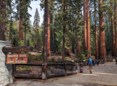
The Mariposa Grove is not in Yosemite Valley or in the town of Mariposa. See info on the free shuttle, a great map with locations of a small accessible only parking lot, trails (noting those that are wheelchair accessible or okay for horses) and mature Sequoia trees by name, including the Bachelor and Three Graces, the Faithful Couple, the Grizzly Giant, California Tunnel Tree, Galen Clark Tree, Telescope Tree and the Clothespin Tree. Please remember that “the climbing or attempting to climb any giant sequoia tree (Sequioadendron giganteum) is prohibited.”
Nature Notes about the Big Trees.
You will be offered a copy of the Yosemite Guide newspaper Yosemite Guide newspaper as you pay at an entrance station to enter the park, (or you can read, download or print in advance). It has hours of operation for visitor centers, museums, tours, stores, food service, post office, laundromat, showers, auto service, gas stations, and a calendar of park activities including Ranger walks.
The Pioneer Yosemite History Center, with a collection of historic buildings, covered bridge, horse-drawn stage rides and daily Ranger tours in warm months is at Wawona.
You can click around at this 3D view to explore the Pioneer History Center at Wawona:
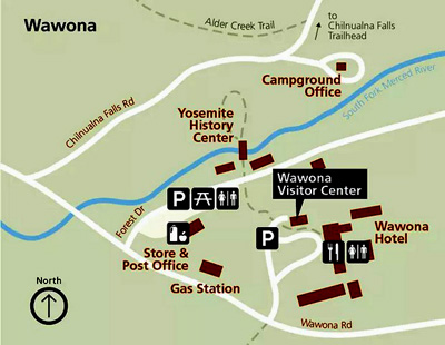
You might sign up for a free or fee photo walk at the Ansel Adams gallery, but the walk could meet at the Ahwahnee, check the park newspaper.
Where were they when they got that great picture in Yosemite?
Where can I take a photo that looks like the one on a Yosemite postcard I just bought?
Places to take photos of Half Dome, Bridalveil Fall, El Capitan, Yosemite Falls, Clouds Rest and Staircase Falls.
To go rafting, pay to rent a raft near stop 14. If you have your own, more info is at: Yosemite Valley Rafting Advice
Raft rental reservations are advised, up to 80% of rafts are reserved the day before. http://www.travelyosemite.com/things-to-do/rafting/ You make them at the little kiosk next to Curry Village registration. You can spot the kiosk on the map at http://www.travelyosemite.com/media/524862/half-dome-village_property-map_web.jpg
Ranger talks, walks and evening programs meet at various locations, including in front of the main visitor center, in front of the Yosemite Museum, at a campground/amphitheater, at a shuttle bus stop, at the Lodge amphitheater behind the office, at the El Capitan Bridge, Ahwahnee hotel shuttle stop or back lawn, check the park newspaper.
There are restaurants and cafeterias, pizzerias / grill / deli of various sizes and styles at Curry Village, Yosemite Village, the Ahwahnee and Yosemite Lodge. Links to menus for the restaurants are at the bus stop listings for each lodging above and at restaurants. The main grocery at stop #2 has premade individual meal-type salads with dressing packets, and whole or half grilled chickens, plus lots of sliced cheese/meats, crackers/breads, cookies to pack an impromptu picnic from.
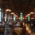

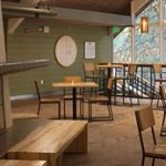
index to over a dozen park webpages with park laws, rules, regulations, policies and prohibitions about pets, bikes, permits, campground regulations, food storage, smoking, speed limits . . . and much more.
(Fee) downhill ski and cross country ski/snowboard and (free or very low cost) snow shoe walk with a Ranger Naturalist, use the free winter bus to the ski resort from, usually in this order: Curry Village, Yosemite Village, the Ahwahnee Hotel and Yosemite Valley Lodge, usually with early morning and mid-morning runs to the ski resort and early afternoon and late afternoon returns. Expect this bus to run on a more rigid schedule than the free valley shuttle buses might.
https://www.travelyosemite.com/media/825706/badger-pass-shuttle-20240116.pdf
The most Sequoia trees (not actually Redwood trees) are at the Mariposa Grove (see Mariposa Grove links above). and at the Tuolumne Grove near Crane Flat on the way to Tuolumne Meadows. https://www.nps.gov/yose/planyourvisit/sequoias.htm
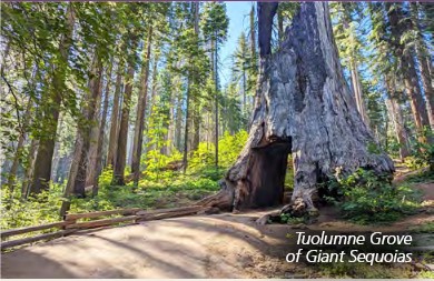
To get a shower in the summer go to Housekeeping Camp or Curry Village. In the winter only the Curry Village shower house is open, and sometimes only on weekends. From the Curry Village bus stops, walk toward the large buildings. To the right, the biggest building houses the stores and a small food service. To the left of them is a service vehicles only road. Up that road a short distance on the right is the shower house (and swimming pool entrance in the summer). (People staying at Camp 4 have showers for their use.)
NPS regulation: “skating, skateboards and similar devices
• The use of roller skates, skateboards, roller skis, coasting vehicles, or similar devices are allowed only in the following areas:
• Yosemite Village Mall
• Bicycle paths in Yosemite Valley . . .
• Campgrounds
Things to do during a Yosemite snow storm besides hiding in your tent uses the free valley shuttle bus.
The Yosemite valley stable no longer offers horseback riding, you need to go to Wawona, usually May to early September. This is also where you can pay for a horse-drawn stage ride.
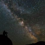
Stargazing can be on your own or is offered during many summers above the valley at Glacier Point. Amateur astronomy clubs host star gazing at the Glacier Point Amphitheater (in cooperation with the park). The program is canceled if the sky is overcast.
https://www.nps.gov/yose/planyourvisit/programs.htm
a Night Skies video is at: https://www.nps.gov/media/video/view.htm?id=CFC7487A-1DD8-B71B-0B2096D9A0182056
Learn about night skies / stargazing at: https://www.nps.gov/subjects/nightskies/upload/Junior-Ranger-Night-Explorer_2016-2018-2.pdf
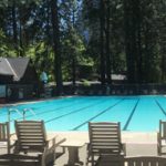
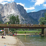
Swimming has details about free for hotel and cabins guests, or pay a fee for others swimming pools with lifeguards and suggestions for swimming in the river in Yosemite Valley, as well as thunderstorms, bacteria in the water, safety issues, favorite beaches, places you should not swim.
how to volunteer in the park, go to: https://www.nps.gov/yose/getinvolved/volunteer.htm
Which bus stops to use to see waterfalls
Best places to see wildflowers (with pictures) are at: https://www.nps.gov/yose/learn/nature/wildflowerviewing.htm
![]()
Notes about bus stops for people not staying overnight in Yosemite Valley – day use only visitors
(It is against the law to sleep overnight in your vehicle in a parking lot, by the side of the road, etc.)
There are three large free day-use parking lots in Yosemite valley for people who are staying at hotels/campgrounds outside of Yosemite valley. Suggest that in the summer (or even spring – fall, especially on weekends and holidays) you get to the valley early in the morning to find a parking space and miss out on waiting in the long lines at the entrance stations.
When you find parking, take a picture on your smart-enough phone of your parking space /vehicle from a few steps away, so you will be more likely to be able to find it. Note which bus stop / store. etc. you were closest to.
Here is a map of the three main day use parking lots:
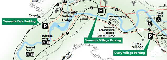
There are free shuttle bus stops at each of them.
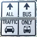
See details and advice at Parking and Traffic Jams in Yosemite valley tips and tricks.
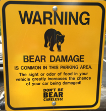
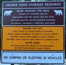
![]()
Other park buses outside of Yosemite Valley
The Mariposa Grove has a free shuttle most warm months of the year: https://www.nps.gov/yose/planyourvisit/mg.htm
A different bus runs to various stops at Tuolumne Meadows in the summer. When it is in operation, (sometimes June to September, sometimes not at all or not all of each summer) it runs most of the day to stops at Tuolumne Lodge, trailhead parking near Tuolumne Lodge, Wilderness Center/parking lot, Lembert Dome, store/grill/campground, Visitor Center, trailhead for Cathedral Lakes at the west end of the meadows, Pothole Dome, the east (beach) end of Tenaya Lake, the west end of Tenaya Lake (also the Sunrise trailhead), the May Lake trailhead and Olmstead Point. Usual schedule: service begins at Tuolumne Meadows Lodge at 7 a.m. Buses arrive at approximately 30-minute intervals between 7 a.m. and 7 p.m. The last shuttle bus leaves Olmstead Point at 6:00 p.m. Most years the shuttle bus also makes two morning (9 a.m. and noon) and two afternoon (3 p.m. and 5 p.m.) runs from Tuolumne Lodge to Tioga Pass with a stop at Mono Pass. All this is subject to change. Look for route maps at the shuttle stops and Visitor Center and/or http://www.nps.gov/yose/planyourvisit/tmbus.htm
This bus was free for years, but see below for recent rates, $1 per trip to much more for longer routes.
https://www.nps.gov/yose/planyourvisit/tmbus.htm
__________________________________________
These next buses run on a much more strict schedule than the free Yosemite Valley shuttle and fee Tuolumne shuttle described above. People who do not plan ahead to get to where the bus departs from in time have found themselves left behind.
There is a (fee) daily hiker’s bus in warm months with stops along the road between Yosemite Valley and Tuolumne Meadows. You can plan to start a day hike up in the high country and hike a trail down to the valley, including the Snow Creek trail/Mirror Lake trail and Upper Yosemite Falls trail.
https://www.travelyosemite.com/things-to-do/guided-bus-tours/
There is also a free winter bus to Yosemite Ski and Snow area (Badger Pass) for skiing, snowboarding and the Ranger snowshoe walk. http://www.yosemitepark.com/badger-shuttle-schedule.aspx
__________________________________________
Videos about Yosemite: https://www.nps.gov/yose/learn/photosmultimedia/index.htm
Yosemite webcams: https://www.nps.gov/yose/learn/photosmultimedia/webcams.htm
![]() WEATHER and Air Quality REPORTS
WEATHER and Air Quality REPORTS
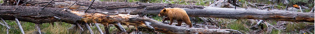
The Yosemite National Park rangers would like you to call them
if you see a bear in Yosemite,
no matter where it is or what it is doing.
Since 2003 there has been a note in the Yosemite Guide: “REPORT ALL BEAR SIGHTINGS! To report bear sightings, improper food storage, trash problems, and other bear-related problems, leave a message for the Bear Management team at: 1 (209) 372-0322. Your call can be made anonymously.”
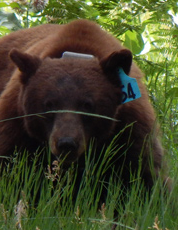
If you can, in all the excitement, try to notice if the bear has a tag (usually on the ear), the color of the tag and if possible, the number on it (the tag is large enough that with a telephoto lens you should be able to read the number).
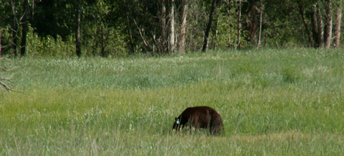
From the Yosemite Daily Report newspaper:
“It is extremely important to remember to yell at bears that are in and around development, even if they are foraging on natural food. Though it is very tempting to get close for a picture, or just to watch these incredible animals, it is important not to give into this urge. Yelling at them if they are in residential areas or near people is critical to keep bears natural fear of humans. Giving bears plenty of space. When bears become too comfortable around people, they will often start causing damage to structures and vehicles, or will even become too bold around people, creating safety concerns.”
And the Yosemite Daily Report also said:
“Scare bears when you see them. . . in developed areas- Yell like you mean it!
Make as much noise as possible, try waving your arms, stomping your feet
or anything to make you look intimidating and to get the bear to run away.
We know it’s fun to see bears and it can feel mean to scare them,
but this is a simple way to truly help save a bear’s life.”

______________________________
Yosemite hiking distances
hiking distances for most Yosemite National Park trails can be found at:
https://www.nps.gov/yose/planyourvisit/upload/trailheads.pdf
Bridal Veil fall parking to Bridalveil fall .5 mile (.8 kilometers) round trip
lower Yosemite fall round trip from bus stop 1 mile (1.6 kilometers)
Mirror Lake round trip from bus stop 2 miles (3.22 kilometers) round trip
from Happy Isles bus stop to:
– Vernal Fall footbridge 1.4 miles (2.25 kilometers) round trip, 400 foot (122 meters) elevation gain
– top of Vernal Fall 3 miles (4.83 kilometers) round trip 1,000 foot (304 meters) elevation gain
– top of Nevada Fall 5 miles (8.05 kilometers) round trip 1,900 foot (579 meters) gain
Four mile trial to Glacier Point 4.8 miles one way, 3,200 feet (975 meters) elevation gain
Camp 4 to Columbia Rock 2 mile (3.21 kilometers) round trip, 1,000 feet (304 meters) gain
Camp 4 to top of Yosemite falls 7.2 miles (11.59 kilometers) round trip, 2,700 foot (823 meters) elevation gain
______________________________
__________________________________________

FAQ: I can find Camp 4, but what are people referring to when they talk about Camp 11 or Upper Tecoya??
Yosemite Place Names has locations and/or information about Camp 1, Camp 2, Camp 3, Sunnyside Walk-in Campground, Swan Slab Meadow , Columbia Boulder (or Big Columbia), Camp 6, Camp Tresidder, Camp 7, Lower River Campground, Camp 8, Camp 9, Camp 11, Clark’s Campground, Camp 12, Camp 13, Camp 14, Camp 15 , Upper River Campground, Camp 16, Camp 17, Camp 20, Lamon Campground, Happy Pines Campground, Yosemite All-Year-Round Hotel, Ahwahnee 6th floor roof garden and dance hall, Library Suite, Sunroom, golf course, Naval Special Hospital, Ash Can Alley, Basket Dome, Boy’s Town, Bug Camp, Camp AE Wood, Camp Yosemite, Camp Lost Arrow, Chinquapin, Chowchilla Mountain Road, Crane Flat Complex, Tamarac Complex and Mariposa Complex, Curry dump site, Curry orchard, Devil’s Bathtub, El Cap Crossover, Ferguson rock slide, Fort Yosemite, Gentry Station, John Muir Hotel, Kenneyville, Great Sierra Wagon Road, La Casa Nevada, Alpine House, Le Conte Memorial, McCauley Cabin, Miller Cascade, Miwok round houses, Monroe Meadows, Northside Drive, Ostrander Ski Hut, Ranger’s Club, Rancheria Flat, Railroad Flat and Abbieville (Hennessey’s Ranch), River Straight, Southside Drive, Stoneman House, Taft Toe, Tecoya (Upper, Middle and Lower), Thousands Cabins, Too-lool-a-we-ack, Train Wreck, Village Drive, Wahhoga (or Wah-hoga), Wosky brown, Wosky Pond.
__________________________________________
——————————————————————-
The author of this webpage, (written for my students), does not give any warranty, expressed or implied, nor assume any legal liability or responsibility for the accuracy, completeness, or usefulness of any information, product, or process included in this website or at websites linked to or from it. Users of information from this website assume all liability arising from such use.