Yosemite National Park has museums in Yosemite valley and at the Mariposa Grove; visitor centers in Yosemite valley, at the Crane Flat entrance, Wawona, and Tuolumne Meadows.
Three favorites are the
Yosemite Exploration Center, west of the main post office, (formerly named the Valley Visitor Center)
the Happy Isles Visitor Center, (there is little or no parking at these except with a handicapped permit), so ride the Yosemite Valley free shuttle bus
and the Tuolumne Meadows Visitor Center, on the right just a little bit up the road into the meadows area from the Crane Flat direction.

At free Yosemite valley shuttle stop #5:
Yosemite Exploration Center, theater, bookstore and Museum
Bookstore
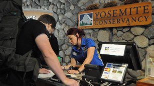
with maps, books, postcards, posters, calendars, clothes (with discounts for Yosemite Conservancy donors).
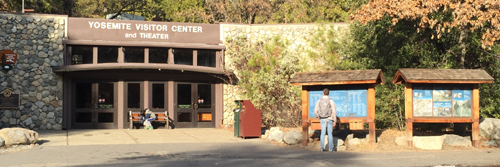
Even when the Exploration Center or the Welcome Center is closed (early morning or overnight or during government shutdowns) you can find a lot of info about trails, with color aerial photos with trails marked at two displays outside the Exploration Center, to the right in the photo above. And / or you can download an App with “information about park services and programs, as well as an interactive map designed to help visitors locate iconic features, scenic spots, trailheads and amenities. . .”
“. . . Most app content can be downloaded before arriving in the park and used offline in areas of limited cell service”
![]()
_______________________________________________
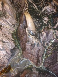
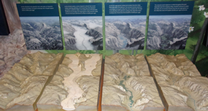
In the Yosemite Valley Exploration Center there was a huge raised relief map of the geological features. Below, a photo of part of this display, showing Half Dome from above and the trail to Vernal and Nevada Falls (and on towards the top of Half Dome), on the right:
There are history, geological and nature displays.
A Yosemite Conservancy magazine has pictures of the “Climbing and Stewardship” educational exhibit in the Exploration Center.
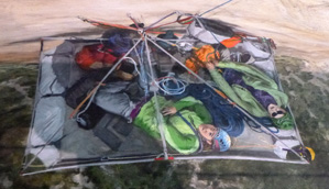
“The exhibit begins with a 9-by-12-foot image of El Capitan, stitched together from more than 2,000 photos and overlaid with climbing routes. The huge photo prompts a question: How can an exhibit capture big-wall climbing in the confines of the visitor center? After all, an average ascent of 3,000-foot-tall El Capitan takes three to five days! The exhibit team landed on key themes, including climbing history, life on the wall, techniques, safety and stewardship. . . . Where do big-wall climbers sleep? What tools are necessary for a safe and successful climb? The exhibit includes gear from past and present, such as a heavy-duty “haul bag” and a portaledge — a suspended platform climbers set up as a cliffside camping spot. In addition to featuring photos, stories and historical artifacts, the exhibit invites visitors to learn the basics of climbing techniques and terminology, and to test out their problem-solving skills, just like climbers do on a wall.”
Here is the rendering of a portaledge where climbers sleep on a big wall climb:
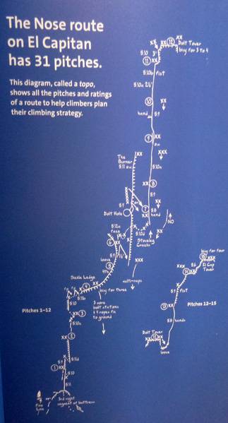
This display has the 31 pitches to climb the El Capitan Nose Route (considered by many to be the easiest full-length route up El Capitan):
The best place to watch climbers on El Capitan and get pictures of climbers with your telephoto is at El Capitan meadow.
And find advice on environmental dangers, descents, big wall bivouacs, unplanned bivouacs, loose rock, climbing unroped, leading, falling, learning to lead, the belay chain, helmets, states of mind, rescues, and risks, responsibility and the limits of climbing.
(often) Two films play every half hour in the theater behind the main building. (usually Mon.- Sat. 9:30 a.m. to (last film) 4:30 p.m. (Sunday first showing at noon). (Occasionally closed due to needs for seasonal onboarding, or other work.)
Yosemite – a Gathering of Spirit by Ken Burns usually shows on the hour. Or you can watch it at:
https://www.pbs.org/video/kvie-viewfinder-yosemite-gathering-spirit/
and The Spirit of Yosemite a great visitor orientation film with some swooping aerial views along with history and scenes from all seasons and all parts of the park, shows on the half hour. Free.
![]()
To the left as you face the Exploration Center is the Yosemite Museum (Indian Cultural Museum)/store.
Restrooms are located a little behind and between the Visitor Center and the Indian Cultural Museum.
In front of the Indian Cultural Museum is a cross‐section of a Giant Sequoia tree that visitors can touch and a re-creation of an umacha, a Miwok and Paiute cedar bark house.
Museum exhibits are listed at https://www.nps.gov/yose/learn/historyculture/museum-exhibit.htm including links to some displays after an exhibit has closed.
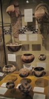
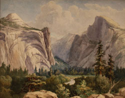
The valley museum occasionally features paintings and watercolors.
For example, one summer, paintings by Chris Jorgensen, such as shown in the photo, (courtesy of the National Park Service), below:
Go to
https://museum.nps.gov/ParkPList.aspx and search for Yosemite National Park.
The Indian Cultural Exhibit, (which interprets the cultural history of Yosemite’s Miwok and Paiute people from 1850 to the present) Village of the Ahwahnee, is behind the visitor center. Sometimes staff present programs about Ahwahneechee skills and culture.
https://www.nps.gov/yose/learn/historyculture/indian-village-of-the-ahwahnee.htm
The Wilderness Center is a couple of buildings away to the right as you face the Exploration Center, with displays on pre-trip planning, minimum impact and Yosemite’s wilderness as well as bear canister rentals and wilderness permits.
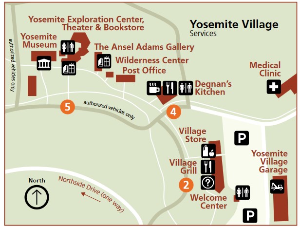
There was previously a Sport Shop at the end of the building where the Welcome Center (visitor info center) is now
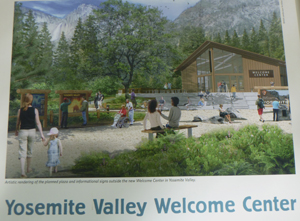
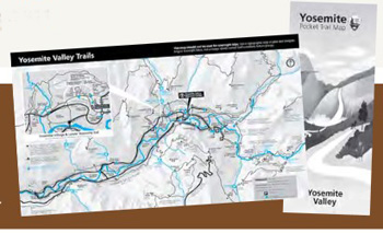
At the Welcome Center you can pick up free Yosemite Valley trail maps:
Detailed info is at:
https://yosemite.org/projects/welcoming-visitors-to-yosemite-valley/
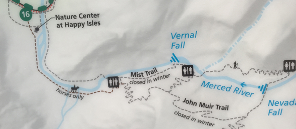
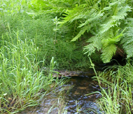
The Happy Isles Visitor Center (Nature Center) (usually not open in the winter) is up a side trail from shuttle bus stop 16, on the other side of the river from the popular John Muir trail to Vernal Fall, Nevada Fall and Half Dome and can be easily overlooked, but it is well worth a stop.
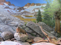
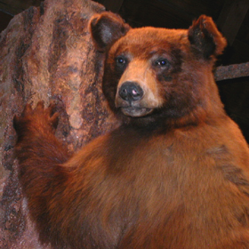
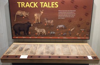
It has natural history exhibits including the animals pictured below, tree and geology explanations.

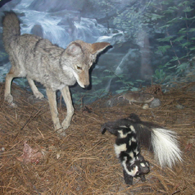
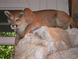
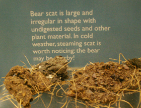
There is a great interactive display with the voices of animals including bear, mule deer, raccoon, mountain lion, ringtail, bobcat, coyote, chipmunk, ground squirrel and more. You can put your paw up next to an impression of an animal paw and compare:
Art Activity Center (https://www.yosemiteconservancy.org/happy-isles-art-and-nature-center with lessons and programs “for artists of all ages and abilities, usually open late March through October).
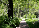
Nearby are short trails focusing on the Happy Isles environment: forest, river, talus slope and the fen (marsh).
There is an outdoor exhibit on the geologic story of rockfalls in Yosemite.
You can place a refundable deposit and borrow a day pack with activities and guidebooks to help you explore. They come in four subject areas: birds, geology, trees and small wonders.
![]()
The Tuolumne Meadows Visitor Center has has the usual maps, books, postcards, various natural history displays including a butterfly display and a raised relief map of the high country. Shown below is the section from Tenaya Lake to Tuolumne Meadows.
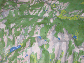
The Tuolumne Meadows hiking map has drawings and descriptions of trails to / around (easy, mostly flat) Soda Springs/Parsons Memorial Lodge, Lyell Canyon via the John Muir Trail, (moderately Strenuous, moderate elevation gain) Dog Lake or Lembert Dome, Elizabeth Lake, Cathedral Lakes, Glen Aulin, Mono Pass, Gaylor Lakes, and (strenuous, long with elevation gain) Vogelsang Area.
http://www.nps.gov/yose/planyourvisit/guide.htm
How much water will there be in the Yosemite waterfalls? has the answer
Yosemite nature and photography links
Yosemite rock falls 2008 to the most recent report and safety tips for hikers
The author of this webpage, (written for my students), does not give any warranty, expressed or implied, nor assume any legal liability or responsibility for the accuracy, completeness, or usefulness of any information, product, or process included in this website or at websites linked to or from it. Users of information from this website assume all liability arising from such use.