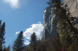
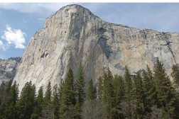
El Capitan (once known as Tu-toch-ah-nulah and “The Great Chief of the Valley”), rises 3,593 feet above Yosemite valley and can be seen from many viewpoints, thirteen of which are described here, some considered the best locations to photograph El Capitan.
(Elevation at the top of El Capitan is 7,569 feet. It is the is the largest exposed monolith of granite in the world.)
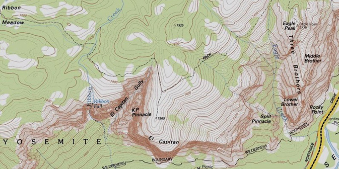
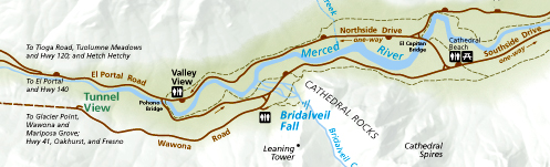
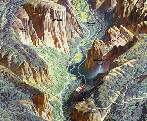
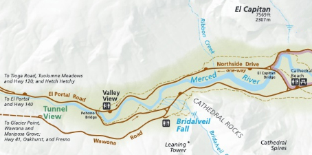
here, a topographical map of El Capitan, (with El Capitan gully and KP Pinnacle) Eagle peak and the Three Brothers as well as Ribbon Fall and Ribbon Meadow. Northside drive in Yosemite valley is partially shown on the right hand side.
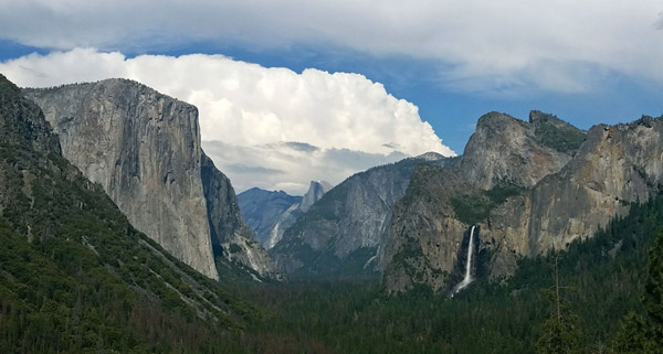
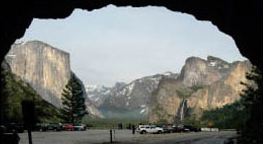
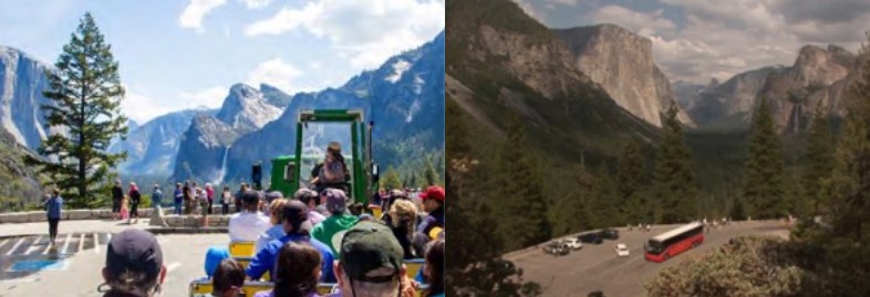
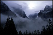
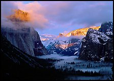
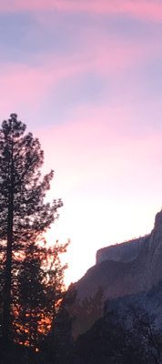
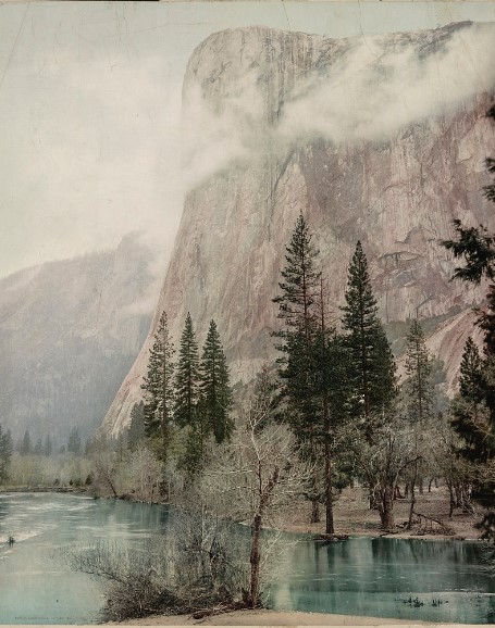
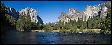
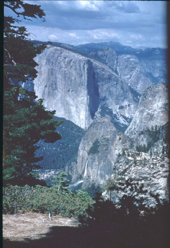
NPS photo of Tunnel View (the massive rock form on the left is El Capitan, in the background in the center is Half Dome, the waterfall on the right is Bridalveil Fall:
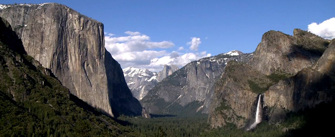
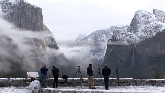
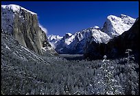
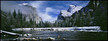
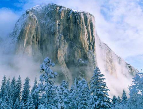
Different times of the year there will be different amounts of snow:
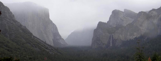
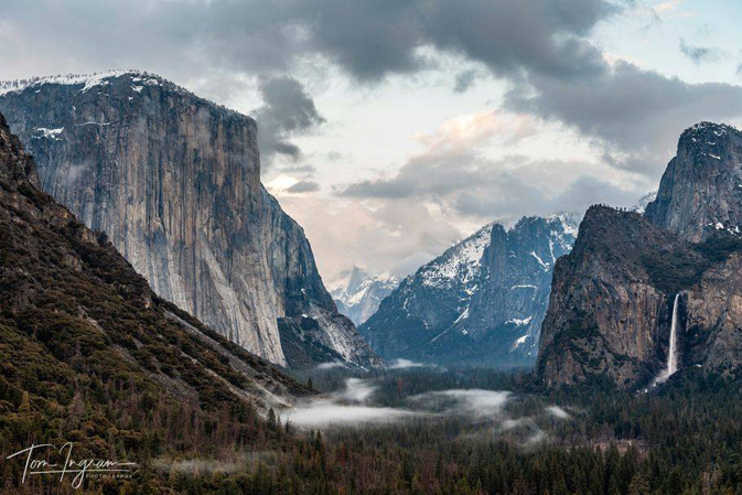
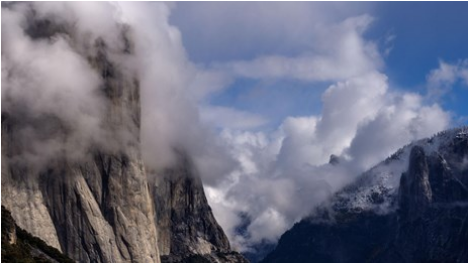
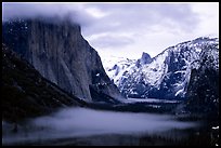
and on another day you might have fog:
This next photo is courtesy of Tom Ingram Photography, all rights reserved Tom Ingram photography
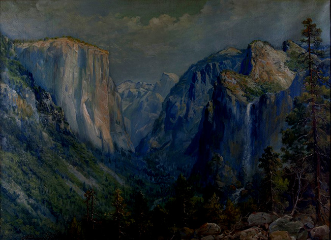
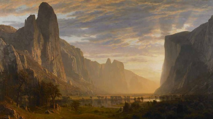
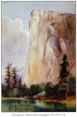
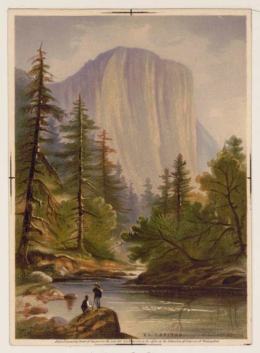
This oil on canvas was painted by Andreas Roth in 1933:
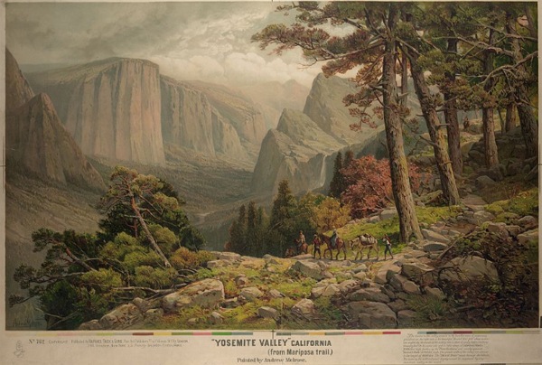
This was painted by Andrew Melrose in the vicinity:
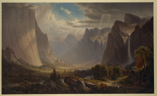
Below a photo from the NPS webpage History Culture Thomas Hill
The website said: View of the Yosemite Valley, 1865, by Thomas Hill, which
served as the backdrop for the President Obama’s 2009 Inaugural Luncheon in Washington D.C.
Courtesy of Collection of The New-York Historical Society
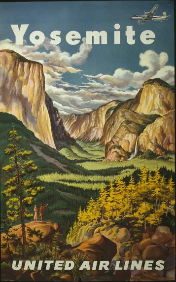
And here, a 1945 drawing from United Airlines:
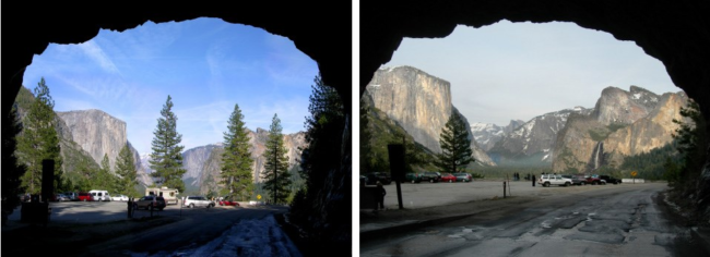
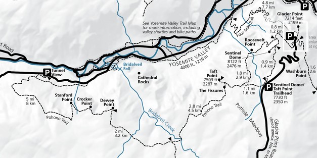
Coming into Yosemite valley on Highway 41, just before the valley, about 7 miles after Wawona, you go through a long tunnel just above the valley floor.
Or you can get to Tunnel View from Yosemite Valley by driving on Northside drive until the Pohono Bridge, then making a left over the river and continuing until a right hand turn (almost U-turn) then up the Wawona Road towards Wawona and Glacier Point road,
(this almost u-turn is the same as you would take entering the valley on Highway 140 to go to Tunnel View) as in the map below
 Coming from highway 41, after going through the tunnel, slow down and put on your right blinker at the end of the tunnel and pull carefully into the small parking lot. Walk across the road (watch out for drivers watching the scenery and not seeing you) to the main viewpoint.
Coming from Yosemite Valley, (or via Highway 140) watch for the parking lot on the right before the tunnel.
Many drivers who are watching the scenery do not notice the crosswalk between the two parking lots. If you plan ahead while driving through the area, you can slow down and look for people waiting to cross:
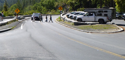
The two parking lots, one on each side of the road, have a small number of parking spaces:
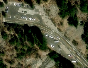
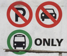
This larger of the two parking lots has a bus parking only section:
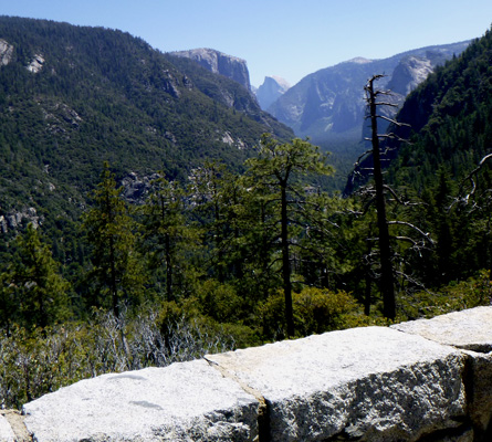
At the edge of the large parking lot is a paved section for photographers with a low wall:
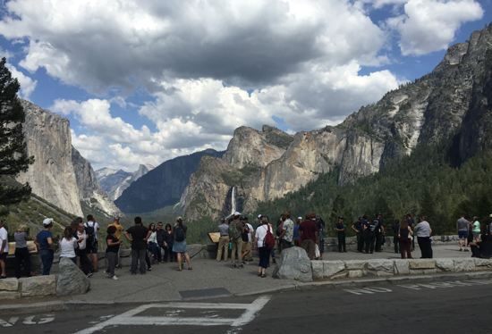
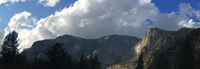
This view is worth stopping for even if you are running late and even if there is rain or snow falling. The Yosemite Fund (now called the Yosemite Conservancy) and the National Park Service funded a remodel in 2008 with educational exhibits, expanded handicap accessible viewing area and improved traffic flow. Thousands of people stop each day in the summer.
Clouds might hide the full view of peaks when you arrive, but they usually clear quickly
(and can add more drama to your photos):
Here, NPS photos of the Tunnel View before and after trees were cleared that had been blocking the view:
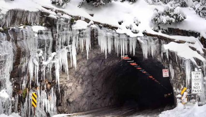
and here, an end of the tunnel in winter (note the Do-Not-Pass-in-the-tunnel sign),
and please do expect sometimes icy conditions in the parking lot.
The red X below is where Tunnel View is, the dotted line below the X is the tunnel:
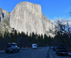
If you are going on Wawona Road to Glacier Point Road, Wawona, or the Mariposa Grove, a bit after you go through the tunnel, there are pullouts along the right side of the road where you can get a photo
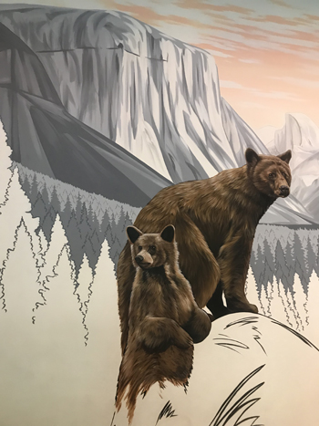
much like this painting on the wall at the Yosemite Lodge Starbucks shows El Capitan and Half Dome
in seemingly close proximity to each other:
Webcam view of El Capitan with the same perspective, courtesy of the Yosemite Conservancy
More photos of the view from the parking lot at tunnel view:
photos below by Quang-Tuan Luong/terragalleria.com, all rights reserved.
__________________________________________
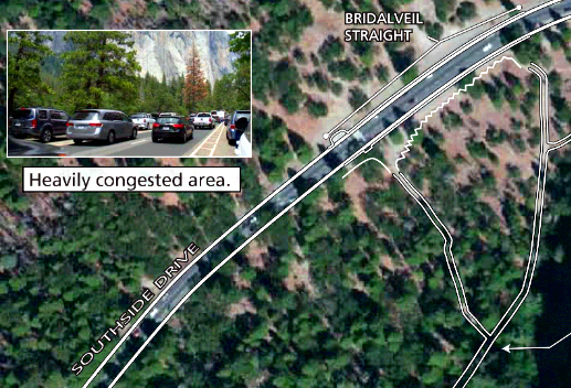
Going back down into Yosemite Valley on (usually one-way) Southside drive
(0.25 miles east of the intersection of Southside Drive and Wawona Road) there are
long paved turnouts at Bridalveil Straight
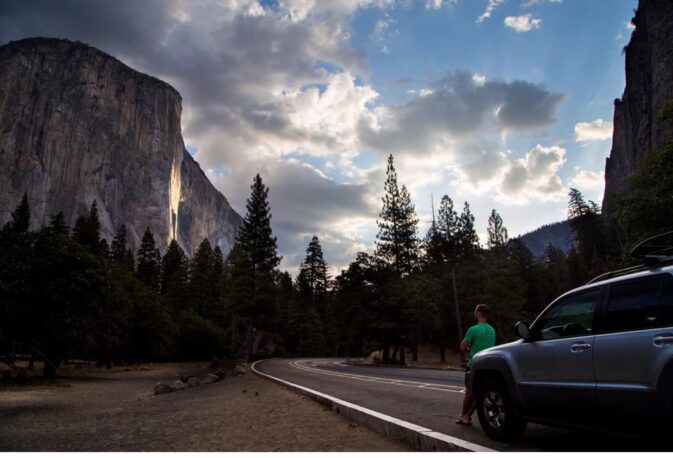
on both sides of the road with a view of El Capitan on the left
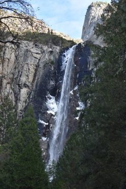
and Bridalveil Fall on the right, where a long trail to Bridalveil fall comes out to the road.
Watch out as you drive through here for people standing in the roadway to look at the view, get a picture, often not looking at oncoming traffic:
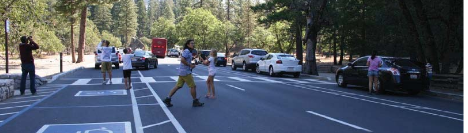
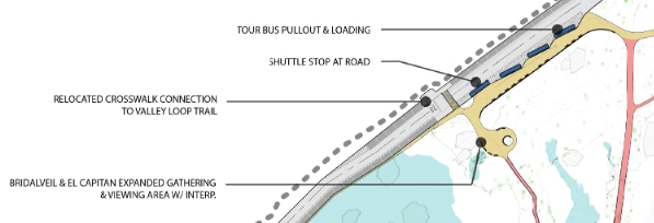
Bridalveil Straight was redesigned in 2022. Note that if you want to stop here, as you approach you should be in the left hand lane to find a parking space, as much of the right hand lane is a no parking zone designated for shuttle buses and tour buses. (The four thin blue rectangles in the map below are to show busses.)
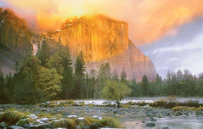
Below, a view from Bridalveil Straight
__________________________________________
__________________________________________
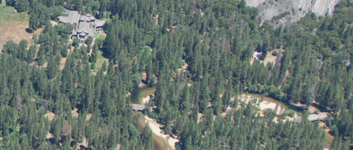
From some of the east end of Yosemite valley, rooms and out on the grounds at the Ahwahnee Hotel, you can see a little of the top of El Capitan:
and the top of El Capitan (on the left, to the right of the trees) with upper Yosemite Fall (lit up by sunlight on the right):
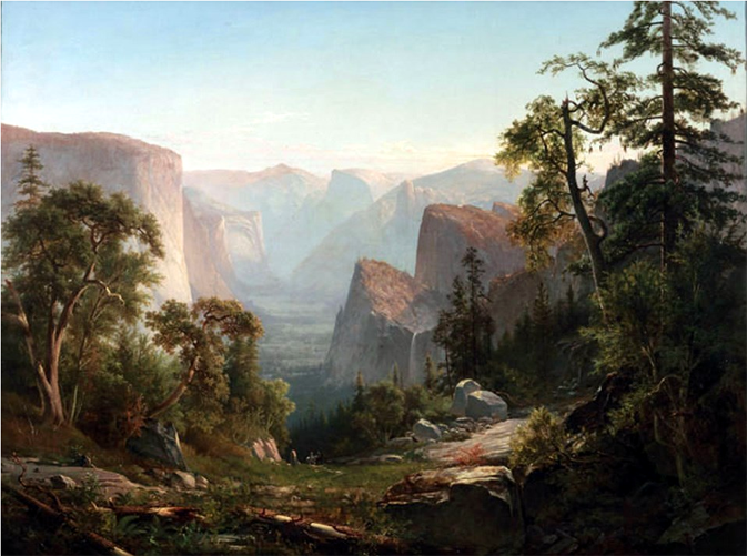
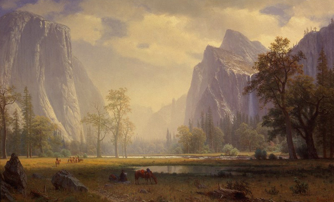
This 1865 oil painting by Albert Bierstadt has El Capitan on right as seen from the east in Yosemite valley:
__________________________________________
Sugarpine Bridge is along one route to Mirror Lake
Looking to the west while on Sugarpine Bridge, you can see the top section of El Capitan, in the upper center of this photo:
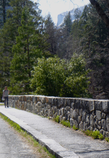
In the photo below, the Ahwahnee hotel is in the upper left, the Ahwahnee Bridge crosses the Merced River near the center and Sugarpine Bridge is to the right.
__________________________________________
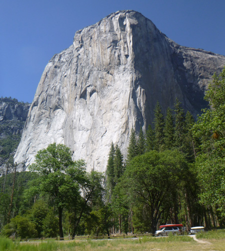
Exiting Yosemite valley on usually one-way northside drive, (top road on the map below) there are four stops many people take to see El Capitan.
The first brown dot above the road on the upper right is Devil’s Elbow (the U shaped part of the Merced River), below the view of El Capitan from Devil’s Elbow:
William Henry Jackson took this photochrom print in 1899 in the vicinity:
This watercolor of El Capitan by Chris Jorgensen (photo courtesy of the NPS), was painted in the vicinity.
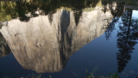
El Capitan crossover (name of the road section) goes over the Merced River on the
El Capitan bridge in the right hand section of the map above, where you can take a photo of an El Capitan reflection in the river.
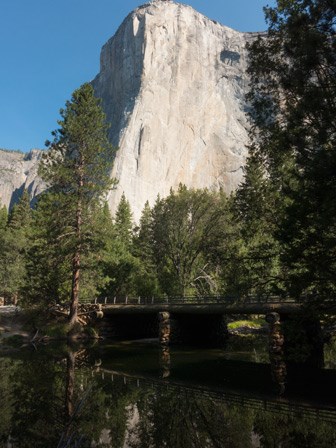
Or with still water, you might get a refection:
Just past El Capitan crossover, there is lots of parking on the left hand side of the road
along El Capitan meadow
Signs direct people to where they can go to multiple choices of viewing areas
by walking through a space in the fencing:
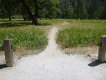
There are specific viewing areas, with worn out soil,
to keep people from trampling wildflowers in the rest of the El Cap meadow,
such as Showy Milkweed (Asclepias speciosa), a source of nectar for butterflies, hummingbirds and bees:
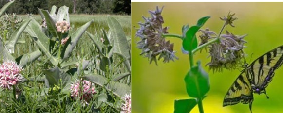
And see common Yosemite wildflowers
If you walk out into the meadow as far as the path goes, you can get more of El Capitan in your photo and fewer tree tops. You can leave your vehicle in the shot for perspective or for trip memories, (and crop it out later if you want).
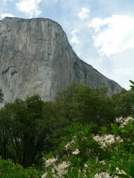
or you might find this view in May or June with Western Azalea blooming:
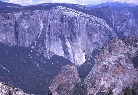
Granitic rocks of different compositions (and colors) are juxtaposed on the southeast face of El Capitan.
The darker rock in the center of the right hand side of the photograph above is the Diorite of North America.
At Yosemite Nature Granite you can find a larger copy of this NPS photo, the “Geologic map of the southeast face of El Capitan showing the complexity of the granitic rocks there” and descriptions of how granite is formed.
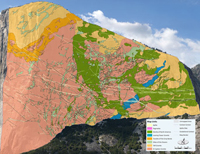
Find a full sized copy of this labeled map of geological data for Yosemite National Park (including many kinds of Granodiorite, diorite, granite)

Many consider El Cap meadow the best place to watch (using binoculars or a telephoto lens) climbers on El Capitan.
Below the view of a climber climbing the Shield Route on El Capitan:
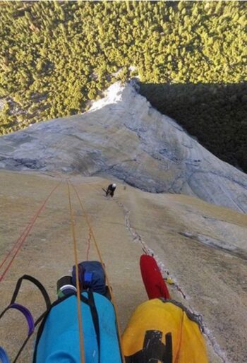
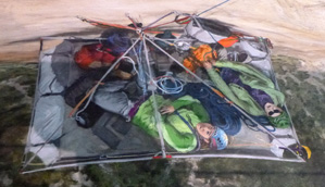
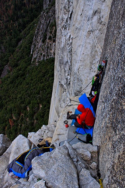
You might be able to spot climbers sleeping overnight on their portaledge.
Below a painting of climbers on their portaledge (which is outfitted with overnight supplies and sometimes even a French press for coffee or a solar panel to charge things),
from a Yosemite display Climbing and Stewardship:
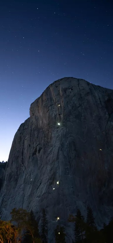
In the vicinity of El Capitan bridge or along El Capitan Meadow, you can try just after sunset when there are a few stars in the sky, to see the headlamps of climbers with enough light to still see the face of El Capitan (photo by Serena Wurmser):
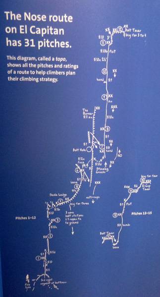
At the Yosemite Exploration Center, (free shuttle bus stop #5 ) here is a big display of climbing routes on El Capitan:
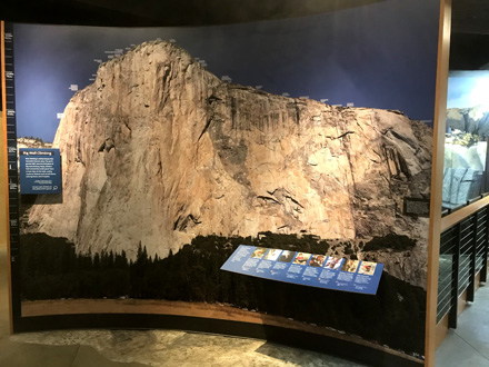
This climbing display has the 31 pitches to climb the El Capitan Nose Route:
The Merced River Plan has projects to improve views by removing trees. Find this photo in the Merced River Plan
Scroll down to Final Documents and click on Volume 3A: appendices A-L, then find page H-33.
It says about the view from El Capitan Meadow:
“The El Capitan Meadow vista is in the northeastern portion of El Capitan Meadow. The vista includes a large portion of the Yosemite Valley with iconic natural landmarks such as El Capitan, The Three Brothers, Cathedral Rocks, and the Cathedral Spires. The viewpoint is part of the Yosemite Road Guide (marker V8). Views from Northside Drive to El Capitan are also listed as a contributing vista to the Yosemite Valley Historical District. The Meadow is a popular location for visitors to watch climbers ascending the Yosemite Valley walls. The Merced River Plan proposes constructing a If a boardwalk is built, the vista should be managed from that location. No trees should be removed from within the rockfall hazard zone.”
247 trees (152 Ponderosa, 97 Cedar and 1 Fir) are in the plan to be removed.
This is the view to be improved, shown in the plan:
and below, before and after NPS photos of another El Capitan view tree clearing project:
And also note
“Ahwahnee Meadow, El Capitan Meadow, Big Meadow, and Tuolumne Meadows are
closed to kite flying regardless of size.
This restriction is necessary to ensure the safety of low flying aircraft being used in SAR (Search and Rescue), medical, fire, or other emergency situations.”
__________________________________________
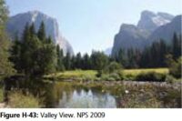
A bit further along usually one-way Northside Drive, at Valley View also known as Gates of the Valley, (the small parking lot is on the left hand side of the road, restrooms on the right hand side of the road).
The water here is usually moving fast enough that you will not find flat enough water to get a great reflection of El Capitan in the river.
A Thomas Hill painting from 1871 (photo courtesy of the Library of Congress) looks to be the same angle of El Capitan as from near Valley View:
This (1885 +/-) painting by Thomas Hill (photo courtesy of the Library of Congress) is in the vicinity.
As is this painting by Albert Bierstadt (which you can see at The Haggin Museum in Stockton, California )
Below a photo from the NPS.
The Yosemite website said: Credit: Artist: Phyllis Shafer; Courtesy of the Artist.
Phyllis Shafer: Autumn in Yosemite Valley, 2005
Nevada artist Phyllis Shafer, a plein air landscape painter, is inspired by a “kind of transcendental essence at the heart of all natural forms and objects.” She paints directly from the natural environment and is particularly intrigued by the juxtaposition of high altitude vistas with “the intimate microcosm of the flora and fauna.”
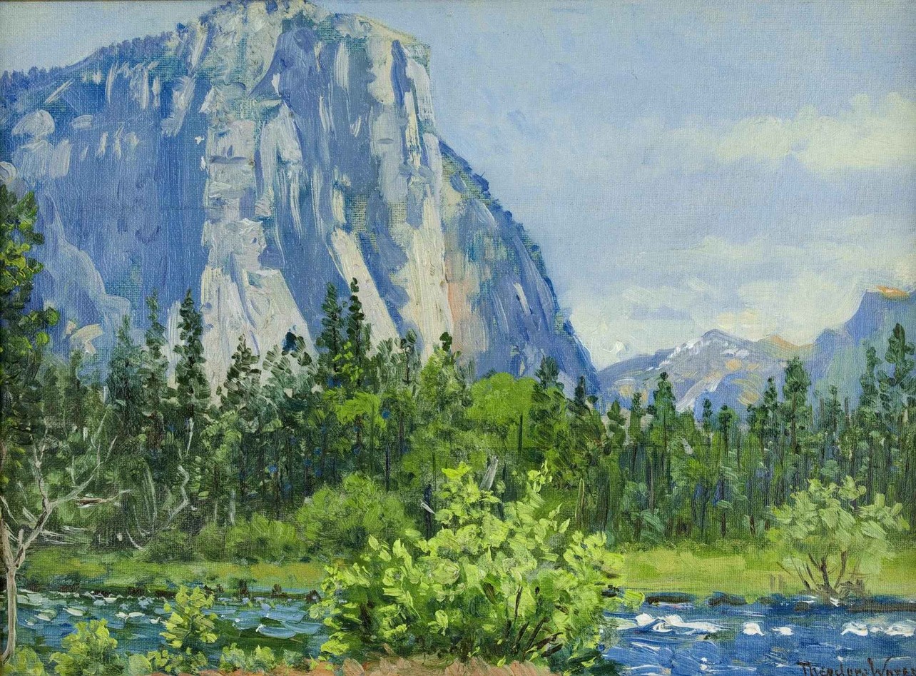
Photo of oil on canvas by Theodore Wores (1859 – 1939) courtesy of NPS
panorama spring and winter:
photos below by Quang-Tuan Luong/terragalleria.com, all rights reserved.
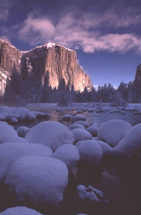
And these after a snow fall:
If you are lucky you might see a Water Ouzel (also known as a Dipper) swimming in and out of the ripples very near you, any time of year, including this photo taken in December:

Find this photo in the Merced River Plan
Scroll down to Final Documents and click on Volume 3A: appendices A-L, then find page H-35.
The N.P.S. Merced River Plan has projects to improve views by removing trees. It says about the view from Valley View:
“Valley View is at the west end of Northside Drive. This is the vista on the 2010 quarter from the US Mint’s “America the Beautiful” series. The viewpoint is part of the Yosemite Road Guide (marker V11) which describes it as being a view of the “gates” of Yosemite with El Capitan on the left and Cathedral Rocks on the right. The landscape of the surrounding Yosemite Valley is reflected in the calm water of the Merced River. The primary objective in managing the vista is to open the mostly obscured view of Bridalveil Fall, and to reduce the number of conifers encroaching on the meadow. There are a large number of dead trees from a controlled burn in 2007. The area from which trees will be removed is approximately 4 acres. There are 117 snags within this area, and of these, those less than 12” dbh will be removed and larger snags of greater habitat value will remain.” 519 trees will be removed.
__________________________________________
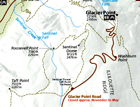
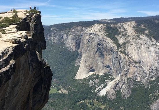
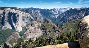
From Taft Point : (2.2 miles round-trip hike from the Glacier Point road, 2 +/- hours). Road closed in the winter. See a map of the trail to Taft point at: https://www.nps.gov/yose/planyourvisit/upload/glacierhikes.pdf and see the Glacier Point road on this free official Yosemite National Park map.
This panorama from Taft point has both El Capitan (on the left) and Yosemite Falls:
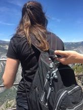
Below two shots of the official Taft Point, with El Capitan across Yosemite Valley (but do be sure to carefully explore the area, there are different, some say better views from further to the left of the official Taft Point):
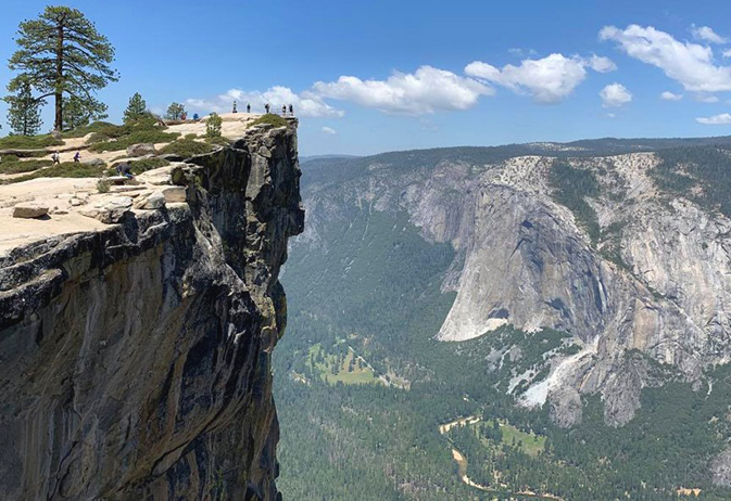
In this next shot, the railing (at the upper left of the photo) is more visible:
And a man held the back of a woman’s daypack as she took photos at the edge of the Taft point viewpoint, (perhaps to protect her from falling over the high railing?)
__________________________________________
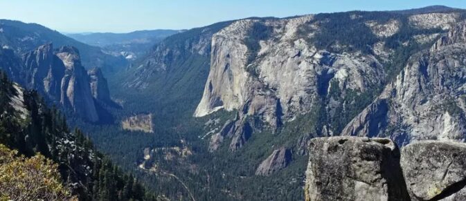
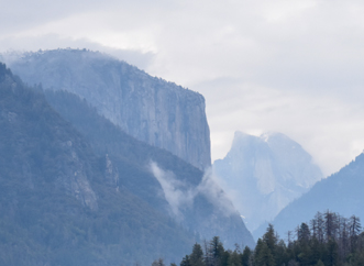
El Capitan as seen from the trail between Taft Point and Sentinel Dome. :
__________________________________________
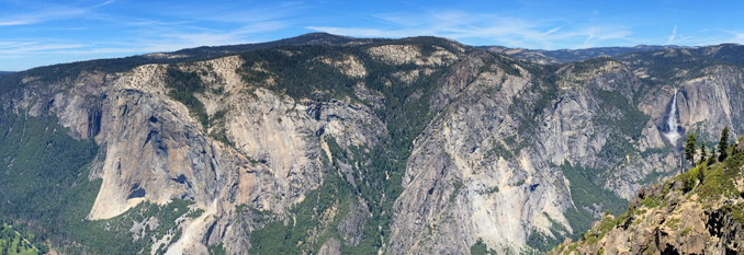
Looking down at El Capitan from the south rim of Yosemite Valley :
__________________________________________
From the Pohono Trail with Bridalveil Falls)
The NPS describes the Pohono Trail (east to west, 13.7 miles (22.0 km) one way):
“Beginning with the sweeping vista of Glacier Point, venture along the south rim of Yosemite Valley and enjoy the evolving views from points like Taft, Dewey, and Stanford as you gradually descend to the end of the trail at the iconic Tunnel View.”
__________________________________________
and here from Dewey Point, to the west of Taft Point (see map above):
__________________________________________
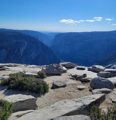
Photo of El Captain (center of the top section of peaks) from the top of Half Dome
by Mollie Boun:
__________________________________________
Coming down to Yosemite Valley from Crane Flat on new Big Oak Flat road (the extension of Highway 120) on the right hand side, after the road to Foresta, but before the tunnels, there is a
small parking lot with a
view of El Capitan and Half Dome seemingly right next to each other

This next NPS photo is from
“Planning for a Changing Climate: Climate-Smart Planning and Management in the National Park Service.”
Google maps 365 degree street view of this parking lot and the view.
__________________________________________
El Capitan from the top:
(Sibylle Hechtel and Bev Johnson at the summit of the first all-female ascent of El Capitan in 1973)
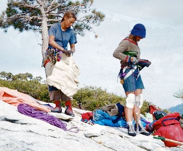
Description from a Yosemite digital exhibit:
“Granite Walls and Glass Ceilings: Gaining respect one climb at a time
“I was told that even if I could learn how to climb I’d never be able to
do the long Yosemite climbs because I’d never have the strength or
endurance to remove pins. (I still can’t do a chin up.)”-Bev Johnson, from The View from the Edge.
When Bev Johnson began training, many male climbers did not take women seriously. Johnson led the first female climbing team to summit El Capitan in 1973.
Lynn Hill was the first person, male or female, to free climb El Capitan’s most famous route, the Nose in 1993. Her first ascent took her four days. She returned in 1994 to repeat an all-free ascent of the Nose, this time in 23 hours. The Nose would not be free-climbed again until 2005.
Beth Rodden has free-climbed three individual routes on El Capitan. In 2019, Rodden authored an op-ed in The New York Times about gender inequality in professional climbing and the sponsors who supported her pregnancy.
“It’s my hope that by talking about it more we can create an equal playing field for the young girls of the next generation.”- Beth Rodden
__________________________________________
__________________________________
You can see a trail in the lower left corner of the NPS photo below, but we are not sure exactly where this photo was taken:
It looks a lot like the location by Chiura Obata, courtesy of Smithsonian American Art Museum, 1931 color woodcut on paper
__________________________________
__________________________________________
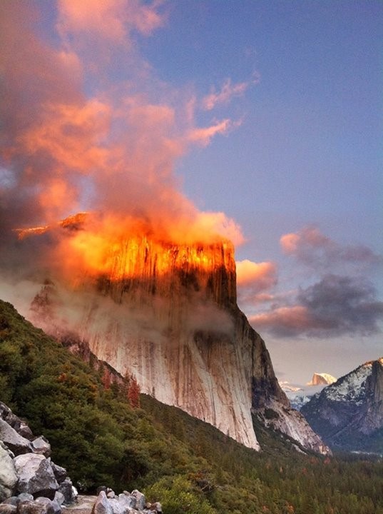
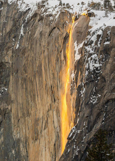
This next photo of February Horsetail Fall is courtesy of Tom Ingram Photography, all rights reserved Tom Ingram photography
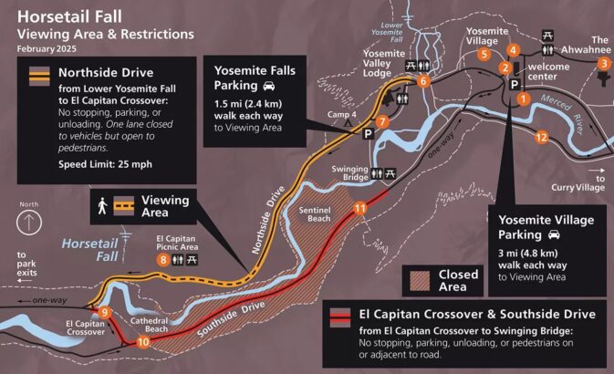
During the February Horsetail Fall natural firefall, lanes of some roads are closed either to vehicles and/or pedestrians. Road-side parking (parts of both Northside and Southside Drives as well as El Cap crossover) and turnouts, many parking lots and picnic areas are closed to parking, and some years you need a permit to go to where you can see this natural light show.
(Horsetail Fall flows over the eastern edge of El Capitan.)
This Firefall comes and goes in roughly only ten minutes.
Watch for signage. Wear warm clothes, waterproof boots, possibly waterproof outerwear and carry a flashlight or head lamp, since your cell phone will not function as a flashlight long enough or brightly enough.
Permit (or no permit, depending on the year)
reservation to enter the park (or no reservation needed, depending on the year)
and parking restrictions/ road closures info for viewing Horsetail Fall, at sunset
(and returning to your overnight accommodation after dark)
are at: https://www.nps.gov/yose/planyourvisit/horsetailfall.htm
including warnings about safety and a larger copy of a map such as this:
Watch a Yosemite Conservancy video of Horsetail Fall.
Some years, for example in 2024: “Due to the Horsetail Fall event, Camp 4, Wawona and Hodgdon Meadow campgrounds will switch from first come, first served, to reservation for the nights of February 9 through February 25.”
Yosemite Valley Lodge could be the best place to stay overnight in Yosemite valley for the February Horsetail Fall natural firefall.
BUT be sure to find a parking space and keep your vehicle parked there, as many other people will want to be parking as close to the firefall as possible.
__________________________________________
Friends of Yosemite Search and Rescue (FOYOSAR) said this:
“Firefall Isn’t Just a Photo — It’s a Search & Rescue Event
Every February, Yosemite’s Horsetail Fall draws thousands of people hoping to see the famous “Firefall.” In 2026, with no reservation system in place, those crowds are expected to be even larger — and that matters for more than just parking and photography.
For Yosemite Search and Rescue and climbing rangers, Firefall week is one of the most challenging operational periods of the winter.
Why? Because Firefall isn’t just a scenic event — it creates the conditions for a front-country emergency surge inside a wilderness park.
What SAR actually sees during Firefall
While most visitors are focused on the sunset, responders are handling
Hypothermia and exposure
Slips and fractures on icy trails
People falling into the Merced River
Medical emergencies
Lost or separated family members
Vehicles blocking emergency access.
These are not minor calls. February rescues are colder, darker, and riskier — for patients and rescuers alike.
Traffic delays can become medical delays
When roads around El Capitan gridlock, emergency vehicles cannot move freely. A response that should take minutes can take nearly an hour. In a cardiac arrest, a severe fall, or a cold-water submersion, that delay can be life-threatening.
Firefall pulls rescuers away from the backcountry
During peak Firefall periods, rangers and technical rescuers are reassigned from climbing, winter travel, and wilderness patrols to manage crowd safety and emergencies in the valley. That means fewer responders are available if something goes wrong on a big wall, ski route, or remote trail.
What you can do to help
You don’t need to be a rescuer to support rescue.
If you’re coming to Yosemite for Firefall:
Arrive early or use bikes and shuttles
Dress for winter, not for Instagram
Bring traction, warm layers, food, and water
Stay off riverbanks and icy edges
Follow ranger instructions — they are managing safety, not just traffic
The Firefall is beautiful.
But the real goal is that everyone — visitors, rangers, and rescuers — goes home safely.”
__________________________________________
_________________________________________________________________
From an NPS report: Yosemite Rockfall Year in Review 2023
“The most spectacular rockfall of 2023 occurred at 11:41 am on February 20 from the southeast face El Capitan. A single block of 1,595 cubic meters (4,746 tons) fell from the cliff along the path of Horsetail Fall, free-falling 325 meters (1,060 feet) before impacting the base of the cliff. Small rocks landed on Northside Drive, but fortunately the road was closed for the Horsetail Fall viewing event and there were no injuries. The Horsetail Fall viewing area was closed while geologists assessed the hazard.”
You can read the whole report at Yosemite Rockfalls
__________________________________________
_________________________________________________________________
A study, Detection of rock bridges by infrared thermal imaging and modeling, published in Sept. 2019, says, in part:
“Over the past 150 years, rockfalls have been intermittently documented from the southeast face of El Capitan, with 45 rockfalls recorded between 1857 and 2017. Exfoliation sheets are characteristic of the Yosemite landscape and are ubiquitous on El Capitan. Boot Flake and Texas Flake are particularly impressive exfoliation sheets and are famous features given their location along the popular rock climbing route “The Nose”.”
__________________________________________
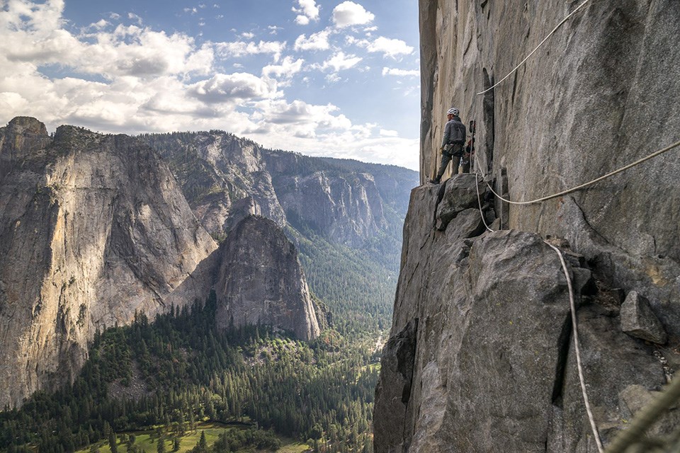
The NPS photo below of a climber on El Capitan is from the Yosemite park climbing webpage.
__________________________________________
Scroll around the almost 3,000 foot El Capitan Dawn Wall to look up close at climbers, a base camp of tents secured to the rock and follow their ropes during a 2015 free climb:
![]()
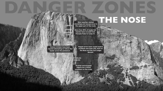
The park service offers this photo of Danger Zones on the El Capitan Nose route:
And see also:
Rescue of Injured Climber from El Capitan
“On Thursday, September 11,” (2014) “at approximately 10:30 am, the Yosemite Emergency Communications Center (ECC) received an international call from a woman stating that her husband’s climbing partner had sent her a text from El Capitan requesting a rescue. A 39-year-old male climber fell while climbing pitch 25 of 31 (the Glowering Spot) on the Nose route, which is a 2,900-foot climb (Grade VI, 5.14a or 5.9 C2). The subject, along with his climbing partner, had slept at the base of pitch 25 on their second night on the wall. The subject began leading pitch 25 at about 9 am, aid climbing off a ledge above where the two climbers had slept. As the subject climbed, he placed protection gear: one stopper, followed by a second stopper, and then a cam. The cam pulled out and the subject started falling, hitting the ledge about 20 feet below him; as he fell beyond the ledge, the first stopper caught him. Later examination revealed that the second stopper was still in the wall with the quickdraw (a piece of webbing) hanging from it, but the lower carabiner, which had been clipped to the rope, was gone. The climbers do not know whether the carabiner broke or became unclipped during subject’s fall. As a result of the fall and hitting the ledge, the subject had severe lower back pain. . . ”
The above is from a detailed description of the rescue.
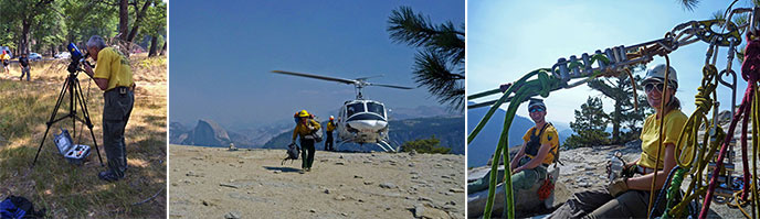
Below, three NPS photos. In the left photo, Yosemite Search and Rescue (SAR) Ranger John Dill watched the climbers with a spotting scope and communicated with them by megaphone, in the center photo a rescuer was delivered to the top of El Capitan by helicopter, and the right hand photo shows rescuers sitting by their rigging.
There is fascinating reading on how Yosemite climbers can avoid injuries/stay alive, by Yosemite Search and Rescue (SAR) Ranger John Dill, (including sections on environmental dangers, descents, big wall bivouacs, unplanned bivouacs, loose rock, climbing unroped, leading, falling, learning to lead, the belay chain, helmets, states of mind, rescues, and risks, responsibility and the limits of climbing), at: climbing advice
and read about climbing regulations, the reasons behind them and practical advice on how to follow the rules, including fixed ropes, permits and sleeping on big walls, food storage, trash and human waste while climbing, bouldering, slacklining, and bolting ethics at:
Climbing route closures in Yosemite
– – – – – – – – – – – – – – – – – – – – – – – – – – – – – – – – – – –
On May 11, 2021 Yosemite National park announced:
Yosemite National Park To Implement Pilot Overnight Climbing Permit System Beginning Friday, May 21, 2021
– Yosemite News Release Release May 7, 2021
Yosemite National Park – All visitors planning to overnight on any rock climbing routes in Yosemite National Park will be required to obtain an overnight wilderness climbing permit beginning on May 21, 2021. This pilot program is being implemented to better understand how park visitors use Yosemite’s big walls and to help improve climbing wilderness ethics and reduce negative human impacts associated with overnight big wall use.
Overnight climbing permits will be available beginning at 8 a.m. on May 14, 2021. For the duration of the pilot program, these permits will be free. Please visit https://yosemite.org/climbingpermits/ to learn more.
– – – – – – – – – – – – – – – – – – – – – – – – – – – – – – – – – – –
![]()
also from the park service, fine dining on El Capitan:
– – – – – – – – – – – – – – – – – – – – – – – – – – – – – – – – – – –
“El Capitan, Nose Route VI 5.11 A3
El Capitan, Salathé Wall VI 5.10 A3”
Are each listed as one of the Fifty Classic Climbs of North America, by Steve Roper and Allan Steck.
“At 5.9 C2, the Nose is considered to be the easiest full-length route on El Capitan, which makes it extremely popular and draws relatively inexperienced big-wall climbers. But the Nose also is a complex climb, requiring a large repertoire of techniques that may be unfamiliar to newcomers. . .” read more at Danger Zones, the Nose
A spread sheet of all accidents on the Nose of El Capitan reported in American Alpine Club Accidents from 1973 through 2013, with links to the relevant articles.
And see:
Rappellers Rescued off of El Capitan
“One of the two rappellers had a climbing helmet. . . This climbing party had some multi-pitch traditional climbing experience but no big wall or aid climbing experience. This incident is a good example of the dangerous cascade of events that can occur when a team is ill-prepared for what is a very serious undertaking. Although climbing El Capitan and other long big wall routes has become increasingly popular, it is still a committing endeavor that requires extensive climbing experience and rope/rigging knowledge in order to be completed safely. Climbers and rappellers attempting to rappel big walls should ensure they have the skills and equipment to troubleshoot and adapt in the event that things do not go as planned. Being able to ascend a rope is a fundamental skill that no rappeller, especially one on such a large cliff, should be without. The consequences of unpreparedness can be, and have been, grave for many parties, and mounting a rescue mission always causes risks for rescuers.”
Injured Climbers Rescued from El Capitan
“Helicopter 551, Yosemite’s fire and rescue helicopter, flew a team of 14 YOSAR members to the top of the Nose . . . Meanwhile, an afternoon thunderstorm approached from the east end of the Yosemite Valley.”
Climber fall on “Lurking Fear” “The placement of multiple questionable pieces of gear (which were used to provide protection in case of a fall) in a row was perhaps the main contributing factor to this accident. Perhaps most importantly, this is a reminder of how helpful helmets can be in preventing serious head trauma. According to medical personnel on scene, it is very likely that the climber’s head injuries would have been much more substantial had the climber not been wearing a helmet.”
Rescue from Muir Wall on El Capitan.
“Peter told his rescuers that he did not set up his storm fly until it started snowing, hours after Mark left, and too late to avoid hypothermia. It’s always wise to set up your shelter before a storm arrives in case of unexpected problems. Once you become hypothermic, both coordination and alertness decline, which makes setting up shelter and performing other tasks even more difficult.”
– – – – – – – – – – – – – – – – – – – – – – – – – – – – – – – – – – –
The Yosemite Assn used to have a page of photo tips from photographer Michael Frye which included:
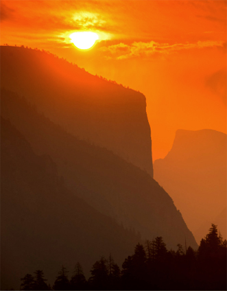
“November, December, and January are the best months to photograph Half Dome and El Capitan. From late afternoon until sunset, low-angle sunlight highlights the texture on the face of Half Dome. Late in the day, El Capitan is also flushed with warm light.”
Didn’t get quite the photo you wanted? You can buy a El Capitan or other Yosemite t-shirt, calendar, poster or art work online from the Yosemite Conservancy
and see: places to take photos of Half Dome in Yosemite National Park (with maps)
Places to take photos of Bridalveil Fall in Yosemite National Park (with maps)
Places to take photos of Clouds Rest in Yosemite National Park with maps
Places to take photos of Yosemite Falls
Places to take photos of Staircase Falls in Yosemite National Park
![]()
Selfies can be great, OR dangerous. The use of cell phones for photography has made preventable injury or even death by selfie common. They were only taking a selfie
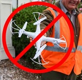
Fireworks and drones (unmanned aircraft) are banned at all times in all National Parks, even for that great photo.
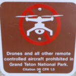
The NPS tells us that the use of unmanned aircraft (e.g., model airplanes, quadcopters, drones) has resulted in noise and nuisance complaints from park visitors, park visitor safety concerns, and incidents in which park wildlife were harassed. Small drones have crashed in geysers in Yellowstone National Park, attempted to land on the features of Mount Rushmore National Memorial, been lost over the edge of the Grand Canyon, and been stopped from flying in Prohibited Airspace over the Mall in Washington DC.
__________________________________________________________
How much water will there be in the Yosemite waterfalls?
Park Service videos about Yosemite
Yosemite National Park webcams
See an index of rules and regulations webpages.
Yosemite trail conditions info
And see shots of Yosemite valley from Glacier Point. (You can not see El Capitan from Glacier Point.)
Hiking Advice has HIKING SECRETS and etiquette including hiking in the heat, preventing and/or dealing with blisters, logistics of hiking, a day hike gear list, Half Dome hiking advice, winter hiking and the answer to the question: When is the best time of day to cross a mountain stream?
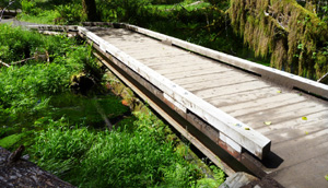
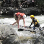
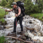
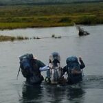
The best place to cross a creek or river is on the bridge built for this endeavor.
Crossing streams safely includes advice from Mount Rainier National Park, Yellowstone National Park, Great Smoky Mountains, and Yosemite National Park
– – – – – – – – – – – – – – – – – – – – – – – – – – – – – – – – – – –
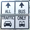
Drivers should note that there have been sections of road in Yosemite Valley, part of the year, with two lanes (usually) in the same direction, with the right lane ONLY for the free shuttle buses, ambulances, ski bus, commercial vehicles with ten or more passengers. The NPS says: “The bus lane ensures emergency vehicles can respond to incidents when traffic is backed up and provides preference for mass transit.”
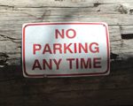
Parking and traffic jams in Yosemite valley tips and tricks has the above advice, with maps of each of the three major day-use parking lots, with advice to help you NOT get a Yosemite National Park traffic or parking ticket, and not contribute to preventable traffic backups. And some details of where you can’t park in Yosemite, or can’t park without a permit.
– – – – – – – – – – – – – – – – – – – – – – – – – – – – – – – – – – –
Hotel, cabin and tent cabin choices in Yosemite valley are at: Yosemite Valley accommodations

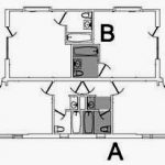
a map of and floor plans for the Ahwahnee cottages is at:
Yosemite Ahwahnee Hotel cottages, (bungalows / cabins) floor plans and map
– – – – – – – – – – – – – – – – – – – – – – – – – – – – – – – – – – –
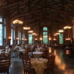

You can find basic to extravagant, (a few with a dress code),
casual, fast (grab and go)
or with table-side service,
indoor and outdoor food service
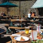
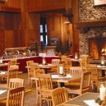
at multiple locations in Yosemite Valley, as well as four grocery stores


all of which are served by the Yosemite valley free shuttle bus.
– – – – – – – – – – – – – – – – – – – – – – – – – – – – – – – – – – –
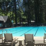
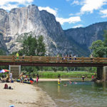
swimming in Yosemite including thunderstorms, bacteria in the water, safety issues, favorite beaches, swimming pools with lifeguards.
– – – – – – – – – – – – – – – – – – – – – – – – – – – – – – – – – – –
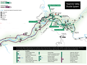
The most current route map for the free Yosemite Valley shuttle bus is in the Yosemite Guide newspaper , which you will be offered a copy of as you enter the park, or can print in advance.
It looks something like this when there is no road construction, rock slides, excess snow affecting the times/routes:
(Map below courtesy of NPS)
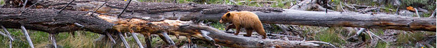
The Yosemite National Park rangers would like you to call them
if you see a bear in Yosemite,
no matter where it is or what it is doing.
Since 2003 there has been a note in the Yosemite Guide: “REPORT ALL BEAR SIGHTINGS! To report bear sightings, improper food storage, trash problems, and other bear-related problems, leave a message for the Bear Management team at: 1 (209) 372-0322. Your call can be made anonymously.”
If you can, in all the excitement, try to notice if the bear has a tag (usually on the ear), the color of the tag and if possible, the number on it (the tag is large enough that with a telephoto lens you should be able to read the number).
The NPS notes: “Tagged, or radio collared, bears do not mean the bear is a “bad” bear. Tagging bears is done for better monitoring, and the ear tag color is completely random, used to help quickly identify a bear.”
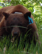
From the Yosemite Daily Report newspaper:
“It is extremely important to remember to yell at bears that are in and around development, even if they are foraging on natural food. Though it is very tempting to get close for a picture, or just to watch these incredible animals, it is important not to give into this urge. Yelling at them if they are in residential areas or near people is critical to keep bears natural fear of humans. Giving bears plenty of space. When bears become too comfortable around people, they will often start causing damage to structures and vehicles, or will even become too bold around people, creating safety concerns.”
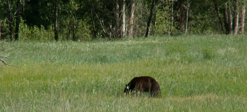
And the Yosemite Daily Report also said:
“Scare bears when you see them. . . in developed areas- Yell like you mean it!
Make as much noise as possible, try waving your arms, stomping your feet
or anything to make you look intimidating and to get the bear to run away.
We know it’s fun to see bears and it can feel mean to scare them,
but this is a simple way to truly help save a bear’s life.”


The author of this webpage, (written for my students), does not give any warranty, expressed or implied, nor assume any legal liability or responsibility for the accuracy, completeness, or usefulness of any information, product, or process included in this website or at websites linked to or from it. Users of information from this website assume all liability arising from such use.