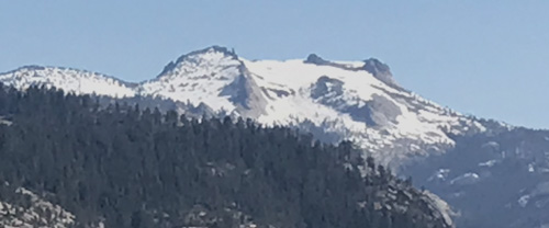
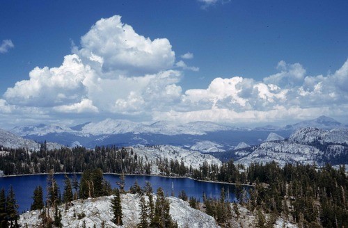
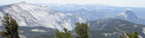
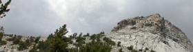
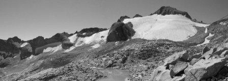
Photos of Mount Hoffman from Glacier Point and Tenaya Lake:
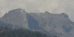
and again from Glacier Point in early July 2023, when the Tioga road was still closed due to snow and all of Mount Hoffman was covered in snow:
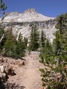
The hike past May Lake (9,229′ elevation) to the top of Mount Hoffman (10850′) is listed in trail guides as a strenuous day hike, even if you cut your trail mileage by driving the 1.8 mile one lane road from road marker T21.
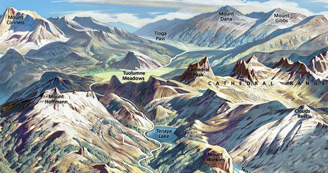
Drawing courtesy of NPS:
You don’t have to go to the top for great views.
May Lake is an easy 1.2 miles from the end-of-the-road trail head by a small pond through lodgepole pines with occasional previews of the views from the top. Here and there along the trail are wet areas with Shooting Stars in July or Corn Lilies in August.
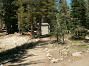
Nearing May Lake the trail splits. The left hand trail past a tiny restroom building is the one you want for our hike.
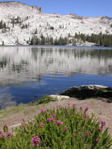
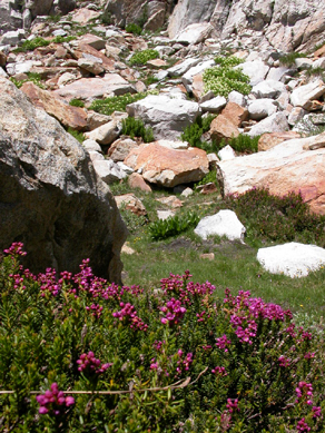
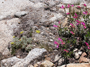
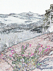
On a mid-July visit we saw snow and wildflowers along the shore.
(Previously there was a rule about no swimming allowed near the outlet of May Lake as that is where the High Sierra camp gets water.
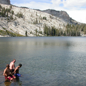
Below a picture after the hike to the top, of people sitting on a large, partially submerged rock, thinking about going swimming in the cold water.
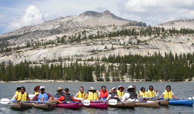
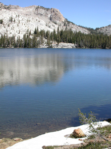
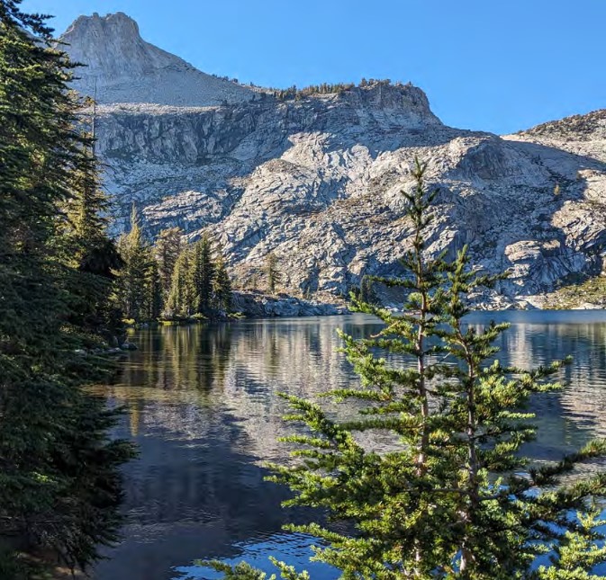
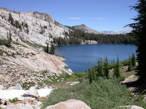
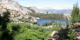
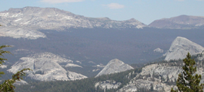
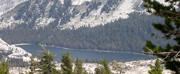
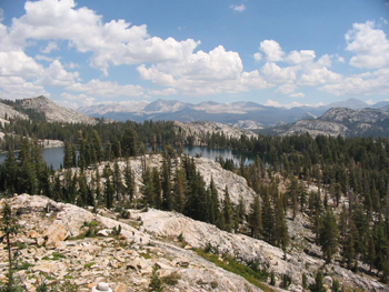
May Lake with Mount Hoffman above it:
May Lake as seen from Mount Conness:
If you got an early start, or if you don’t stop at the lake for too long, you’ll have time to go higher.
All along the route there are views of Mount Hoffman, like this one along the shore of the lake.
After a climb you’ll get to a small meadow with views down behind you of the lake.
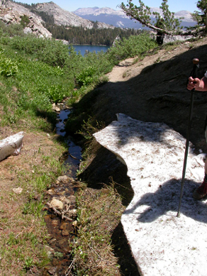
Early in the season (mid-July) the trail still goes thru snowbanks.
The trail to the top was never built or maintained until 2008, when the Yosemite Fund built a real trail.
There may be sections still marked by ducks – three rocks piled on top of each other. The ducks are sometimes misleading and people are encouraged to not create them.
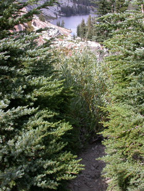
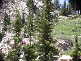
You might have to squeeze between shrubs and small trees:
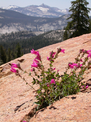
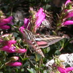
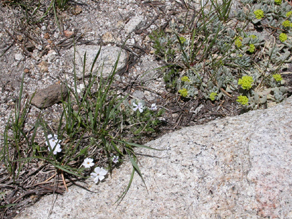
July Penstemon:
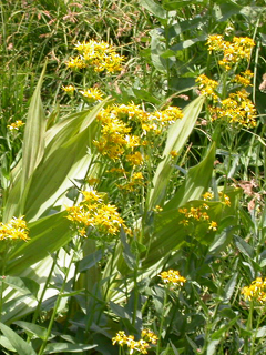
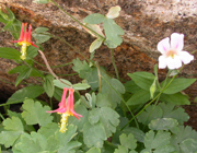
In August we saw Groundsel, Columbine and Monkeyflower blooming:
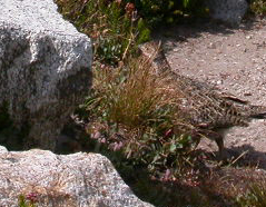
and saw a juvenile Ptarmigan:
One more long climb:
 ”
”
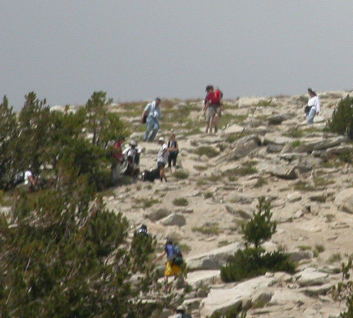
and you will get to a long meadow with a resident Marmot. Can you spot the hikers (those small dots) at the beginning of this stretch of trail across the meadow?
In August the stream is very low and there are a few water holes surrounded by mud. We found lots of tracks of deer and Ptarmigan:
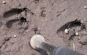
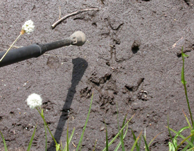
These tracks had no visible claw marks that a coyote would leave, so were they of a bobcat?
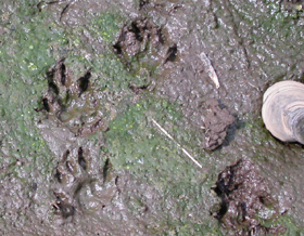
(The end of the hiking staff is 1 3/8 inches in diameter).
Don’t start for the top here, it’s easier further up the trail.
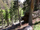
Not much farther from the end of the longer meadow, you might spot a second meadow down on the left off the trail, a bright green in mid-July.
There are many ducks and defacto trails leading up at this point, so follow the real trail. 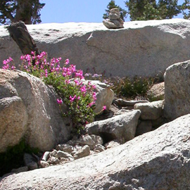
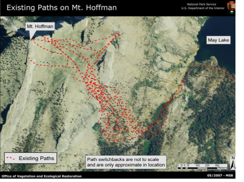
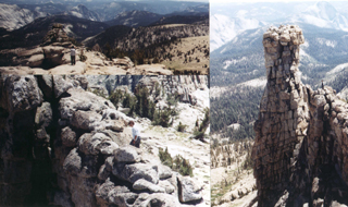
When the trail to the top of Mount Hoffman was rebuilt, the park service made a photo map of the de-facto trails / paths created by hikers
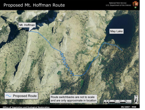
and the proposed new trail for comparison:
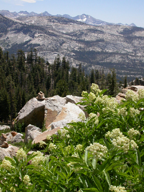
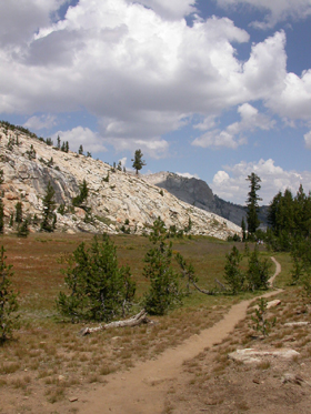
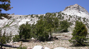
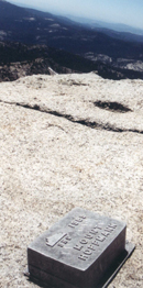
The trail leads to a plateau:
The views are great from here if you don’t want to conquer the top, such as Clouds Rest and Half Dome (with binoculars or a good telephoto you can see the hikers on the cables),
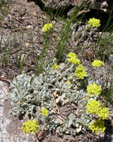
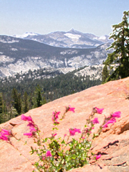
And at the plateau, look around for more wildflowers (in mid-July):
Sulphur Flower and Penstemon / Sulphur Flower
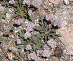
Phlox and Sulphur Flower / Pussypaws: a circle of bright green leaves surrounded by a circle of little round fluffy hot pink flowers (okay, an umbellate cluster).
But if you want, and if you got an early enough start, (if there are no puffy white cumulus building up and warning you of the inevitable afternoon Sierra thunderstorm), then drink some more water, maybe have a lunch break and reapply sunscreen and head for the top.
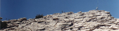
Can you spot the hikers at the left of this photo looking up at the ridge?
If not, try this view from a telephoto:
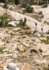
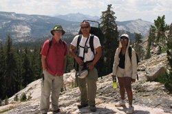
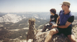
Here (photos by Manny Respicio, 2004 trip) the view down to May Lake from the top and for a sense of the space and distance shown in that shot, a closeup from that shot of hikers on the mountain. If you can spot the white hat at the bottom of both photos you might be able to spot the two hikers in both photos:
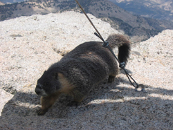
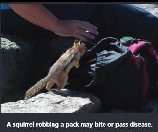
Two more photos from Manny Respicio, including a big fat Marmot who is aggressive about trying to get your food. Please don’t feed him and don’t leave packs sitting out unguarded.
Four photos below by/from Chris Throm (2003 trip).
In the background of the photo below you can see Cloud’s Rest and Half Dome.
(See also 29 more places to take photos of Half Dome.)
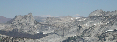
On the top, (depending on where you are), when you spot Tenaya Lake, you might be able to identify, in this order, Tenaya Peak above the lake, and along the skyline or slightly below, left to right, Simmons Peak, Vogelsang Peak, Mt Lyell, Mt Maclure, Mt. Florence, Mt Ansel Adams, Foerster Peak, Long Mtn, Isberg Peak, Post peak, Triple Divide Peak, Mt. Clark, Gray Peak, Clouds Rest, Buena Vista Crest, Quarter Domes, Buena Vista Peak, Mt Starr King, Horse Ridge and Half Dome.
The domes viewable down at Tuolumne Meadows are (left to right) Pothole Dome, Fairview Dome and Lembert Dome.
Above Tuolumne Meadows and across to Tenaya Lake, from left to right, you might be able to identify:
Gaylor Peak, Tioga Pass, Dana Plateau, Mt Dana, Mt Gibbs, Cathedral Peak, Unicorn Peak, Lower Cathedral Lake, Johnson Peak, Cockscomb, Koip Peak, Echo Peaks, Blacktop Peak, Tresidder Peak, Rafferty Peak, Matthes Crest and Donohue Peak.
Looking from Tuolumne Meadows, moving right to left towards the northeast you can see: White Mountian, Ragged Peak, Mt Conness, Sheep peak, Shepard crest, Tuolumne Peak, Virginia Mtn. and Whorl Mtn.
_____________________________________________
Read John Muir’s description of a hike to the top of Mount Hoffman and a visit to Tenaya Lake from the book My First Summer in the Sierra, (Chapter 6) written July 26 to August 1st.
https://www.gutenberg.org/ebooks/32540
___________________________
Global warming is real! Check out these August 14, 1903 and August 14, 2003 photos of the Lyell Glacier melt:
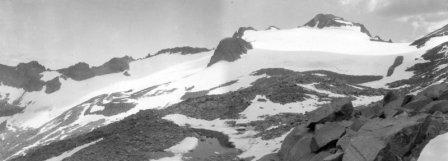
The second photo was taken by Hassan Jules Basagic IV for his masters thesis (used with his permission).
Read / see more at: https://www.nps.gov/yose/blogs/lyell-glacier.htm
_____________________________________________
Enhance your hike by reading:
The day hike gear section at Camping equipment checklist
Thunderstorm and lightning safety includes the answer to the question: Why can’t you swim during a lightning storm? A strike on a lake doesn’t kill all the fish in the lake.
see also: Cell phones in the wilderness which has advice on how/when to use a cell phone to contact 911 in the wilderness and a warning about interference between cell phones, iPods and avalanche beacons.
They were only taking a selfie
Depending on a GPS unit to intentionally be separated from your hiking partners can lead to confusion or even disaster. Be certain that the people you are with are happy with this prospect. GPS is not infallible
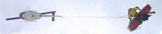 You can’t always expect a helicopter rescue
Can a person who is prescribed an epi-pen risk going into the wilderness? and some sting prevention notes are at: Anaphylaxis quick facts
Hiking Advice has hot weather hiking advice, hiking logistics and the answer to the question: When is the best time of day to cross a mountain stream?
Yosemite National Park regulations, policies and rules links
_____________________________________________
Trying to get to the top of Mount Hoffman by climbing up the east side, right above May Lake is for experts.
This is from the Yosemite Daily report of August 1, 2006:
“Rescue Of Seriously Injured Concession Employee –
Employees at the May Lake
High Sierra Camp in the Tuolumne Subdistrict reported hearing cries for
help coming from the east buttress of Mt. Hoffman just before 10 a.m. on
July 25th. Rangers and concession employees responded immediately to the
area, a steep loose granite slope. They found park concession employee
Colin Decker, 25, lying on the ground with a severe head injury and a
collapsed lung. He was unresponsive and was having difficulty maintaining
his airway. Witnesses reported that Decker was scrambling up a Mt. Hoffman
route when he fell over 100 feet, striking his head. Rangers and search and
rescue personnel provided advanced life support while a short-haul rescue
was organized due to the steep terrain. Decker was short-hauled from the
site, then transported to Ahwahnee Meadow, where he was met by a medevac
helicopter that flew him to Modesto for treatment of his life-threatening
injuries. The rescue team consisted of 16 park employees. The initial
response by concession employees was paramount in providing patient care
and in assuring the overall success of the operation. Later the same day,
Tuolumne rangers conducted a second helicopter evacuation for a patient
experiencing chest pains. (C. Cuvelier – 8/1/06)”
___________________________
Enhance your drive to the park: Road trip advice and etiquette
——————————————————————-
The author of this webpage, (written as a reading assignment for my students), does not give any warranty, expressed or implied, nor assume any legal liability or responsibility for the accuracy, completeness, or usefulness of any information, product, or process included in this website or at websites linked to or from it. Users of information from this website assume all liability arising from such use.