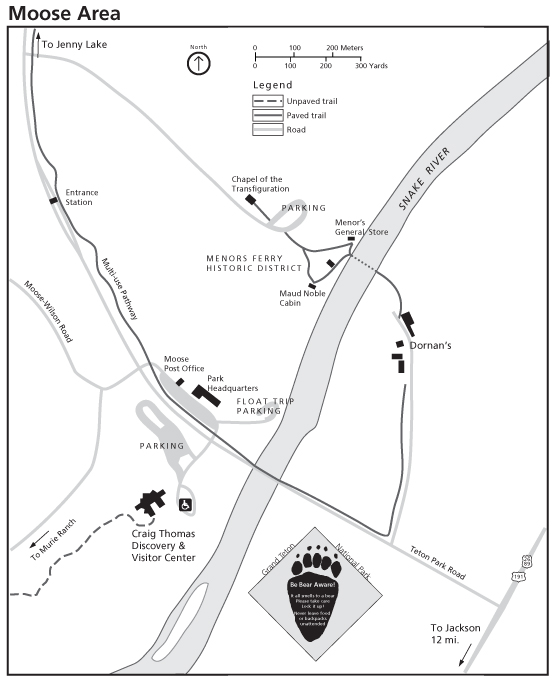
On the map above you can find
When you first turn off the highway, on to the Teton Park Road, the first road to the right goes to
Dornan’s which has bike, canoe/kayak rentals, gift shop, Dornan’s Pizza & Pasta, or the Chuckwagon.
Menus are at: http://www.dornans.com/dining/
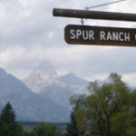
and Spur Ranch Cabins, more info at Grand Tetons hotels, cabins, lodging
and on the right,
The Park Headquarters, which some people will remember as the original park visitor center. That visitor center was closed August 10, 2007. ( There is no longer a post office next to it.) On the map at the top of this page, find the words
FLOAT TRIP
PARKING
which has become:
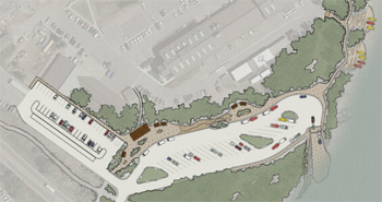
Across from the Park Headquarters, on the left is the road to the Craig Thomas Discovery and Visitor Center. This visitor center is also known as the Moose Visitor Center.
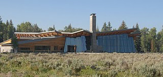
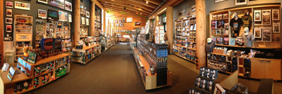
It has the biggest collection of books, postcards and posters for sale (they accept your Yosemite Conservancy membership card for a discount) and free without a secret code wireless internet.
__________________________________
Past the Park Headquarters, on the left is the
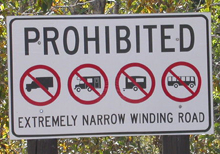
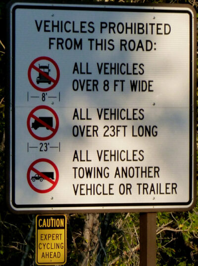
Moose-Wilson road. Four miles south on the slow, winding Moose-Wilson road, is the Laurance S. Rockefeller Preserve. No trailers are allowed and the maximum vehicle length 23.3 feet. (For example, a Sequoia with a fairly long bike rack will fit, but measure your vehicle if you are not certain.) The road goes all the way to Jackson, Wyoming and vicinity.
__________________________________
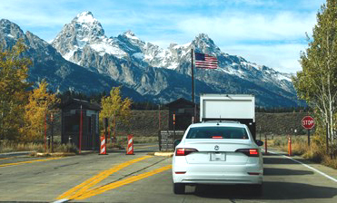
Then the Teton Park road goes through a park entrance station (upper left of map above), please do come to a complete stop next to the window. Note that only one of the entrance stations might be open and there might or might not be cones marking a closed entrance.
If you already have the parks pass and photo ID of the person in your vehicle who owns the pass, out and ready to go, you will not hold up the rest of the vehicles in the line as much.
__________________________________
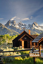
Past the entrance station on the right is the road to
The Chapel of the Transfiguration You’ll recognize the altar window view framing the tallest Teton peaks from postcards. The park services asks: “Please be respectful, the chapel is a house of worship.”
photo below used with permission from Ron Niebrugge: http://www.wildnatureimages.com/
Menor’s ferry (the dotted line across the Snake River) General store and cabin, Noble Cabin
__________________________________
A darker line along the Teton Park Road on the map at the top of this page is labeled Multi-Use Pathway.
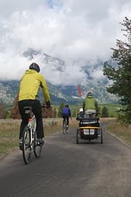
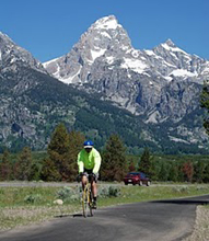 It is safer to enjoy a bike ride on a designated bike/roller blade/walk Multi-Use Pathway than on the road with drivers looking at scenery instead of you on your bike, and there is am 8 mile long pathway from the Moose Visitor Center (please walk your bike in the parking lot) to South Jenny Lake. Pets (except guide dogs) are prohibited and the pathway is closed from dusk to dawn for wildlife and public safety. Grand Tetons biking
__________________________________
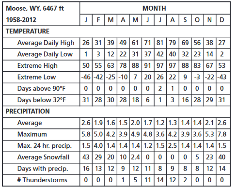 see also Grand Tetons weather.
__________________________________
Grand Tetons sightseeing has more info about the Moose area attractions
The arrow at the top left of the map points to Jenny Lake, where you can find the Jenny Lake campground and Jenny Lake Lodge.
See also: Grand Tetons hotels, cabins, lodging
Grand Teton National Park gas stations.
Grand Tetons and Jackson Lake aerial photo
NASA aerial photo of Teton Range
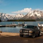
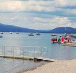
Grand Teton National Park boat launch access has maps and answers to questions:
When do Grand Teton National Park and Jackson Lake boat ramps open and close?
Where and how long can I park my boat trailer in Grand Teton National Park?
Can I bring my dog on my boat in Grand Teton National park?
and photos, details & maps about marinas and/or free boat launch ramps at Leeks Marina, Colter Bay, Jackson Lake Dam, Snake River Launch to Pacific Creek Landing, Snake River Launch and take out, Signal Mountain Lodge, and a String Lake launch ramp for non-motorized, hand carried boats
as well as details and maps of boat-in camping on Jackson Lake.

Jackson Hole, Wyoming has a description and map of the main streets and how to find grocery stores, hardware, Teton County library, St John’s Medical Center / hospital and more.
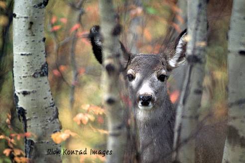
photo below courtesy of http://rickkonrad.com/