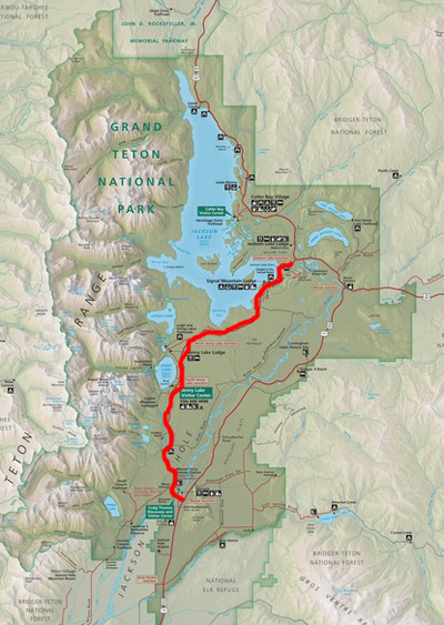
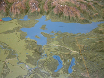
There are three main driving routes into and through Grand Teton National Park.
(A larger copy of this map of the three main driving routes is below.)

At this page you will find descriptions of
the stops you can make (historic waysides/buildings/properties), vistas/viewpoints, overnight accommodations, and trailheads
along the three main routes. As well as touring resources
about identifying peaks, wildlife and birding, biking, boat launching, Grand Teton and Yellowstone driving distances, Grand Teton National park restaurants, and a link to info about gas stations in the park.
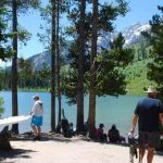
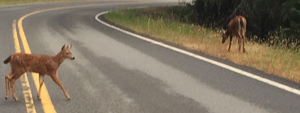
Don’t plan too tight of a schedule, as you may stop and spend quite awhile longer watching animals than you might have expected.
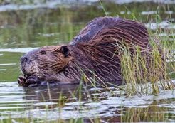
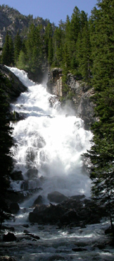
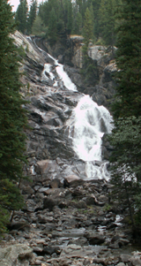
(There are more pictures of beavers at: Grand Tetons beaver lodge pictures)
Download a Grand Teton Park map
to be able to follow along with this narrative.
Grand Teton National Park
touring resources
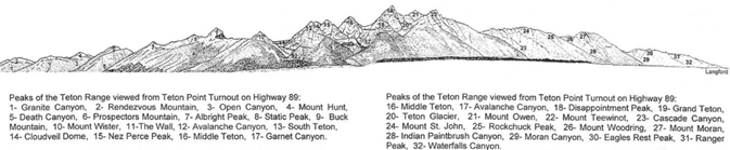
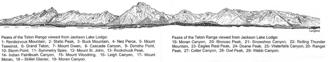
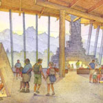
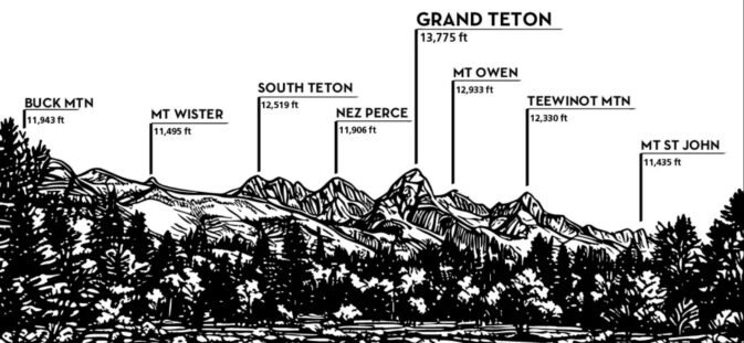
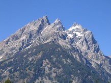
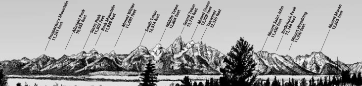 This drawing of the Teton range is often printed in the park newspaper. Details about the peaks are at: Teton range peak names
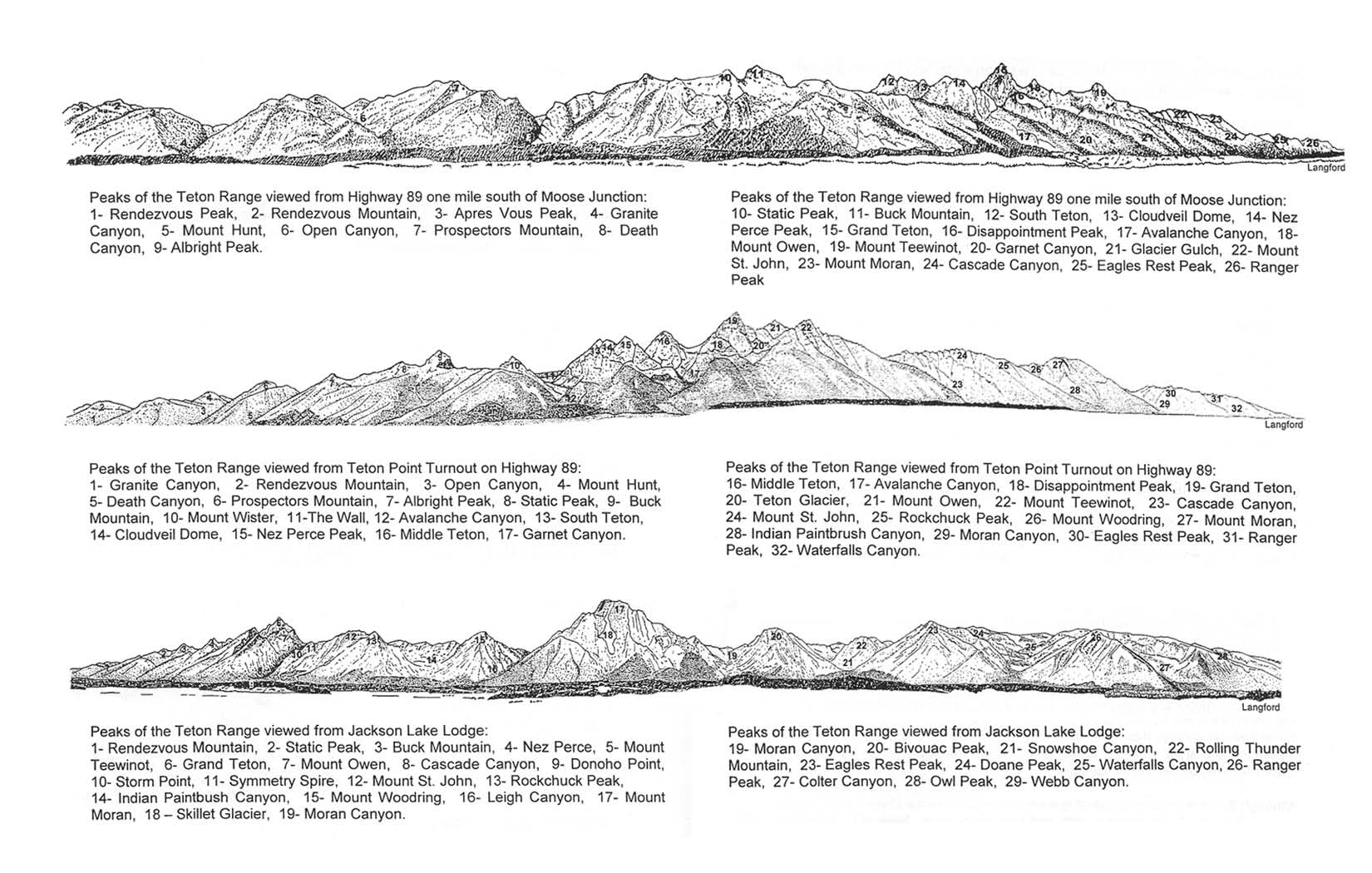
Print yourself a larger, more readable copy of three profile drawings below of the Teton Range with the names of peaks seen from these three views
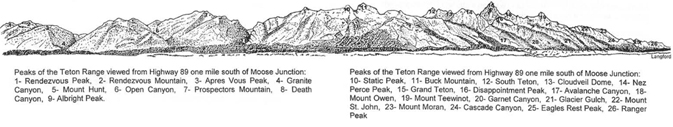
1) Highway 89, one mile south of Moose Junction
2) Teton Point turnout on Highway 89
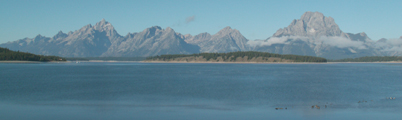
3) from Jackson Lake Lodge
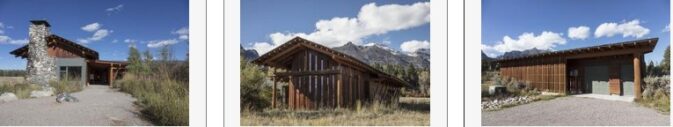
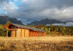
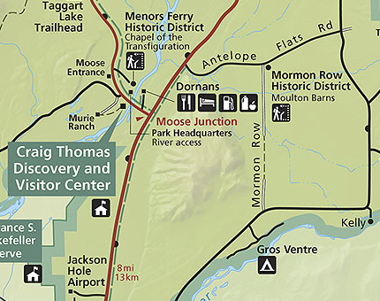
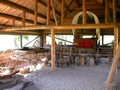
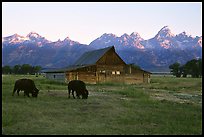
Below, a map for a Historic Properties driving tour including White Grass Dude Ranch, Murie Ranch, Chapel of the Transfiguration, Menors Ferry & Maud Noble Cabins, Luther Taylor Cabins (used in the movie Shane), Mormon Row (and the John and Bertha Moulton House), Jenny Lake Ranger Station and Visitor Center (and the Crandall Studio), Cunningham Cabin, Elk Ranch and AMK Ranch (with a photo of Berol Lodge) plus other historic buildings not listed on the map.
The NPS notes: “Visit the park’s many historic districts to learn about the hardships homesteaders endured, the dude ranch period, the events leading to park expansion, the early conservation movement and the evolution of the park into a world-class destination. The number next to each district on the map corresponds to a narrative in the Grand Teton National Park Historic Properties Driving Guide.
![]()
if the link to the tour does not function, try:
Built Beneath the Mountains
Historic Properties in Grand Teton National Park
and see: Dude Ranching at Grand Teton National Park
__________________________________
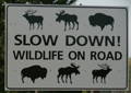
WILDLIFE
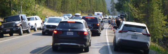
When you see a bunch of cars stopped along the road, it usually means someone spotted a large mammal. As you sightsee, park in parking lots in designated parking spaces or well out of traffic on a solid road side pavement strip. Remember that parking on natural vegetation results in permanent damage to plants; violators are ticketed.
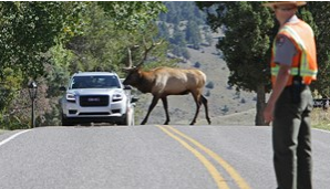
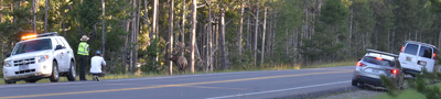
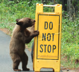
Rarely there will be Park Rangers managing traffic:
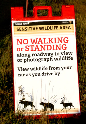
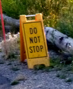
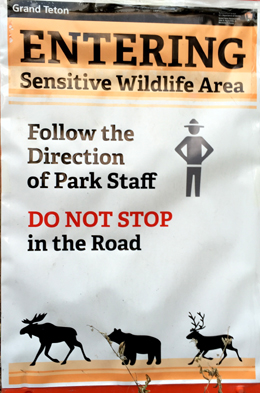
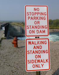
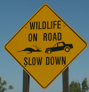
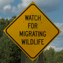
Along some roads, some parts of the year, there may be signs telling you to NOT stop:

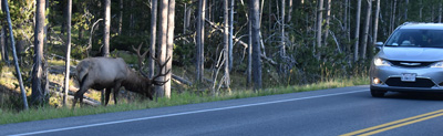
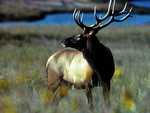
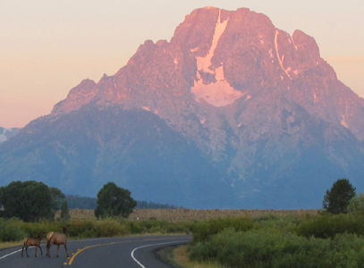
When a bull elk decides to dine at the edge of a road, there might or might not be a park Ranger trying to keep vehicles from stopping / getting out of their vehicle to get that picture too close to the elk.
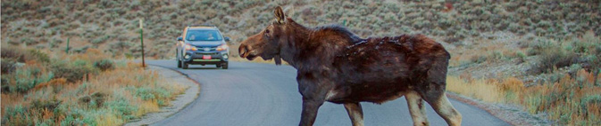
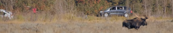
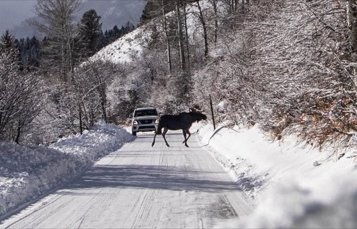
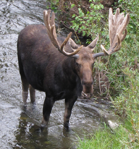
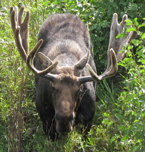
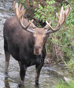
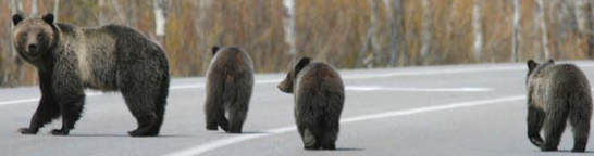
All is well when the moose is up on a hill, but when he decides to come down, cross the road, and head for his mid-day napping/hiding place, people need to give him a lot more room than these did:
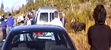
Read about safety at wildlife jams
The camera angle in one of the photos above makes the moose look much smaller than he was. Try this comparison of the size of a SUV or pickup truck with a camper shell and a moose (NPS photo) :
![]()
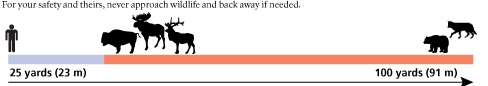
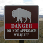
Safe Distances from Wildlife includes reasons to stay away from even friendly seeming animals in parks, and charts and photos to better be able to determine and visualize how far away from wildlife you need to stay to be safe (and obey laws that do have penalties).
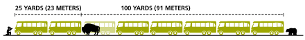
For your safety while wildlife viewing, stay 25 yards away, at least, for most wildlife, and 100 yards for bears, moose, elk, bison and wolves, whether on foot or in your car.
Keep the animal’s line of travel or escape route clear and move away if wildlife approaches you.
How far away is 100 yards? Picture the length of a football field without the end zones.
25 yards? picture four car lengths or six kayak lengths, or the width of an Olympic-sized pool like ours at the college.
More NPS advice:
“Rule of “thumb”: Another way to help keep your distance is to use the rule of “thumb.” Hold your arm straight and give the animal a thumbs up. If you can’t cover the animal in your line of sight, then you’re too close. Take a few steps back and try again.”
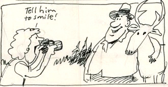
If you are close enough to take a selfie with an animal, you are too close.”
You will really want your own binoculars.
and a telephoto lens for your camera.
And see: before a bison charges which includes what the bison was doing before it charged and injured people.
__________________________________
People who have not done a lot of touring in parks sometimes do not know
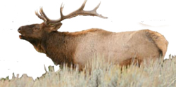
that elk are not just grown-up deer.
Or they may tell people that they saw an elk in the Colter Bay Campground, or at the cabins area, where we see deer regularly, but seeing elk there is highly unlikely.
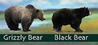 Was that a black bear or a grizzly, a coyote or a wolf or a fox, a deer, an elk or a moose we just saw?
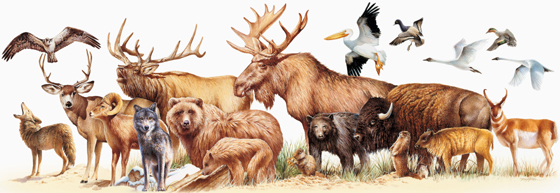
Rocky Mountain mammal size comparisons has photos and comparisons of beavers, squirrels, pika, marmot, elk, moose, bison, fox, coyote, wolf, golden-mantled ground squirrel, chipmunk, Red Squirrel (also known as) Chickaree, Unita Ground squirrels, bobcat, lynx, mountain lion (cougar), pine marten, mountain goats, bighorn sheep, pronghorn, grizzly and black bears, as well as tundra swan, trumpeter swan, adult and juvenile Bald Eagles.
___________________________________
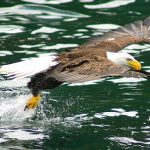
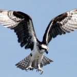
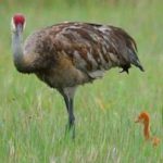
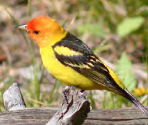
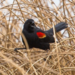
Grand Teton National Park birds has photos and details about the most common ones we can hope to see
including Bald Eagle, Barred Owl, Barrows Goldeneye, Red-winged Blackbird, Mountain Bluebird, Mountain Chickadee and Black-capped Chickadee, Canada Geese, Clark’s Nutcracker, Golden Eagle, Ruffed Grouse, Red-tailed Hawk, Swainson’s hawk, Great Blue Heron, Great Gray Owl, Great-horned Owl, Harlequin duck, Hummingbird, Ruby-crowned Kinglet, Loon, Magpie, Merganser, Northern Flicker, Osprey, Ouzel, Pelican, Peregrine Falcon, Ptarmigan, Raven, Sandhill Cranes, Steller’s Jays, Trumpeter Swan, Western Meadowlark, Western Tanager with links to calls / songs from most of them to listen to.
and you can Download photos of over a hundred birds of Grand Teton National Park

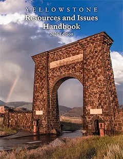
Well worth looking at for info about animals and much more: Resources and Issues is “an annual compendium of important concepts about Yellowstone’s many resources, park history, science and research conducted in the greater Yellowstone area, and critical management issues facing Yellowstone National Park.” and Grand Teton National Park as well. And find more books about Grand Teton National Park you can download for free (or check out at the library before the trip).
– – – – – – – – – – – – – – – – – – – – – – – – – – – – – – – – – – – – – – – – – –
Many people think of trees the shape of the ones shown below as “pine” trees,
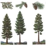
but only one of them is actually a pine tree and you will see it in Yosemite National Park rather than in Grand Teton National Park. If you are interested in learning more, see tree identification in Grand Teton Park.
– – – – – – – – – – – – – – – – – – – – – – – – – – – – – – – – – – – – – – – – – –
___________________________________
You can’t always drive on every road or hike every trail.
The park enforces a half mile closure from (usually) Feb. 15 to Aug. 15 around all bald eagle nests, a closure from April 1 to September 1 within 330 feet (or as posted) around nesting sites of osprey, trumpeter swans, peregrine falcons and great blue herons. The area within one mile of wolf den sites is closed as well. Sometimes trails or even whole sections of roadways can be closed due to grizzly activity. Mid-march to mid-May the sage grouse seasonal mating arena (lek) is closed and observers are asked to arrive well before sunrise, remain as quiet as possible and not leave until after the birds have completed their morning display.
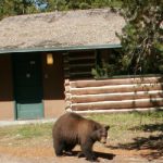
The Moose – Wilson Road is closed briefly each year (occasionally) due to bear activity. There will be signs and an announcement from the park might say: “The northern section of the Moose-Wilson Road, between Murie Ranch Junction and north of the Laurance S. Rockefeller Preserve, is temporarily closed to all visitors including motorists, cyclists, and hikers. Visitors can access the Laurance S. Rockefeller Preserve from the south. There is currently no access to the Death Canyon Trailhead…
. . . Black and grizzly bears are currently eating berries along the Moose-Wilson Road. The road is closed for human safety and the protection of the bears. Park staff will monitor the situation and will reopen the road when conditions allow.”
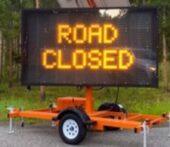
You could find a road blocked with cones and a sign saying the road is closed. An example of why the road to Signal Mountain summit was closed, from 2019, was that people were feeding bears and a black bear was bluff-charging people
Road Construction in Grand Teton National Park has closures, delays (often with the amount of time you can expect to be delayed 20 minutes. . . 45 minutes. . . even 1 hour) two lane roads that will be one lane, example: “Traffic will be controlled with a temporary stop light and alternating one lane of travel,” parking areas closed, construction areas, etc. “Project timelines and impacts are subject to change. Immediate updates will be communicated through the park website. ”
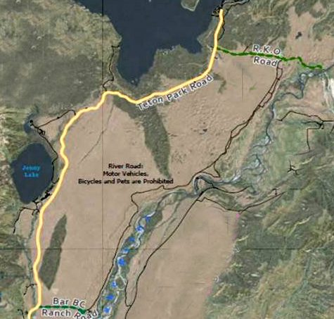
Years ago the River Road, that runs along the Snake River, parallel to the Teton Park Road was a four-wheel drive adventure, but it is permanently closed
“River Road is closed to motorized vehicles, bicycles, and pets.
Natural hydrologic processes continue to erode the banks of the Snake River where River Road is located. To ensure the preservation of park resources, the use of River Road between Bar BC Dude Ranch and RKO Road junction will be permanently closed, and the road’s existence has been terminated.”
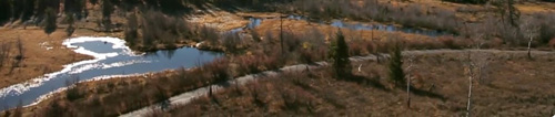
See the thin black line on the map below, parallel to the yellow Teton Park Road :
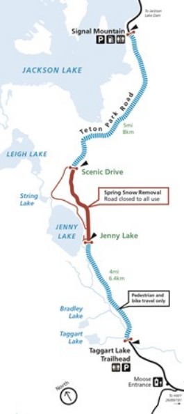
Winter months have many closures
There are winter and, shown on the map below, Spring Teton Park Road closures with part of the road open to “walking, biking and skating,” and sometimes part of the road closed to all uses in spring due to snow removal:
__________________________________
Please note it is against park regulations to imitate an elk bugle or wolf/coyote howl or use any artificial or natural audio attractants to attract or disturb wildlife.
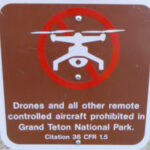
Fireworks and drones (unmanned aircraft) are banned at all times in all of the park.
The NPS tells us that the use of unmanned aircraft (e.g., model airplanes, quadcopters, drones) has resulted in noise and nuisance complaints from park visitors, park visitor safety concerns, and incidents in which park wildlife were harassed. Small drones have crashed in geysers in Yellowstone National Park, attempted to land on the features of Mount Rushmore National Memorial, been lost over the edge of the Grand Canyon, and been stopped from flying in Prohibited Airspace over the Mall in Washington DC.

__________________________________________________________
Grand Teton National park has an announcement that some park visitors seem to not have learned about:
“Be thoughtful of how music may affect others. Operating an audio device, such as a stereo, Bluetooth speaker, radio, or musical instrument in a manner which is unreasonable and impacts park users is prohibited by law.”
– – – – – – – – – – – – – – – – – – – – – – – – – – – – – – – – – – –
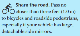
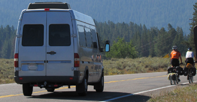
BIKES
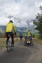
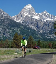 It is safer to enjoy a bike ride on a designated bike/roller blade/walk path than on the road with drivers looking at scenery instead of you on your bike, and there is am 8 mile long pathway from the Moose Visitor Center (please walk your bike in the parking lot) to South Jenny Lake. Pets (except guide dogs) are prohibited and the pathway is closed from dusk to dawn for wildlife and public safety. Grand Tetons biking
__________________________________
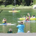
BOAT RAMPS
Grand Teton National Park boat launch access has maps and answers to questions:
When do Grand Teton National Park and Jackson Lake boat ramps open and close?
Where and how long can I park my boat trailer in Grand Teton National Park?
Can I bring my dog on my boat in Grand Teton National park?
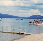
and photos, details & maps about marinas and/or free boat launch ramps at Leeks Marina, Colter Bay, Jackson Lake Dam, Snake River Launch to Pacific Creek Landing, Snake River Launch and take out, Signal Mountain Lodge, and a String Lake launch ramp for non-motorized, hand carried boats
as well as details and maps of boat-in camping on Jackson Lake.
![]()
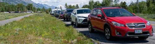
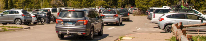
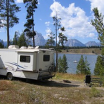
Expect that by mid-day many trailhead parking lots and the roadways alongside the parking lot will be full.
![]()
Check road construction for closures / delays of 15 to 45 minutes – not including entrance station wait time.
Below find descriptions of the stops you can make on the two roads between Moose Junction and Jackson Lake Junction.
– The main highway through the park: highways 191, 26/89 (also known as the Outer Road)
– and the Teton Park Road, which runs closer to the mountains (also known as the Inner Road.
(It often takes the same amount of time to go from Moose to Jackson Lake Junction on the highway as on the Teton Park Road.)
and the
Moose-Wilson road that comes in to the park at the Granite entrance station and runs to the Moose entrance station
on the map below, the Teton Park road is the thick red line running north from Moose to Jackson Lake Junction
and the more narrow red line running almost parallel to it and to the right of it is Highway 191/26/89 also running north from Moose to Jackson Lake Junction and beyond to Yellowstone National Park.
The Moose-Wilson Road is the blue line coming from the south and joining the Teton Park Road.
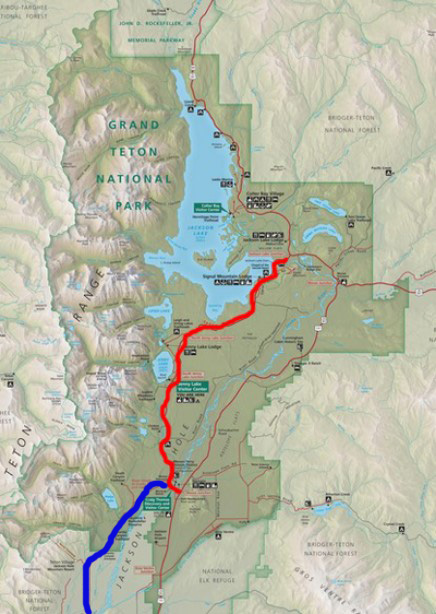
Below is the description of the Moose-Wilson Road (blue line on the map above) and as seen as a red line on the map below: (the Moose end of the road will be realigned to end at a being built in 2026 roundabout just north of the entrance station at Moose ).
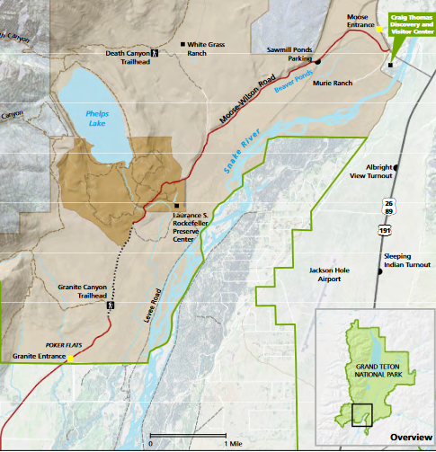
Moose-Wilson road runs from Wilson, Wyoming to Moose in the park.
(On the map above, near the top, note the Sawmill Ponds parking, one of the few places you can actually stop on the road.) Much of the road is 20 to 25 mph.
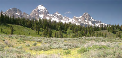
View of the Tetons at the junction of Teton Park Road and Moose-Wilson Road:
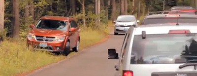
When people park illegally off the road in grassy areas, as in the NPS photo above, they risk their hot tail-pipe catching the grass/weeds in fire, and some have caused further traffic congestion when other drivers can not get past them without swiping their rear-view mirrors.
Note in the NPS photo below, tall shrubs all along the roadside block many views out towards the various ponds and streamlets:
A park service Youtube video describes the wildlife viewing opportunities: Best Place to View Wildlife: Moose-Wilson Corridor
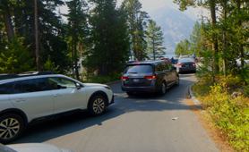
Below, a scene from the NPS video with cars on the Moose-Wilson road:
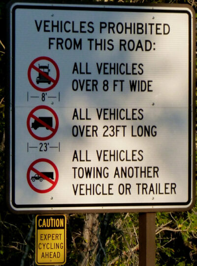
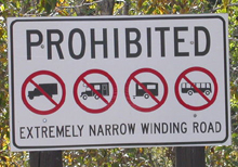
From Moose, four miles south on the slow, winding Moose-Wilson road, is the Laurance S. Rockefeller Preserve. No trailers are allowed and the maximum vehicle length 23.3 feet. (For example, Class A motorhomes are generally 37 to 40 feet long. A Toyota Sequoia with a fairly long bike rack will fit, but measure your vehicle if you are not certain.) Carpools and an early arrival are advised as there is limited parking (50 spaces) and the parking lot often fills 10 a.m. to 3 p.m.
Some years in parts of August / September the Moose-Wilson road is totally closed beyond the LSR Preserve to protect bears feeding on berries.
A large part of this preserve was a dude ranch donated to the park. “All of the buildings have been removed from the JY Ranch and the land returned to its natural habitat.”
 The main center building is LEED (Leadership in Environmental and Energy Design) platinum level, like our De Anza College Kirsch Center. It features high-definition nature videos, a library with comfy seating and a soundscape room with nature recordings Laurance S. Rockefeller Preserve Soundscape Key . You can pick up a nature explorers pack.
The center is open 9 or 10 a.m. to 5 or 6 p.m. (May 30 or June 1- Sept. 20 or 22) most years. Check the park website for times/dates this year.
Rangers offer hikes, for example: “Evening Hike to Phelps Lake, every day at 5:30 PM from June 21, 2026 to September 07, 2026. (Two hours and thirty minutes.) Explore the meaningful connections of people and nature on this ranger guided hike. Bring water, snacks, and insect repellent.
3 miles round trip, 1.5 miles guided. Easy hike.
Reservations are required and group size is limited. Please call 307-739-3654 to make a reservation. Leave a message if no one is available. Call 307-739-3654 to cancel reservation if unable to attend.
Meet at the Laurance S. Rockefeller Preserve Center parking lot. Please arrive between 5:10 and 5:20 pm so the program can start promptly at 5:30 pm.
Latitude and Longitude 43.626416, -110.775228
“Park Ranger Clay Hanna describes the philosophy of Laurance S. Rockefeller and how it is embodied in the experience of visitors to the Moose-Wilson corridor and the LSR Preserve.”
On one wall is an extraordinary rendition of Phelps Lake, (a short hike from the center), made of hundreds of individual nature photos that the photos below do not do justice to:
The NPS photo map below has trails near Laurance S. Rockefeller Preserve and Phelps Lake, Granite Canyon, Open Canyon, Death Canyon, Stewart Draw, Mount Hunt, Fox Creek Pass, Mt. Hunt Divide, Static Peak Divide, Static Peak, Albright Peak, Mt Meek Pass, Death Canyon Shelf, Prospectors Mountain and White Grass Meadow.
![]()
Two NPS photos of Phelps Lake from the Death Canyon trail:
![]()
The park has this birding info:
Laurance S. Rockefeller Preserve Several trails follow creeks and traverse a glacial moraine with mixed conifers and aspens. Look for western tanagers, MacGillivray’s warblers, northern flickers, Lazuli buntings, ruby-crowned kinglets and green-tailed towhees. Listen for the sweet songs of hermit and Swainson’s thrushes. Calliope and broad-tailed hummingbirds feed on scarlet gilia.
________________________________________________________
This next description is of the main highway through Grand Teton National Park, Highway 191/26/89, (also known as the Outer Road).
The highway has a nighttime (usually 30 minutes after official sunset to 30 minutes before official sunrise) speed limit of 45 m.p.h.

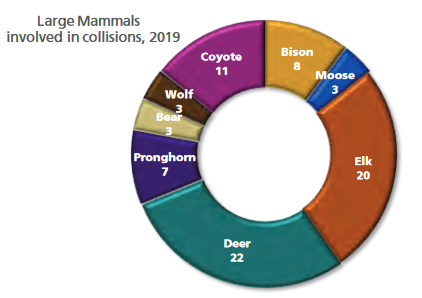
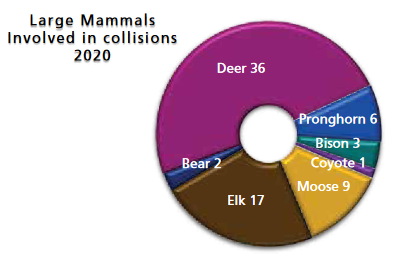
From Grand Teton park news releases: “A total of 37 animals are known to have been struck by vehicles on park roadways in 2016. One grizzly bear cub, two black bears, nine deer, two bison, nine elk, two coyotes, and one red fox were involved in those collisions, which do not always involve a confirmed mortality. Over 100 large wildlife are known to be hit on park roadways annually, with 118 in 2015 and 115 in 2014.” . . . “In 2010, vehicles in the park hit and killed two wolves, five bears, 6 pronghorn, 17 bison, five moose, 41 deer and 48 elk. Most of the deaths occurred between dawn and dusk on the main highway between Moose and Moran Junctions. Please drive the speed limit and be prepared to stop suddenly. Speed was the biggest factor, especially at night when people “overdrive their high beams – when stopping distance is greater than the headlight illumination distance.” Driving slower than the posted speed limit, especially after dark, can save animal (and human) lives.”
![]()
![]()
![]()
![]()
![]()
And you can expect animals on the roads in the winter:
________________________________________________________
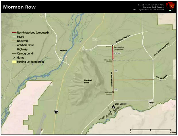
Just past the road leading to the Moose Entrance Station, at Moose Junction, while on Highway 191, 26/89, going north toward Moran, if you turn off at Antelope Flats road just north of Moose, Mormon Row runs south from it to Gros Ventre Junction road.
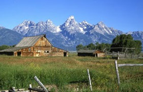
and see: Mormon Row Historic District Cultural Landscape where we read: “The community represents late-frontier Mormon settlement of high, arid country. Domestic and agricultural infrastructure was constructed of locally procured materials, and irrigation systems represented the life-blood of the community. ”
The parking lot at Mormon Row has 29 total spaces and 4 oversized spaces.
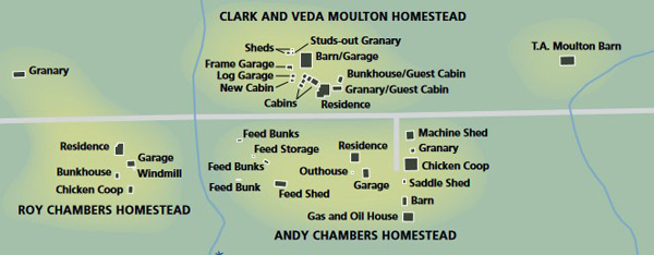
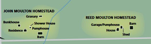
Here are NPS maps of the buildings in the Moulton and Chambers homesteads. The first map is at the south end of Mormon Row road and the second is at the north end, at the corner of the intersection with Antelope Flats road.
People wanting to plan a wedding at this location have been told: “You may take photos in front of the barn as long as you are respectful of sharing the space with all visitors seeking to do the same.”
The park has this birding info:
Antelope Flats – Kelly Road Large hayfields attract raptors such as American kestrels, prairie falcons, red-tailed and Swainson’s hawks and northern harriers hunting small rodents. Check fence posts for western meadowlarks, western and eastern kingbirds and mountain bluebirds. Scan the old pastures for long-billed curlews and savannah sparrows.
An Audubon webpage said: Around Antelope Flats, look for Greater Sage-Grouse, Northern Harrier, Long-billed Curlew, Black-billed Magpie, Mountain Bluebird, Sage Thrasher, Brewer’s Sparrow, Vesper Sparrow, and Green-tailed Towhee.
Future plans are for Mormon Row to be improved, starting in 2025. with “a larger and more centralized parking lot, a pedestrian- and cycling-only area, new restrooms and site furnishings like benches and trash cans.”
and read more at Renewing Life on Mormon Row
_______________________________ _________________________
The main highway has a number of turnouts to stop and take pictures,
and side roads down to the river.
The trailhead to Blacktail Butte
and the turnoff for for Blacktail Ponds overlook are not shown on most park maps.
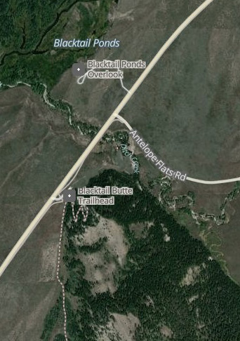
About a half-mile north of Moose on US Highway 26/89/191, on the right is Blacktail Butte and the small trailhead parking lot.
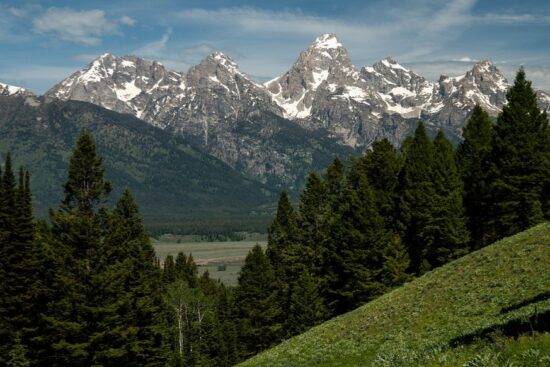
Here is the view of the Teton range from Blacktail Butte:
After you drive past Blacktail Butte, just past the turnoff to Antelope Flats Road and Mormon Row, the road to Blacktail Ponds overlook is on the left.
You can see a Google Map 360 degree view of the Blacktail Ponds overlook intersection at the highway
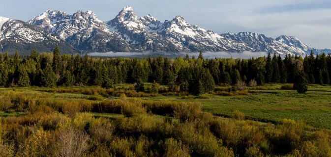
“Blacktail Pond
Old beaver ponds have filled with sediment and now support grassy meadows where elk graze during the cooler parts of the day. Several kinds of ducks feed in the side channels of the Snake River. Moose browse on willows growing along the river.”
The park offers this birding info:
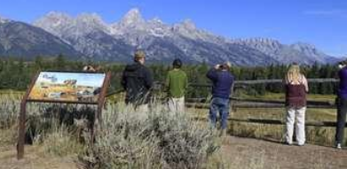
Blacktail Ponds Overlook. From this overlook north of Moose Junction view
many different communities. Wetlands are home to American wigeons, blue-winged teal, mallards, and goldeneyes. Up to six species of swallows zip by catching insects. Bald eagles and osprey roost in the cottonwoods. Yellow warblers, song sparrows and willow flycatchers frequent the willows.
You will need binoculars to see closely down at Blacktail ponds from the overlook:
________________________________________________________
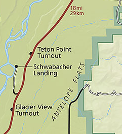
Glacier View turnout (approximately 26 parking spaces), has this view:
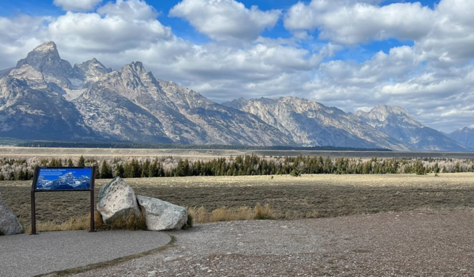
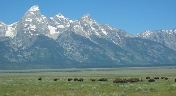
At many points along this stretch of highway 191 you may see bison:
The Cornell Lab of Ornithology offers
Iconic birds of Glacier View Turnout
and recent (fewer in winter, more in summer) bird sightings (with pictures of each bird)
________________________________________________________
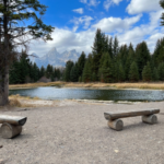
At the end of bumpy dirt/mud Schwabacher Landing Road, (approximately 20 parking spaces) here is the view:
This next photo is courtesy of Tom Ingram Photography, all rights reserved
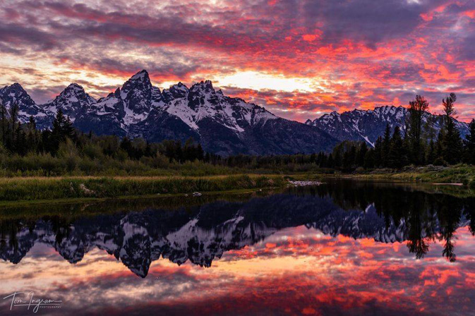
At the parking lot at the end of Schwabacher Landing Road there is a small restroom, a path and trail to an area by the river that usually has a few benches:
The Cornell Lab of Ornithology offers
Iconic birds of Schwabacher Landing
and recent (fewer in winter, more in summer) bird sightings (with pictures of each bird)
________________________________________________________
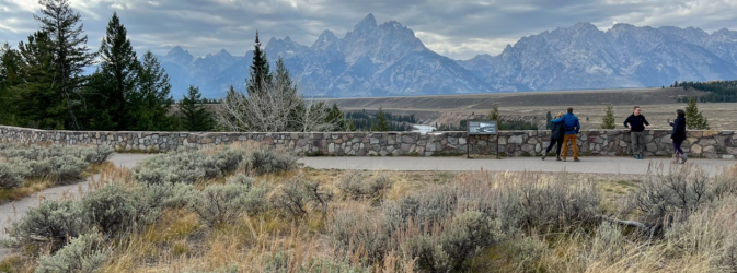
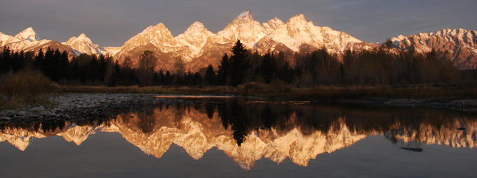
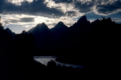
The Snake River overlook (approximately 16 parking spots),
is where Ansel Adams took his famous 1942 black and white picture. (Ansel Adams photo below courtesy of the National Archives.) Read about Ansel Adams.
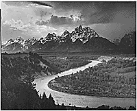
You will need to wander around a bit to try to find the exact place he took it from,
not to mention trees have grown in.
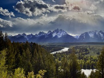
and here, the view from Snake River overlook just after sunset:
The Cornell Lab of Ornithology offers
Iconic birds of Snake River Overlook
and recent (fewer in winter, more in summer) bird sightings (with pictures of each bird)
________________________________________________________
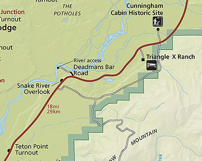
See the center of the map above for Deadman’s Bar Road (river access), which is not a sightseeing stop, but rather for professional boats to launch. The NPS notes this: “Deadmans Bar to Moose Landing 10 miles. This is the most challenging stretch of river in the park, many accidents occur here. The river drops more steeply and the current increases. Complex braiding may obscure the main channel and strong currents can sweep boaters into side channels blocked by logjams. . . Innertubes, air mattresses, float tubes, and similar flotation devices are prohibited on the Snake River.”
________________________________________________________
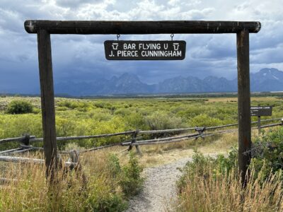
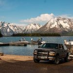
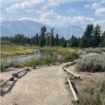
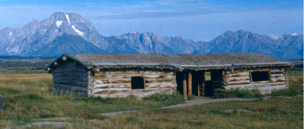
We recommend you include a 3/4 mile walk around the 1890 Cunningham Cabin, 6 miles south of Moran.
It is at the top of this map:
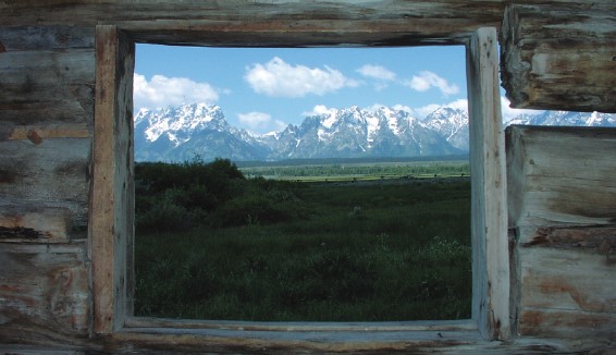
Here, the view out the window space at the back:
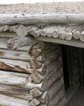
It’s a lodgepole pine “dog-trot” building of two boxes apart from each other with a sod-covered roof over its entirety, creating a veranda in the center. At first it was used as a house, then a barn and smithy.
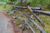
The buck-and-rail fences at the homestead and in the entire area were used so that people didn’t have to dig fence post holes in the rocky ground. They are designed with upright Xs or “cross bucks” supporting the horizontal rails.
and here the Teton range as seen from Cunningham Cabin:
The Cornell Lab of Ornithology offers
Iconic birds of Cunningham Cabin Historical Site
and recent (fewer in winter, more in summer) bird sightings (with pictures of each bird)
________________________________________________________
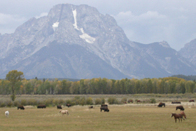
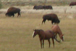
All along this road are occasional opportunities for seeing bison, or in this case, horses and bison grazing together:
________________________________________________________
Part of the road is often long and straight,
tempting you to exceed the speed limit, but try not to. You’ll be much happier when you have the time to brake as an animal runs across the road in front of you or a tourist stops suddenly when they think they’ve seen something.
________________________________________________________
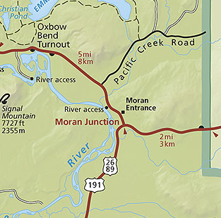
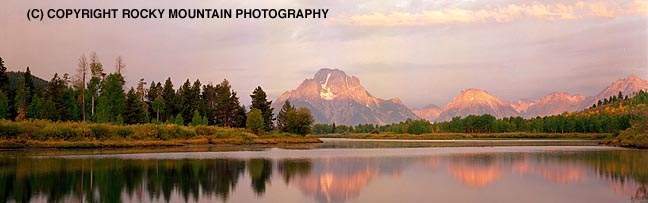
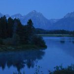
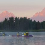
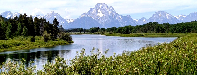
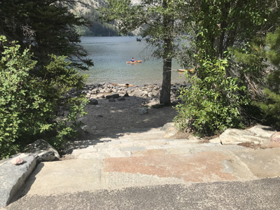
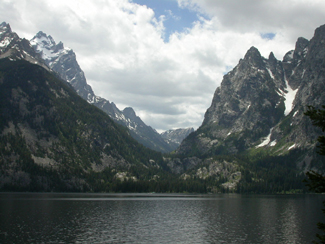
At the Moran Junction and Moran entrance station the main road bears left. From the entrance station it is 5 miles to a junction with the Teton Park Road described below. On the way you should stop at the small parking lot / turnoff on the left for Oxbow Bend, one of the best aquatic wildlife watching areas. Check with the park for times a Ranger will be there to answer questions. On our trips this is the place we most often kayak at in the morning, starting before sunrise.
The Cornell Lab of Ornithology offers Snake River Oxbow Bend area iconic birds and recent sightings
An Audubon website said that at the Oxbow “you might see Trumpeter Swan, Barrow’s Goldeneye, Common Merganser, Common Loon, Western Grebe, American White Pelican, Osprey, and Sandhill Crane.”
We often see Common Merganser ducks with chicks swimming behind mom in a row:
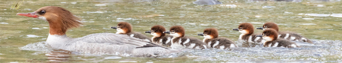
Photo below by Fred Hanselmann
The other road through Grand Teton National Park in a potential loop tour
(Teton Park Road, also known as the inner park road)
is on the other side of the river, closer to the mountains. It also has many turnouts worth stopping at.
Here again is the map showing the Teton Park Road as a wide red line, beginning at the south end at Moose Junction:
After you turn from the highways on to Teton Park Road, on the right down a side road are Dornans rental cabins, gas, small store, a deli/pizzeria and canoe/bike/sports rentals. Find each of these on a large map at: Moose, Wyoming
The Cornell Lab of Ornithology offers
Iconic birds of Dornan’s
and recent (fewer in winter, more in summer) bird sightings (with pictures of each bird)
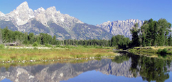
Just past your turn from highways 191, 26/89 on to the Teton Park Road at Moose Junction, there is a bridge on the Snake River at Moose, Wyoming that looks down on prime moose habitat.
It can be a safe place to watch moose from relatively nearby,
(with you up on the bridge)
as long as you don’t drop your sunglasses, camera, binoculars over the bridge
and your hat does not fly away in a breeze.
With a telephoto or your own binoculars you can see any moose that are in the vicinity up close:
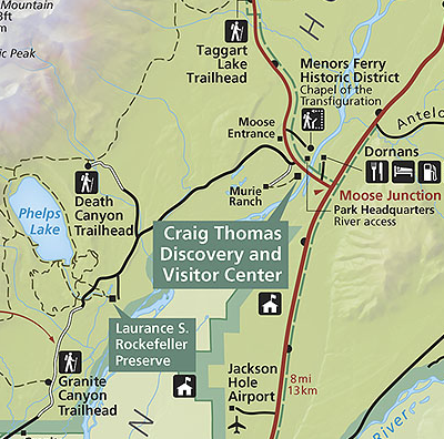
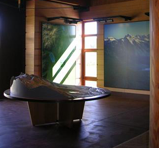
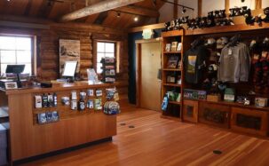
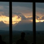
At Moose junction, just over the bridge, turn left to the Craig Thomas Discovery and Visitor Center , (also known as the Moose Visitor Center) which has free usually reliable wireless internet, wilderness permits office, Rangers to answer your questions,
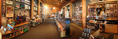
and the biggest collection of books, postcards and posters for sale in the park (they accept your Grand Teton Association or Yosemite Conservancy donor membership card for a discount)
No longer open year-round. Closed early November to early March. Various hours depending on time of year. Early June to late September, often open 8 a.m. to 5 p.m. Parking lot has 180 total spaces with 20 oversize spaces for RVs, boats, and buses.
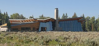
From the welcome-to info:
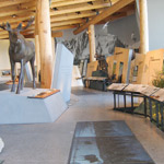
“Touch rocks, video rivers, climbing equipment, fur, footprints, and life-like displays stimulate the senses and invite exploration of Grand Teton National Park…
The interwoven themes of place, people, and preservation encourage visitors to connect intellectually and emotionally with Grand Teton National Park. The “video river”, a series of video screens in the floor with an accompanying soundtrack, leads you from “Place” to “People” to “Preservation” following the symbolic river flowing through the valley. As you enter “Place,” the video river displays footage of animals and the landscape during the different seasons. The “People” footage traces American Indians, trappers, and visitors across this landscape. Finally, the “Preservation” footage shows the story of historic structures, wild places, and on-going processes that are important to the park’s future. Images of flowing water at the end of each video segment connect the three themes…
A raised-relief map provides a birds-eye view of this landscape. The color scheme replicates natural communities, while the wedge of the Teton Range towers over Jackson Hole and slopes gently toward the Idaho plains. Look for the park’s major landmarks such as the Grand Teton and Jenny Lake. Notice metal bars embedded in the floor, radiating like spokes from the entry toward the terrace. If you stand on these “Peak Identifiers” and look west, your gaze will fall upon one of the major peaks in the Teton Range. Inside, the bars are engraved with the peak name and elevation, but if you follow the bars out to the terrace, you can learn the origin of the peak’s name and interesting facts about that mountain.”
You can watch a 24 minute high-definition movie about the earthquakes that created the range, the first native Americans, fur traders, settlers, dude ranchers: Grand Teton National Park: Life on the Edge.
And a 25 minute video about Grand Teton animal migrations you can also watch at home: Animal Trails: Rediscovering Grand Teton Migrations by Wyoming Migration Initiative.
Ranger programs are offered. for example: Courtyard Talk, every day at 4:00 PM (30 minutes) from June 11, 2026 to September 07, 2026. Meet outside the Craig Thomas Discovery and Visitor Center entrance in the large courtyard. The park is full of wonders and mysteries that often get missed during a casual visit. Stop by for a short ranger program that will help you to see and experience more during your visit. Topics vary.
The Cornell Lab of Ornithology offers
Iconic birds of Craig Thomas Discovery Center / Moose Visitor Center
and recent (fewer in winter, more in summer) bird sightings (with pictures of each bird)
Here, a webcam looking toward the Teton range at the Moose visitor center
and the names of the peaks as seen in the webcam or thru the visitor center windows or on the road going thru the entrance station:
The parking lot is a paved 180-car lot with designated handicapped parking spaces. The lot has 20 oversize spaces for RVs, boats, and buses.
Down a side road on the opposite side of the Teton Park road is a float trip parking area. Find it on a large map at:
________________________________________________________
One mile to the west of the Moose visitor center,
just up the Moose Wilson Road and a left turn at the sign,
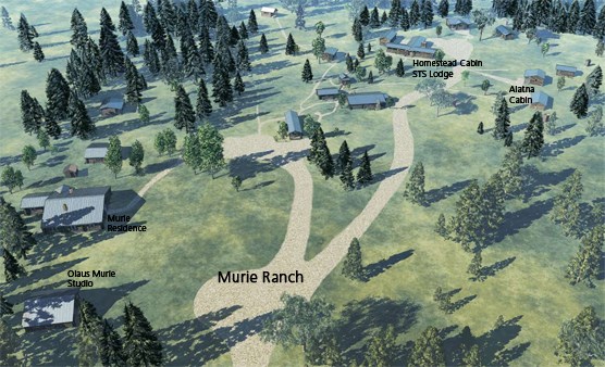
is the Murie Ranch, as a National Historic Landmark, with occasional tours, for example:
Murie Ranch Daily Docent tours Every day at 11:00 AM and 3:00 PM from May 24, 2026 to September 30, 2026. . . duration 45 minutes . . . visitors can join an interpretative walking tour that showcases the natural surroundings and historic buildings, while weaving in the vibrant legacy and enduring impact of the Muries. Meet at Mardy’s Front Porch.
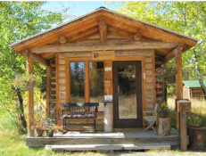
Some of the guided tours might include a peek inside the Murie residence, with Mardy’s front porch:
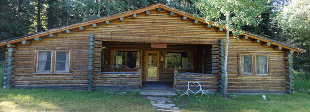
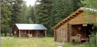
Below, the Murie residence on the right and the Olaus Murie studio on the left:
Watch videos about wilderness and science at the Murie Ranch courtesy of Florida Center for Instructional Technology.
and see: A National Public Radio program about Mardy Murie.
and see: Murie Ranch Cultural Landscape
where we read:
“The Murie Ranch Historic District is located in Grand Teton National Park. The district includes over 73 acres along the west side of the Snake River, at the base of the Teton Mountain range. Its significance is owed to the Murie family, leaders in the conservation movement who resided on the ranch from 1945 until 2003.
At the Murie Ranch property, Olaus, Mardy, and Adolph developed theories and positions, hosted luminaries in the conservation movement, and wrote numerous scientific publications. The setting at the foot of the Tetons was inspirational to their work.
Naturalists Olaus Murie and his wife Mardy were seminal figures in preservation activities of the Wilderness Society and the passage of the Wilderness Act in 1964. The property served not only as the setting for the writing of the Wilderness Act, but also as a place where the great minds in conservation science could converge in the seclusion of the great wilderness at the base of the Tetons. The 1953 annual meeting of the Wilderness Society, held at the Murie Ranch, is among the most notable of these academic convergences, though many other noteworthy figures visited the ranch during the Murie’s residency there. . . ”
. . . “Mardy’s unwavering support of wilderness protection and other environmental causes earned her our nation’s highest civilian honor, the Medal of Freedom, and the affectionate title of “grandmother of the modern conservation movement.”
Grand Teton National Park Murie Ranch Historic Furnishings Report 2013 Book inventory has a list of, and links to free downloads of some of the books at the Murie home.
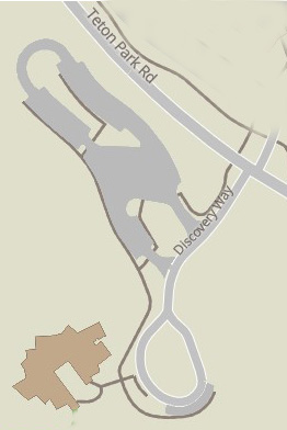
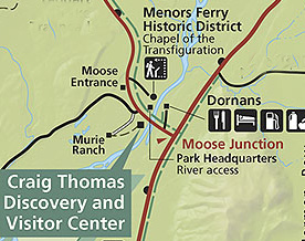 To get to the Murie Ranch, turn on the Teton Park Road at the intersection at Moose Junction, go over a bridge and past the Visitor Center and make a left on Moose-Wilson Road, then another left where the the road to the Murie Ranch will take you to a small parking lot near the office:
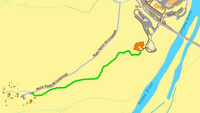
OR, since parking is limited, park at the Moose Visitor center and walk a path to the Murie Ranch (green line, right to left on the map below). The NPS notes it is a “1.1 mile (1.8 km) roundtrip hike with 50 ft (15 m) of elevation gain and an average slope of 3%. The trail is flat but narrow.”
The Cornell Lab of Ornithology offers
Iconic birds of Murie Ranch
and recent (fewer in winter, more in summer) bird sightings (with pictures of each bird)
________________________________________________________
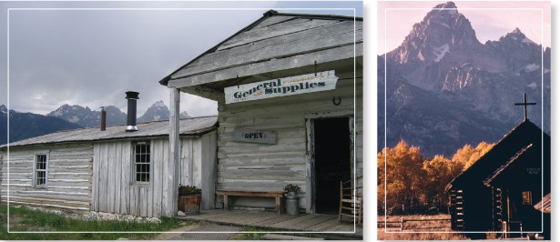
Just past Moose, save time for a long stop at the 1/2 mile loop trail pioneer homesteading displays, historic cabin and store at Menor’s Ferry. (The turnoff is on the right as you drive north on the Teton park road just north of the Moose Visitor Center and the Moose entrance station.)
You will drive on a long roadway towards the river and find a parking lot in about the center of all the Historic District buildings:
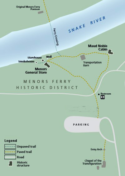
The park service says the trail “affords a look at homesteading and pioneer life in Jackson Hole. Ride a replica of the ferry that crossed the Snake River at the turn of the century (the ferry is launched after high water in the spring, usually after the 4th of July,” when staffing allows).
“Bill Menor charged 50 cents for a team, 25 cents for a horse and rider. A foot passenger was carried free if a vehicle was crossing…
NPS photo: ![]()
During the wild berry season, Bill would charge “huckleberry rates” to the local people—fare one way only—when the berries were ripe along the ridges and around the lakes under the Tetons…
“Once, after looking over the miles of sage that covered the levels of land that rise from the river to the mountains, an Eastern lady said to Bill, “Mr. Menor, what do you raise in this country?”
Bill, a dyed-in-the-wool bachelor, looked at her and said, “Hell and kids and plenty of both.”
Historic Menor store hours usually are 9 a.m. to 4:30 p.m. through late September. Join a ranger for a 45 minute walk June-early September, for example: “A Walk into the Past- daily at 2:30 p.m. (6/10/2025 – 9/1/2025) 45 minutes, 0.25 miles easy walk- Meet at the Menors Ferry General Store. Take a walk back in time at the Menors Ferry historic district and see what life was like for valley residents in the 1890s and early 1900s.”
Read more at:
The park website page about Menor’s ferry
Read a thumbnail history of the founding of the park
The park has this birding info:
Menors Ferry at Moose Follow the pathway to homesteader cabins along the Snake River. Violet-green, tree, cliff and barn swallows scoop insects out of the air as western wood-pewees, dusky flycatchers and mountain bluebirds hawk for flying insects. Yellow warblers glean insects from cottonwood trees and shrubs. Calliope, broad-tailed and rufous hummingbirds seek wildflower nectar. Kingfishers, common mergansers, ospreys and bald eagles catch fish.
________________________________________________________
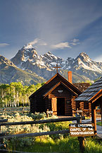
The Chapel of the Transfiguration is nearby. You’ll recognize the altar window view framing the tallest Teton peaks from postcards.
The park services asks: “Please be respectful, the chapel is a house of worship.”
photo below used with permission from Ron Niebrugge
The Sacred Heart Chapel, right on the lake, south of Jackson Lake dam, is not the same photo opportunity.
Scroll around here to see the short path to the Chapel of the Transfiguration from the parking lot. The other buildings and displays are a longer walk on a paved trail.
Moose, Wyoming has a black and white aerial photo/map that could help you locate Menor’s and the Chapel of the Transfiguration.
![]()
Next on the Teton Park Road watch for the turnout on the left, with a parking lot.
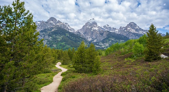
for the Taggart Lake and Bradley Lake hikes.
As you approach the parking lot you may find a row of vehicles along the road
because the lot (seen in the upper left of this photo) is full.
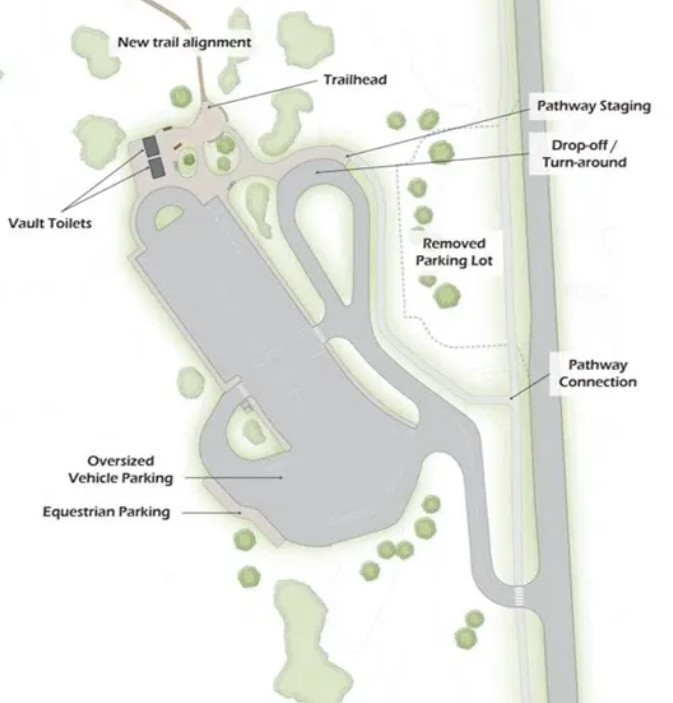
Scroll around at this Google Maps 360 degree view to see the parking lot and trailhead. The parking lot has 59 spaces, 5 oversized.
Taggart Lake Trailhead parking will be redeveloped to accommodate 140 vehicles. See maps, including the one below form 2026, of the road construction work.
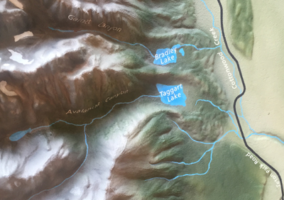
The NPS photo map below shows the location of Taggart Lake, Bradley Lake, Avalanche Canyon, Garnet Canyon, Stewart Draw, Buck Mountain, Mt. Wister, South Teton, Nez Perce, Middle Teton, Grand Teton, Mt. Owen, and Teton Glacier.
![]()
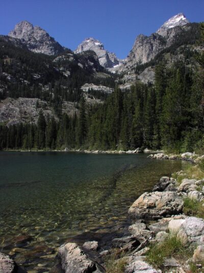
Taggart Lake:
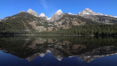
Bradley Lake:
A Google maps 360 degree view of Bradley Lake.
Below, NPS photo of Bradley & Taggart Lakes from the Garnet Canyon Trail:
![]()
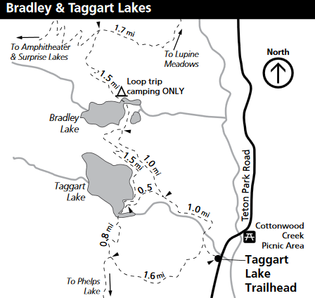
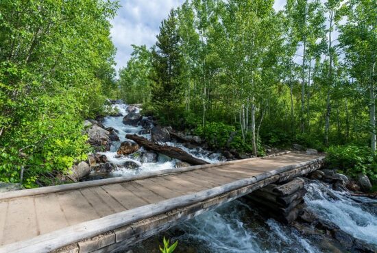
Footbridge on Taggart Lake trail. (Many footbridges on trails in National Parks do not have handrails.)
Rangers offer hikes, for example: “Taggart Lake Hike Daily at 8:30 a.m. (6/10/2025 – 9/1/2025) 2.5 hours-3 miles- 1.5 miles guided. moderate hike – meet at Taggart lake Trailhead. Hike with a ranger along the scenic trail to Taggart Lake, where a variety of stories can unfold. Limited parking, arrive early.”
The Cornell Lab of Ornithology offers
Iconic birds of Taggart Lake
and recent (fewer in winter, more in summer) bird sightings (with pictures of each bird)
________________________________________________________
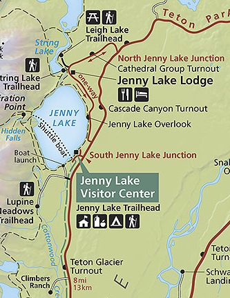
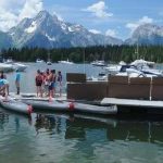
On the left about 8 miles from Moose is the side road to South Jenny Lake, and the Jenny Lake Visitor Center with geology information, a small store and in season, the (fee) shuttle boat across the lake to Cascade Canyon. The Ranger Station issues backcountry permits (hours often 8 a.m. to 5 p.m., early June to early September). Visitor Center hours usually 8 a.m. to 5 or 7 p.m., open mid May to late September.
In the map below,
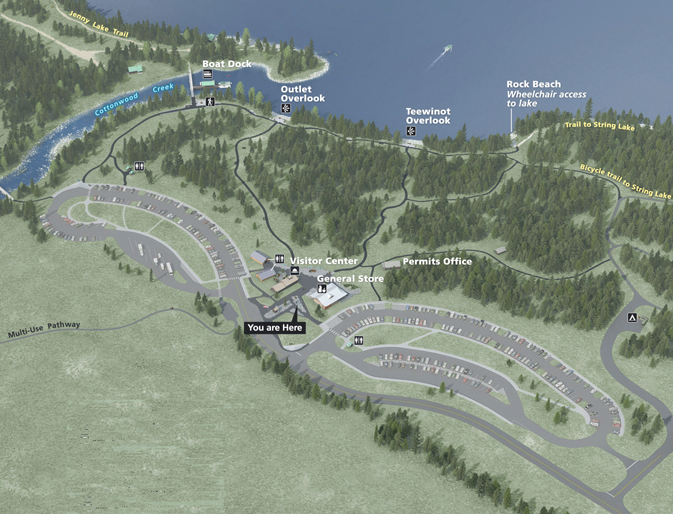
The You Are Here points to the location of the exhibit this map is from.
The campground check-in office is at the center of the right hand side of the map, a small black square with a white tent triangle in it.
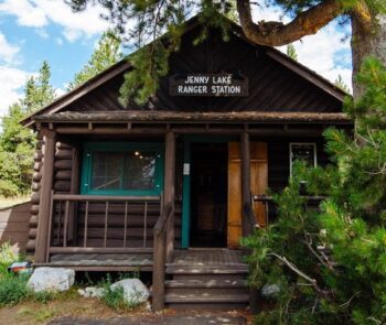
The “permits office” in about the center of the map is the Jenny Lake Ranger Station:
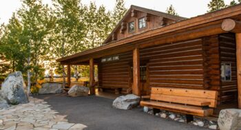
To the left of the Permits Office (Ranger Station) on the map below is the General Store, with the usual souvenirs, t-shirts, posters, postcards, some ready-to-eat food items and some basic snack-type groceries.
Here is the Jenny Lake Visitor Center (on the left) and adjacent restroom building as seen from the store:
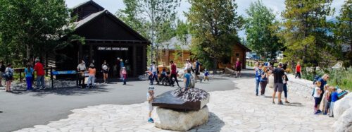
The small bookstore is at the back of the visitor center:
Ranger programs are offered, for example: Jaunt along Jenny. Every day at 9:00 AM from June 05, 2026 to September 07, 2026. Hike with a ranger beside Jenny Lake to learn about the plants, animals, water, and other beings that call this place home. This 2.5 mile round-trip trail is welcoming to the whole family and those new to hiking. Meet in the plaza outside the Jenny Lake Visitor Center.
When you are at the overlooks (named above at the map at the edge of the lake, and in a photo below)
![]()
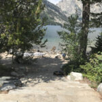
you will see, at lake level, people on the beach. Please do not climb down over the overlook wall to get to the beach (yes, even if you can do it safely – there are children watching you who might think they can do it too) and as careful as you think you can be, you will destroy vegetation and create more wear on the slope. Be a good role model and use one of the staircases.
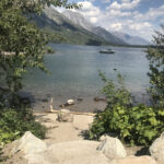
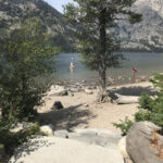
or walk to near the end of the overlooks area and go down to the beach at the area of of Rock Beach
(see upper right of shoreline on map above) with wheelchair access to the lake and a staircase up to the trail to String Lake.
Bears that frequent the campground also like using the walkways of the Jenny Lake Discovery trail:
![]()
The overlooks are a part of the Jenny Lake renewal project
See before and after pictures at the campaign for Jenny Lake
Parking (414 spaces, 9 RV only, 17 designated handicapped parking spaces) can be crowded or not available from about 10 a.m. to 4 p.m. in the summer. The Park service warns: “you may be required to park along the (main) road. If doing so, pull fully off the shoulder.”
Here, the typical look at mid-day, with lines of cars driving around and around through the parking lots:
The Jenny Lake campground was the first to fill each day when the campgrounds were first come, first served, and can be expected to be filled in advance much of the summer now that campgrounds are on a reservations system.
Birding notes: “On Jenny Lake, a variety of waterfowl may be seen such as Canada goose (Branta canadensis), mallard (Anas platyrhynchos), Barrow’s goldeneye (Bucephala islandica), and common merganser (Mergus merganser).
In the lodgepole pine forest . . . to the west, common birds include olive-sided flycatcher (Contopus cooperi), yellow-rumped warbler, (Dendroica coronata), Steller’s jay (Cyanocitta stelleri), ruby-crowned kinglet (Regulus calendula), mountain chickadee (Poecile gambeli), white-crowned sparrow (Zonotrichia leucophrys), chipping sparrow (Spizella passerine), red-breasted nuthatch (Sitta canadensis), pine siskin (Carduelis pinus), red crossbill (Loxia curvirostra), and dark-eyed junco (Junco hyemalis).
Local raptors commonly observed in lodgepole pine forests and sagebrush-grasslands in and around Jenny Lake include red-tailed hawk (Buteo jamaicensis), Cooper’s hawk (Accipiter cooperii), common raven (Corvus corax), great-horned owl (Bubo virginianus), northern harrier (Circus cyaneus), American kestrel (Falco sparverius), and rough-legged hawk (Buteo lagopus) (in the winter).
Other common birds in the area include gray jay (Perisoreus canadensis), barn swallow (Hirundo rustica), and mountain bluebird (Sialia currucoides).
Species more closely linked to sagebrush-grasslands include the green-tailed towhee (Pipilo chlorurus), Brewer’s sparrow (Spizella breweri), and sage sparrow (Amphispiza belli).
Non-migratory species include the hairy and downy woodpeckers (Picoides villosus and P.pubescens), and black-billed magpie (Pica hudsonia).
The Cornell Lab of Ornithology offers Iconic birds of Jenny Lake
and recent (fewer in winter, more in summer) bird sightings (with pictures of each bird)
Cascade Canyon is a quite popular hike, sometimes crowded, but not if you get up earlier or go farther than most of the hikers. We’ve seen moose, deer, a black bear, a pine marten, a fox, a weasel, marmots, pikas, river otters, golden-mantled ground squirrels, tree squirrels, Steller jays, tanagers, sparrows, water ouzels, butterflies and more.
Birding Notes
An Audubon webpage said: “Hike into the middle and higher slopes via the Cascade Canyon Trail, and you might find Ruffed Grouse, Broad-tailed Hummingbird, Red-naped Sapsucker, American Three-toed Woodpecker, Hammond’s Flycatcher, Gray Jay, Steller’s Jay, Clark’s Nutcracker, Mountain Chickadee, Red-breasted Nuthatch, American Dipper, Ruby-crowned Kinglet, Townsend’s Solitaire, Swainson’s Thrush, MacGillivray’s Warbler, Yellow-rumped Warbler, Western Tanager, Black-headed Grosbeak, Cassin’s Finch, Red Crossbill, and Pine Siskin.”
The Cornell Lab of Ornithology offers Iconic birds of Cascade Canyon Trail
and recent (fewer in winter, more in summer) bird sightings (with pictures of each bird)
Most people only do the short walk to Hidden Falls, so the crowds disappear as you go farther.
Below, Hidden Falls in June and September:
and many people go to the Inspiration Point viewpoint down to the lake (The Rangers lead hikes there daily usually at 8:30 a.m. for about 2 1/2 hours from early June to early Sept. and occasionally later in September). For a farther hike it’s 4.5 miles to the trail junction and another 2.7 miles and a 1,000 foot plus climb to Lake Solitude at 9,024 feet elevation.
Cascade Canyon, Grand Teton National Park has pictures, maps, more details and the shuttle boat cost.
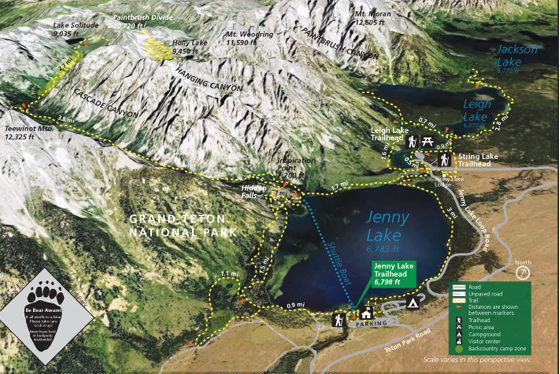
The NPS photo map below shows Jenny Lake, String Lake, Leigh Lake, Paintbrush Divide, Cascade Canyon, Paintbrush Canyon, Hanging Canyon, Mount Woodring, Mount Moran, Teewinot, Holly Lake and Lake Solitude.
![]()
A few miles further north on the Teton Park road is the turnoff at North Jenny Lake Junction
to String Lake, with 226 total parking spaces in three lots, 18 oversized parking spaces.
and the hike/or paddle and portage to Leigh Lake.
One stop on the road between the Teton Park road North Jenny Lake Junction and the String Lake Junction is the Cathedral Group Turnout with a spectacular view of the Grand Teton (13,770′), Teewinot (12,317′) and Mt. Owen (12,922′).
See details at String Lake.
The Cornell Lab of Ornithology offers
Iconic birds of Leigh and String lake
and recent (fewer in winter, more in summer) bird sightings (with pictures of each bird)
Just past the road to the String Lake parking lots, the road becomes one way going past Jenny Lake Lodge for the Jenny Lake Scenic Drive (also known as Jenny Lake Loop Road). No parking is allowed on the scenic road, just in a couple of turnouts (please don’t park in the bike lane).
If you stay at, dine at or just take a look at Jenny Lake Lodge, you do not need to exit the property at the driveway you came in on off the one-way road and be stuck in traffic. There is a map showing the back road / driveway out of Jenny Lake Lodge at Jenny Lake Lodge map.
In 2022 “The popular Scenic Drive” (3 mile / 4.8 km long) “that starts at String Lake in the north, continues south along Jenny Lake and connects to Teton Park Road was restriped to allow for one-way vehicle traffic and two-way bicycle traffic. The existing southbound bicycle lane was widened to allow for bicycles and vehicles and a new northbound lane was created for bicycles only.”
see the one-way road in the map below:
At one end of the scenic drive where it connects to the Teton Park Road, you will see Wrong Way (do not enter) signs for automobiles, but also see arrows showing it is okay for bikes to enter, since the road is one-way for autos/truck/RVs and 2 way for bicyclists.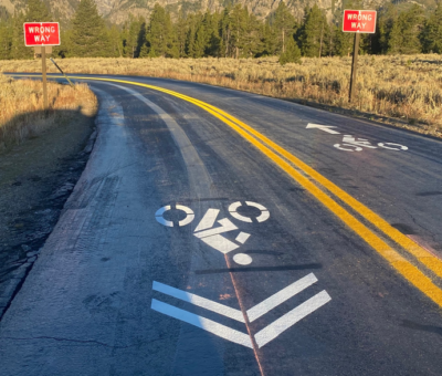
This was how it looked before the striping to make it two-way for bicycles:
and how it looks now: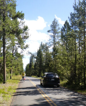
As you drive, bike or hike this route you are on the terminal moraine of the Jenny Lake Glacier that formed the lake.
There is a small parking lot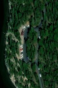
right above the lakeshore on the right hand side of the vehicles one-way road with this view across to Cascade Canyon:
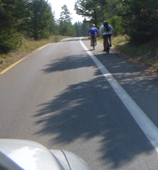
We like this road better than some others for bike riding as the traffic is slower.
The Jenny Lake Scenic Drive rejoins the Teton Park Road near South Jenny Lake. Watch out for people on the Teton Park Road mistakenly trying to turn onto the one-way road you are leaving.
The Cornell Lab of Ornithology offers
Iconic birds of Jenny Lake Road
and recent (fewer in winter, more in summer) bird sightings (with pictures of each bird)
________________________________________________________
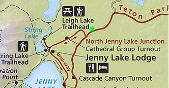
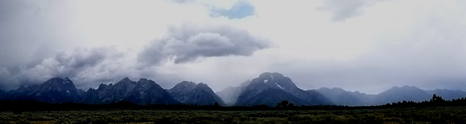
Back on the Teton Park Road, just past the North Jenny Lake Junction, is the Mountain View turnout with 23 parking spaces
(the lime green dot on the map above) with different views in different seasons/weather:
The Cornell Lab of Ornithology offers Iconic birds of Mountain View turnout
and recent (fewer in winter, more in summer) bird sightings (with pictures of each bird)
On the map below, the Mountain View turnout is at the left, Mount Moran turnout is in the middle and the and Potholes turnout is to the right:
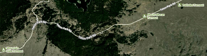
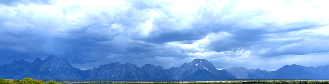
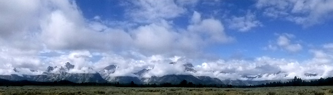
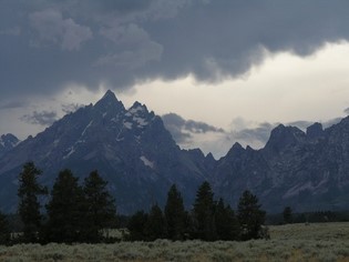
Here a storm over the Cathedral Group (Grand Teton, Teewinot, Mt. Owen) from the Potholes Turnout:
________________________________________________________
Just under 6 miles to the north you find the intersection, to the 5 mile drive up (20 mph)
Signal Mountain summit road for a panoramic view of the entire Teton range,
Jackson Lake and most of Jackson Hole.
(The road is usually closed November to May.)
This sign might be on the road:
The Cornell Lab of Ornithology offers
Iconic birds of Signal Mountain
and recent (fewer in winter, more in summer) bird sightings (with pictures of each bird)
________________________________________________________
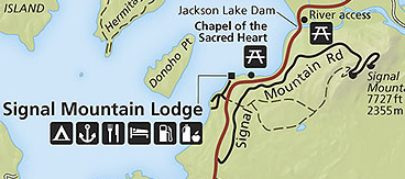
On the left past Signal Mountain Lodge (see also Grand Teton Lodging) and Signal Mountain Campground
is the Chapel of the Sacred Heart, (see a google maps 360 degree view). It is not the chapel with the postcard view of the Tetons from the altar window, that is the Chapel of the Transfiguration, at Moose.
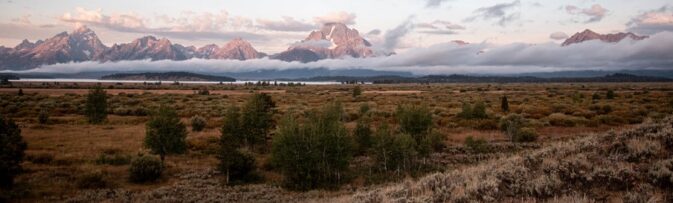
and then you’ll see Jackson Lake close by for the first time.
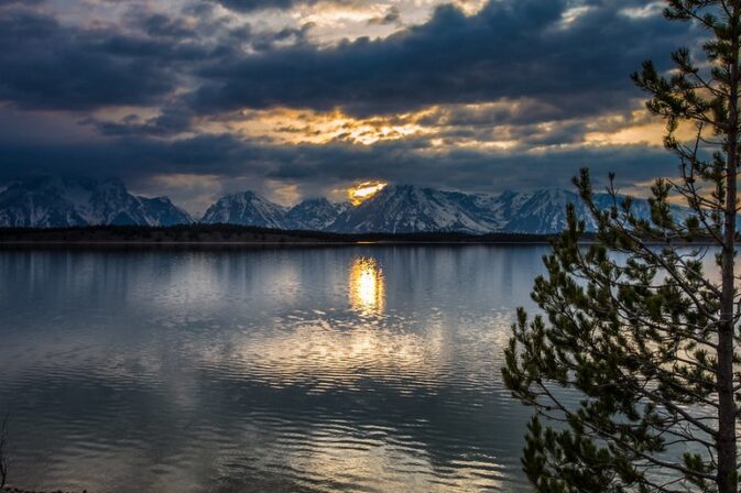
Here, a photo at sunset:
Just past the bay, where the road moves away from Jackson Lake, on the left hand side is a small parking area for a two story building with no public access, the Brinkerhoff cabin. This historic lodge is used by the Park Service for VIP housing, including some U.S. Presidents. The cabin and outbuildings are “closed to all public entry unless permission is granted by the Superintendent or their representative.”
________________________________________________________
Further past this bay, just before the dam itself, on the left is a small parking lot with restrooms and a smaller parking lot on the right. From there you can walk by the dam, but not out on the dam for a long view and pictures.
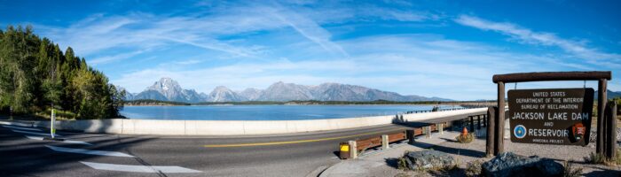
The mountain on the left in the view above and right in the view below is Mount Moran.
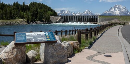
The Cornell Lab of Ornithology offers Jackson Lake dam area iconic birds and recent sightings
________________________________________________________
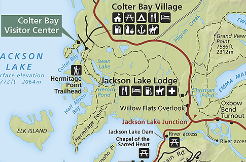
At Jackson Lake Junction the two main roads meet and combine to head north to
Colter Bay and Yellowstone.
On the left will be a turnout/ small parking lot for walk to a view of Willow Flats,
that sometimes has signs warning people to NOT use the trails out to the view. 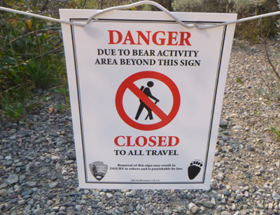
Willow Flats overlook parking lot (360 degree view)
(360 degree tour)
The Willow Flats are a major elk calving ground,
closed to people “from May 15 to July 15 or when posted.”
See the closure map below.
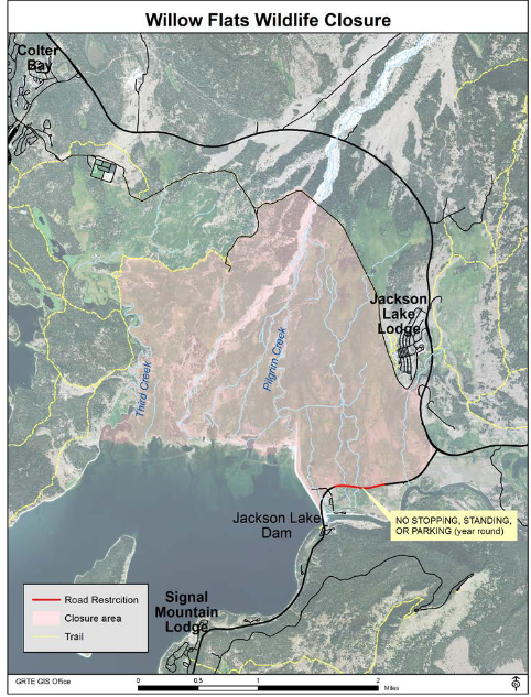
NPS notes: “The area known as Willow Flats is closed to public entry from May 15th to July 15th or when posted. This area is described as being the willows, springs and aquatic systems encompassed by the following landmark/boundary lines beginning at the Willow Flats Overlook: south on the North Park Road to the Jackson Lake intersection, then west on Teton Park Road to the Jackson Lake Dam, then northwest along the high water line of the Jackson Lake to Third Creek, then north along Third Creek to the abandoned Third Creek Bridge site, northeast on the old Third Creek trail to the GTLC cook site spur road and southeast along the Wagon Road to the Willow Flats Overlook. This closure includes the Wagon Road from the Jackson Lake Lodge to the cook site spur road junction.
•In addition, the signed section of the Teton Park Road (TPR) between Jackson Lake Dam and Jackson Lake Junction with dense vegetation along the road is closed to all stopping, standing, and parking. This is a year-round closure”
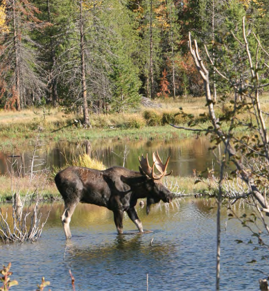
Watch photographer Tom Mangelsen photographing a moose
The park service has this birding info:
Willow Flats
Extensive willow thickets merge with wet grassy meadows crossed by small creeks and beaver dams. Cinnamon teal, green-winged teal and American wigeon frequent ponds and creeks. Sandhill cranes, northern harriers, American bitterns, common snipes and soras nest here. Calliope hummingbirds feed on scarlet gilia. Red naped sapsuckers and other woodpeckers abound. Frequent songbirds include willow flycatchers; cliff swallows; yellow, MacGillivray’s and Wilson’s warblers; common yellowthroats; fox and white-crowned sparrows; pine siskins; and yellow-headed blackbirds. Lazuli buntings and green- tailed towhees use the drier hillsides adjacent to Willow Flats.
photos of some of these are at: Grand Teton birds
and the park offers this:
Willow Flats: north of the Jackson Lake Dam moose browse on willow shrubs. At dawn and dusk, elk graze on grasses growing among willows. Predators such as wolves and grizzly bears pursue elk calves in early summer. Beavers create ponds by damming streams that also harbor muskrats and waterfowl
The Cornell Lab of Ornithology offers
Iconic birds of Willow Flats
and recent (fewer in winter, more in summer) bird sightings (with pictures of each bird)
________________________________________________________
Just before you pass Jackson Lake Lodge you might find a traffic jam and cars parked along the roadway. This will either be because someone spotted a moose at a big pond well below the roadway,
or because a lot of people are looking for moose, swans and ducks along the sagebrush trails of Christian Pond on the right.
The trail from Jackson Lake Lodge to Christian Pond, an easy, 3.3 mile / 5.3 kilometer loop trail, (dotted line on the map below) goes under the highway:
And look for the black and white aerial photo at: Jackson Lake Lodge vicinity to find Christian Pond.
The park has this birding advice:
Christian Pond Look for waterfowl such as ruddy ducks, ring- necked ducks, American wigeon, American coots, and the occasional Trumpeter swan.
The Cornell Lab of Ornithology offers
Iconic birds of Christian Pond
and recent (fewer in winter, more in summer) bird sightings (with pictures of each bird)
________________________________________________________
COLTER BAY VISITOR CENTER and INDIAN ARTS MUSEUM
About eight miles north of Jackson Lake junction, down the road from the Colter Bay campground, Tent Village and Colter Bay cabins,
The Colter Bay visitor center is open early May to mid October, times vary with each season. Summer usually 8 a.m. to 5 p.m. – 7 p.m.
Some of the David T. Vernon Indian Arts Museum displays have been sent to a conservation facility.
Each year the park sponsors a program for visiting Native American artists at the Colter Bay Visitor Center, usually a different artist each week, May to September. Guest artists usually exhibit daily, Monday through Sunday, from 9 a.m. to 7 p.m. adjacent to the Grand Teton Association bookstore. Artists also offer their finished items for purchase, including painting, carving, beadwork, weaving, jewelry, quillwork, drums, flutes, flint knapping, knives &/or pottery.
Indigenous Arts and Cultural Demonstration Program
At the north end of Colter Bay there is a 1.5 mile trail with a small causeway to an island. A self-guiding nature trail goes around the island. The trail starts behind the visitor center or at the day use area. See maps, photos of and descriptions of the trails from Colter Bay
Rangers offer programs, for example: “Colter Bay Lakeshore stroll, every day at 8:30 AM (two hours) from June 11, 2026 to September 07, 2026. 2 miles round trip. Easy hike. Meet at the flagpole in front of the Colter Bay Visitor Center.”
 ” Wildlife and You Every day at 11:00 AM from June 11, 2026 to September 07, 2026. Come learn about the amazing wildlife that call Grand Teton home. Discover unexpected human connections with wildlife, and how to see them safely during your trip. Meet at the Colter Bay Visitor Center back deck.”
And usually, a Colter Bay “evening talk with a ranger, Sunday-Friday at 8 p.m. Meet at the Colter Bay amphitheater (auditorium if inclement weather).” Different topics, often posted in advance at the visitor center.
You can watch a 25 minute video about Grand Teton animal migrations that is seen at the Colter Bay Museum during the summer season.
Look for the black and white aerial photo at: Colter Bay, Grand Teton National Park to find the visitor center, grocery,
lakeside swim beach with restrooms and picnic tables, etc.

The NPS trail photo map below shows Colter Bay, Half Moon Bay, Little Mackinaw Bay, Swan Lake, Cygnet Pond, Heron Pond, Hermitage Point, Donoho Point and Willow Flats.
![]()
The Cornell Lab of Ornithology offers Colter Bay area iconic birds and recent sightings
________________________________________________________
Past Colter Bay, on your way to Yellowstone, stop at the north end of Jackson Lake for this view, as seen in an Ansel Adams photograph (courtesy of the National Archives.) Read about Ansel Adams.
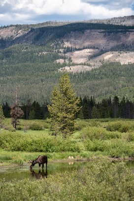
And on the John D. Rockefeller, Jr. Memorial Parkway going to Yellowstone you might be lucky to see a bull moose:
___________________________________________
You can get boat or backpack permits, a complete bird checklist, park fishing regulations and lots of other information and questions answered at any visitor center. The Moose and Jenny Lake centers have a raised relief map of the park, a section of which is shown below. (Jackson Lake is the big lake, Jenny Lake is the lake in blue at the top left, the red dot at the upper left edge is the Jenny Lake Visitor Center.)

_____________________________________________
Annual impacts of vehicle collisions with wildlife in Grand Teton: $155,000 personal property damage, over 100 large animals killed annually.
Photos of griz and cubs and of a porcupine crossing a road in Grand Teton Park courtesy of NPS: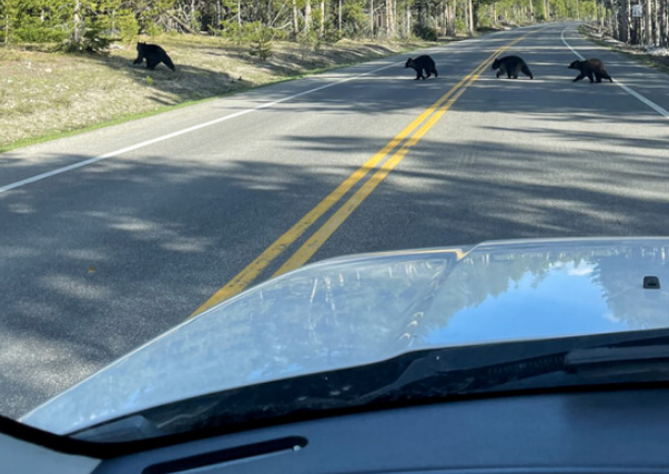

_________________________________________________________________
![]()
Top reasons not to speed in a National Park has defensive driving advice.
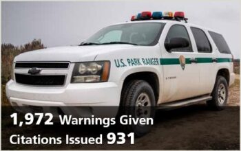
The Grand Teton National park annual report for 2023
mentioned
876 Warnings Given
Citations Issued 514
Photo below from a Grand Teton National park report in 2024
____________________________________________________________________
The local Forest Service reminds us:
“YOU ARE TOO CLOSE TO WILDLIFE IF:
· The animal stops feeding or resting.
· The animal starts moving either toward or away from you.
· The animal starts panting, huffing or making unusual sounds.
· The animal begins pawing the ground or swinging its head.
· Neck hair or feathers stand up.
· The animal appears nervous, uneasy or stressed.
If you notice these signs you are disturbing the animal and it is time to slowly move away.The safest way to view wildlife is through binoculars or spotting scopes.”
_______________________________________
![]()
_______________________________________
And see: Grand Teton National Park campgrounds, hotels, cabins, lodging
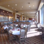
Grand Teton National park restaurants has links to menus and links to info about restaurants in Jackson, Wyoming.

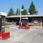
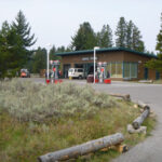
We tell people on our college trips to Grand Teton National Park to plan to fill their gas tank whenever they are in Jackson as the cheapest gas stations are in town and the prices get higher the further you go into Grand Teton park. See a map of gas stations in Grand Teton National Park and gas costs at some of them over the years.
Grand Teton and Yellowstone driving distances
Idaho Falls- Victor Idaho 64.1 miles
Victor, Idaho – Jackson (over Teton Pass and thru Wilson) 34.1 miles
Jackson to airport 9.3 miles
Jackson Hole Airport to Colter Bay via Moran 32.2 miles
Jackson – Gros Ventre river 7 miles
Jackson at south highway 89 to Colter Bay 43 miles
Gros Ventre river – Moose 6 miles
Moose – Moran 18 miles
Moran -Jackson Lake junction 4 miles
Moose – Colter Bay 28.4 miles
Moose – Jenny Lake 10 miles
Jenny Lake – Jackson Lake Junction 11 miles
Jenny Lake – Colter Bay 18 miles
Jackson Lake Junction – Colter Bay 10 miles
Colter Bay – Leek’s marina 2.4 miles
Colter Bay – Signal Mountain Lodge 9.4 miles
Colter bay – String Lake 18.1 miles
Colter Bay – West Thumb Yellowstone 39 miles
Colter Bay – Jackson Lake Lodge 5.9 miles
Moran – West Thumb Yellowstone 48 miles
Moran – Old Faithful Yellowstone 66 miles
West Thumb Yellowstone – Madison Junction 33 miles
Madison Junction Yellowstone – Norris Junction 13 miles
Norris Junction Yellowstone – Canyon Junction 12 miles
Canyon Junction Yellowstone – Lake Junction ( fishing bridge) 15 miles
Lake Junction ( fishing bridge) – West Thumb Yellowstone 20 miles
Old Faithful Yellowstone – Boseman, Montana 119 miles
Old Faithful Yellowstone – Cody, Wyoming 116 miles
Old Faithful Yellowstone – Idaho Falls 138 miles
– – – – – – – – – – – – – – – – – – – – – – – – – – – – – – – – – – –
Was that shaking an earthquake? See a map of USGS Magnitude 2.5+ Earthquakes, Past Day
Enhance a hike or just a drive by reading:
The day hike gear section at Camping equipment checklist
Thunderstorm and lightning safety
includes the answer to the question:
Why can’t you swim during a lightning storm?
A lightning strike on a lake doesn’t kill all the fish in the lake.
see also: Cell phones in the wilderness which has advice on how/when to use a cell phone to contact 911 in the wilderness and a warning about interference between cell phones, iPods and avalanche beacons.
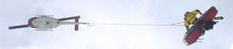 You can’t always expect a helicopter rescue
Can a person who is prescribed an epi-pen risk going into the wilderness? and some sting prevention notes are at: Anaphylaxis quick facts
Leave no trace camping has these basic principles:
Plan Ahead and Prepare
Travel and Camp on Durable Surfaces
Dispose of Waste Properly
Minimize Campfire Impacts
Respect Wildlife
Be Considerate of Other Visitors
examples and details of how easy this can be are at: Leave no trace
Hiking Advice has hot weather hiking advice, hiking logistics and the answer to the question: When is the best time of day to cross a mountain stream?
Enhance your drive to the park: Road trip advice and etiquette
Download these instead of buying them at a visitor center, (well worth looking at for info about animals and much more):
Go to Vital Signs and scroll down for a few of these Resources and Issues Handbooks:
![]()
$70.16 or a free download
Yellowstone Grizzly Bears: Ecology and Conservation of an Icon of Wildness
” . . . Bears can see in color, can hear in the ultrasonic range, and possess an incredible sense of smell. . .
Heaviest Known Body Mass in the Greater Yellowstone Ecosystem: Adult male 715 pounds (324 kilograms); Adult female 436 pounds (198 kilograms)
Speed: 35 to 40 miles per hour (56 to 64 kilometers per hour)
Strength: 2.5 to 5 times greater than humans.”
Grizzlies were once rare in the Grand Tetons, but are growing in numbers.
your safety in grizzly bear territory tells you what to do if
you see a bear in the distance or a bear charges you and has info, including links to park videos about how to use Bear Pepper Spray.
__________________________________________
Camping solutions for women has tips for and answers typical questions from first-time women campers, including the question: Can menstruating women camp or backpack around bears? YES
Bears has links to general info about bears, then practicalities of camping and backpacking around bears, (food storage, what to do if you see a bear) mostly geared towards our trips around black bears in California.
NASA aerial photo of Teton Range
more pictures at:
Grand Teton and Yellowstone National Park photos
photos below by Quang-Tuan Luong/terragalleria.com, all rights reserved.
This is from an eastern U.S. website: The Rockies and the Tetons 2002.
Some of the advice is reasonable, but the author is a bit too worried about dangers.
We are including it here mostly for a laugh, but hey, most of it is true.
It was all italicized by the author.
“WARNING: I recommend against hiking in these parks, due to the numerous life-threatening dangers. The high altitude of the mountains impose numerous requirements on hikers: lightning strikes the highest points on mountains, and when you are above tree-line you become the highest point, so always get off the mountain when rain occurs; the thin air results in heavy breathing which creates a loss of water vapor, hence you require about three times as much drinking water as required on Eastern U.S. mountains; thin air causes dizziness which can result in falling off the mountain, fainting, and death through edema, which requires numerous days of getting used to the thin air at lower altitudes; thin air provides less protection against ultraviolet radiation, so prescription dark glasses and sunscreen are required. If you do hike in these mountains, always talk with a park ranger about the conditions of the trail and your own physical condition and experience. Always tell someone where you are going, and when to expect you back; never hike alone. Also, the only real window for hiking is around the first two weeks of August, since snowstorms and icestorms can occur at any time. Beware of forest fires, and always check beforehand about their locations. Beware of wild animals jumping right in front of your moving vehicle. Beware of loose rocks and rockslides that may fall onto your trail from mountainsides nearby. Finally, the single greatest cause of death or injury in many of our national parks is automobile accidents, and driving in the western mountains is especially dangerous.”
Drownings are the number one cause of accidental death in the National Park Service.
Next to drowning, motor vehicle crashes are the second leading cause of accidental
deaths in the National Park Service. One study found that “visitors distracted by scenery was a contributing factor in 27% of all motor vehicle crashes, alcohol was a contributing factor in 23% of the crashes, visitors from Asia and Europe crossing over the centerline to drive on the left side of the road was a factor in 14% of the crashes, excessive speed was the primary factor in 8% of the crashes, and visitors driving off-road and hitting stationary objects or rolling over was the primary factor in 11% of crash fatalities.
NPS photo:
The Grand Teton National Park & John D. Rockefeller, Jr. Memorial Parkway Superintendents Compendium
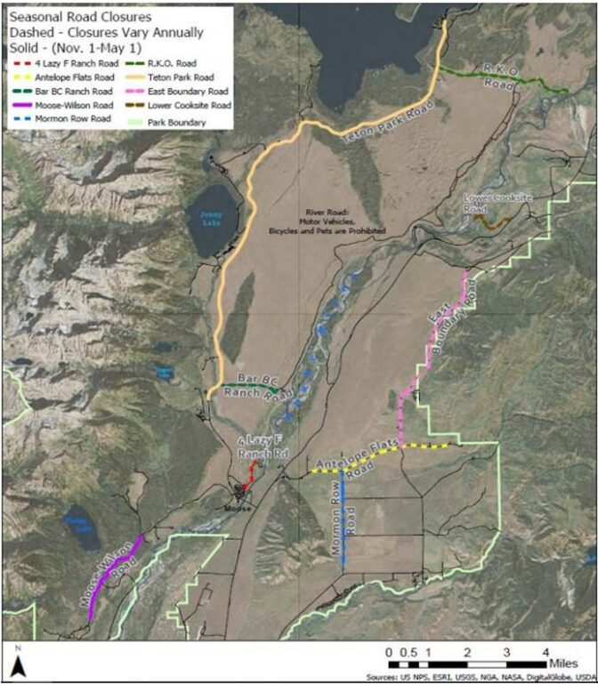
(As of 2024. 5, 6) it includes this map of seasonal road closures. Please note that the dotted lines are roads with closures that vary each year. The solid line roads closed from Nov. 1 to May 1, but these dates can change due to snow.
The author of this webpage, (written for my students), does not give any warranty, expressed or implied, nor assume any legal liability or responsibility for the accuracy, completeness, or usefulness of any information, product, or process included in this website or at websites linked to or from it. Users of information from this website assume all liability arising from such use.