Almost all of the dozens of lakes in Grand Teton National Park
do not allow motorboats.
Jet skis, personal watercraft and submersibles are not allowed on/in any park waters.
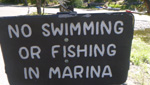
Underwater diving / snorkeling are allowed only in Jackson and Jenny lakes, within existing limitations on swimming.
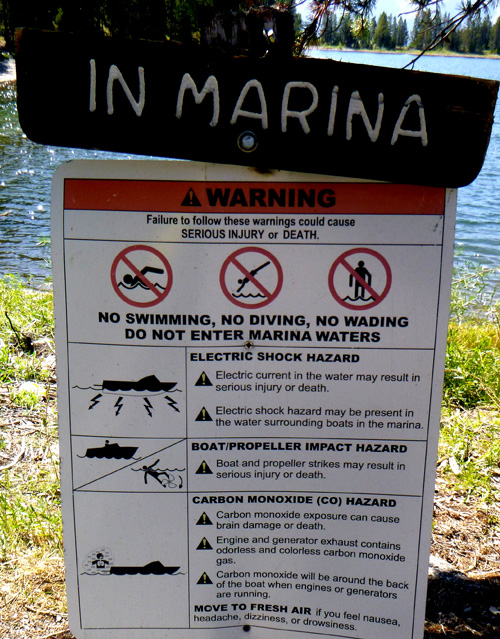
Limitations on swimming/wading include not within 150 feet of the downstream face of Jackson Lake dam, not within marinas, boat mooring areas or in the vicinity of the Jenny Lake ferry boat concession.
Floating any river or stream within the park on an air mattress, float tube, inner tube or similar individual flotation device is prohibited.
Windsurf boards are only allowed on Jackson lake.
Water skiing and other types of towing behind vessels is only permitted on Jackson Lake.

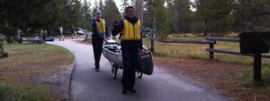
All motorized and non-motorized boats, canoes, kayaks, windsurf boards and stand-up paddle boards must have a boat permit which you can obtain at any visitor center.
![]() In recent years people have had to pull into a inspection station at / near a park entrance each time they enter the park, (for example) with a canoe on their vehicle roof, or towing a boat on a trailer. If people leave their boats at their campsite when they go into Jackson for groceries, they do not need to stop at the inspection station.
In recent years people have had to pull into a inspection station at / near a park entrance each time they enter the park, (for example) with a canoe on their vehicle roof, or towing a boat on a trailer. If people leave their boats at their campsite when they go into Jackson for groceries, they do not need to stop at the inspection station.
After the inspection, if their boat is found to not be clean of aquatic nuisance species, they may find themselves having a park ranger cleaning it.
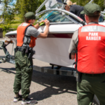
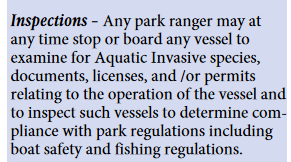
Rangers on patrol have come to takeouts and checked for park and Wyoming annual Aquatic Invasive Species decals (permits). NPS: “A park ranger may, at any time, stop or board any vessel to examine documents, licenses and permits relating to operation of the vessel and to inspect the vessel to determine compliance with boating and fishing regulations.”
The Park says: “User fees for operating a boat within the park help cover the costs for maintaining routine patrols of park lakes and the Snake River. Boating fees also help in supplying equipment and training for aquatic rescue operations.
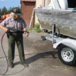
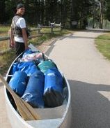
 Boats, and anything that comes in contact with the water (a boat trailer that you drive into the water to launch, waders, paddles, Tevas, nets, etc.) must be cleaned before use in the park. They must be cleaned again before use in Yellowstone waters and again when you come back to the Tetons.
– – – – – – – – – – – – – – – – – – – – – – – – – – – – – – – – – – –
Aquatic invasive species, such as whirling disease and zebra or quagga mussels, are a serious ecological and economic threat to the Greater Yellowstone Ecosystem.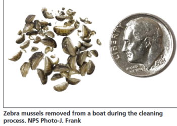
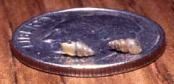 New Zealand mud snails, shown on a dime in this NPS photo, are only about a quarter of an inch long. They form dense colonies on rocks and aquatic vegetation and crowd out native aquatic insect communities, which are a primary food for fish, which are food for many animals. They also eat the majority of alqae growth in streams, which is a primary food for aquatic invertebrates.
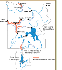 This map shows the first areas (in red) in the Yellowstone and Grand Teton area invaded by mud snails as of 2010.
– – – – – – – – – – – – – – – – – – – – – – – – – – – – – – – – – – –
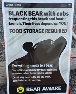
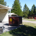
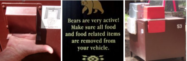
Bears are everywhere in the park and proper food storage is required everywhere.
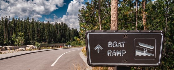
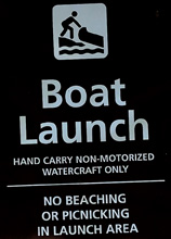
Here, a sign at a launch ramp with things to bring:
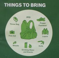
and often, some of your gear should be in dry bags.
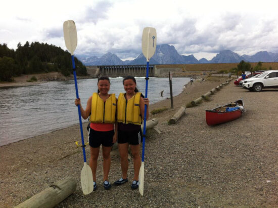
Why you need to wear a lifejacket.
– – – – – – – – – – – – – – – – – – – – – – – – – – – – – – – – – – –
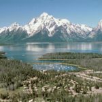
How much water is in Jackson Lake (reservoir) right now?
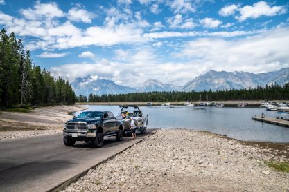
Will I be able to launch my boat at the ramp where I will be staying near, or will I need to go somewhere else?
How much water is in the lake depends on how much snow fall over the winter melts into the lake, and on when and how much the reservoir is drained for Idaho farmers. On many of our fall trips the ‘bay’ at Colter Bay is a mud flat due to irrigation water being drained from Jackson Lake.
![]()
For example, in 2021 the park announced:
“Due to very low natural flows and the need to supplement downstream reservoirs, Jackson Lake is expected to drawdown rapidly to levels only seen three times in the last thirty years.
Park concessions with marina facilities, including Grand Teton Lodge Company and Signal Mountain Lodge Company, are modifying operations in accordance with forecasted lake level changes. The Colter Bay boat ramp is expected to close to motorized vessels by Wednesday, July 21. The ramp will still be accessible to vessels that can be hand carried. In addition, it is likely that impacts to Signal Mountain and Leek’s Marinas will occur as early as the end of August or early September. Park visitors with motorized boats should note that recreation opportunities will be increasingly limited in the park.”
– – – – – – – – – – – – – – – – – – – – – – – – – – – – – – – – – – –
Full pool of Jackson Lake (reservoir) is 6769′.
The end of the boat ramp at Colter Bay is at 6753′,
at the end of the boat ramp at Signal Mountain Lodge is 6737′
and at Leek’s Marina it’s 6735′.
How high the water level has been on Jackson Lake for the last five days. (Scroll down past the drawing at the top.)
When do Grand Teton National Park and Jackson Lake
boat ramps open and close?
Besides the water being drained for farmers, some of the closures dates are dependent on the onset of snow heavy enough to close roads to ramps, and winter wildlife closures. (Grand Teton weather.)
For example, in 2020: most opened June 5, the winter wildlife closure closed everything by Dec. 14.
Colter Bay Marina June 5 – Sept. 20, 2020
Leeks Marina June 5 – Oct. 4, 2020
Signal Mountain Marina June 5 – Sept. 13, 2020
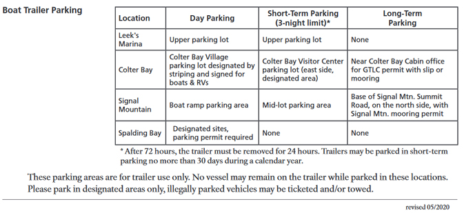
Where and how long can I park my boat trailer
in Grand Teton National Park?
(Please note that you should verify the chart below by reading signs at parking lots. This chart was in effect 5/2020 when I copied it and I found the same chart in 2024, 2025 and 2026.
– – – – – – – – – – – – – – – – – – – – – – – – – – – – – – – – – – –
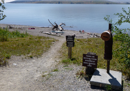
You can usually find a fishing line recycling box at each of the ramps and marinas.
– – – – – – – – – – – – – – – – – – – – – – – – – – – – – – – – – – –

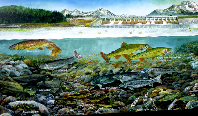
The Park Service reminds people in mid to late summer: you can help save native trout by not fishing in warm weather when the water in rivers and streams gets too warm. When the high temps are forecasted to reach 85 degrees, the water may warm up to 68 degrees. Stress caused by catch and release can be fatal to fish. When water temps reach 60 degrees, use heavier line and release the fish quickly after catching it, since fish may be prone to stress. 45 degree water is optimal. Read more at fishing advisory
Fishing regulations, including legal tackle, creel and size limits, consumption advisories and much more.
– – – – – – – – – – – – – – – – – – – – – – – – – – – – – – – – – – –
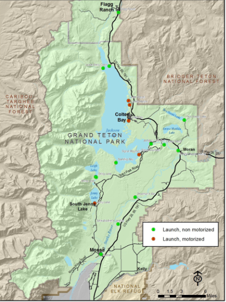
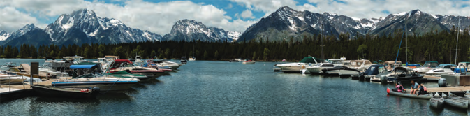
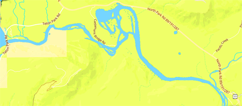
Here is a map of Grand Teton National Park boat launch sites.
Red dots on the map are launch sites for any boat, including motorized.
Green dots are only for non-motorized.
(See below for descriptions and local maps of some of these.)
The Grand Teton National Park website had a list of ramp and access by type:
Developed ramp indicates trailer access to the water (paved and unpaved),
(some level of access but may not allow for a trailer to be driven into the water),
Undeveloped indicates a need to hand carry a vessel to the water.
__________________________________
“The following sites are designated as vessel launching sites”:
Motorized vessels ramps– Jenny and Jackson Lakes
Spalding Bay (all vessels, undeveloped ramp, no services) – small parking lot and two small campsites at this location. Some years: “Because of limited space, only single axle boat trailers are allowed at Spalding Bay. Trailer parking requires a special parking permit.” Inquire at a visitor center before you drive down the long side road (2.25 miles) from Teton Park Road.
Google maps 360 degree view of the launch ramp and small parking lot.
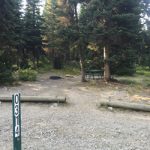
Lizard Creek campground (hand carried vessels only, undeveloped ramp)
The Lizard Creek campground boat launch is down a steep, narrow unpaved path that is suitable for a canoe or kayak, but not for bigger boats:
and see details, photos below:
Jenny Lake launch ramp (all vessels, developed ramp)
Signal Mountain launch ramp (all vessels, developed ramp)
Colter Bay launch ramp (all vessels, developed ramp)
Leek’s Marina launch ramp (all vessels, developed ramp)
Non-motorized vessels are allowed on Jackson, Jenny, Phelps, Emma Matilda, Two Ocean, Taggart, Bradley, Bearpaw, Leigh, and String Lakes.
Where specific launch sites are not designated, boaters may carry hand-propelled vessels to shore line points where launching is convenient unless otherwise posted.
Non-motorized vessels ramps–
Snake River at Flagg Canyon (South Gate) launch ramp (John D. Rockefeller, Jr. Memorial Parkway / semi-developed)
Flagg Ranch (Snake River bridge) launch ramp (John D. Rockefeller, Jr. Memorial Parkway / semi- developed)
Jackson Lake dam parking area (1,000-feet downstream of the dam, semi-developed)
Cattleman’s bridge (semi-developed)
Oxbow Bend (undeveloped)
Pacific Creek launch ramp, (semi-developed)
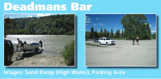
Deadman’s Bar launch ramp (semi-developed)
Moose launch ramp (developed)
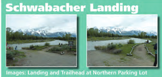
Schwabacher Landing (during high water, undeveloped)
(The launch ramp at String Lake to carry hand-propelled vessels to shore line was not on this list, but is described below.)
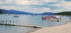
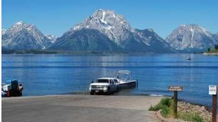
Leeks Marina
ramp at low water:

One boat tied up to the small dock getting fuel:
Google maps 360 degree view of the pizzeria (largest brown building), launch ramp and parking lot. You can use the arrows to go up past the boat trailer parking lot.
Google maps 360 degree view down at the launch ramp end .
The park service says; “Leeks Marina includes a boat launch, private boat services, and lakefront pizzeria. Note, boat rentals not available at this marina.”
Pizza and . . . menu Leek’s Pizzeria menu
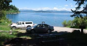
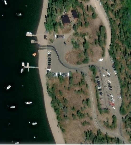
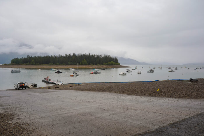
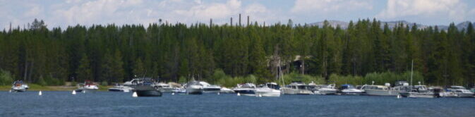
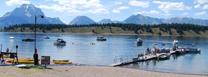
Colter Bay Marina
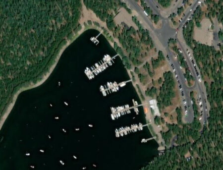 has a free boat launch ramp at the southern edge of the marina, canoe and boat rentals, fishing equipment and licenses, cruises with meals, boat fuel and dump services.
Below, the ramp with low water level on Jackson Lake. Most NPS photos of this ramp show just one boat launching,
but there is space for multiple kayakers and canoeists to launch and still leave space for a boat on a trailer to back down into the water

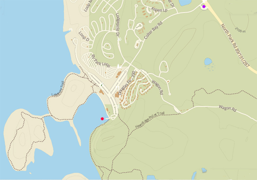
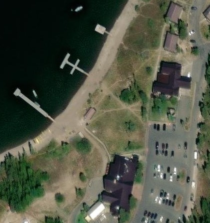
The end of the boat launch is the red dot on the map above. There is a gas station (purple dot) at the intersection of the Colter Bay Road and North Park road (highways 89 / 191/ 287).
Google maps 360 degree view of the marina.
Colter Bay launch ramp (the wide driveway almost in the center) photo taken from a dock at the Marina is at this Google maps 360 degree photo.
This next view, from out on the water, has the ramp/driveway on the far right

this photo has the view of the tops of the cell phone towers that are in the Colter Bay Campground (see site F132) from out on the water at the marina (look for them in the center of this photo above the forest trees):

Here, the view out through the entrance to Jackson Lake from out on the water on Colter Bay:
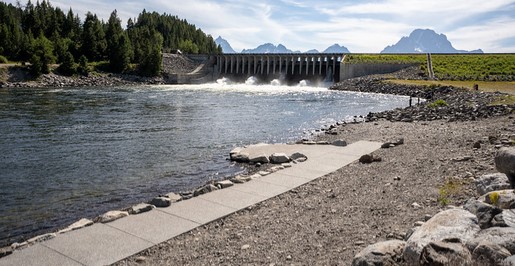
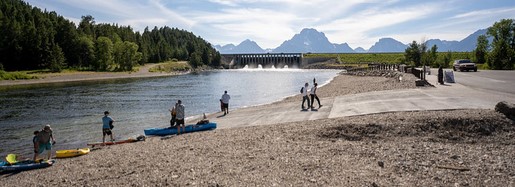
Jackson Lake Dam, Snake River Launch
to Pacific Creek Landing, Snake River Launch and take out
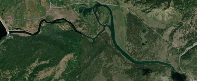
A five mile stretch of the Snake River from Jackson Lake just above Oxbow Bend, down to the raft launch just past Pacific Creek at the landing north of the Moran entrance station, is great for canoes and kayaks. People sometimes plan to shuttle cars.
(Most canoe / kayak rental companies do not let people use their rentals on the Snake River at all.)
Here is the route, left to right along the stretch of river in this map:
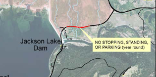
On the way to the launch point, coming from the north (Colter Bay, for example), a signed section of the “Teton Park Road (TPR) between Jackson Lake Dam and Jackson Lake Junction with dense vegetation along the road is closed to all stopping, standing, and parking. This is a year-round closure.”
See the red stripe on the map below:
People start at a formal launch point down a side road from Teton Park Road (TPR), (the white circle of roadway to the right of the word “Access” on the map below)
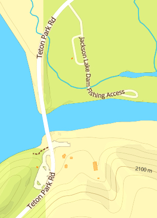
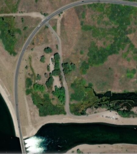
on a slope/ beach on the river far enough below the dam for safety:
“The Snake River for 150-feet below the downstream face of the Jackson Lake Dam is closed to fishing, swimming, wading and / or bank use.”
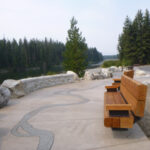
Here, a bench to sit on and displays that ask you to “think like a fish:”
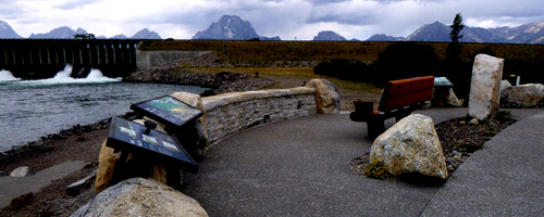
Here, one of the fully accessible sidewalks leading to an accessible fishing platform:
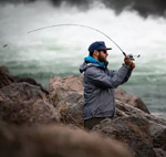
or you often see people fishing on the river bank.
Concessioners who do guided fishing tell customers that
August and September are the most requested times to float/fish the Snake river in Grand Teton National park, “due to its consistent fishing.”
and slightly further down the river, a boat ramp which will accommodate two vehicles at a time
Here, the view of the launch ramp as seen from Jackson Lake dam:
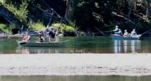
All along this stretch of the Snake River there are often people fishing from boats
(below is a photo near Pacific Creek landing):
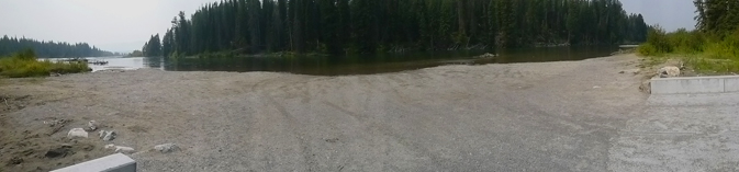
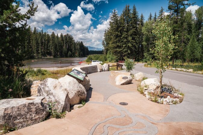
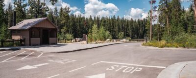
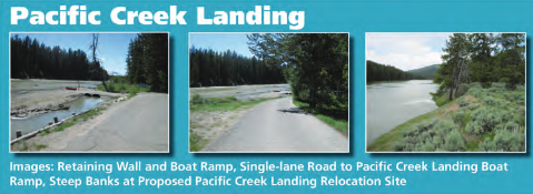
At the end of the down river paddle there is a formal landing point, sometimes with a line of trailers waiting to get their boats up the driveway from the river to the road, at Pacific Creek Landing, just downriver from where Pacific Creek enters the river.
(360 degree view from the highway)
Here, the view at the river:
Here, from up at the end of the parking lot, looking down to the river:
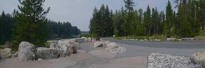
and a bit closer down, again looking towards the Snake River:
The one way loop road down to the ramp from the parking lot is for boats being launched and taken out
and there is no visitor parking and little room for extra vehicles to maneuver:
The restroom building is at the side of the large parking lot above the takeout.
and here, what Pacific Creek landing looked like before the 2021 remodel:
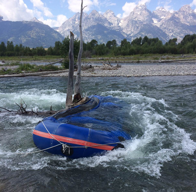
There are few obstructions along this 5 mile stretch of the Snake river and only a couple of islands to go around.
A bit further downriver from the Pacific Creek takeout the Snake River has many braided sections. Professional guides can take people on this stretch, but the general public, (even experienced boaters) are discouraged due to risk of getting lost, capsized or having their canoe wrap around a tree in the sometimes fast moving sections of the river.
The park service notes: “Though the Snake River in Grand Teton National Park does not consist of any whitewater, it is a complex and unpredictable braided river. A strong current, shifting channels, numerous logjams, eddies, and snags all combine to make floating the Snake a challenging proposition. These obstacles often require floaters to set up maneuvers well in advance, and inexperienced pilots often make maneuvers too late.”
You might not survive this, even with a lifejacket:
Plan your visit float has a map of launch points (beginner, intermediate and advanced) mostly for commercial guides.
It includes various warnings and advice: Afternoon thunderstorms and winds produce waves that may swamp canoes . . Complex braiding may obscure the main channel and strong currents can sweep boaters into side channels blocked by logjams. . . Avoid playing loud music. Excessive noise disrupts the river experience for other boaters and disturbs wildlife.
Steer clear of other boaters and anglers, including fishing lines.
Only one section of the Snake river, ending at the Pacific Creek take -out is safe for boaters who are not trained guides and even professionals can get in trouble:
From a Teton County Search and Rescue report
SWIFTWATER RESPONSE AT WILSON BRIDGE
JUNE 16, 2023 /10:46AM
DURATION: 1 hour, 19 minutes
ATTENDEES: 14
WHAT HAPPENED: A commercial raft hit a pylon at the
Wilson Bridge and deposited all 12 passengers into the
Snake River. TCSAR was one of several agencies to respond,
including Jackson Hole Fire/EMS, Teton County Sheriff
Deputies, and commercial guides. As the different parties
responded, all swimmers self-rescued from the river, and
guides helped them walk from an island to the levee.
Medics warmed patients while a deputy gave two
members a ride home, and TCSAR returned to the hangar.
From a Teton County Search and Rescue report
DRIFT BOAT DRIFTING AWAY AT PRITCHARD
JUNE 7, 2025 @6:53PM
DURATION: 22 minutes
ATTENDEES: 9
WHAT HAPPENED: A drift boat drifted away from a
guide after he failed to secure his boat when he got out
at Pritchard boat ramp. Two people were in the boat
as it floated down the river without their guide. A rental
company provided assistance and brought the guideless
craft to shore about a mile and a half downriver.
Signal Mountain Lodge
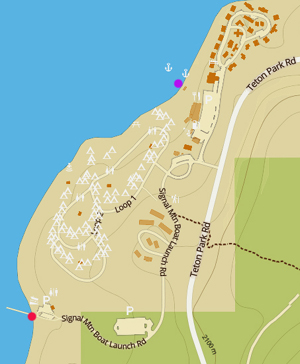
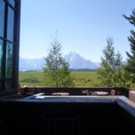
Google maps 360 degree view of the boat launch ramp , small parking lot, restroom building at the end of the Signal Mountain boat launch road (red dot on the map above) and this photo with Mount Moran visible across Jackson Lake:
Reservations for daily buoy rentals are usually accepted for the Signal Mountain Marina when the marina opens for the season. Boat rentals are available (usually including Deck Cruisers, Pontoon Boats, Runabouts,fishing boats, kayaks and canoes)..
Google maps 360 degree view from the main parking lot , purple dot on the map above.
and Signal Mountain marina boat docks Google maps 360 degree view
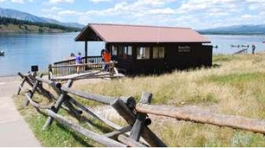
The Signal Mountain marina:
Signal Mountain marina office:
Hotel rooms are the double loop of brown shapes at the top of the map at the top of this section and described at Grand Tetons hotels, cabins, lodging
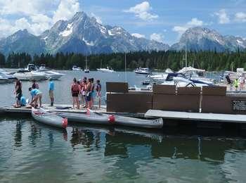
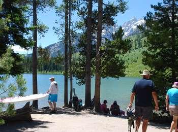
String Lake has a parking lot for people with canoes / kayaks to use the non-motorized, hand-carried boat launch ramp, and people are discouraged from parking in that lot if they will not be launching a boat.
![]()
Sometimes boaters have needed to ask people picnicking or just sitting at the lakeshore at the end of the canoe launch ramp to move so they can get their canoe through to the water:
So the park service put up signs asking people to picnic elsewhere:
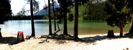
Photos and map of the three parking lots at String Lake are at String Lake.
![]()
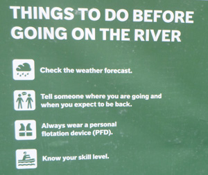
A sign at a launch ramp of a minimum number of things to do before boating:


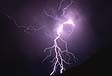
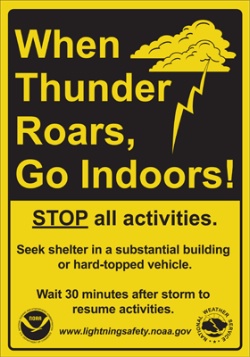
It is dangerous to boat / swim during a lightning storm ,
and wise boaters do not even launch if a storm is approaching,
even well before they first time they hear thunder.
The park had this warning:
“Lightning: Afternoon thunderstorms are common. Plan your trip accordingly; find a safe place before a storm hits. Avoid exposed summits and ridges, open areas and lone trees. Forested areas with trees of similar height are safer. Do not stand on tree roots. If boating, get off the water.”
You are never fully safe outside:
A very accurate local weather report has lightning predictions:
Using the lightning strikes links below you can check out where the storm lightning hits are moving
and it can help you decide if you are launching your boat, going swimming, taking a shower now or later, and when you actually hear thunder you can check out where lightning hit (closer to Yellowstone, or nearby in the park, or . . . YIPES, that really was nearby!).
Lightning strikes in the last 24 hours
severe weather map of the U.S.

The park had this warning:
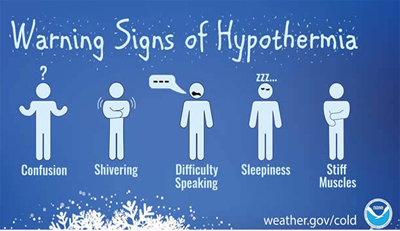
“Hypothermia (lowering of body temperature) is a serious condition that may lead quickly to death. Hypothermia is often due to exposure from a storm or a swamped boat. Watch for signs of hypothermia: uncontrollable shivering, incoherent speech and exhaustion. Seek shelter, replace wet clothing and provide warm, nonalcoholic liquids. In serious cases, place the undressed victim in a sleeping bag with another undressed person. Always carry rain gear and extra clothing. Dress in layers and avoid wearing cotton.”
Boat-in camping on Jackson Lake
in Grand Teton National park

This map has campsites for motorized and non-motorized vessels.
There are ten boat-in-or-hike-in, or boat-in-only campsites on Jackson Lake in Grand Teton National park.
Only a few of them have views of the Teton range.
They are not reserved through the system that makes reservations for the regular campgrounds, rather they are considered a part of the wilderness backcountry permits system. If you want one the these you should plan in advance and be ready to get online in early January to try to get one of them.
Details about wilderness backcountry permits system (mostly backpacking, but also canoe, kayak or boat into (non-motorized vessels) campsites, are at Grand Tetons backpacking.
You can boat or drive to the 2 small campsites on Spalding Bay on Jackson Lake (2.25 miles) from the Teton Park Road. They have bear boxes as well as pit toilets. Google maps 360 degree view of the launch ramp and small parking lot .
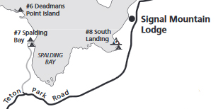
Deadman’s Point is boat-in only.
South Landing is small site a mile south of Signal Mountain, boat in or half mile hike in.
South Landing group site a mile south of Signal Mountain, boat in or half mile hike in.
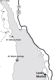
You can boat-in to a campsite on the north-west shore of Jackson Lake at Wilcox Point (can be accessed by either boat across Jackson Lake, or an 8 mile hike from Glade Creek Trailhead which will include a creek crossing.)
or a group campsite and nearby regular campsite, boat-in only on the north-west shore of Jackson Lake at Warm Springs
(All Jackson Lake campsites require packing out solid human waste and all your trash.
See also: How to Poop in the woods.)
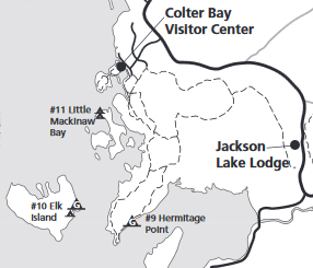
The NPS photo trail map below, shows Donoho Point, Hermitage Point, Half Moon Bay, Colter Bay, Little Mackinaw Bay, Willow Flats, Pilgrim Creek, Elk Island, Heron Pond, Swan Lake, Cygnet Pond and Colter Bay village streets
![]()
There are campsites on Jackson Lake, including, in the vicinity of the photo map above,
a Hermitage Point group site, a 4 mile hike in or boat in;
Elk Island boat-in only,
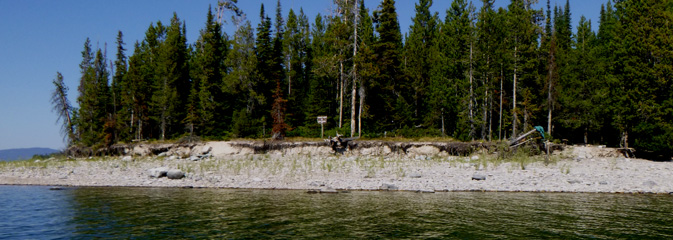
and Little Mackinaw Bay boat-in only:
(Please note that the map below is oriented north to south, and the photo map above is not.)
Here, the Little Mackinaw Bay campsite as seen from the water:
(All Jackson Lake campsites require packing out solid human waste and all your trash.
See also: How to Poop in the woods .)
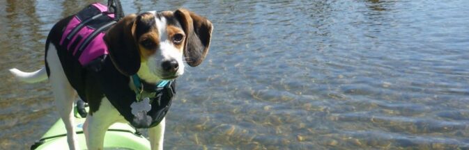
Can I bring my dog on my boat
in Grand Teton National park?
Rangers on patrol enforce pets rules, including
“Pets are prohibited from riding in boats on park waters, except for Jackson Lake.”
“Pets are prohibited on trails, pathways, and swimming in any park waters.”
“Pets are only allowed on a permitted vessel on Jackson Lake, but not in lakeshore campsites or in the water. Pets are not allowed on the Snake River or any other body of water in the park.”
“Pets are prohibited on trails, pathways, and swimming in any park waters…
Pets must be on a leash (six feet or less), under physical restraint, and within 30 feet of the roadway… ”
“Leave your pets at home. Pets are not allowed on trails or in the backcountry of Grand Teton National Park. They may become lost or prey for wildlife, they can also adversely impact park resources. If you need to bring your pet to the park, consider hosting it at a kennel in Jackson during your outing in the mountains.”
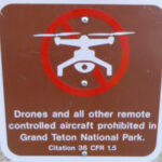
Fireworks and drones (unmanned aircraft) are banned at all times in the park.
Always check current regulations as this website can’t be kept completely up to date as well as the park website and costs / rules can change quickly.
How to get the right permits and decals for your vessel before you launch in Grand Teton National Park.
And when you search online, please check the date the park service page you get to was most recently revised. Putting together this page I found a “revised 02/2012” NPS boating page with out-of-date information.
Overnight accommodations in Grand Teton National Park include cabins, hotel suites, tent cabins, campgrounds.
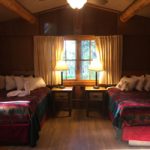


See maps of each and details about which might have a television, WiFi, laundromat, recommended rooms to ask for at Grand Teton National Park lodging.
Grand Teton National park restaurants has links to menus and links to info about restaurants in Jackson, Wyoming.


Grand Teton National Park
al fresco dining:


_____________________________________________________
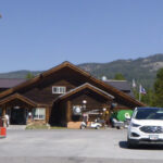
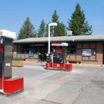
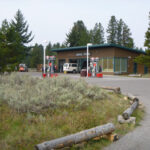
The lowest cost gas stations are in the nearby town of Jackson and the prices almost always get higher the further you go into Grand Teton National Park. See a map of gas stations in the park and gas costs at some of them over the years.
__________________________________
There is a medical clinic on the grounds of Jackson Lake Lodge, near the gas station, open 7 days a week in the summer, usually 9 a.m. to 5 p.m. (307-543-2514, 307-733-8002 after hours). No appointment needed. See the map at: Jackson Lake Lodge vicinity 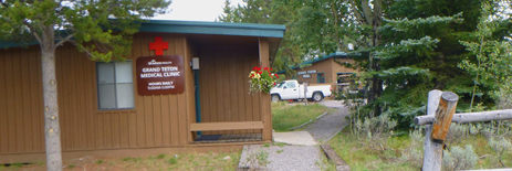
St John’s Medical Center hospital (24 hour emergency room) is at 625 E. Broadway at Redmond, in Jackson
__________________________________
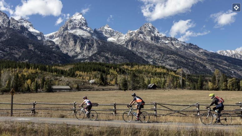
I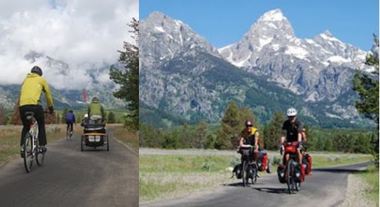 It is safer to enjoy a bike ride on a designated bike/roller blade/walk path than on the road with drivers looking at scenery instead of you on your bike, and there is am 8 mile long pathway from the Moose Visitor Center (please walk your bike in the parking lot) to South Jenny Lake. Pets (except guide dogs) are prohibited and the pathway is closed from dusk to dawn for wildlife and public safety. Grand Tetons biking
__________________________________
You can put downloads and links to info
on your smart-enough-phone
to be able to access info more easily
The very accurate local weather report: Jackson Hole weather
![]()
An app for Grand Teton National Park info (best downloaded before you get there when you can find reliable internet), with info about visitor centers, historic places, natural features, and services throughout the park.
“Even without cellular service, the app will be able to share your location on the map and bring up all site content.”
Weather map: “GeoColor is a multispectral product composed of True Color (using a simulated green component) during the daytime, and an Infrared product that uses bands 7 and 13 at night. During the day, the imagery looks approximately as it would appear when viewed with human eyes from space. At night, the blue colors represent liquid water clouds such as fog and stratus, while gray to white indicate higher ice clouds, and the city lights come from a static database that was derived from the VIIRS Day Night Band.”
For the drive to the park: Tetons area road conditions (Wyoming Department of Transportation)
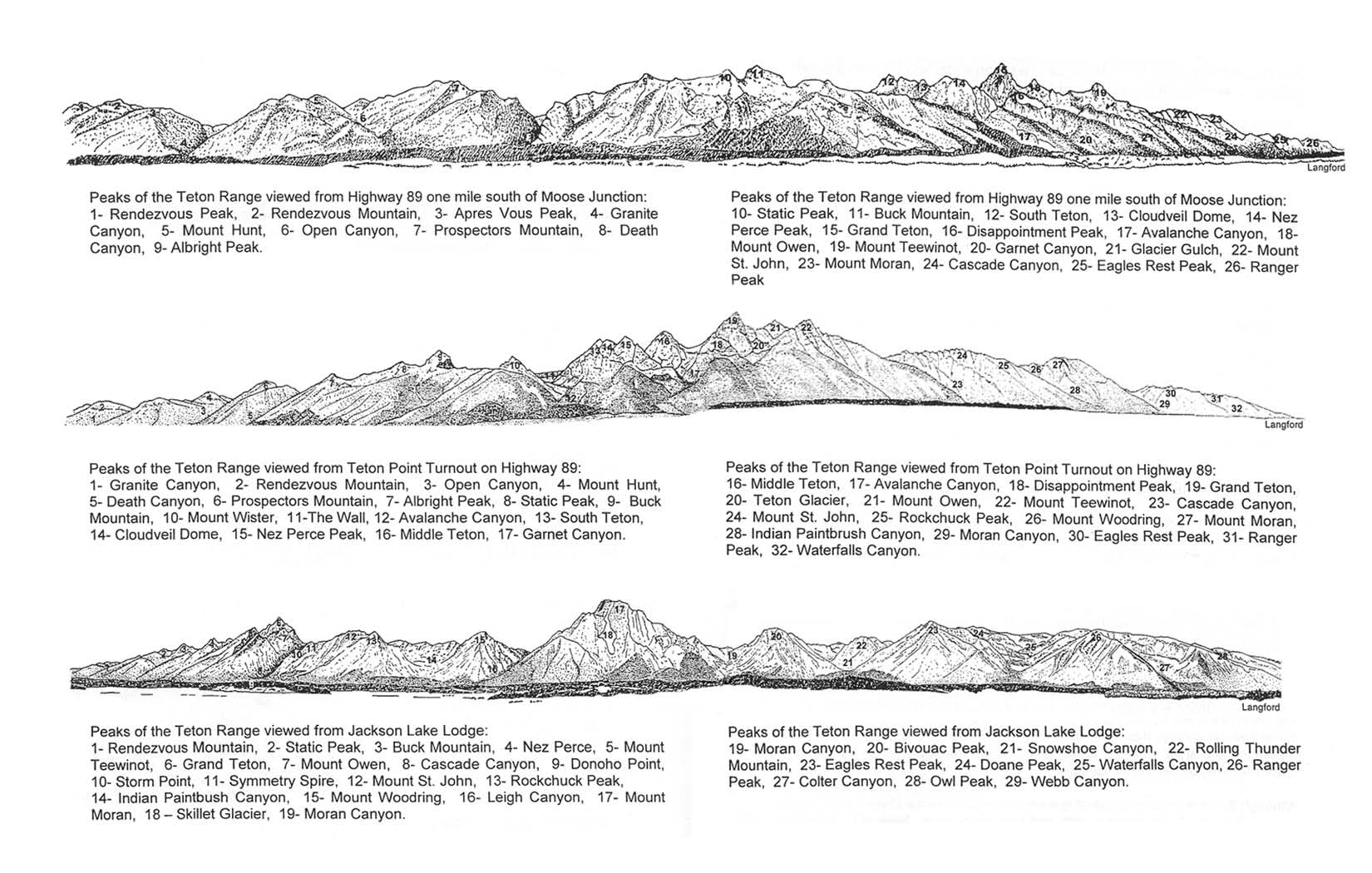
A drawing of the peaks with the names of the peaks, from various locations
App for when Old Faithful in Yellowstone will next erupt
Download photos of over a hundred birds of Grand Teton National Park
Yellowstone Park offers bird songs (many of the same birds as Grand Teton and other National Parks in the Rocky Mountains)
Download these instead of buying them at a visitor center, (well worth looking at for info about animals and much more):
Go to Vital Signs and scroll down for a few of these Resources and Issues Handbooks:
![]()
$70.16 or a free download
Yellowstone Grizzly Bears: Ecology and Conservation of an Icon of Wildness
” . . . Bears can see in color, can hear in the ultrasonic range, and possess an incredible sense of smell. . .
Heaviest Known Body Mass in the Greater Yellowstone Ecosystem: Adult male 715 pounds (324 kilograms); Adult female 436 pounds (198 kilograms)
Speed: 35 to 40 miles per hour (56 to 64 kilometers per hour)
Strength: 2.5 to 5 times greater than humans.”
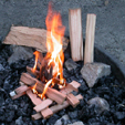
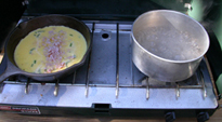
There’s easy camping info at: Have more fun camping
You can learn how to build campfires that don’t smoke too much, how to pack an ice chest, do dishes in camp and lots more.

__________________________________
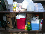
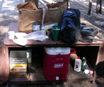
Using a campsite food storage locker, gives you ideas on how to use a metal campsite food storage locker, including some logistics on sharing one in a large group.
__________________________________
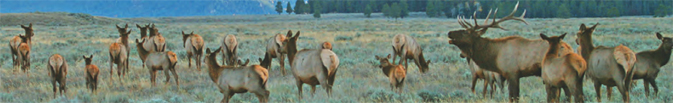
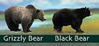 Was that a black bear or a grizzly, a coyote or a wolf or a fox we just saw?
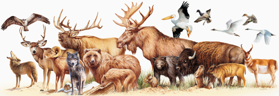 Rocky Mountain mammal size comparisons has photos and comparisons of beavers, squirrels, pika, marmot, elk, moose, bison, fox, coyote, wolf, golden-mantled ground squirrel, chipmunk, Red Squirrel (also known as) Chickaree, Unita Ground squirrels, bobcat, lynx, mountain lion (cougar), pine marten, mountain goats, bighorn sheep, pronghorn, grizzly and black bears, tundra swan, trumpeter swan, adult and juvenile Bald Eagles.
___________________________________
Birding notes from the park service:
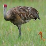
“On Jackson Lake a variety of waterfowl may be seen such as Canada goose (Branta Canadensis), mallard (Anas platyrhynchos), Barrow’s goldeneye (Bucephala islandica), common merganser (Mergus merganser), and sandhill crane (Grus Canadensis).
In the lodgepole forests, common birds include olivesided flycatcher (Contopus cooperi), yellow-rumped warbler (Dendroica coronata), ruby-crowned kinglet (Regulus calendula), mountain chickadee (Poecile gambeli), white-crowned sparrow (Zonotrichia leucophrys), chipping sparrow (Spizella passerine), and dark-eyed junco (Junco hyemalis).
Other common birds in the area include red-tailed hawk (Buteo jamaicensis), Cooper’s hawk (Accipiter cooperii), gray jay (Perisoreus canadensis), common raven (Corvus corax), barn swallow (Hirundo rustica), and mountain bluebird (Sialia currucoides).”
The Cornell Lab of Ornithology offers
Iconic birds of the Grand Teton National Park
and recent (fewer in winter, more in summer) bird sightings (with pictures of each bird) at:
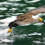
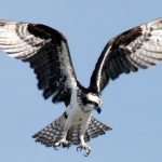
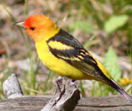
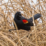
Grand Teton National Park birds has photos and details about the most common ones we can hope to see
including Bald Eagle, Red-winged Blackbird, Canada Geese, Clark’s Nutcracker, Golden Eagle, Great Blue Heron.Great Gray Owl, Harlequin duck, Loon, Magpie, Merganser, Northern Flicker (woodpecker 0, Osprey, Ouzel, Pelican, Peregrine Falcon, Ptarmigan, Raven, Sandhill Cranes, Steller’s Jays, Trumpeter Swan , Western Meadowlark, and Western Tanager, with links to calls / songs from most of them to listen to.
and you can Download photos of over a hundred birds of Grand Teton National Park

___________________________________
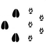
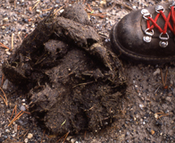 See also: animal sign comparisons
(how to use tracks and scat to distinguish species)
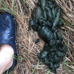
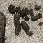
Please do not handle scat. Wolf scat, for example, can transmit tapeworm eggs to humans.
______________________________________
How to load a kayak on top of a car has pictures and advice.
______________________________________
![]()
Top reasons not to speed in a National Park has defensive driving advice.
________________________________________________________________
The author of this webpage, (written for my students), does not give any warranty, expressed or implied, nor assume any legal liability or responsibility for the accuracy, completeness, or usefulness of any information, product, or process included in this website or at websites linked to or from it. Users of information from this website assume all liability arising from such use.