This webpage has maps and notes about using the free Yosemite valley shuttle bus to find hikes and walks in and from Yosemite valley, with maps of trails and which is the best free bus stop to use to find the trailhead (start of a hike) to go to Bridalveil Fall, Columbia Rock, Cook’s meadow, to Glacier Point via the Four Mile trail, Mirror Lake, Vernal Fall, Nevada fall, Half Dome and Upper Yosemite falls, as well as walks around Happy Isles.
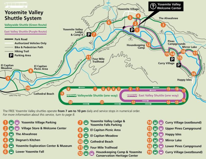
A complete explanation of the shuttle bus route map shown below, with list of the bus stops on the two routes, and descriptions of what you will find at each of them, as well as logistics for using the bus is at Yosemite Valley Free Shuttle Bus.
hiking advice covers hot weather and winter hiking, logistics, blisters, a gear list, GPS is not infallible and more.
A Yosemite Conservancy Naturalist can be hired to lead your choice of a custom hike
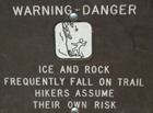
trail conditions It would be wise to ask at a Visitor Center about trail conditions before your hike, but a rockfall could close part of the trail and they would not know about it. In cold weather the trail may also have icy conditions that are not reported. You take your own risks. IF there are any trail closure signs, please follow them.
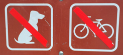
Bikes, strollers and pets are not allowed on unpaved trails, but are okay on paved roads and paved bike paths.
Also see park service webpages about
Crane Flat and White Wolf hikes
– – – – – – – – – – – – – – – – – – HIKES / TRAILHEADS: – – – – – – –
To bus and walk to Bridalveil Fall
The Yosemite valley shuttle system does not have a stop right in the vicinity of Bridalveil Fall. Use the valley wide shuttle and take a long walk. From the El Capitan Meadow area stop # 9 or Cathedral Beach stop #10 go west on paths to the Bridalveil Fall parking area. Once at the Bridalveil Fall parking area, the walk is .5 mile (.8 kilometers) round trip.
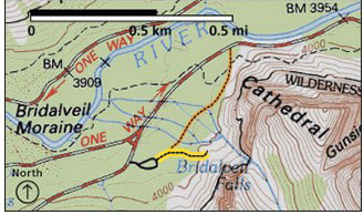
Places to take pictures of Bridalveil Fall has pictures and more descriptions of the walks and parking area at Bridalveil Fall.
– – – – – – – – – – – – – – – – – – – – – – – – – – – – – – – – – – – – – – – – – –
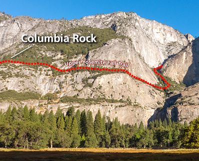
To hike to Columbia Rock
(2 miles round trip, 1,000 feet elevation gain), upper Yosemite Fall (7.2 miles round trip, 2,700 feet elevation gain), Yosemite Point or Eagle Peak (Three Brothers) use the Yosemite Falls day use parking lot (and Camp Four) stop #7 and head across the main road and through Camp Four. Upper Yosemite Fall hike
– – – – – – – – – – – – – – – – – – – – – – – – – – – – – – – – – – – – – – – – – –
To walk the circle or figure eight of
Cook’s Meadow
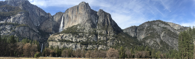
see: four routes for this walk or hike with this view:
– – – – – – – – – – – – – – – – – – – – – – – – – – – – – – – – – – – – – – – – – –
To hike to Mirror Lake
and beyond to the Snow Creek trail
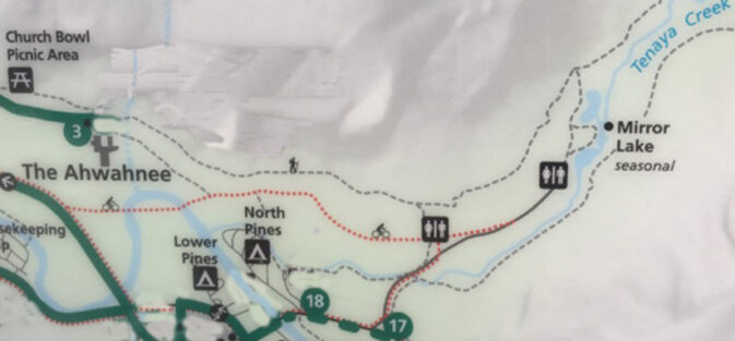
the trail along the cliffs below the Royal Arches, (across the parking lot from the Ahwahnee hotel, the top dotted line on the map below) is longer but can be much more pleasant and less crowded than the paved road from stop 17.
(Note that the map below was edited to show new shuttle bus stops number. #3 the Ahwhanee Hotel, and #17 Mirror Lake, as well as #18 Lower Pines Campground, are still the same.)
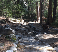
At the start of this trail, in some months, you can see and feel mist from the Royal Arch Cascades or may be walking in water.
(in heavy rain – two photos below from February 2017 – the white is not snow, it is rushing water – this section of trail can become an unsafe creek/river!)
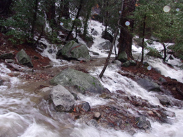
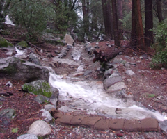
Compare the February photo above to April 2017:
Or make it a loop (to or from) the official Mirror Lake trailhead bus stop 17 (to or from) the Ahwahnee parking lot.
The trailhead is at the end of the main guest parking lot.
At the start of the trail, right next to the parking lot, on the left hand side of the trail, you might be able to spot a rock where Yosemite indians ground acorns and left behind deep holes in the rock. (You could call it the original Ahwahnee kitchen.)
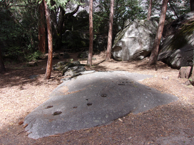
If you start up the trail and decide it is too wet for you,
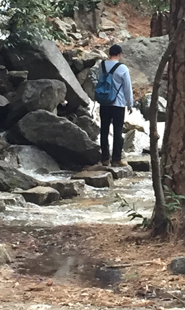
you can turn around, then turn left and walk the dirt/paved road through the valet parking lot, through some storage and on to where it deadends at a “T” intersection with one of the paths to Mirror Lake, then turn left, perhaps after walking out on the bridge to take a look at the river.
The map below shows the loop trail to Mirror Lake from stop #17, a second route to Mirror Lake:
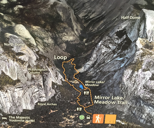
Five routes to Mirror Lake are described at Mirror Lake trails and maps.
– – – – – – – – – – – – – – – – – – – – – – – – – – – – – – – – – – – – – – – – – –
To hike to
Glacier Point
via the
Four Mile trail
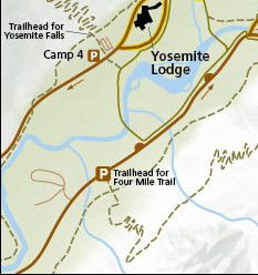
(4.8 miles one way, 3,200 foot elevation gain, not open all the way in winter) There is very little parking at the trailhead, but you can use the Yosemite Falls day use parking lot at shuttle stop #7 and take a short walk across the river at Swinging Bridge and slightly south/west on the main road to the trailhead. (This would be faster than using the shuttle.)
A Google street 360 degree view from Glacier Point down to Vernal and Nevada falls , and across to Half Dome.
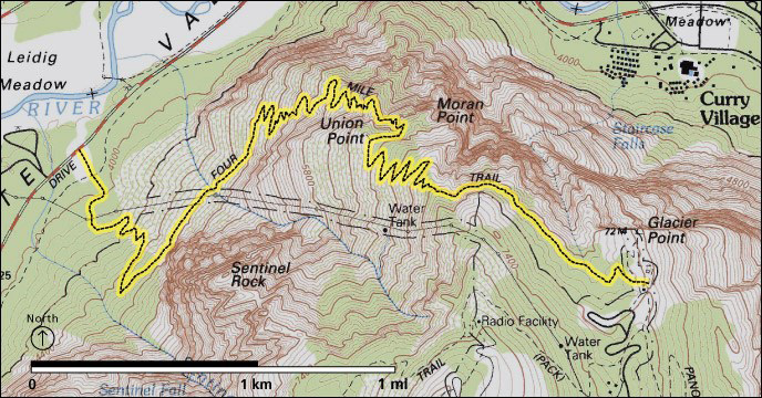
Read more at the park service Four Mile Trail page
People who want to get a bus ride to Glacier Point and hike back down the Four Mile trail or the trail past Illilouette, Nevada and Vernal Falls, can do so in months when the road is open. The road has opened anywhere from April 14 to July 1, depending on snow pack. Book a one way ride on the Glacier Point tour, most years leaving 8:30 a.m. from the Lobby entrance at Yosemite Lodge.
The Four Mile Trail typically opens for the season sometime in May (or as early as April) and partially closes due to treacherous conditions after significant snow accumulation and ice buildup (usually by November or December- for example, it closed partially Dec 20, 2024). The partial closure leaves the lower three miles (5Km) open to the gate below Union Point. After major snowfalls, the entire trail may close.
The Glacier Point hiking webpage with a map includes drawings of and descriptions of trails to / around (easy) Glacier Point, Mc Gurk Meadow, (moderate) Dewey Point, Taft Point and the fissures, Sentinel Point, Taft Point / Sentinel Dome loop, (strenuous) Four Mile Trail, Panorama Trail, Mt Starr King View, Ostrander Lake and Pohono trails.
– – – – – – – – – – – – – – – – – – – – – – – – – – – – – – – – – – – – – – – – – –
To hike to Vernal Fall
(the top is 3 miles round trip, 1,000 feet elevation gain)
Nevada Fall
(the top is 5 miles round trip, 1,900 feet elevation gain)
There are pictures at Vernal Fall Mist Trail.
or Half Dome,
permit required to go to the top of Half Dome. (To hike to Half Dome and back in one day, get up earlier than the buses run and make your way to the trailhead at Happy Isles.)
or to take a walk around Happy Isles,
take the shuttle bus to stop number 16.
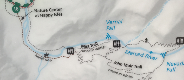
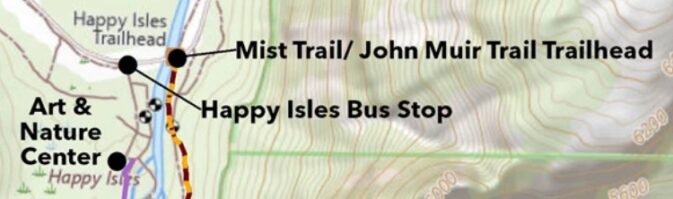
On the bus stop side of the river there are restrooms, a nature center, Art Activity Center with lessons and programs “for artists of all ages and abilities, usually open late March through October),
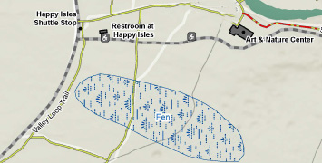
and a fen (marsh), (see blue letters “Fen” in map below) that is well worth a walk around.
The Happy Isles Fen has a boardwalk through it.
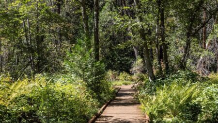
The NPS describes the fen: home to sedges, horsetails, ferns, and much more, explore this quiet wetland in the eastern corner of Yosemite Valley near Happy Isles. A fen is a peat-forming wetland fed by groundwater. This area stays wet in all seasons, promoting the growth of a variety of water-loving vegetation and attracting many species of animals.. . The fen can be reached year-round. Boardwalks are slippery when wet and even more so when icy. In spring, during peak snow melt, this area may be flooded.”
You can go directly to the trailhead for Vernal Fall, Nevada Fall, Half Dome and the Merced Lake High Sierra Camp, by walking from the Happy Isles bus stop across the bridge and turning right.
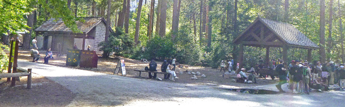
In the photo below, the restrooms are on the left and bus stop is at the right:
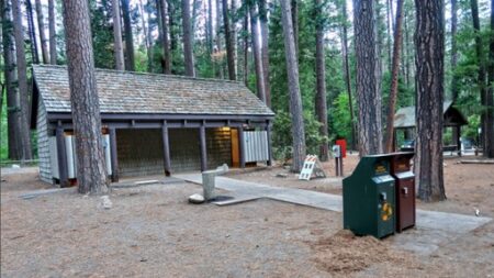
in the photo below, the restrooms are again on the left and the shuttle bus stop is on the right:
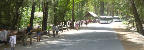
In the photo below we see people walking away from the shuttle bus stop towards the Happy Isles bridge and two shuttles at the bus stop:
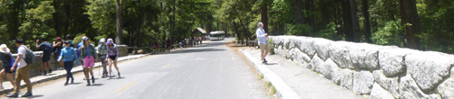
and below, people walking across the Happy Isles Bridge:
after you cross cross the large bridge you can turn right to get to the trailhead for the mist trail (dotted red and yellow line on the map above) and the rest of the 211- mile John Muir Trail including to Vernal Fall, Nevada Fall, Half Dome and . . . Mount Whitney.
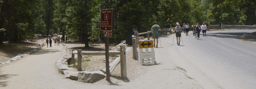
In the photo below, on the right we see people going across the bridge, and on the left, the trailhead (start of the trail):
A Google street 360 degree view from Glacier Point down to Vernal and Nevada falls, and across to Half Dome.
– – – – – – – – – – – – – – – – – – – – – – – – – – – – – – – – – – – – – – – – – –
To hike to a fairly close-in view of the base of or to the top of
upper Yosemite Falls Yosemite Point or Eagle Peak (Three Brothers)
(2 miles round trip, 1,000 feet elevation gain to Columbia Rock), then on to upper Yosemite Fall (7.2 miles round trip, 2,700 feet elevation gain), use the Yosemite Falls day use parking lot/ Yosemite Lodge stop #7 and head across the main road and through Camp Four.
Where did they get those photos of Yosemite falls ?

The author of this webpage, (written for my students), does not give any warranty, expressed or implied, nor assume any legal liability or responsibility for the accuracy, completeness, or usefulness of any information, product, or process included in this website or at websites linked to or from it. Users of information from this website assume all liability arising from such use.