An Environmental Assessment of the Mist Trail is available for public review from June 11, 2026 to July 13, 2026. The NPS notes: “Your input helps the NPS better understand visitor perspectives and informs decision‑making for managing Yosemite’s resources and visitor experiences.
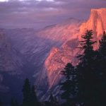
The trail to the bridge below Vernal Fall, and then up the mist trail and beyond is considered by many to be the best short hike in Yosemite Valley. For people who want to do the Mist Trail and continue with the hike to the top of Half Dome and back in one day, it should be started by at least 5 a.m. For a shorter excursion, the best pictures with rainbows in the mist are taken if you start the hike at around 10 a.m., but this is also the time with the most crowds.
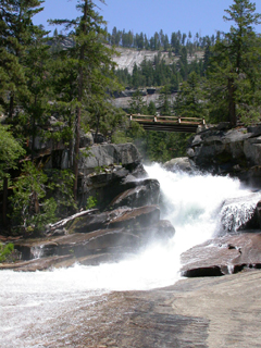
The hike to the top of Nevada Fall is 5.4 mi (8.7 km) round trip (via Mist Trail) with an elevation gain of 2000 ft (610 m). It takes most people 5-6 hours.
You will note that this means, if you use that route going up to Half Dome,
when you get to the top of Nevada Falls you are not yet half way there.
(And see notes about continuing to Half Dome.)
The Yosemite Assn used to have a page of photo tips from photographer Michael Frye which included that the best light for photos of Vernal Fall is from 5 to 6 p.m. and the best time for Nevada Fall is 6:30 to 7 p.m.
The mist trail section can open in late March to early May (April 15, 2024,for example)
and stay open to late November or mid December.
The Yosemite Daily report said, on May 2, 2023: “Mist Trail Open
The Mist Trail is now open for the season. The JMT still has some really challenging spots due to snow coverage on the switchbacks before Clark’s Point. The Ice Cut on the JMT is still holding snow, but passable if you stay close to the wall.”
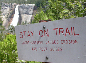
“Obey trail closures. The Mist Trail is usually closed in winter due to icy conditions, as well as ice and rock falling onto the trail from above. Entering closed areas is prohibited, and visitors who do so put themselves at unnecessary risk,” is a quote from winter trail run ends in disaster
The falling ice can happen even in sunny weather when you would expect the trail to be open, example March 2025: “The John Muir Trail is closed from the Mist Trail junction near the Vernal Fall footbridge to near Clark Point due to falling ice.”
Dogs and bikes are prohibited on all unpaved trails in Yosemite (see also links to Yosemite rules and regulations ).

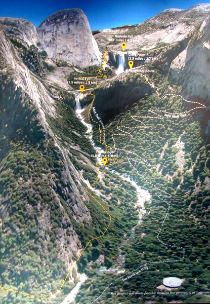
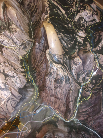
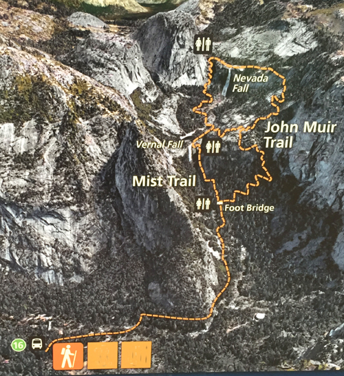
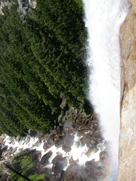
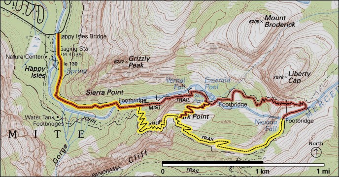
The former main valley visitor center had a huge raised relief map of Yosemite geological features with trails marked on it. Below, a photo of part of this display, showing Half Dome from above and the trail to Vernal and Nevada Falls (dotted yellow lines) and on towards the top of Half Dome, on the right.
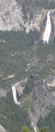
The trail that goes past the white of the river and waterfalls is the Mist Trail, to trail to the right of it is the John Muir Trail.
If you get an early start you can miss the CROWDS on the Mist Trail
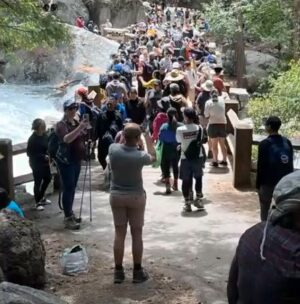
and have a more pleasant and perhaps faster hike.
Going back down the trail along the John Muir trail section is a longer distance, but because there are more gradual switchbacks (and fewer people) it can be a half hour faster than going down the Mist Trail portion, and easier on your tired legs / knees.
Wear sturdy shoes (hiking boots are best) with good tread on the soles. See hiking advice for a list of gear.
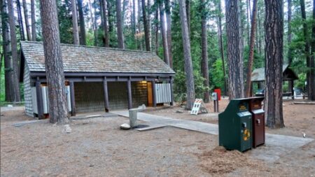
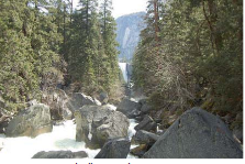
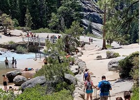
Take the Yosemite Valley free shuttle bus to stop 16 at Happy Isles, make one last stop at the restroom, ( restroom on the left, shuttle bus stop on the right in the photo below)
then cross the bridge
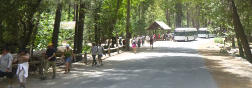
and turn right.
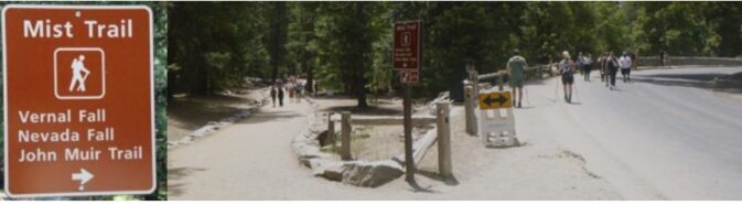
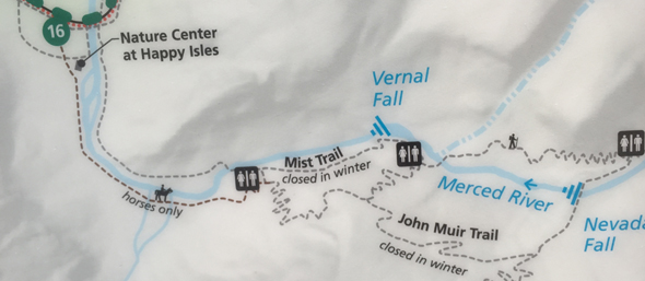
This shows the two ways to go to Vernal and/or Nevada Fall, (most people go up the Mist trail and down the John Muir trail and in winter only some parts of the trail may be open).
From the trailhead at Happy Isles, the initial walk on a paved path to the bridge below Vernal Fall is .8 miles. If you have any extra time, you should not start immediately from Happy Isles, but take a few minutes to walk directly up the path from the bus stop to the best nature center in the park, and maybe wander for a bit in the fen on the right hand side of that pathway. There are pictures at: Yosemite visitor centers
Then go back to the bus stop, walk across the bridge on the main road, turn right and walk through an area that is dusty from wear of feet. Ahead there is a big sign with trail distances on this section of the John Muir trail.
After .8 miles you get to the bridge.
The Merced River Plan, ( see page H23) has projects to improve views by removing trees, but the plan says none would be removed at the bridge below Vernal Fall:
“The Vernal Fall Foot Bridge is located on the mist trail approximately 0.75 miles from the Mist Trail trailhead. There has been a bridge near the base of the fall since one was constructed by the state of California in 1885. At present, there are conifers encroaching from the north, but these are within the Wilderness boundary, which is about 25 meters upstream from the bridge. No trees larger than 6” dbh are recommended for removal. This site should be monitored and maintained. There are small maple trees, outside of Wilderness, near the bridge that could be trimmed in the future to preserve a view to the fall.”
Here is the view shown in the Merced River Plan, see page H23
Just over the bridge are restrooms and a drinking fountain with purified water.
The Vernal Fall Comfort Station and drinking fountain at the Vernal Fall Foot Bridge are only open in warm-enough-that-water-won’t-freeze-in-the-pipes months. They are open most of the year, opening day after winter varies, but often in early April, usually closing in October.
For example, from the Yosemite Daily Report April 24, 2023: “The Vernal Fall Comfort Station and Drinking Fountain at the Vernal Fall foot bridge are open for the 2023 season” (2023 season and 2022 season on Friday, April 8th, 2021 season on Friday, April 2.)
And for example, from the Yosemite Daily report of Oct. 24, 2016: “The Vernal Fall water system and comfort station will close for the season on Monday, October 24. Potable water will no longer be available beyond Happy Isles on the John Muir Trail. The composting toilets located at Emerald Pool, Nevada Fall, and Little Yosemite Valley remain open all year.” (close October 28th, 2024, Oct. 26, 2025).
But the drinking fountain at the Vernal Fall Foot Bridge can be closed at any time with little or no notice due to water turbidity. Plus, you should have carried more water or a filter for a longer hike. It is not safe to drink unpurified water directly from streams, rivers or lakes anywhere in the park.
Too many people make the mistake of ending their hike at the bridge and returning to Happy Isles. Many think they are too tired from walking, either because they went too fast or didn’t drink enough water and have a few salty snacks. Some think it is too much of an adventure to go farther, but they should at least try going part way up the Mist Trail for great closeup views of the fall.
Below, a May 22, 2005 NPS photo during the ten year flood:
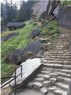
A couple of hundred yards uphill past the restrooms another trail comes in from the right. It might be your return route, so stop for a few seconds and look around in the direction you are coming from and up the trail you will continue on, so this junction will look familiar on your return. After this short detour, you should continue alongside the river.
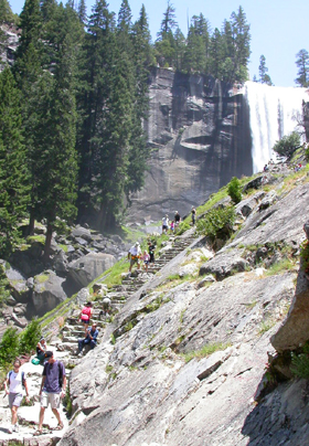
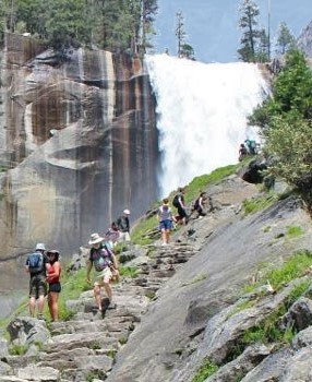
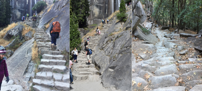
In the photo below you can see the start of the staircase shortly ahead.
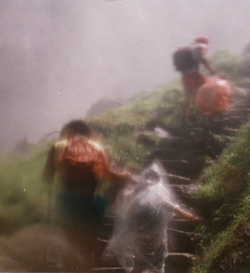
When we hike the Mist Trail in its mistiest months we like to either wear better rain gear than this shown below, or wear a minimum amount of clothes and plan to get soaked. (But we always bring warm things to put on at the top after.) When the water flow is highest in some spring months, some of the steps can be inches deep in water.
Be careful of your huge backpack (or even a large daypack) on a tight trail. If you turn around too quickly you can knock someone behind you off the trail. AND, of course, have some distance between you and the person in front of you.
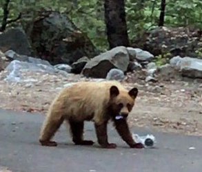
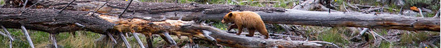
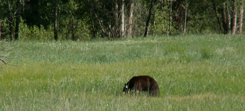
Bears on the trail? From the Yosemite Daily Report Sept. 20, 2021: “In Yosemite Valley, an elevated number of reports has been received of bears on the Mist Trail. One bear even used the railed steps to come down from the top of Vernal Falls during the middle of the day. If you run into bears on trails, give the animal plenty of space and protect your food—do not abandon it. Given the many heavily populated, narrow, switchbacking trails in the park – it is easy for a bear to quickly become surrounded with no exit if it is not given proper space. Always try to maintain 50 yards from a bear, even if that means backtracking and waiting for the bear to pass. If the bear approaches you (closer than 50 yards) yell as loudly as possible and try to scare the bear off…”
and from the Yosemite Daily Report of April 2022:
“The first two (bear) incidents of year took place in April, including a bear obtaining human food from a hiker along the Merced River below Vernal Fall, and a bear entering the bathroom at Vernal Fall footbridge on the Mist Trail. Bears are very active on the Mist Trail and John Muir Trail corridor south of Nevada Fall. Because of the amount of foot traffic in this area, it is important to yell aggressively and loudly if you see a bear on these trails (especially if it is approaching people).
While a bear in a developed or highly used area may not be a threat to your safety, bears that learn to tolerate people being close may become habituated, learn to associate people with food, and then become aggressive. Stay back a minimum of 50 yards from all bears and keep any food either in hand or within arm’s reach at all times in Yosemite.”
(Why would a bear go into a Yosemite restroom? Likely because people left food trash in the can in the restroom and the bear smelled it and wanted to eat it. Please pack out all your trash, orange peels, apple cores, . . . and get it all to a proper dumpster/bear-proof trash can.)
Here, a bear on a trail eating food trash:
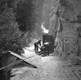
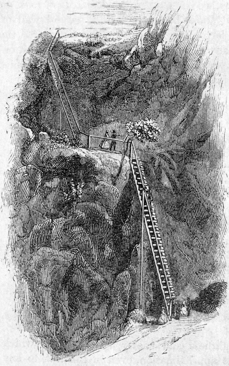
Below an NPS photo of the original construction of the trail:
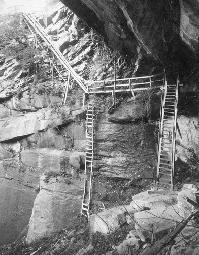
and, (NPS photo from the late 1800s) the 80 feet of ladders up the original Mist Trail:
Railing near the end of the mist trail:
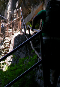
Next are NPS photos of the trail from a park service “Mist Trail Visitor Safety Railing and Widening Improvements (2020):
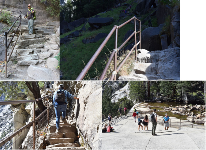
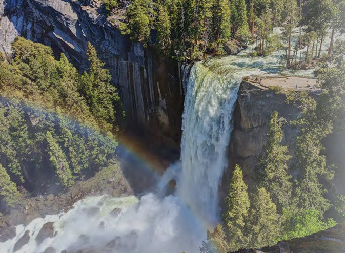
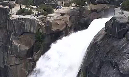
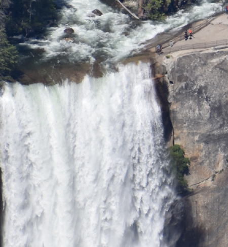
On the right hand side above is the railing to keep people from falling over the cliff where the falls drop 320 feet into the gorge you just walked up:
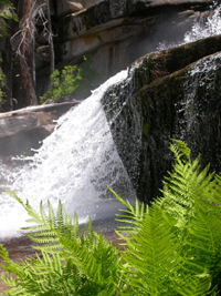
For a few weeks around the summer solstice there are fragrant azaleas just upriver.
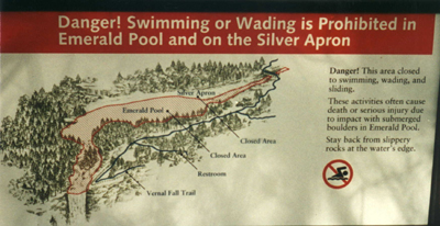
If you made it this far, you should have a picnic, but the best place for one is not necessarily with the crowds at the huge flat sheet of rock at the top of the fall. Walk a bit farther upriver past the side path to the restrooms, to find the Silver Apron cascade (aka Diamond Cascade) and it’s resident ouzel:
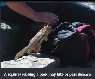
Please don’t feed the ground squirrels, they need to fill up on natural foods to make it through the long winter. Watch out, they can get into the pack you set on the ground in seconds. Other people have fed them and they become aggressive.
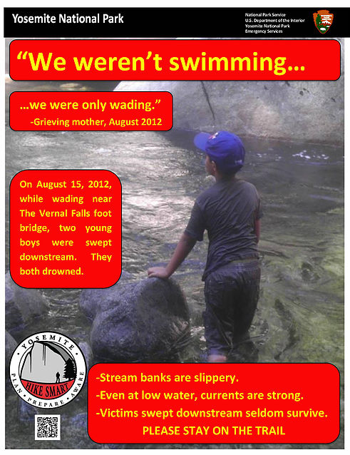
This whole area is closed to wading, sliding and swimming, as every year people lose their lives in the park from overestimating the power of moving water and being swept over waterfalls, crashed into submerged boulders or drowning. Rescue teams do respond to this area if needed, but rarely in time to actually save people in trouble in the water. Swimming in Yosemite National park has safe places to play in the water.
A link to the story Turning Blue in Emerald Pool of two young men used to playing in the ocean, who thought that they could swim in the Emerald Pool and almost died (the page says: “Emerald Pool is not a swimming pool. Other swimmers have drowned after discovering the challenge of cold and current when it was too late.”).
-A male in his early twenties deliberately slid down the Silver Apron, later telling medical staff who treated him that he was thinking, “I’m hot, and this looks like fun.” When he careened into Emerald Pool, he hit his shin in between two boulders, and he thought he had broken his leg. He then had to make his way through the pool to shore, leaving a trail of blood as he swam. He received eight stitches on his shin bone, and, as he was being treated, he said, “I’ll never do that again.”
Also see Five Silver Apron Injuries on Same Day near the end of this webpage.
Some people think you can just carefully slide along the granite above the pool and if you are careful enough, get out to the side quickly. You can’t count on that. Please stay away from the water.
After a picnic in either the sun to dry off from the Mist Trail or in the shade if you are tired of the heat, some people who want to make this a short hike will return back down the Mist Trail, which is often crowded in the afternoon. Others, who don’t want to slip on the steep downhill sections of granite steps with sandy surfaces which can be fine going uphill but potentially dangerous downhill, take an alternate route with new views.
The other route is longer in distance, but has mostly wide switchbacks that can be walked briskly if you wear shoes/boots with sufficient tread. (If you go all the way to the top of Nevada Fall, it is a half hour faster to take this John Muir Trail section down than to go back down the Mist Trail steps.) This section of trail starts in the vicinity of the Silver Apron. There are signs, but the whole area is so worn that the trail is not distinct. It goes uphill at first through mostly open sections, aren’t you glad you have a wide brimmed hat? (hiking advice)
The trail intersects a trail which goes to the left towards Nevada Fall or to the right (your route to the valley).
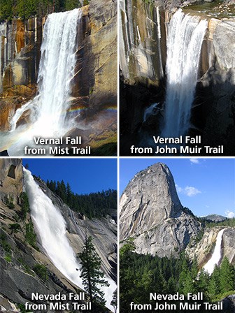
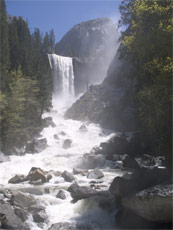
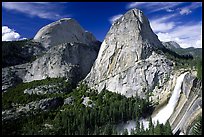
If you take the trail towards Nevada Fall, here is one of the views from that section of the John Muir trail:
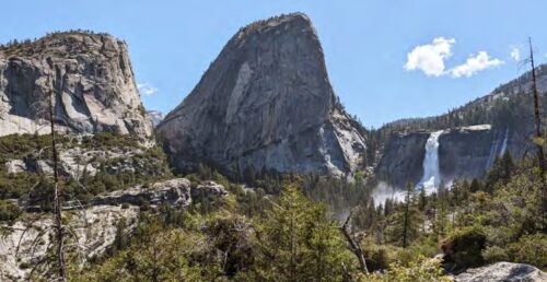
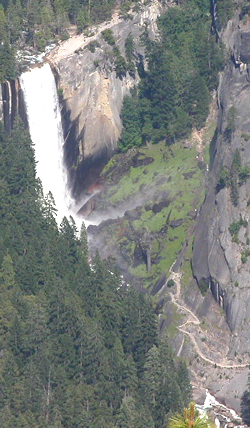
and here, Nevada Fall from another part of the Mist trail:
people at/near the top of Nevada Fall:
here, a railing at the top of Nevada Fall:
and here, the view from that railing area at the top of Nevada Fall:
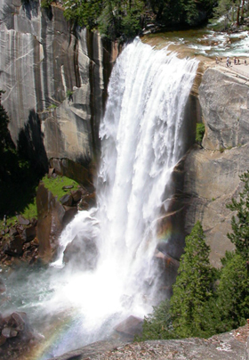
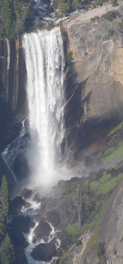
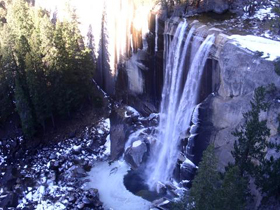
and here, a view of Vernal Fall:
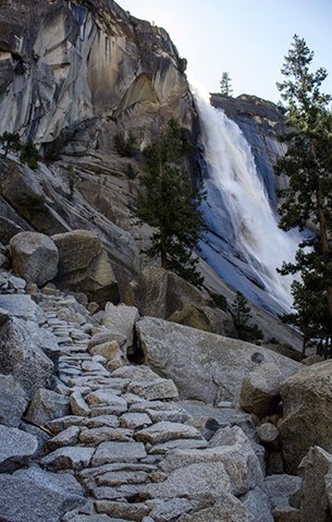
This uphill section is for a half mile to Clark Point with views behind you to Nevada Fall,
then there is more shade and mostly fast hiking along countless switchbacks your leg muscles will like better than downhill steps, past a horses only trail to the left, and down to the trail section above the first main Vernal bridge. Turn left here and continue downhill. If you stopped on the way up, took a few steps up the trail, turned around and looked back and around, you should not feel as though you are lost. From the bridge/restrooms/drinking fountain it is only about 15 to 20 minutes to Happy Isles.
If you go to Glacier Point and/or Washburn Point later you can spot a lot of the trail you walked:
Google maps street view of Nevada Fall.
Here you can compare the elevation gain and length of various strenuous hikes up from / down to Yosemite Valley:
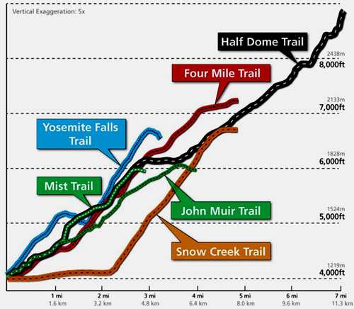
Note that the chart says “vertical exaggeration five times.”
From Happy Isles, the distances on the John Muir Trail and Mist Trail are:
Vernal Fall Footbridge…………………………….. 0.8 mile 1.3 Km
Vernal Fall (top)…………………………………….1.5 miles 2.4 Km
Clark Point…………………………………………..2.1 miles 3.4 Km
Nevada Fall (top, via Mist Trail)………………….2.7 miles 4.0 Km
Nevada Fall (top, via John Muir Trail)………….. 3.5 miles 5.5 Km
Little Yosemite Valley (via Mist Trail)……………3.8 miles 6.1 Km
Little Yosemite Valley (via John Muir Trail)……. 4.7 miles 7.6 Km
Glacier Point (via Panorama Trail)……………… 8.5 miles 13.7 Km
Half Dome (via Mist Trail)……………………….. 7.0 miles 11.2 Km
Half Dome (via John Muir Trail)………………… 8.2 miles 13.1 Km.
Clouds Rest………………………………………… 10.5 miles 17.0 Km
Merced Lake……………………………………….. 13.1 miles 21.0 Km
Tenaya Lake…………………………………………16.4 miles 26.4 Km
Sunrise High Sierra Camp……………………….. 13.2 miles 21.2 Km
Tuolumne Meadows (via Cathedral Lakes)……. 21.2 miles 34.1 Km
Tuolumne Meadows (via Vogelsang)…………… 28.1 miles 45.2 Km
Mount Whitney…………………………………….. 211 miles 340 Km
___________________________________________________
Yes, you can often do PART of this trail in the winter, just check with the Rangers first.
“Vernal & Nevada Falls Winter Trail Closures
The Mist Trail from its junction with the John Muir Trail above Vernal Fall footbridge to the top of Vernal Fall, and the John Muir Trail from Clark Point to near the top of Nevada Fall (the “Ice Cut”) are closed” often all winter, starting in November, “due to hazardous conditions.”
It is possible to hike to the top of Vernal and Nevada Falls using still-open sections of trail, however, conditions may be snowy and/or icy. For more information and a map, go to https://www.nps.gov/yose/planyourvisit/vernalnevadawinter.htm
Sometimes the trail can be open for days in the winter then quickly closed due to ice. The restrooms and water faucet at the Vernal bridge aren’t open all year.
Photo below of Vernal Fall from Clark Point, February, 2004, by Sudharsan Sripadham.
___________________________________________________
“Visitor Fatality in Yosemite National Park – Yosemite News Release February 25, 2019
At approximately 12:30 p.m. on Sunday February 24, 2019, a park visitor was killed in an incident on the Mist Trail in Yosemite National Park. X___ W___, 56, from Cupertino, California was hiking on the trail when she was struck by falling rock and ice and she succumbed to her injuries soon thereafter.
The Mist Trail, a popular trail from Yosemite Valley to the top of Vernal Fall, is closed this time of year due to icy and hazardous conditions. The trail closure is clearly marked and there is a gate on the trail reminding visitors of the closure. W___ ignored the signs, went around the gate and the incident happened on the trail leading to Vernal Fall.”
___________________________________________________
Swimming or wading above waterfalls is dangerous. Almost every recent year someone, or even more than one person, has been swept over a Yosemite waterfall. Some people just got too close trying to get a picture. Others climbed over protective railings/fences. Look at: fatal, near fatal or close call incidents/accidents in camping, backpacking, climbing and mountaineering for details.
Please consider that besides the enormous risk you personally are taking
when you climb over a railing meant to protect you,
you are also being a role model for kids who are watching:
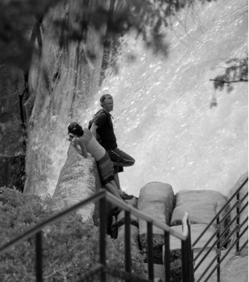
![]()
For perspective, the two photos above were taken where they climbed over the railing at the top right hand side of this photo of the Vernal Fall (Yosemite):
___________________________________________________

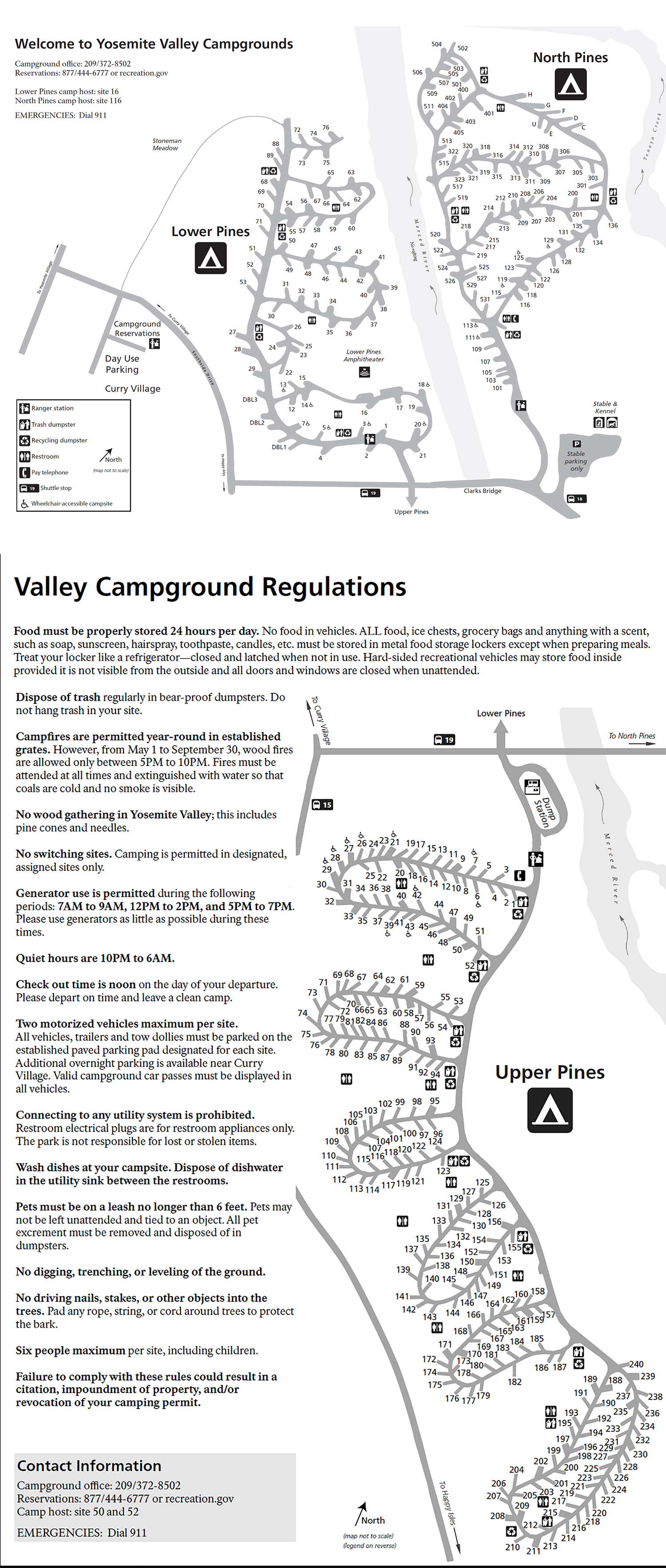
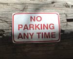
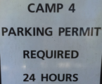
The campsites that are the best for a short walk back after a Half Dome or Mist Trail / Vernal Fall / Nevada Fall hike
that took a bit longer than you expected
and ended after the free shuttle buses are running, are those in higher numbered campsite loops (188 – 240 and 158 to 187) of Upper Pines campground.
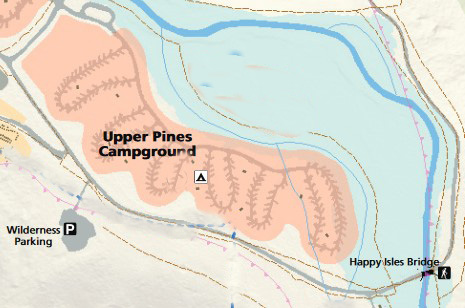
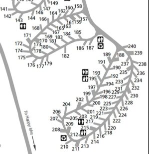
These campground loops are in the upper left corner of this map of the Mist Trail (in red) and John Muir Trail (in yellow):
See on the map of Pines campgrounds
The sign below on the Vernal Fall Footbridge, circa 1946 says:
Horses
Have Right-of Way
Do Not Frighten Them
By Sudden Movements
Or Attempt To Pet Them
___________________________________________
Enhance your hike by reading: NPS Plan Your Visit Vernal Nevada Fall trail
Yosemite nature and photography links
How much water will there be in the Yosemite waterfalls?
Safety video click on Beautiful but Deadly
The day hike gear section at Camping equipment checklist
Thunderstorm and lightning safety includes the answer to the question: Why can’t you swim during a lightning storm? A strike on a lake doesn’t kill all the fish in the lake.
see also: Cell phones in the wilderness which has advice on how/when to use a cell phone to contact 911 in the wilderness and a warning about interference between cell phones, iPods and avalanche beacons.
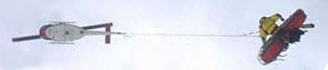 You can’t always expect a helicopter rescue
Leave no trace camping and hiking has these basic principles:
Plan Ahead and Prepare
Travel and Camp on Durable Surfaces
Dispose of Waste Properly
Minimize Campfire Impacts
Respect Wildlife
Be Considerate of Other Visitors
examples and details of how easy this can be are at: Leave no trace
GPS is not infallible
The use of cell phones for photography (with or without a selfie stick) has made preventable injury or even death by selfie common. They were only taking a selfie
Using a drone is illegal in Yosemite National park, including for photography. See an index to over a dozen park webpages with park laws, rules, regulations, policies and prohibitions about pets, bikes, permits, campground regulations, food storage, smoking, speed limits . . . and much more.
Yosemite trail conditions, wilderness conditions update info
Can a person who is prescribed an epi-pen risk going into the wilderness? and some sting prevention notes are at: Anaphylaxis quick facts
The Yosemite National Park rangers would like you to call them
if you see a bear in Yosemite,
no matter where it is or what it is doing.
Since 2003 there has been a note in the Yosemite Guide: “REPORT ALL BEAR SIGHTINGS! To report bear sightings, improper food storage, trash problems, and other bear-related problems, leave a message for the Bear Management team at: 1 (209) 372-0322. Your call can be made anonymously.”
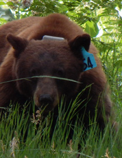
If you can, in all the excitement, try to notice if the bear has a tag (usually on the ear), the color of the tag and if possible, the number on it (the tag is large enough that with a telephoto lens you should be able to read the number).
The NPS notes: “Tagged, or radio collared, bears do not mean the bear is a “bad” bear. Tagging bears is done for better monitoring, and the ear tag color is completely random, used to help quickly identify a bear.”
From the Yosemite Daily Report newspaper:
“It is extremely important to remember to yell at bears that are in and around development, even if they are foraging on natural food. Though it is very tempting to get close for a picture, or just to watch these incredible animals, it is important not to give into this urge. Yelling at them if they are in residential areas or near people is critical to keep bears natural fear of humans. Giving bears plenty of space. When bears become too comfortable around people, they will often start causing damage to structures and vehicles, or will even become too bold around people, creating safety concerns.”
And the Yosemite Daily Report also said:
“Scare bears when you see them. . . in developed areas- Yell like you mean it!
Make as much noise as possible, try waving your arms, stomping your feet
or anything to make you look intimidating and to get the bear to run away.
We know it’s fun to see bears and it can feel mean to scare them,
but this is a simple way to truly help save a bear’s life.”

Where were they when they got that great picture in Yosemite?
Where can I take a photo that looks like the one on a Yosemite postcard I just bought?
Places to take photos of Half Dome, Bridalveil Fall, El Capitan, Yosemite Falls, Clouds Rest and Staircase Falls.
– – – – – – – – – – – – – – – – – – – – – – – – – – – – – – – – – – –
Drivers should note that there have been sections of road in Yosemite Valley, part of the year, with two lanes (usually) in the same direction, with the right lane ONLY for the free shuttle buses, ambulances, ski bus, commercial vehicles with ten or more passengers. The NPS says: “The bus lane ensures emergency vehicles can respond to incidents when traffic is backed up and provides preference for mass transit.”


Parking and traffic jams in Yosemite valley tips and tricks has the above advice, with maps of each of the three major day-use parking lots, with advice to help you NOT get a Yosemite National Park traffic or parking ticket, and not contribute to preventable traffic backups. And some details of where you can’t park in Yosemite, or can’t park without a permit.
– – – – – – – – – – – – – – – – – – – – – – – – – – – – – – – – – – –

You have a number of lodging choices of where to stay overnight in Yosemite Valley in Yosemite National Park, including campsites or
wood-walled cabin without a bath; heated or unheated wood floored, canvas sided and roofed tent cabin; wood walled cabin with a bath
luxury or generic hotel rooms, suites with a bath

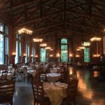
Ahwahnee hotel map webpage has summer and winter photos of rooms, balconies, parlors, (and the views from some of them), including the Presidential Suite with the huge balcony at the (south) far end of the Ahwahnee from the parking lot, the large third floor parlor with fireplace, two main building ADA Suites, featured room 417 with it’s own, small, private balcony, 5th floor rooms that share a balcony, the El Dorado Diggins Suite Jacuzzi tub, the 24 cottages / (bungalows / cabins), including the classic cottages that have an alcove between the bedroom and the bathroom with a bed you can fit a child on, and a door between the bedroom and alcove for privacy, sixth floor Mary Curry Tressider Suite, Library Suite, Underwood room, Sunroom Suite (Sun Porch), Mather, Spencer.
__________________________________________

You can find basic to extravagant, (a few with a dress code),
casual, fast (grab and go)
or with table-side service,
indoor and outdoor food service
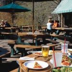
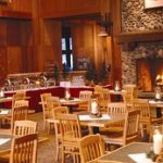
at multiple locations in Yosemite Valley , as well as four grocery stores


all of which are served by the Yosemite valley free shuttle bus.
________________________________________________
John Muir compared Vernal and Nevada falls in the book The Yosemite. Read the whole book for free.
“The Vernal, about a mile below the Nevada, is 400 feet high, a staid, orderly, graceful, easy-going fall, proper and exact in every movement and gesture, with scarce a hint of the passionate enthusiasm of the Yosemite or of the impetuous Nevada, whose chafed and twisted waters hurrying over the cliff seem glad to escape into the open air, while its deep, booming, thunder-tones reverberate over the listening landscape. Nevertheless it is a favorite with most visitors, doubtless because it is more accessible than any other, more closely approached and better seen and heard. A good stairway ascends the cliff beside it and the level plateau at the head enables one to saunter safely along the edge of the river as it comes from Emerald Pool and to watch its waters, calmly bending over the brow of the precipice, in a sheet eighty feet wide, changing in color from green to purplish gray and white until dashed on a boulder talus.”
In the same book he recommended a one day hike of: “If I were so time-poor as to have only one day to spend in Yosemite I should start at daybreak, say at three o’clock in midsummer, with a pocketful of any sort of dry breakfast stuff, for Glacier Point, Sentinel Dome, the head of Illilouette Fall, Nevada Fall, the top of Liberty Cap, Vernal Fall and the wild boulder-choked River Cañon.”
This would be about a 24 mile hike, starting with the Glacier Point “Four Mile” trail.
__________________________________________
From Scenes of Wonder and Curiosity in California (1862) by James M. Hutchings, a description of the trail nearing the original ladders up to Vernal:
“Upward and onward we toil; and, after passing a bold point we obtain, suddenly, the first sight of the Pi-wy-ack, or Vernal Fall. While gazing at its beauties, let us, now and forever, earnestly protest against the perpetuation of any other nomenclature to this wonder, than “Pi-wy-ack,” the name which is given it by the Indians, which means “a shower of sparkling crystals,” while “Vernal” could with much more appropriateness, be bestowed the name-giver, as the fall itself is one vast sheet of sparkling brightness and snowy whiteness, in which there is not the slightest approximation, even in the tint, to any thing “vernal.”
Still ascending and advancing, we are soon enveloped in a sheet of heavy spray, driven down upon us with such force as to resemble a heavy storm of comminuted rain. Now, many might suppose that this would be annoying, but it is not, although the only really unpleasant part of the trip is that which we have here to take, on a steep hill-side, and through a wet, alluvial soil, from which, at every footstep, the water spurts out, much to the inconvenience and discomfort of ladies—especially of those who wear long dresses.
As the distance through this is but short, it is accomplished, and in a few minutes we stand at the foot of “The Ladders.” Beneath a large, overhanging rock at our right, is a man who takes toll for ascending the ladders, eats, and “turns in” to sleep, upon the rock. The charge for ascending and descending is seventy-five cents; and, as this includes the trail as well as the ladders, the charge is very reasonable.
Formerly there were no means of ascending or descending this perpendicular wall of rock, except with ropes fastened to an oak-tree that grows in one of the interstices; and that, too, at great personal risk and inconvenience—so that but few persons would make the dangerous attempt.
Ascending the ladders, we reach an elevated plateau of rock, on the edge of which, and about breast high, is a natural wall of granite, that seems to have been constructed by nature for the especial benefit and convenience of people with weak nerves, enabling them to lean upon it, and look down over the precipice into the deep chasm below.”
It does take awhile to load, but see the original ladders up to Vernal Falls
__________________________________________
photo below by Quang-Tuan Luong/terragalleria.com, all rights reserved.
____________________________
Five Silver Apron Injuries on Same Day
July 25, 2014 written by: Yosemite Search and Rescue
On Wednesday, July 16, at approximately 6 pm, three 17 year-old males arrived at the Yosemite Medical Clinic seeking medical attention for injuries to their legs, ankles, and feet. The subjects all sustained their injuries while sliding down the Silver Apron, a large, sloping granite area that the Merced River flows over, located in between Vernal Fall and Nevada Fall, just east of Yosemite Valley, and which is a closed area. Moments later, two more 17-year-old males, unrelated to the previous group, walked into the clinic and, similarly, requested medical attention for lower extremity traumatic injuries caused by sliding down the Silver Apron.
Due to a language barrier, the exact details of how each of the five individuals hurt themselves are not known. One subject recounted entering the area and being surprised by how slippery the Silver Apron was, even where the granite was not wet. He further explained that when he started sliding down the Silver Apron, there was no way to slow down, let alone stop, before striking the pile of boulders and rocks at the base. The injuries sustained by the five subjects included lower leg and buttock abrasions, lower leg lacerations, and a sprained left ankle.
Every year at the Silver Apron, significant numbers of visitors are injured at the Silver Apron . . . Visitors either deliberately slide down the wet slope and then crash into the unavoidable pile of rocks at the entry to Emerald Pool, or, before they even have a chance to start sliding, they slip and fall on the slick granite. Often, hikers suffer more traumatic injuries than those sustained by the subjects mentioned above. There appears to be a correlation between a drop in the flow of the Merced River and an increase in the number of visitors injured at the Silver Apron. Visitors hiking along the Mist Trail are strongly advised to stay on the trail and away from the Merced River between the Happy Isles Trailhead and Little Yosemite Valley, especially when the river level drops. The smooth, polished granite of the river bed, whether wet or dry, is extremely slick, and the currents of the river remain deceptively powerful.”
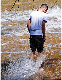
Below, a hiker off trail wading into the Silver Apron, risking a slip and fall:
________________________________________________
_____________________________________________
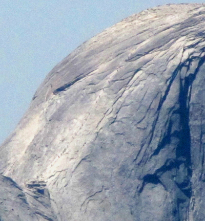
Photo below of a long line of people on the Half Dome cables taken with a telephoto lens from Olmstead Point near Tuolumne Meadows:
There is info, advice, (with photos and maps) about the
hike to the top of Half Dome here.
Including
The two choices of trails most people use for the start of the hike, one of which can be a half hour faster on your way back down,
Common mistakes people make that you can skip doing,
Logistics about the time it takes, including that it can take a minimum ONE hour to get from the base of the subdome to the top of Half Dome.
Logistics of the cables use,
A great Yosemite park video to watch
Dates the cables have gone up and come down, back to 2011 (more snow pack some years)
Logistics of getting a permit (well in advance or very near the date you want to go), including the most popular days.and the daily Half Dome permits lottery success rates,
Why there are permits required,
Where to camp along the hike to Half Dome. (Camping is no longer permitted on top of Half Dome.)
A cautionary tale of: “The salesperson advised the subject not to wear his new boots on his upcoming Half Dome hike, since new boots that haven’t been broken in on shorter hikes often cause hot spots, blisters, and soreness on a long, strenuous hike like the Half Dome hike. Even so, the subject chose to wear his new boots. . . .
Which Yosemite valley campsites are the best for a short walk to the trailhead at Happy Isles or a short walk back after a Half Dome hike that took a bit longer than you expected and ended after the free shuttle buses are running,
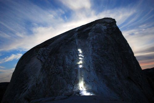
Just before sunrise, people with headlamps going up the cables:
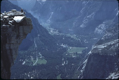
NPS photo of the view from the top of Half Dome down to Yosemite valley: (the man at the left is at the top edge, the “lip” of Half Dome)
___________________________________________
____________________________
——————————————————————-
The author of this webpage, (written as a reading assignment for my students), does not give any warranty, expressed or implied, nor assume any legal liability or responsibility for the accuracy, completeness, or usefulness of any information, product, or process included in this website or at websites linked to or from it. Users of information from this website assume all liability arising from such use.