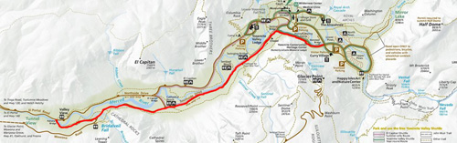
This page has photos and maps, descriptions of access to the six classic places to take photos of Bridalveil Fall in Yosemite valley, some considered the best locations to photograph Bridalveil Fall.
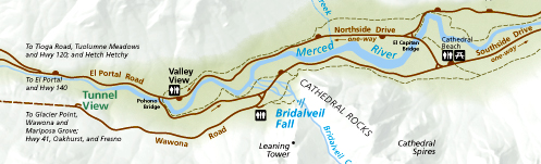
Coming into Yosemite valley on two-way Highway 140, (El Portal Road, see the left of the map below) after you cross the Pohono Bridge, the road becomes (usually) one-way.
( “Pohono” was the name the Southern Sierra Miwok Indians called Bridalveil fall.)
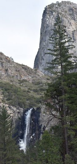
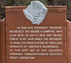
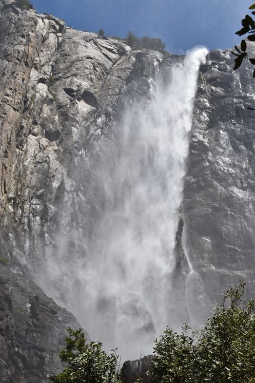
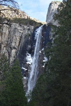
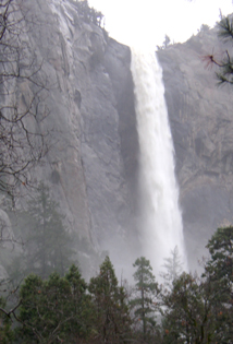
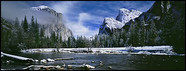
.45 miles east of the bridge there is a small turnout (Roosevelt turnout) on the right hand side of the road, across the road from a large meadow, with this view of Bridalveil Falls (which drops 620 feet):
and a large sign the commemorates the general location of where John Muir and President Theodore Roosevelt camped in 1903 when Muir toured the president through the park.
See also: How to find the location of John Muir’s cabin (hang nest) in Yosemite Valley.
__________________________________________
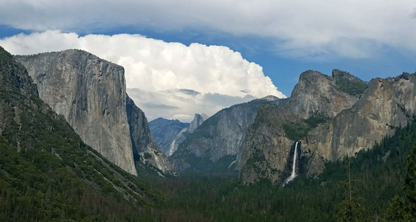
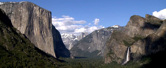
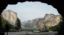
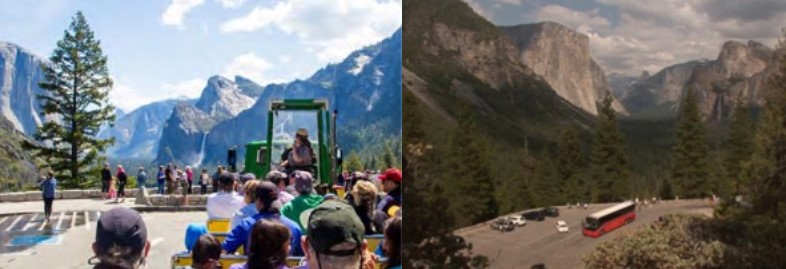
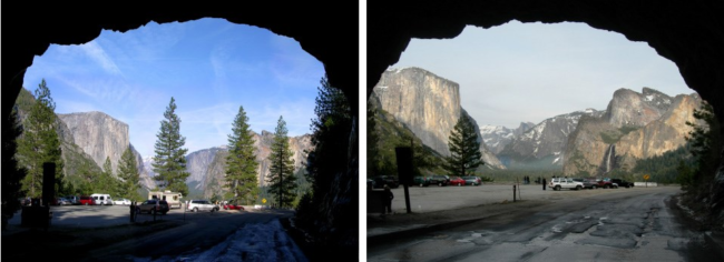
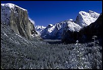
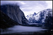
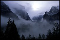
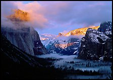
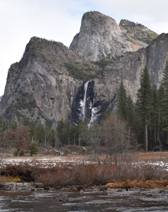
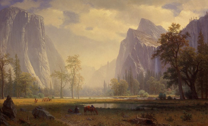
NPS photo of Tunnel View (the massive rock form on the left is El Capitan, in the background in the center is Half Dome, the waterfall on the right is Bridalveil Fall:
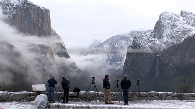
Different times of the year there will be different amounts of snow:
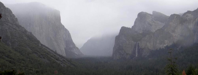
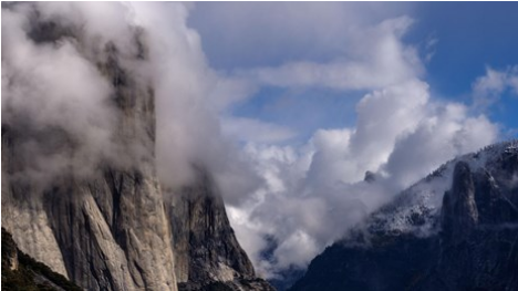
and on another day you might have fog:
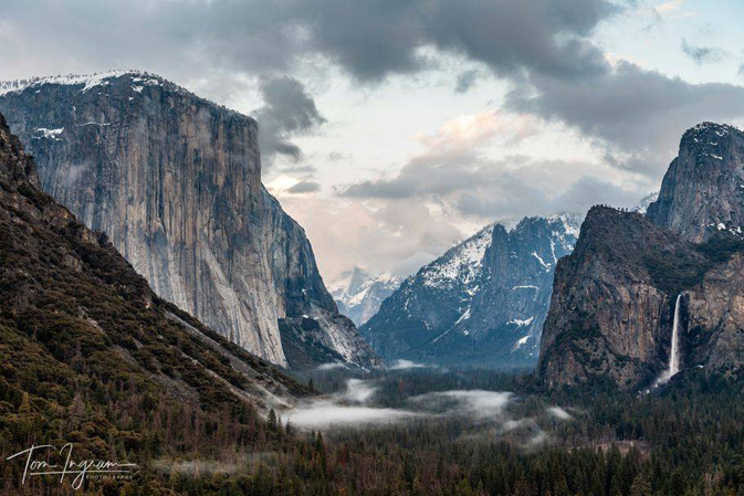
This next photo is courtesy of Tom Ingram Photography, all rights reserved tomingramphotography
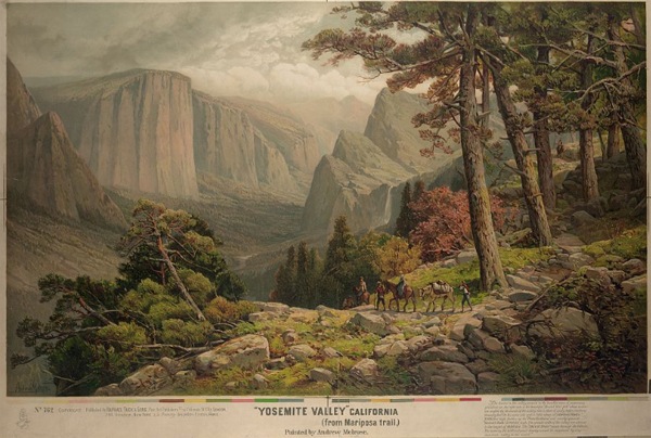
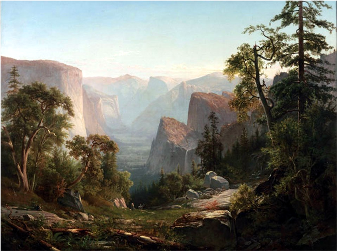
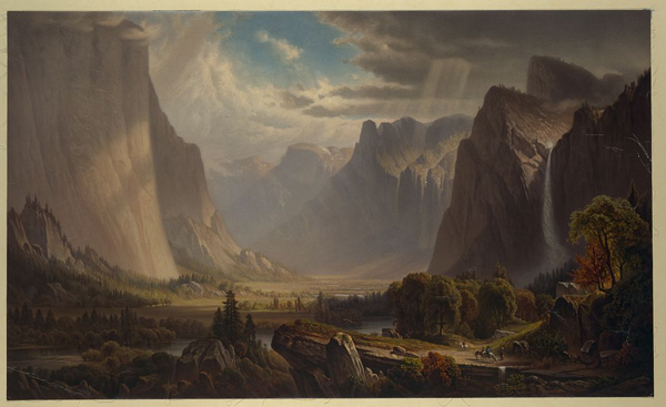
This was painted by Andrew Melrose in the vicinity:
Below a photo from the NPS webpage about Thomas Hill.
The website said: View of the Yosemite Valley, 1865, by Thomas Hill, which
served as the backdrop for the President Obama’s 2009 Inaugural Luncheon in Washington D.C.
Courtesy of Collection of The New-York Historical Society
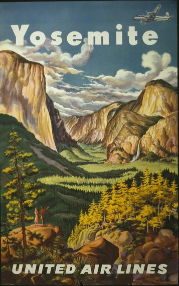
And here, a 1945 drawing from United Airlines:
Coming into Yosemite valley on Highway 41, just before the valley, about 7 miles after Wawona, you go through a long tunnel just above the valley floor.
Or you can get to Tunnel View from Yosemite Valley by driving on Northside drive until the Pohono Bridge, then making a left over the river and continuing until a right hand turn (almost U-turn) then up the Wawona Road towards Wawona and Glacier Point road,
(this almost u-turn is the same as you would take entering the valley on Highway 140 to go to Tunnel View) as in the map below
 Coming from highway 41, after going through the tunnel, slow down and put on your right blinker at the end of the tunnel and pull carefully into the small parking lot. Walk across the road (watch out for drivers watching the scenery and not seeing you) to the main viewpoint.
Coming from Yosemite Valley, (or via Highway 140) watch for the parking lot on the right before the tunnel.
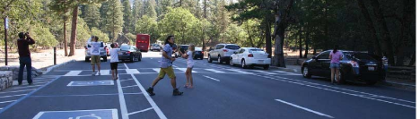
Many drivers who are watching the scenery do not notice the crosswalk between the two parking lots. If you plan ahead while driving through the area, you can slow down and look for people waiting to cross:
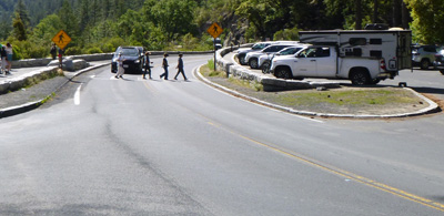
The two parking lots, one on each side of the road, have a small number of parking spaces:
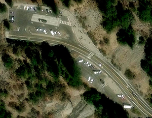
This larger of the two parking lots has a bus parking only section:
At the edge of the parking lot is a paved section for photographers with a low wall:
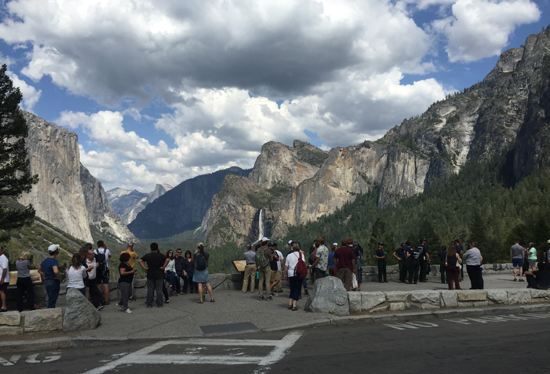
This view is worth stopping for even if you are running late and even if there is rain or snow falling. The Yosemite Fund (now called the Yosemite Conservancy) and the National Park Service funded a remodel in 2008 with educational exhibits, expanded handicap accessible viewing area and improved traffic flow. Thousands of people stop each day in the summer.
Clouds might hide the full view of peaks when you arrive, but they usually clear quickly (and can add more drama to your photos):
Here, NPS photos of the Tunnel View before and after trees were cleared that had been blocking the view:
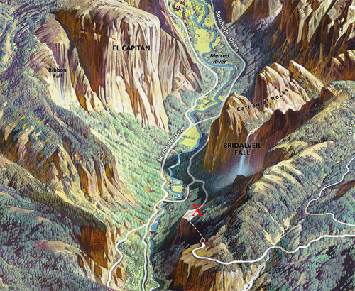
The red X below is where Tunnel View is:
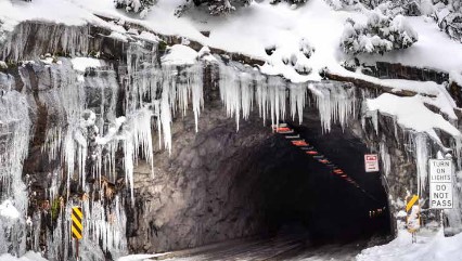
and here, an end of the tunnel in winter (note the Do-Not-Pass-in-the-tunnel sign),
and please do expect sometimes icy conditions in the parking lot.
More photos of the view from the parking lot at tunnel view:
photos below by Quang-Tuan Luong/terragalleria.com, all rights reserved.
Webcam near Tunnel View located on a dome near the Wawona Tunnel
![]()
Southside Drive runs almost the length of Yosemite valley, in a one way direction west-to-east, as outlined in red in the map section below:
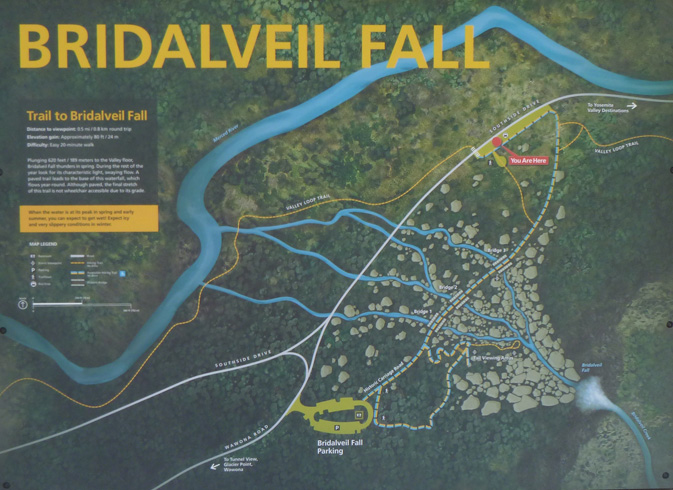
From tunnel view, on your way down into Yosemite valley, before you join Southside Drive, a part of the main road that circles around the valley, there is a turn to the right to a parking area (Bridalveil Fall parking lot)
for the short walk to the base of Bridalveil Fall.
The park service described the walk:
“Take a short stroll to the base of Bridalveil Fall. A gentle incline leads to a wheelchair-accessible viewing area, while a steeper path climbs closer to the base of the fall.
Stay behind barriers. Rocks at the base of the waterfall are very slick and dangerous.
0.5 mi (0.8 km) round-trip, paved with gentle incline.”
The Bridalveil fall parking lot was remodeled to look something like this:
![]()
The parking lot loop is in black and the walk is in yellow in this map:
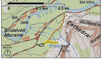
It’s only a five minute walk to the base of the fall.
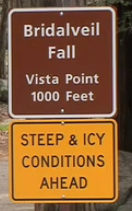
The park service cautions that the paved walkway can be slippery, especially in the winter.”The rocks and boulders above the viewing platform are slippery even when dry; stay safe by staying on the paved trail. Scrambling off trail in this area has led to serious injuries.
If you choose to park along Southside Drive, when getting out of your vehicle, watch for traffic and be cautious opening car doors and crossing the road.”
explanation of work on restoration of the Bridalveil Fall area.
Read details and see plans / photos for the Bridalveil Fall rehabilitation project
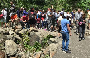
The main viewing platform could get very crowded mid-day:
The plans included better viewing platforms:
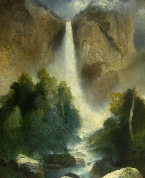
Here is a view of the fall from this walk:
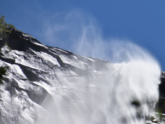
The wind can blow strong enough to lift some of the spray back over the top of the waterfall:
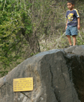
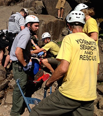
This warning sign, often ignored, is at the viewing platform at the end of the short trail. (The picture below is from: A Common Yosemite Search and Rescue where it says: “Danger signs are not there to ruin our fun. They are often posted in places with a large accumulation of past accidents.”)
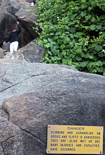
It can take quite awhile for a rescue team to get to you.
“Open Ankle Fracture at Bridalveil Fall .. .The subject, a 48 year-old male, along with his nine-year-old son, had hiked to the viewing platform below Bridalveil Fall. The pair then left the established trail to scramble up the boulder field toward the base of the waterfall (left), bypassing signs that advise against leaving the trail. Although the boulders were dry, they were still extremely slick; over the years, the boulders have been polished smooth by water from Bridalveil Fall (even rescuers that day, wearing approach shoes with sticky rubber soles, had trouble with their footing).. .”
![]()
__________________________________________
PARKING
The Park Service described parking:
“The parking area often fills up quickly in summer and, while there is a lot of turnover, traffic jams are common when getting in and out of this parking lot. Another option is to drive a little further east on Southside Drive into Yosemite Valley (a few hundred yards), where you’ll find parking on either side of the road with a different trail option. This trail is a bit longer—an additional 0.25 miles (0.4 km), crosses Bridalveil Creek, and showcases different views of Bridalveil Fall as you approach the main parking area.”
and also said: “Shuttle service is not available to the Bridalveil Fall area. Drive your own car to the trailhead (or take a long hike using the Valley Loop Trail).”
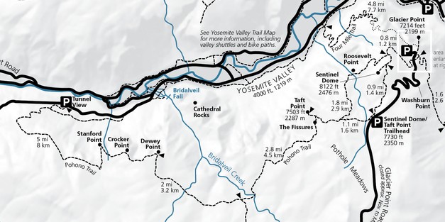
The NPS map below has the parking area closest to Bridalveil fall (Bridalveil Fall parking lot, mentioned above) marked with a large P
and in almost the center of the map, a smaller P with the location of the long paved turnouts pictured below.
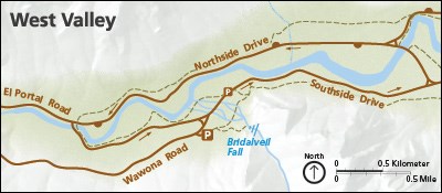
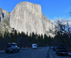
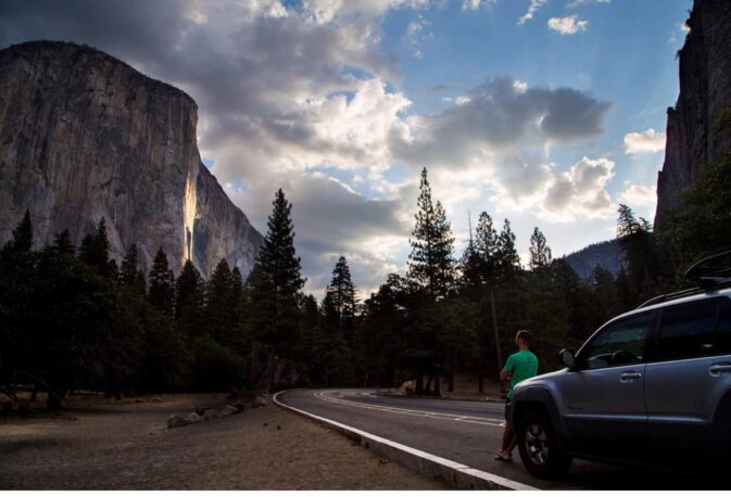
Further along (usually one-way) Southside drive into Yosemite valley, (0.25 miles east of the intersection of Southside Drive and Wawona Road) there are long paved turnouts on both sides of the road with a view of El Capitan on the left
and Bridalveil Fall on the right, where a long trail to Bridalveil fall comes out to the road.
Watch out as you drive through here for people standing in the roadway to look at the view, get a picture, often not looking out for oncoming traffic:
This section of Southside Drive, known as Bridalveil Straight
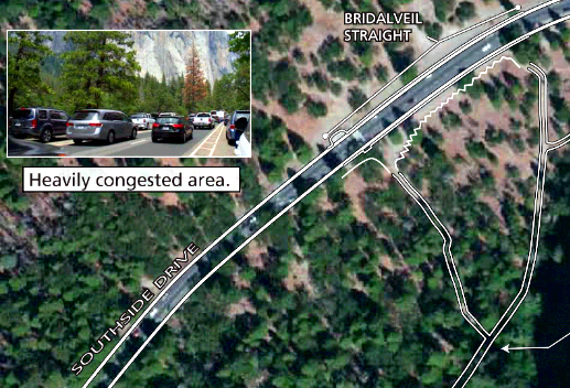
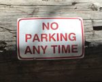
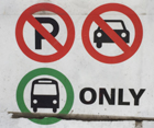
was redesigned in 2022. Note that if you want to stop here, as you approach you should be in the left hand lane to find a parking space, as much of the right hand lane is a no parking zone designated for shuttle buses and tour buses. (The four thin blue rectangles in the map below are to show busses.)
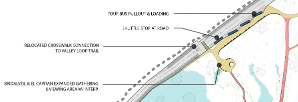
At the side of the road, near the bus parking, you can find display with a map of the trails / walkways from there to Bridalveil Fall:
Below, a view from Bridalveil Straight
__________________________________________
__________________________________________
Exiting Yosemite Valley on usually one-way Northside Drive (top of the map below), there is a long turnout made for people to get yet another view of Bridalveil Fall .
At the map above, at the top right of center, look for Northside Drive (in brown letters) and just below that, to the left of the “M” in Merced River (in blue letters above a blue river drawing) you can see where the road goes closer to the river. Get in the left lane, slow down, and look for this turnout:

If the turnout is full there are two more small paved turnouts a little further along the left side of Northside Drive. Watch carefully for traffic while walking along the road.
At the turnout viewpoint, here is the view of Bridalveil Fall in December:
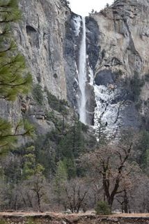
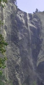
Bridalveil fall in September, with just a wisp of water:
and in February 2017, with full flow:
The Bridalveil Fall (height 620 feet) drainage was never scoured by glaciers. We learn in The Waterfalls of Yosemite, by Michael Osborne, that “the watershed of Bridalveil Creek is about 25 square miles in area and largely forested. Because its moderately large watershed has especially deep soils, Bridalveil is Yosemite’s only tributary waterfall that does not become dry. The others usually go dry in the Autumn, but are revived by November rains.”
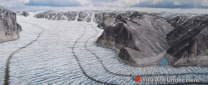
There is a display describing the viewpoint, and glaciation that caused the hanging valley the fall flows from:
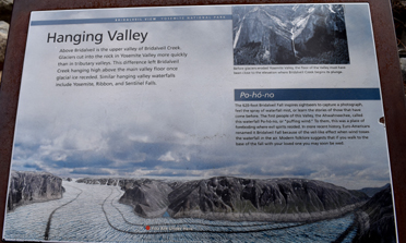
with a drawing of the glaciation:
__________________________________________
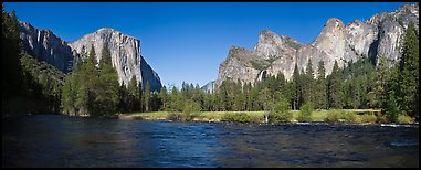
A bit further along usually one-way Northside Drive, Valley View, also known as Gates of the Valley, (seen on the way out of Yosemite Valley, the small parking lot is on the left hand side)
panorama spring and winter:
photos below by Quang-Tuan Luong/terragalleria.com, all rights reserved.
and a close-up with your telephoto of Bridalveil Fall:
If you are lucky you might see a Water Ouzel (also known as a Dipper) swimming in and out of the ripples very near you, any time of year, including this photo taken in December:

The N.P.S. Merced River Plan, (see page H-35) has projects to improve views by removing trees. It says about the view from Valley View:
“Valley View is at the west end of Northside Drive. This is the vista on the 2010 quarter from the US Mint’s “America the Beautiful” series. The viewpoint is part of the Yosemite Road Guide (marker V11) which describes it as being a view of the “gates” of Yosemite with El Capitan on the left and Cathedral Rocks on the right. The landscape of the surrounding Yosemite Valley is reflected in the calm water of the Merced River. The primary objective in managing the vista is to open the mostly obscured view of Bridalveil Fall, and to reduce the number of conifers encroaching on the meadow. There are a large number of dead trees from a controlled burn in 2007. The area from which trees will be removed is approximately 4 acres. There are 117 snags within this area, and of these, those less than 12” dbh will be removed and larger snags of greater habitat value will remain.” 519 trees (175 Ponderosa, 327 Cedar and 17 Fir) will be removed.
This (1885 +/-) painting by Thomas Hill (photo courtesy of the Library of Congress) was done in the vicinity.
as was this (1871), also by Thomas Hill (photo courtesy of the Library of Congress):
As is this painting by Albert Bierstadt (which you can see at The Haggin Museum in Stockton, California )
This NPS photo of a painting by Thomas Moran is a bit of a different angle
and see:
Thomas Moran Virtual Museum Exhibit, National Park Service Museum Management Program
Below a photo from the NPS.
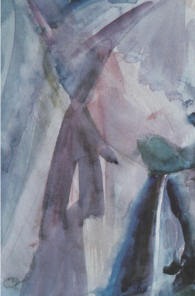
William Zorach: Bridalveil Fall in Yosemite Valley, 1920
(The Yosemite webpage this is from said: Zorach’s stylized portrait of Bridalveil Fall.
Credit: Artist: William Zorach; Courtesy of Fresno Art Center.
Lithuanian-born, William Zora, his wife Marguerite, and their two small children, spent the summer of 1920 in Yosemite, hiking, sketching, and painting the landscape. Inspired by Ralph Waldo Emerson’s essays about nature, William’s watercolors were Fauvist in style, emphasizing bright colors and simplified forms. “There are things one does for the pure love of form and color, in the easy abandonment to the moods and the fancies of the moment. These are my watercolors.” )
__________________________________________
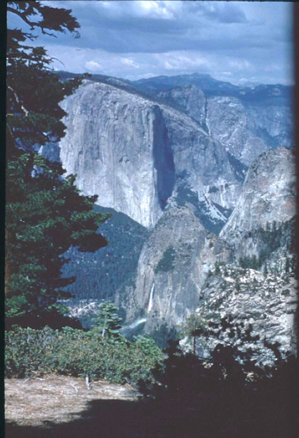
From the Pohono Trail with El Capitan
The NPS describes the Pohono Trail (east to west, 13.7 miles (22.0 km) one way):
“Beginning with the sweeping vista of Glacier Point, venture along the south rim of Yosemite Valley and enjoy the evolving views from points like Taft, Dewey, and Stanford as you gradually descend to the end of the trail at the iconic Tunnel View.”
__________________________________________
You can buy a Bridalveil Fall tshirt, poster or art work online from the Yosemite Conservancy
__________________________________________
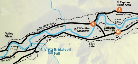
The Yosemite Valley free shuttle bus does not make a stop near Bridalveil Fall. You must drive to near it and walk to it or hike to it, (the closest shuttle stops are 9 and 10).
Here, a map of the closest shuttle bus stops to Bridalveil Fall:
__________________________________________
The Yosemite Assn used to have a page of photo tips from photographer Michael Frye which included:
“Nice late-afternoon sunlight strikes Bridalveil Fall about an hour-and-a-half before sunset (about 6:30 p.m.) in May and June.”
__________________________________________
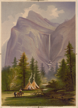
This plate supposedly shows Bridalveil Fall and the Merced River:

__________________________________________
How much water will there be in the Yosemite waterfalls?
__________________________________________
Also perhaps of interest:
places to take photos of Half Dome in Yosemite National Park (with maps)
places to take photos of Yosemite Falls in Yosemite National Park (with maps)
Places to take photos of El Capitan in Yosemite National Park, (with maps)
Places to take photos of Staircase Falls in Yosemite National Park
Places to take photos of Clouds Rest in Yosemite National Park with maps
And see shots of Yosemite valley from Glacier Point. (You can not see Bridalveil Fall from Glacier Point.)
![]()
Selfies can be great, OR dangerous. The use of cell phones for photography has made preventable injury or even death by selfie common. They were only taking a selfie
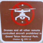
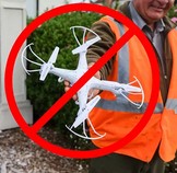
Fireworks and drones (unmanned aircraft) are banned at all times in all National Parks.
The NPS tells us that the use of unmanned aircraft (e.g., model airplanes, quadcopters, drones) has resulted in noise and nuisance complaints from park visitors, park visitor safety concerns, and incidents in which park wildlife were harassed. Small drones have crashed in geysers in Yellowstone National Park, attempted to land on the features of Mount Rushmore National Memorial, been lost over the edge of the Grand Canyon, and been stopped from flying in Prohibited Airspace over the Mall in Washington DC.
See an index of Yosemite rules and regulations webpages .
__________________________________________________________
Yosemite trail conditions info
How much water will there be in the Yosemite waterfalls?
Park Service videos about Yosemite
Yosemite National Park webcams
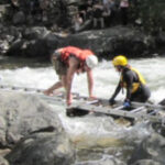
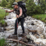
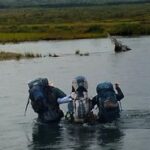
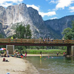
The best place to cross a creek or river is on a bridge built for this endeavor.
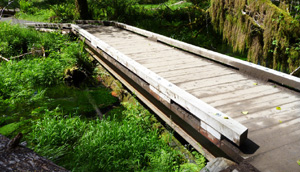
Crossing streams safely includes advice from Mount Rainier National Park, Yellowstone National Park, Great Smoky Mountains, and Yosemite National Park
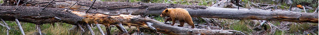
The Yosemite National Park rangers would like you to call them
if you see a bear in Yosemite,
no matter where it is or what it is doing.
Since 2003 there has been a note in the Yosemite Guide: “REPORT ALL BEAR SIGHTINGS! To report bear sightings, improper food storage, trash problems, and other bear-related problems, leave a message for the Bear Management team at: 1 (209) 372-0322. Your call can be made anonymously.”
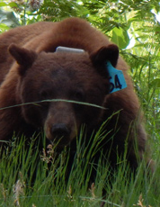
If you can, in all the excitement, try to notice if the bear has a tag (usually on the ear), the color of the tag and if possible, the number on it (the tag is large enough that with a telephoto lens you should be able to read the number).
The NPS notes: “Tagged, or radio collared, bears do not mean the bear is a “bad” bear. Tagging bears is done for better monitoring, and the ear tag color is completely random, used to help quickly identify a bear.”
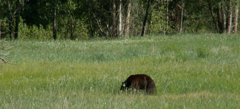
From the Yosemite Daily Report newspaper:
“It is extremely important to remember to yell at bears that are in and around development, even if they are foraging on natural food. Though it is very tempting to get close for a picture, or just to watch these incredible animals, it is important not to give into this urge. Yelling at them if they are in residential areas or near people is critical to keep bears natural fear of humans. Giving bears plenty of space. When bears become too comfortable around people, they will often start causing damage to structures and vehicles, or will even become too bold around people, creating safety concerns.”
And the Yosemite Daily Report also said:
“Scare bears when you see them. . . in developed areas- Yell like you mean it!
Make as much noise as possible, try waving your arms, stomping your feet
or anything to make you look intimidating and to get the bear to run away.
We know it’s fun to see bears and it can feel mean to scare them,
but this is a simple way to truly help save a bear’s life.”


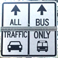
Drivers should note that there have been sections of road in Yosemite Valley, part of the year, with two lanes (usually) in the same direction, with the right lane ONLY for the free shuttle buses, ambulances, ski bus, commercial vehicles with ten or more passengers. The NPS says: “The bus lane ensures emergency vehicles can respond to incidents when traffic is backed up and provides preference for mass transit.”
Parking and traffic jams in Yosemite valley tips and tricks has the above advice, with maps of each of the three major day-use parking lots, with advice to help you NOT get a Yosemite National Park traffic or parking ticket, and not contribute to preventable traffic backups. And some details of where you can’t park in Yosemite, or can’t park without a permit.
– – – – – – – – – – – – – – – – – – – – – – – – – – – – – – – – – – –
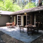
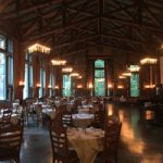
Hotel, cabin and tent cabin choices in Yosemite valley are at: Yosemite Valley accommodations

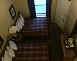
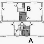
a map of and floor plans for the Ahwahnee cottages is at:
Yosemite Ahwahnee Hotel cottages, (bungalows / cabins) floor plans and map
– – – – – – – – – – – – – – – – – – – – – – – – – – – – – – – – – – –
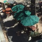

You can find basic to extravagant, (a few with a dress code),
casual, fast (grab and go)
or with table-side service,
indoor and outdoor food service
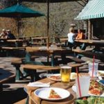
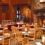
at multiple locations in Yosemite Valley, as well as four grocery stores


all of which are served by the Yosemite valley free shuttle bus.
– – – – – – – – – – – – – – – – – – – – – – – – – – – – – – – – – – –
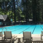
swimming in Yosemite including thunderstorms, bacteria in the water, safety issues, favorite beaches, swimming pools with lifeguards.
– – – – – – – – – – – – – – – – – – – – – – – – – – – – – – – – – – –
The author of this webpage, (written for my students), does not give any warranty, expressed or implied, nor assume any legal liability or responsibility for the accuracy, completeness, or usefulness of any information, product, or process included in this website or at websites linked to or from it. Users of information from this website assume all liability arising from such use.