The hike from Yosemite valley floor to the top of Upper Yosemite Fall is 7.2 miles round trip (one source says 6.6 miles) with a 2,700 feet elevation gain. (Or you can choose to not go all they way to the top for a great hike with great views.)
Plan to start early and take all day to do this hike and enjoy it.
(See also ten places to take pictures of Yosemite Falls besides along this trail)
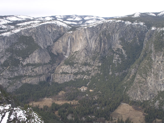
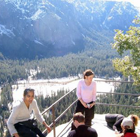
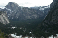
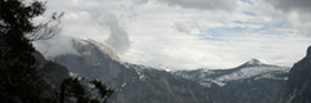
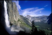
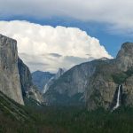
photo above of Yosemite Falls from Glacier Point courtesy of NPS
Conservationist John Muir wrote of the trail to Upper Yosemite Fall:
“The Yosemite Fall is separated into an upper and a lower fall with a series of falls and cascades between them, but when viewed in front from the bottom of the Valley they all appear as one.
So grandly does this magnificent fall display itself from the floor of the valley few visitors take the trouble to climb the wall to gain nearer views, unable to realize how vastly more impressive it becomes when closely approached, instead of being seen at a distance of from one or two miles.
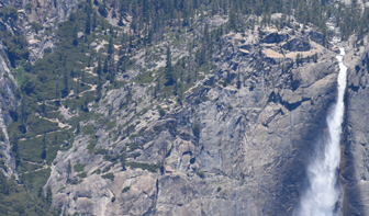
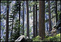
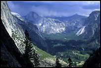
The views developed in a walk up the zigzags of the trail leading to the upper fall are as varied and impressive, and almost as extensive, as those on the well known Glacier Point Trail. One rises as if on wings. The groves, meadows, fern-flats and reaches of the river at once new over and over again as we go higher from point to point; the foreground also changes every few rods in the most surprising manner, although the bench on the face of the wall over which the trail passes is very monotonous and common place as seen from the bottom of the valley. Up we climb with glad exhilaration, through shaggy fringes of laurel and ceanothus, and glossy-leaved manzanita and live oak from shadow to shadow across bars of sunshine, the leafy openings making charming frames for the valley pictures beheld through them, and for the glimpses of the high alps that appear in the distance.”
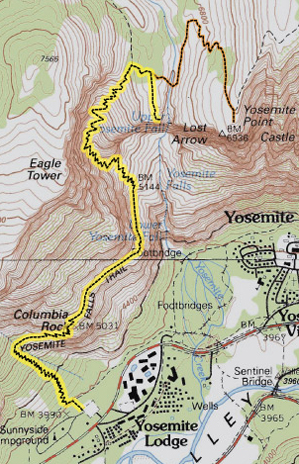
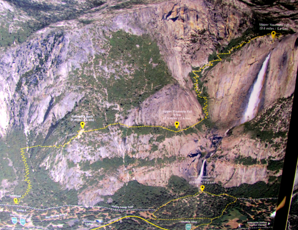
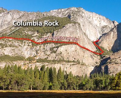
Along the way to the top, the hike to Columbia Rock (also known as Columbia Point) is only 2 miles round trip;
it gains over 1,000 feet and is listed by the park service as moderate (as opposed to strenuous for the entire hike to the top).
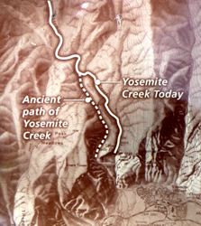
In the map below (courtesy of the National Park Service)
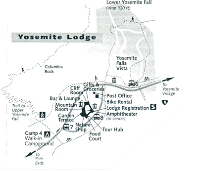
the dotted line in the upper left in the drawing above is part of the trail.
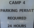
If you drive to the trailhead, please do not park in the small parking lot near the trailhead. It is for occupants of campsites in Camp Four (Sunnyside Campground) only and you can be ticketed and / or towed.
To choose the best parking lot to park before your hike to the top of Upper Yosemite Falls, or half way there or to Columbia Rock, don’t try to park in the side of the road near free shuttle bus stop 6. The lot at Lodge day use just down the road, across the road from Camp Four, is better. You can take food, etc. out of your car and put it in one of the bearboxes (bear-proof storage container) so you don’t risk having a bear break into your car if you come back from your hike after dark
For closest restrooms, very near the trailhead (start of the hike) see the Camp 4 map.
Or even better, take the free shuttle bus!
If you stay at the Yosemite Lodge, leave your car parked next to your hotel building and walk to the trailhead. See Yosemite Valley Lodge for details about room choices at the Lodge, including adjoining rooms, best views (or rooms with a total lack of a view).
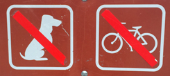
Dogs and bikes are prohibited on all unpaved trails in Yosemite (see also links to Yosemite rules and regulations )
A warning sign about ice and rock falls at the trailhead:
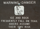
(From the Yosemite Rockfall Year in Review: “There were 37 documented rockfalls in Yosemite in 2008 with an approximate cumulative volume of 6385 cubic meters.” “There were 52 documented rockfalls in 2009, with an approximate cubic volume of 48,129 cubic meters (142,000 tons).” “2014 was an active year for rockfalls in Yosemite. In all, there were 77 documented rockfalls, which is considerably more than the recent (2006-2013) average of about 45 rockfalls per year. Most of the rockfalls in 2014 were relatively small, with a total volume of about 6,500 cubic meters (about 19,350 tons).””Rockfall activity in 2016 was slightly lower than in previous years, with 58 documented events (rockfalls and rockslides) and a cumulative volume of about 5,000 cubic meters (roughly 15,000 tons).” “72 rockfalls documented in 2023, with a cumulative volume of 18,730 cubic meters (55,740 tons), well above annual averages.” In 2025: “43 documented events with a cumulative volume of approximately 478 cubic meters (1,423 tons)”. Read details and yearly reports at: Yosemite rock falls
It would be wise to ask at a Visitor Center about trail conditions before your hike, but a rockfall could close part of the trail and they would not know about it. In cold weather the trail may also have icy conditions that are not reported. You take your own risks. IF there are any trail closure signs, please follow them.
Thinking about ignoring a trail closed sign? Besides putting yourself in danger, “there is a $280 fine for entering a closed construction zone.” And where trails are closed due to ice/rock, etc. that needs to be cleared, they are a construction zone.
The Yosemite Guide newspaper has had this warning about winter:
“Winter in Yosemite offers unique challenges.
Some trails are inaccessible or closed during the winter.
Trails that remain open may be covered in ice and snow, making hiking hazardous.
Even if the Valley floor is free of snow, expect to find it as you climb in elevation.
Ask about trail conditions before you go.
Carry trekking poles, warm, waterproof layers, and traction devices for your shoes.”
– This park service photo shows over-the-bottom-of-your-shoe foot traction devices. But the person on the left has short socks that do not go over her ankles, not recommended in the cold, whether our Yosemite trip has sunny weather or rain or snow… or all three.
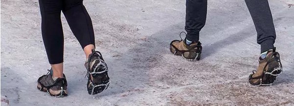
Please remember to not wear traction devices into buildings or tents.
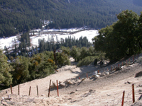
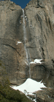
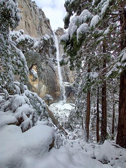
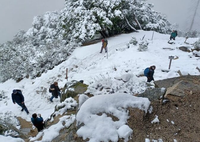
In winter, when most of the pictures on this page were taken, the lower and middle sections of trail don’t have much snow except for one stretch during some years:
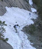
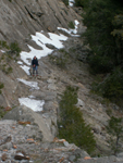
(Here a picture looking down the trail to the section pictured above.)
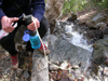
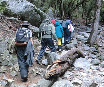
After the first long section of switchbacks (the yellow zigzags on the maps above), there are a few streamlets in wetter months to pump water at.
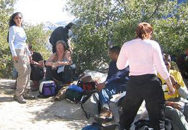
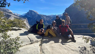
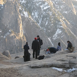
There’s a railing at Columbia Rock (also called Columbia Point) to aid in taking pictures and a big section of granite to have lunch on. (Two photos below by Pavan Singh.)
2018 photo from Piyush Rohatgi:
![]()
2020 photo at Columbia Rock by a hiker going by who stopped and took the shot:
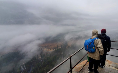
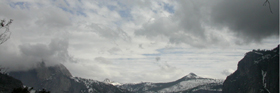
2025 with low clouds obstructing most of the view:
There’s usually a great view down to the valley. You can pick out rafters on the river (well, in the summer), bikers on trails and the various hotels.
The rangers told us on our winter 2022 hike that the trail to the top of upper Yosemite Falls was dangerously icy, so people only hiked as far as Columbia Rock. (And met others on the trial who said they “slipped all the way down” when they went beyond Columbia Rock.)
View just after sunset at the end of the hike to Columbia Rock (photo by Aaron Genovia):
Below, the view of worn switchbacks on the trail looking down towards Columbia Point.
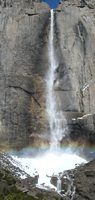
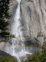
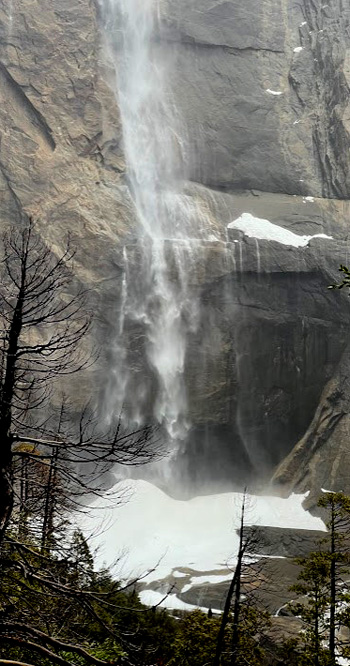
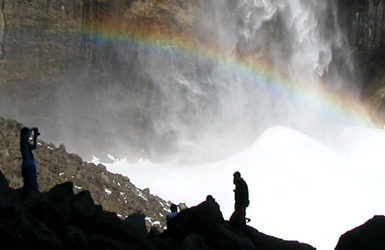
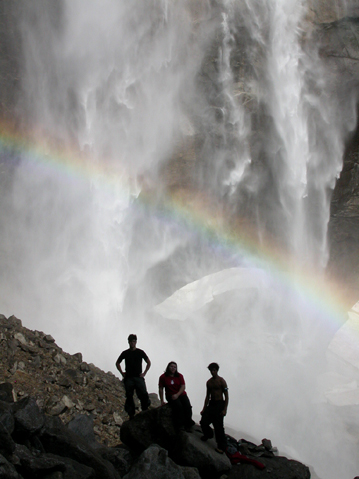
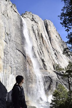
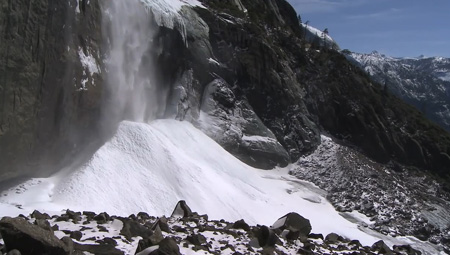
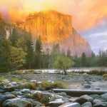
Don’t let this section of switchbacks intimidate you, because the section of trail following them isn’t as steep and you can get to a view of the whole upper fall (a 1,430 foot drop), and snowcone at the base, sometimes with a rainbow. Pictures below are from early February 2005, 2003, a trickle in Feb. 2007.
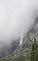
In 2025 there were low clouds:
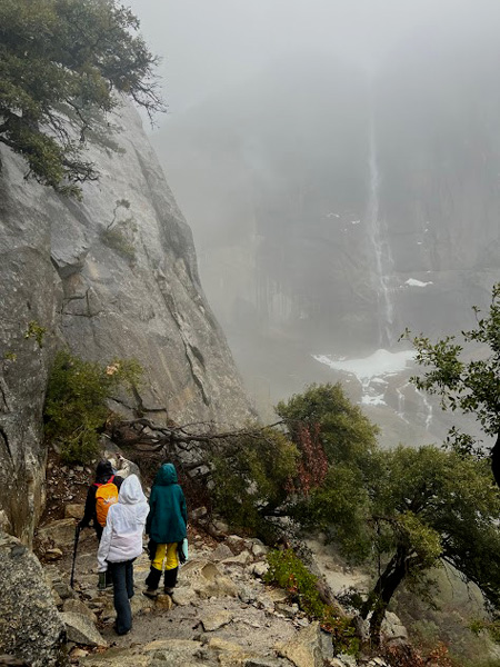
but they cleared enough some of the time:
I suggest to people that they stop when they get to this point on their hike, look at the upper fall, imagine it with full flow in the winter and then imagine the wind catching and holding the flow. Conservationist John Muir, who built a cabin in a tree near the base of Yosemite Falls, wrote about a winter storm when this happened and he counted to 190 before the wind stopped holding the water. Read what he wrote about the experience at:
Upper Yosemite Fall held stationary in mid-air.
Read what happened to a hiker on a routine hike who left this trail and attempted a short rock scramble, broke his ankle and found himself stranded. At that report the NPS notes:
“Lessons Learned:
Trails out of the Yosemite Valley are characteristically steep and uneven. Polished granite surfaces coated with a layer of fine, sandy soil makes for challenging footing. Sturdy hiking boots that provide good grip and ankle protection are essential.
Yosemite’s trails lead to some highly desirable destinations, but some favorite areas are more than several miles from the trailhead, one way. Your goal may require considerable physical effort to achieve. Most of our injuries occur on the way down, when physical (and mental) exhaustion conspires with gravity to generate a fall.
Hike within your physical limits; rest as needed and allow yourself lots of time to complete your hike.
Stay well hydrated throughout your hike by carrying more than enough water, so that you never need to ration. You should be more than halfway through with your hike before your water is halfway gone. Dehydration will make you feel miserable and diminish your physical and mental capacity.
Frequently eat salty, easy-to-digest snacks to replenish salts lost through sweating.
Yosemite looks like a giant adult playground, but resist the temptation to leave the trail for a spontaneous round of rock scrambling or other exploring. Granite rocks are slippery, even when dry, and injuries and fatalities while scrambling are common.
Always ask yourself: “what are the potential consequences if I slip and fall right here?” An unprotected fall, even just a few feet, can break bones, leaving you unable to reach the trailhead and emergency room without professional rescue. Longer falls can cause life altering or life ending injuries.”
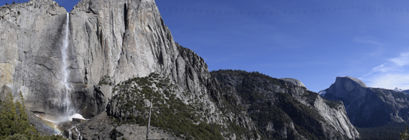
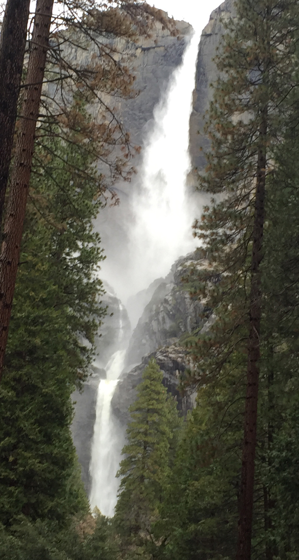
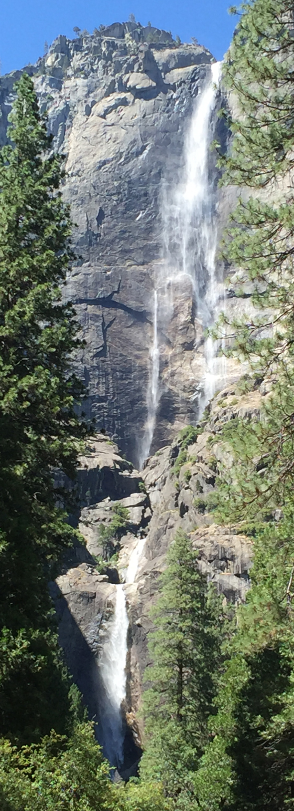
Yosemite Falls, is three falls (three sections), drops a total of 2,424 feet, almost a half mile. Upper Yosemite Fall drops 1,430 feet, Middle Cascades drops 675 feet, and Lower Yosemite Fall drops 320 feet.
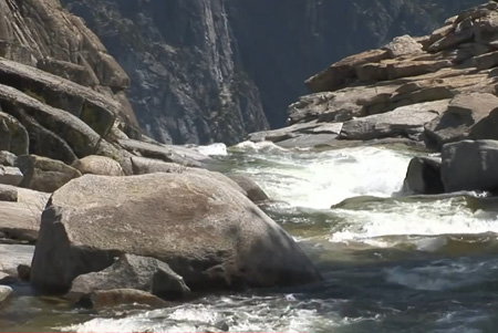
Here a photo of the inner gorge (center section of Yosemite Falls, the middle cascade that drops 675 feet total):
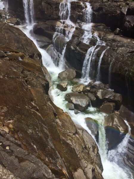
In about the center of the photo you might be able to spot a hiker “lying on a boulder below a series of cascades in class V+ whitewater in an area commonly referred to as the “Inner Gorge.”
. . . he had been “scrambling around on wet slabs near the gorge when he slipped and fell in. The subject was extremely fortunate that another member of his party happened to see him fall, as they were slightly separated at the time of the incident. The creek flushed him through over 100 feet of whitewater before he was able to pull himself onto a boulder in the middle of the gorge. Had the subject been unable to self-rescue by getting onto the rock, he would have taken fatal plunge over a waterfall. . . When hiking in areas with swiftwater, stay on the trail and away from the water. Rocks along rivers and creeks are extremely slick when dry, and even more so when wet. Many visitors slip on slick rock every year and a few are swept away, often suffering serious injuries or death. Look where the current will take you before approaching the water. Even water that looks calm can have powerful—often deadly— currents.. . .” The above is in a National Park Service report you can read Hiker slips and falls with a larger copy of the photo and a link to a video of the rescue.
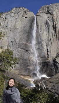
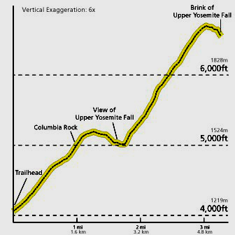
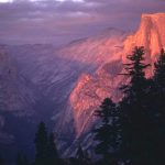
When you get to the view of Upper Yosemite Fall above Columbia Rock, you have gone about half the distance and climbed almost half the elevation gain:
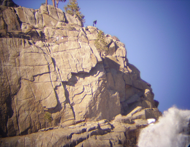
The last of the steep switchbacks to the top are along the original route of Yosemite creek and Yosemite fall, as shown on the left in this NPS display:
these switchbacks are seen on the left in this photo taken from Taft Point:
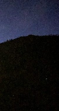
after dark, from down in Yosemite Valley, you can often see flashlight beams as people coming down the trail go back and forth on the switchbacks and their flashlights point for a moment in the direction of the valley:
The park service says: “The upper half of the trail is steep and rocky, but the arduous climb is well worth the amazing views you will be rewarded with at the top. Here you may be surprised by the small size of Yosemite Creek, which feeds this massive waterfall. Use extreme caution when near the creek and remember you are directly above a waterfall.”
__________________________________________
You will find that with a large group, some people are not as fast of hikers as others, and the fastest do not always keep track of the rest. Or someone stops to take pictures and becomes separated unintentionally or . . . The NPS gave this caution: “The Yosemite Emergency Communications Center frequently receives calls from separated parties, which usually result when groups did not make a plan for where and when to meet in the event they became separated. Fortunately, many of these incidents self-resolve; however, a few become search and rescue incidents when the separated parties fail to reunite. When hiking in a group, be sure to account for all members of the group while hiking and develop a plan with group members before separating from the group.
If you each take a photo of all the hikers in your group on your cell phone just before you start the hike, this can be used to document what each person was wearing, maybe quite helpful if someone gets lost.
Or even better, always hike and stay in groups of four so if someone gets injured, there is one person to stay with them while two others go for help. Cell phone service is often not available on trails in Yosemite Park. Perhaps of interest: You can’t always expect a rescue.
or best . . . everyone hikes together . .
__________________________________________
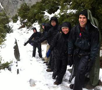
From a winter hike (February 2014) in cold, rainy (or snowy at higher elevations) weather:
and here, (February 2025), people all had their waterproof, hooded rain jackets and rain pants, but some got too warm as they hiked and ended up with some of their gear hanging from their packs for part of the hike:
__________________________________________
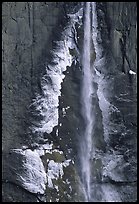
John Muir wrote “In winter the thin outer folds and whirling spray of the great Yosemite Fall are frozen while passing through the air freely exposed, and are deposited around the base of the fall in the form of a hollow, truncated cone, which sometimes attains a height of 400 feet.
In the building of this cone, part of the frozen spray flows directly to its place in the form of minute particles like the dust of wind-beaten snow, but a considerable portion is frozen upon the face of the cliff along the edges of the fall and attains a thickness of a four or more during the night. When the sun strikes this ice-coating on the cliff it is cracked off in large masses and built into the walls of the cone, while in windy, frosty weather, when the fall is swayed from side to side, the whole surface is drenched, dinding the whole mass of loose blocks and dust firmly together. While in the process of formation the surface is smooth, and pure white, the outlines finely drawn, the whole presenting the appearance of a beautiful crystal hill wreathed with clouds of irised spray, with the fall descending into the heart of it with a tremendous roar, as if pouring down the throat of a crater.”
__________________________________________
The big dark cloud moving in from the right of these 2003 pictures brought snow falling on the students who made it to the top of the falls, as well as rain and a hailstorm on them on the way down and on everyone making dinner or sitting around the campfire that night.
In 2007 Howard Wang (?) took this photo at the top with less snow:
Here, a photo of the large bridge that crosses Yosemite Creek as it nears the brink of the fall (and that might be dangerous in the winter):
and here, Yosemite Creek as it goes over the brink and becomes Yosemite fall:
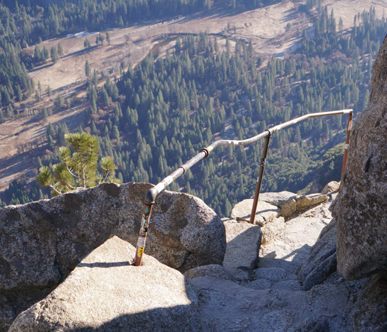
here, the railing at the top:
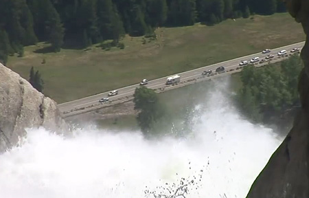
and here, the view down to Southside Drive from up on the trail:
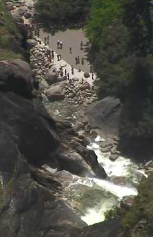
and here, the view down to the viewing area at the base of the falls
next photo of hikers finishing the hike by flashlight (electric torch) / headlamp after dark in 2009 by Peter Ye:
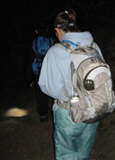 (Your cell phone will not function as a flashlight bright enough or long enough after dark.)
and 2020 photo by Jimmy Pham
![]()
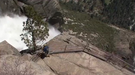
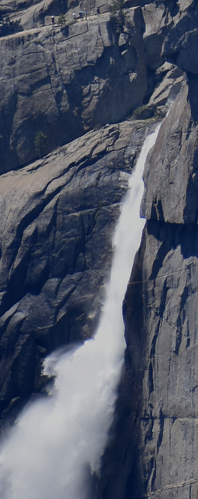
Four views, (each one closer in than the previous one), of the same part of the top of the upper Yosemite Fall trail, with railings so hikers can walk out on the cliff face where the falls start dropping.:
– – – Upper Yosemite Fall drops 1,430 feet.
(Yosemite Falls, is three falls (three sections), drops a total of 2,424 feet, almost a half mile. Upper Yosemite Fall drops 1,430 feet, Middle Cascades drops 675 feet, and Lower Yosemite Fall drops 320 feet.)
![]()
![]()
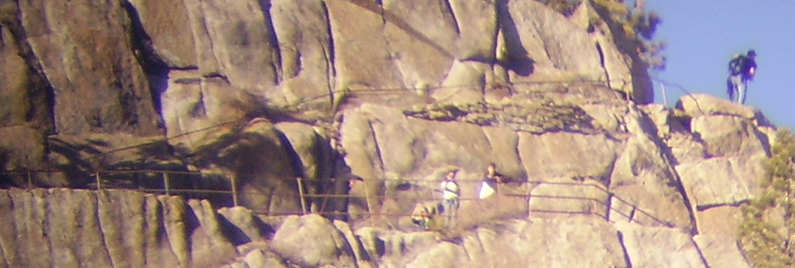
The trail and railing near the top of the cliff: (photo by Jimmy Pham):
This photo of the top of upper Yosemite Fall was taken from Taft Point. To the left of the fall / Yosemite creek, you can see people at the top of the trail on the steps / stairs section down to the railing, and on the lower level of the railing:
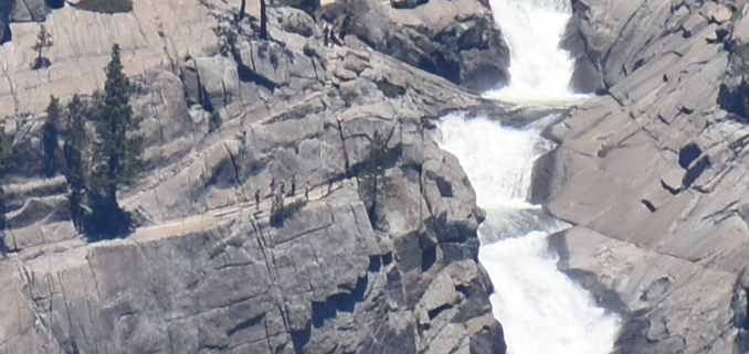
You can see hikers along the railing at the top of this photo taken from Glacier Point:
Here you can compare the elevation gain and length of various strenuous hikes up from / down to Yosemite Valley:
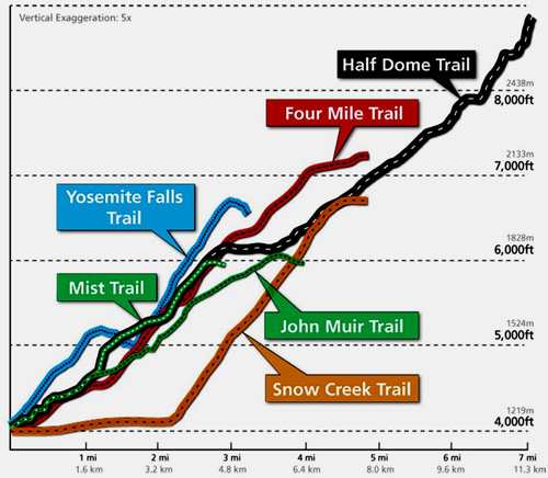
Note that the chart says “vertical exaggeration five times.”
Columbia Rock…………………………………….. 1.2 miles 1.9 Km.
Yosemite Falls (top)………………………………. 3.6 miles 5.7 Km.
Yosemite Point…………………………………….. 4.2 miles 6.7 Km.
North Dome………………………………………… 7.9 miles 12.7 Km.
Eagle Peak…………………………………………..6.0 miles 9.6 Km.
El Capitan……………………………………………7.9 miles 12.7 Km.
Tioga Road (via Porcupine Creek)……………….9.2 miles 14.8 Km.
Tioga Road (via Yosemite Creek)………………..11.3 miles 18.1 Km.
Tamarack Flat……………………………………….14.9 miles 23.9 Km.
Old Big Oak Flat Road Trailhead………………… 16.7 miles 26.8 Km.
Yosemite Valley (via Mirror Lake)………………. 17.5 miles 28.1 Km.
White Wolf………………………………………….. 14.0 miles 22.5 Km.
Harden Lake……………………………………….. 17.0 miles 27.3 Km.
Ten Lakes…………………………………………… 17.6 miles 28.3 Km.
If you decide to go off-trail, please be prepared that you can step between rocks and unknowingly step near a rattlesnake, or “crevices can hide scorpions, spiders, and yellow jacket nests”.
In another rescue report the park said “scrambling off trail is one of the leading causes of serious injury and death in Yosemite”. People on the Yosemite Falls hike are often tempted to go a bit off trail to see better views of the rainbow/snowcone. A bit off trail, maybe a few yards below the trail, is the farthest they should go, trying to go all the way down to where the waterfall flows is risking too much.
Quoted parts above are from Last Post of the Season
A woman (and friends), “while the group was at Columbia Rock, . . . decided to take a jumping photo to post on social media. The group of hikers . . . all jumped and tucked their legs behind them. When the subject landed, she slipped forward on gravel and face-planted on a rock . . . The subject had broken several teeth and was bleeding profusely.”
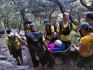
Photo and quote above from Picture for Social Media results in a carry-out
photos below by Quang-Tuan Luong/terragalleria.com, all rights reserved. Same trail, but not from our trip.
Google maps street view of trail as close to the base of upper Yosemite fall as you should get
Google maps street view of railing at top, scroll around to see where the railing trail comes down.
Yosemite nature podcasts episode #2 is Yosemite Falls
How much water will there be in the Yosemite waterfalls?
Enhance your hike by reading:
The National Park Service often warns hikers :
“Avoid becoming dehydrated or experiencing heat exhaustion. Drink plenty and drink often; pace yourself; rest in the shade; eat salty snacks.”
“Replace sodium lost through sweat by supplementing your water intake frequently with salty, easily digested snacks, such as trail mix or nuts.”
Avoid salt tablets, as they can irritate your stomach and cause nausea and/or vomiting, can raise blood pressure, cause stomach ulcers, and seriously affect people with heart disease.
This advice from Grand Canyon National Park applies to any hike:
Avoid Huffing and Puffing
IF YOU CAN TALK WHILE YOU ARE WALKING, YOU ARE WALKING THE PERFECT SPEED.
When you huff and puff your body is not getting enough oxygen. Walking at a pace that allows you to be able to walk and talk means that your legs and your body are getting the oxygen needed to function efficiently.
When your body generates fewer metabolic waste products, you enjoy your hike more and you feel better at the end. At times it may seem like you are walking too slow, but at an aerobic pace (sometimes even baby-sized steps when the trail is steep) your energy reserves will last longer. You will also feel much better that night and the next day.
Take a Break
TAKE A TEN MINUTE BREAK AT LEAST ONCE EVERY HOUR.
A break of ten minutes helps remove the metabolic waste products that build up in your legs while hiking. Take a break at least every hour. Sit down and prop your legs up. Eat some food, drink some fluids, and take this time to enjoy and appreciate the view. These efficient breaks can recharge your batteries. In the long run, breaks will not slow you down.
Hiking Advice has HIKING SECRETS and etiquette, including hiking in the heat, preventing and/or dealing with blisters, logistics of hiking, a day hike gear list, Half Dome hiking advice, winter hiking and the answer to the question: When is the best time of day to cross a mountain stream?
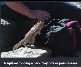
Watch out, ground squirrels can get into the pack you set on the ground in seconds. Other people have fed them and they become aggressive.
Can a person who is prescribed an epi-pen risk going into the wilderness? see: anaphylaxis quick facts
Thunderstorm and lightning safety
Snow camp weather, hike safety and first aid considerations
The world’s 10 tallest waterfalls
Angel Falls, Venezuela 3,212 ft.
Tugela Falls, South Africa 2,800 ft.
Utigordsfossen, Norway 2626 ft.
Mongelfossen, Norway 2540 ft.
Yosemite Falls, Yosemite 2425 ft.
Espelandfoss, Norway 2307 ft.
Sentinel Fall, Yosemite 2,000 ft.
Cuquenan Falls, Venezuela 2000 ft.
Sutherland Falls, New Zealand 1,904 ft.
Kjellfossen, Norway 1,841 ft.
The view of Yosemite falls in February from the far left hand portion of the lower Yosemite Falls walkways/trails.
(This path is a short walk from Yosemite Lodge. )
The view of Yosemite falls in June from the far left hand portion of the lower Yosemite Falls walkways/trails.
When you walk to the base of any Yosemite waterfall, please consider
“Choosing to leave the trail and scramble in boulders below waterfalls can have a costly outcome. Is getting closer really worth the risk?”
The Yosemite National Park rangers would like you to call them
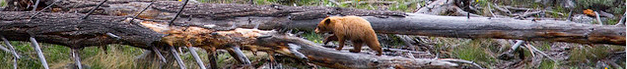
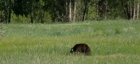
if you see a bear in Yosemite,
no matter where it is or what it is doing.
Since 2003 there has been a note in the Yosemite Guide: “REPORT ALL BEAR SIGHTINGS! To report bear sightings, improper food storage, trash problems, and other bear-related problems, leave a message for the Bear Management team at: 1 (209) 372-0322. Your call can be made anonymously.”
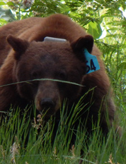
If you can, in all the excitement, try to notice if the bear has a tag (usually on the ear), the color of the tag and if possible, the number on it (the tag is large enough that with a telephoto lens you should be able to read the number).
The NPS notes: “Tagged, or radio collared, bears do not mean the bear is a “bad” bear. Tagging bears is done for better monitoring, and the ear tag color is completely random, used to help quickly identify a bear.”
From the Yosemite Daily Report newspaper:
“It is extremely important to remember to yell at bears that are in and around development, even if they are foraging on natural food. Though it is very tempting to get close for a picture, or just to watch these incredible animals, it is important not to give into this urge. Yelling at them if they are in residential areas or near people is critical to keep bears natural fear of humans. Giving bears plenty of space. When bears become too comfortable around people, they will often start causing damage to structures and vehicles, or will even become too bold around people, creating safety concerns.”
And the Yosemite Daily Report also said:
“Scare bears when you see them. . . in developed areas- Yell like you mean it!
Make as much noise as possible, try waving your arms, stomping your feet
or anything to make you look intimidating and to get the bear to run away.
We know it’s fun to see bears and it can feel mean to scare them,
but this is a simple way to truly help save a bear’s life.”


Where were they when they got that great picture in Yosemite?
Where can I get a photo that looks like the one on a Yosemite poster I bought?
places to take photos of Half Dome in Yosemite National Park (with maps and some trail descriptions)
places to take photos of Yosemite Falls in Yosemite National Park (with maps and some trail descriptions)
locations to photograph Bridalveil Fall in Yosemite National Park (with maps and some trail descriptions)
places to take pictures of El Capitan in Yosemite National Park (with maps and some trail descriptions)
locations to photograph Staircase Fall in Yosemite National Park (with maps and some trail descriptions)
places to take photos of Clouds Rest in Yosemite National Park (with maps and some trail descriptions)

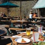
Restaurants, cafeterias, coffee bars, pizza, grocery stores are at: Yosemite valley restaurants,


![]()
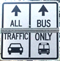
Drivers should note that there have been sections of road in Yosemite Valley, part of the year, with two lanes (usually) in the same direction, with the right lane ONLY for the free shuttle buses, ambulances, ski bus, commercial vehicles with ten or more passengers. The NPS says: “The bus lane ensures emergency vehicles can respond to incidents when traffic is backed up and provides preference for mass transit.”
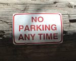
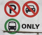
Parking and traffic jams in Yosemite valley tips and tricks has the above advice, with maps of each of the three major day-use parking lots, with advice to help you NOT get a Yosemite National Park traffic or parking ticket, and not contribute to preventable traffic backups. And some details of where you can’t park in Yosemite, or can’t park without a permit.
——————————————————————-
The author of this webpage, (written as a reading assignment for my students), does not give any warranty, expressed or implied, nor assume any legal liability or responsibility for the accuracy, completeness, or usefulness of any information, product, or process included in this website or at websites linked to or from it. Users of information from this website assume all liability arising from such use.