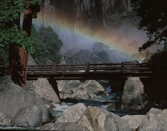
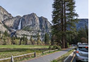
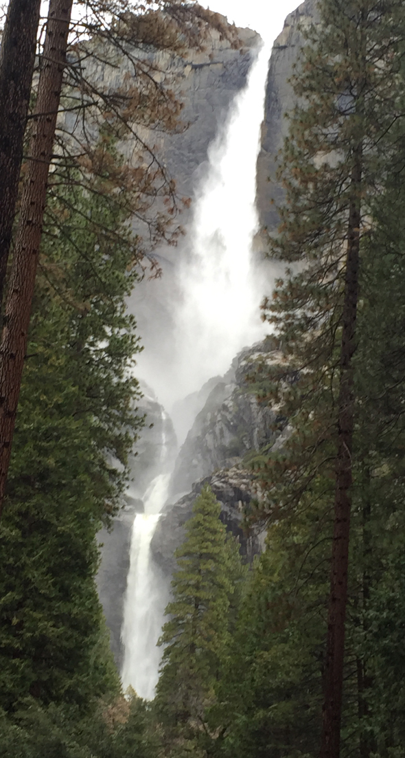
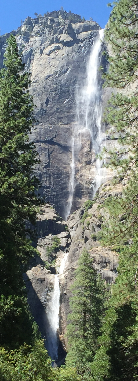
Yosemite Falls, which is three falls (three sections), drops a total of 2,424 feet, almost a half mile. Upper Yosemite Fall drops 1,430 feet, Middle Cascades drops 675 feet, and Lower Yosemite Fall drops 320 feet. Part or all of Yosemite Falls can be seen from many locations in Yosemite Valley and from trails or parking lots above the valley along the Glacier Point road.
You can get “classic” shots of all the three levels of the falls together or just the lower or upper fall, relatively close up or from a distance.
The webpage describes thirteen locations to get pictures, with examples of the shots you can get at each location,
some of which are considered the best location to photograph Yosemite Fall.
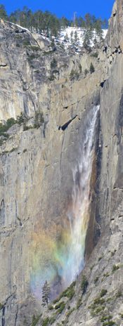
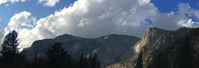
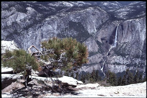
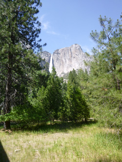
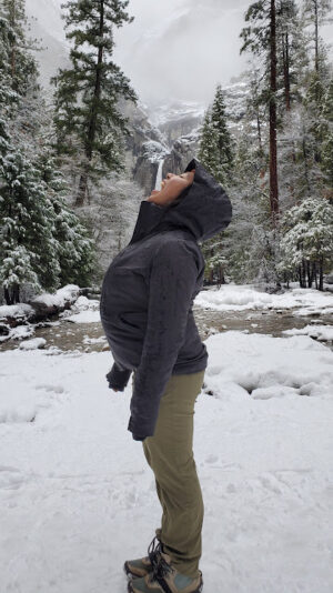
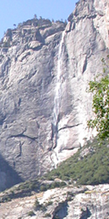
This shot is taken from along the trail to the top of Yosemite Falls,
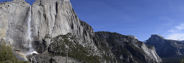
More pictures of the falls from the trail are at upper Yosemite Fall hike description. More places to take photos of Half Dome (on the right in the photo above) are here.
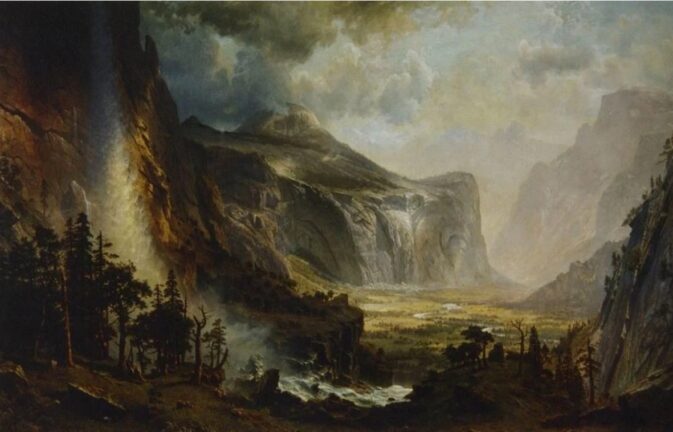
Albert Bierstadt painted The Domes of the Yosemite in 1867. At history of painting in Yosemite we find this note: “The depiction of waterfalls to the left of the painting is one example of the painting’s exaggeration of nature. To achieve the angle of the painting’s perspective, Bierstadt moved the base of Yosemite Falls quite a bit to the south of its actual location. Artist’s license.”
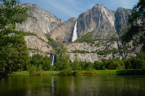
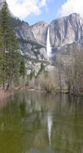
This shot is taken from Cook’s Meadow loop in Yosemite Valley.
This 1863 watercolor by George Burgess has the Merced river in the foreground and Cook’s meadow between the river and Yosemite Falls. Photo courtesy of National Park Service Museum Collections, catalog #26809.
and this photo, (courtesy of the NPS), in the morning has the falls in shadow:
You can find the Cook’s meadow loop or double loop or figure eight trail by using the free shuttle bus to go to either the Yosemite Exploration Center – previously the Main Visitor Center (stop 5 or to stops 6, 7. See details and many maps of each route at Cook’s Meadow.
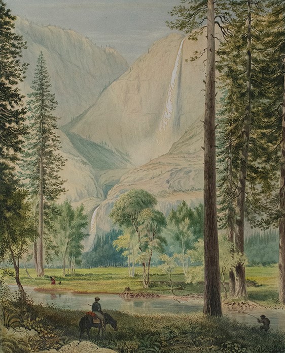
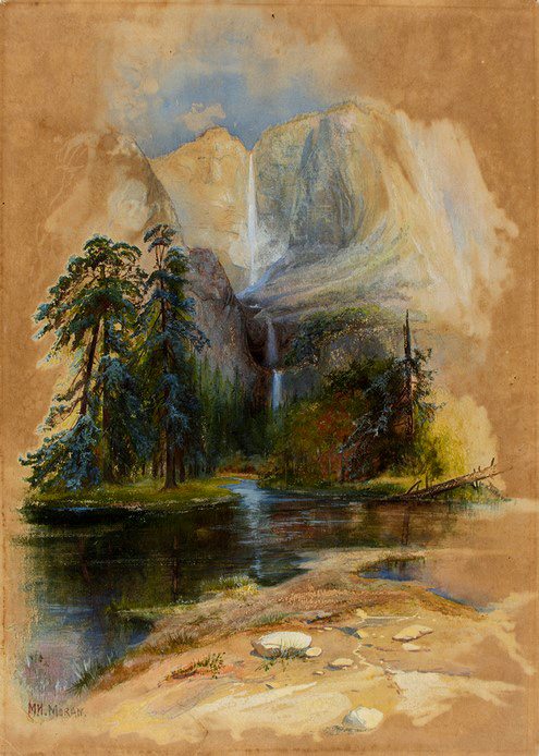
This 1874 watercolor by Mary Nimmo Moran was described as “view looks up Yosemite creek towards Yosemite Falls.” The location it was painted at now has roadways. (photo courtesy of the National Park Service Museum Collections catalog #26809)
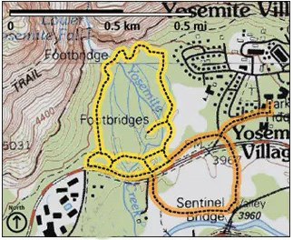
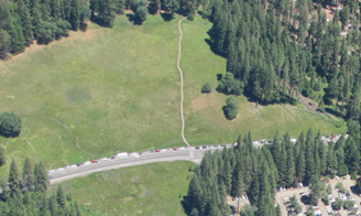
Map below of the lower Yosemite falls loop trail, (in yellow – more about this below)
and the Cook’s Meadow loop trail (in orange) courtesy of the NPS:
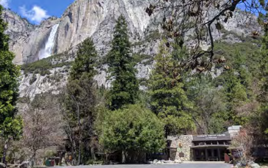
You can see part of the upper falls from the walkways in front of the Yosemite Exploration Center – previously the location of the Main Visitor Center:
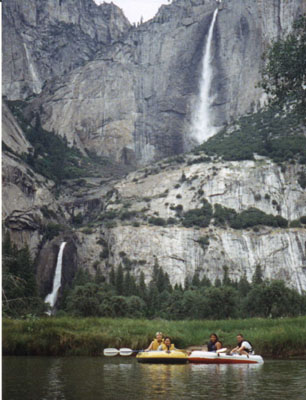
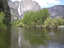
While rafting the Merced river in Yosemite Valley:
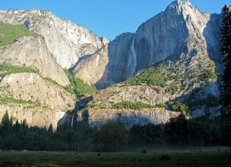
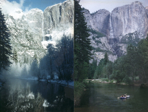
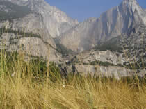
Yosemite Falls in various seasons, from Swinging Bridge :
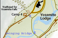
To get to Swinging Bridge, head towards the river from free shuttle bus stop 7, or from any building at Yosemite Valley Lodge, along a parking lot road and down a path alongside Leidig Meadow.
After crossing Swinging Bridge, if you continue on the bike or walk path alongside Southside Drive
Swinging Bridge in winter:
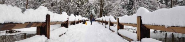
OR on your drive into the valley a bit before you get to the chapel
there is a long strip of parking on the left
with a boardwalk that leads out to the river .
In the NPS photo below of flooded Sentinel Meadow taken May 16, 2005, you can just make out the sunken edge of the boardwalk across the meadow between the two posts on the fence and can just see Yosemite Falls thru the low clouds in the background. Next to it is the same place in June, 2005 and again in February 2008
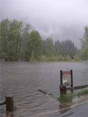
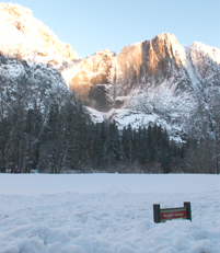
and in February 2017 with heavy flooding:
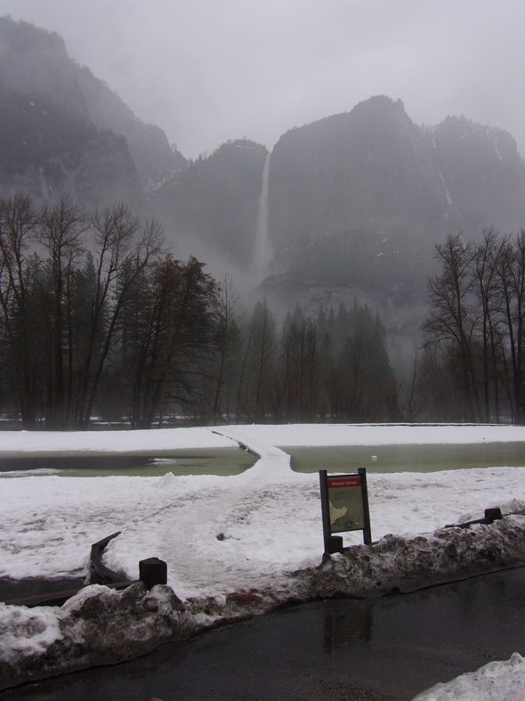
Yosemite Falls view in February snow and other seasons has more pictures and larger ones from this location.
(On the map below) the boardwalk described above is just beyond where the first white right arrow in a black circle is on the lower road (a section of Southside Drive, your route into Yosemite Valley for any overnight accommodation, and all day-use parking lots).
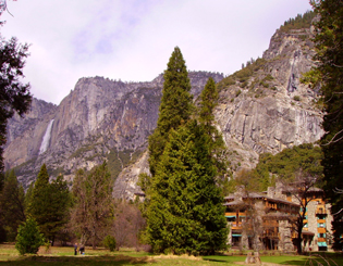
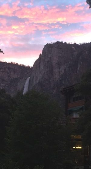
From at or near the Ahwahnee Hotel (briefly named the Majestic Yosemite Hotel) :
In the morning light, the mist caught in sunlight can make the upper fall look like two waterfalls:
To go to the Ahwahnee hotel use the free, year-round, shuttle bus and get off at stop 3.
This photo was also taken at the Ahwahnee, from the largest balcony. Can you spot Upper Yosemite Falls just about in the center of this picture below after heavy snow fall covered the cliff face?
just about the same location for this shot with late afternoon light and wind whipping upper Yosemite Fall:
and here from the parking lot as you go just past the Porte Cochere:
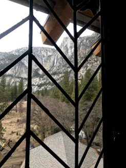
The view through the leaded glass window of the sixth floor Ahwahnee Hotel Library Suite towards Yosemite Fall, with upper Yosemite Fall in the upper center of the photo:
and . . .
From some of the east end of Yosemite valley you can see a little of the top of El Capitan (on the left to the right of the tallest trees) with upper Yosemite Fall (lit up on the right):
A boardwalk leads across Stoneman Meadow across the road from the day use and guest use parking lot at Curry Village (briefly named Half Dome Village) (lower right corner of this photo) to the higher numbered loops at the back of Lower Pines Campground:
Stoneman Meadow has one of the best views of Staircase Falls, here in full flow in May:
and in this panorama, Staircase Falls on the left and upper Yosemite Fall on the right, both barely visible in this photo, but stunning in person:
A better view than the photo above is at a Google maps 360 degree view showing upper Yosemite Fall, the top of Royal Arch Cascade, the Royal Arches, North Dome, (if you tip the photo up a little) Glacier Point, and Staircase Falls as seen from along the Stoneman Meadow boardwalk.
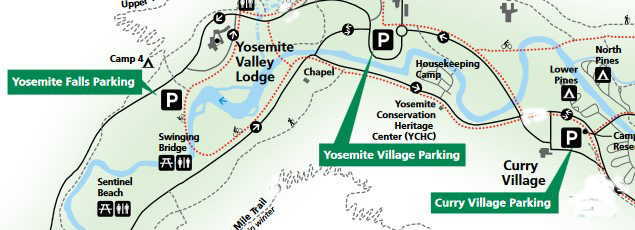
In the map below, the Curry Village day use and guest use parking lot is the black square with the letter P in white in the center of it, at the right hand side of the map:
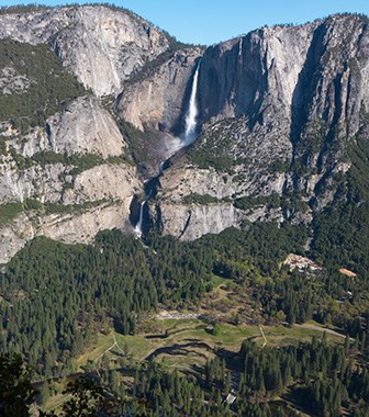
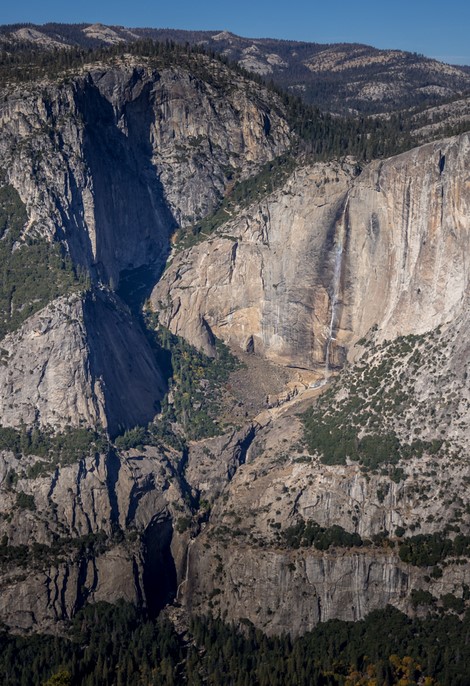
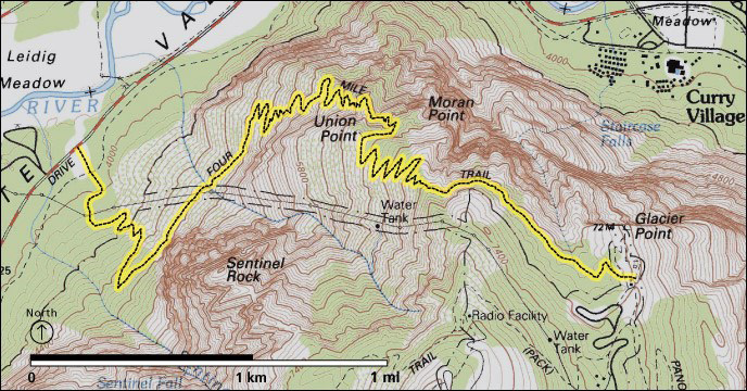
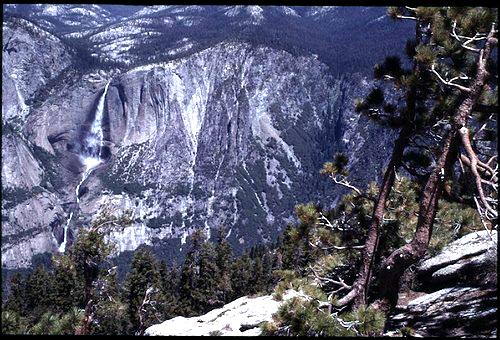
From Glacier Point. (about an hour drive from Yosemite Valley, but with limited parking, so get an early start or perhaps even expect to be turned away, especially on busy summer weekends). Road closed in the winter.
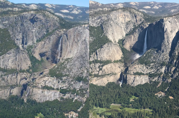
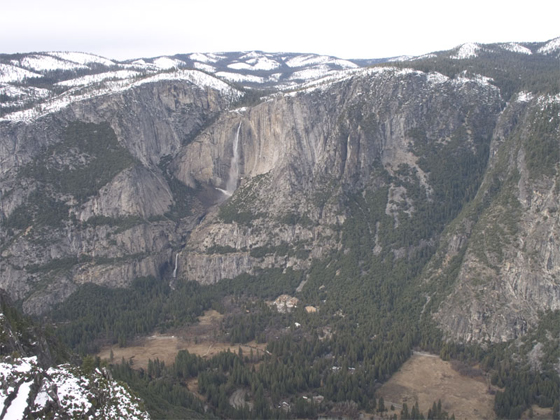
photo above courtesy of the National Park Service (NPS)
Here, a raven on top of the tip of Glacier Point, with Yosemite Fall across the valley:
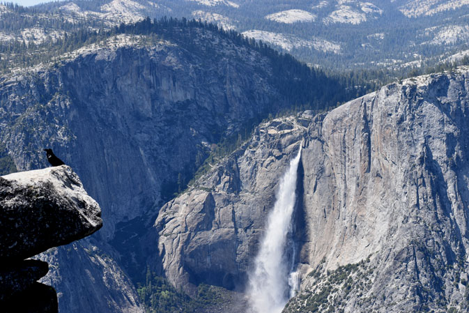
photo below by Quang-Tuan Luong/terragalleria.com, all rights reserved.
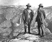
This photo of Teddy Roosevelt (L) and John Muir (R) at Glacier Point with Yosemite Falls in the background is from the National Park Service historic photo collection:
And see shots of Yosemite valley from Glacier Point.
Besides driving to Glacier Point, you can hike there via the Four Mile trail
About half way up the Four Mile trail this can be your view of Yosemite Falls:
The hike is 4.8 miles one way, 3,200 foot elevation gain, not open all the way / or at all the in winter, “when partially closed, only the lower three miles (5 km) are open to the gate below Union Point.” There is very little parking at the trailhead, but you can use the Yosemite Falls day use parking lot at free Yosemite valley shuttle bus stop #7 and take a short walk across the river at Swinging Bridge and slightly south/west on the main road to the trailhead.
and here, Yosemite falls from the Four Mile Trail in November with less water flow:
A Google street 360 degree view from Glacier Point down to Vernal and Nevada falls, and across to Half Dome.
Read more about the Four Mile trail at the park service page
People who want to get a bus ride from Yosemite Valley to Glacier Point and back to Yosemite Valley
OR a bus ride up to Glacier Point and hike back down the Four Mile trail or the trail past Illilouette, Nevada and Vernal Falls,
can do so in months when the Glacier Point road is open. The road has opened anywhere from April 14 to July 1, depending on snow pack. Book a ride on the Glacier Point tour, most years leaving 8:30 a.m. from the Lobby entrance to Yosemite Lodge,
From Sentinel Dome : (2.2 miles / 3.5 km round-trip hike from the Glacier Point road, 2 +/- hours). Road closed in the winter. See a map of the trail to Sentinel Dome. and see the Glacier Point road on this official park map
Sentinel Dome is in about the center of the map below.
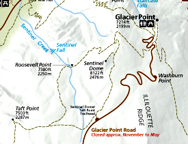
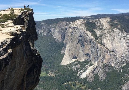
From Taft Point : (2.2 miles / 3.5 km round-trip hike from the Glacier Point road, 2 +/- hours). Road closed in the winter. See a map of the trail to Taft point and see the Glacier Point road on this official park map. Taft Point is in the lower left of the map below.
This panorama from Taft point has both El Capitan (on the left) and Yosemite Falls:
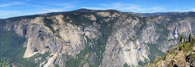
At the upper left is the railing at the official Taft Point, with El Capitan across Yosemite Valley (but do be sure to carefully explore the area, there are different, some say better views from further to the left of the official Taft point):
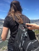
And a man held the back of a woman’s daypack as she took photos at the edge of the Taft point viewpoint, (perhaps to protect her from falling over the high railing?)
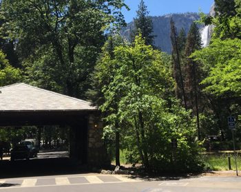
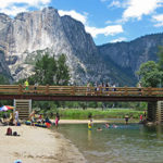
Along the bike path / walkway from Yosemite Valley Lodge to the path to the base of Yosemite Falls,
there is a bit of a view of the upper fall in the distance above the tree tops:
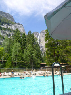
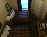
Most rooms at Yosemite Valley Lodge do not have views of Yosemite Falls.
Azalea building has rooms, that if you walk out on your patio, you can see almost all of upper Yosemite Fall:
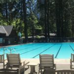
Next to one of the Yosemite Valley Lodge swimming pool lifeguard stands you get a partial view of upper Yosemite Fall:
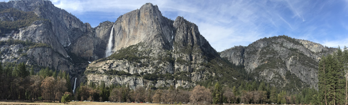
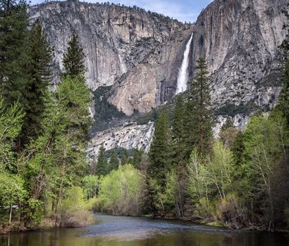
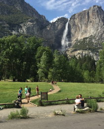
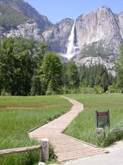
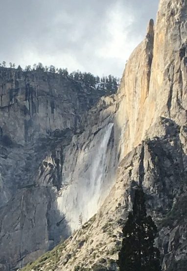
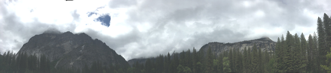
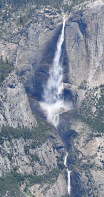
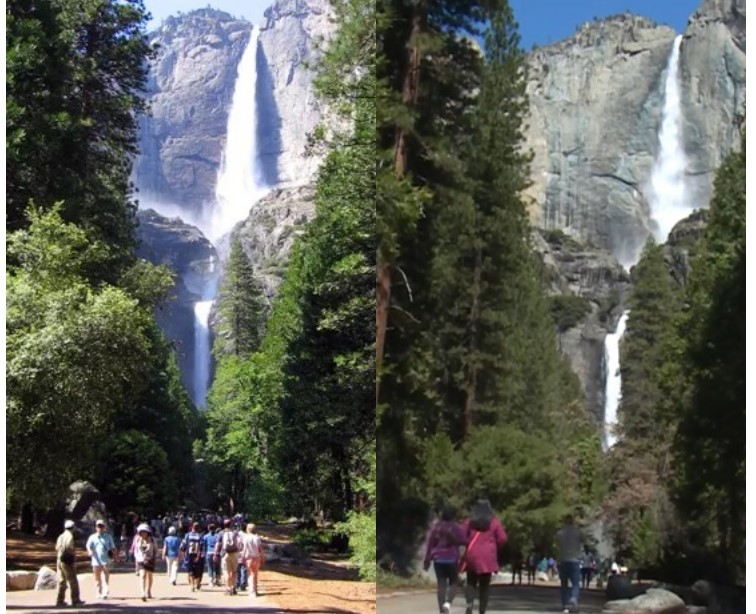
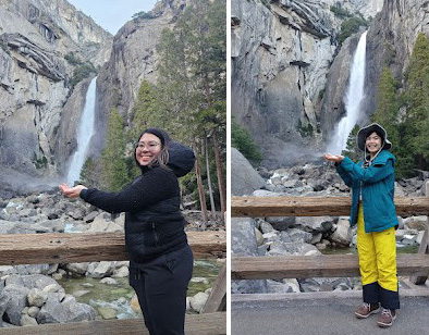
The most classic view, on the lower Yosemite Falls loop trail is of all three falls (all three sections of Yosemite Fall) from fairly close up.
The map below is of the lower Yosemite falls loop trail, (in yellow)
and the Cook’s Meadow loop trail (in orange) courtesy of the NPS:
From Yosemite Lodge, in the lower left hand corner of the map above, you can take a short walk directly to the left hand section of the lower Yosemite Fall loop (again, in yellow in the map above).
From this far west pathway along the loop trail, (again, a direct walk from Yosemite Lodge) the view of Yosemite Falls (lower, middle and upper, in full flow in February 2017).
![]()
I suggest to people that they stop when walking on the pathway to Lower Yosemite Fall, look at the upper fall, imagine it with full flow in the winter and then imagine the wind catching and holding the flow. Conservationist John Muir, who built a cabin in a tree near the base of Yosemite Falls in 1869, wrote about a winter storm when this happened and he counted to 190 before the wind stopped holding the water. Read his description of this at Upper Yosemite Fall held stationary in mid-air.
And see: How to find the location of John Muir’s cabin in a tree (he called it his hang nest) on this path.
You can set up a photo of getting a drink from the lower fall:
or pretend to catch lower Yosemite fall in your hands:
The Merced River Plan, (see page H-29) has projects to improve views. It says about this view:
“Trees were cleared as part of the Yosemite Falls approach project in 2005. The intention in managing this vista is to broaden the view to minimize future maintenance needs of trimming, and lessening the alley-like appearance of the trees on the approach to the falls.”
22 Ponderosa, 64 Cedar trees and 7 fir trees are in the plan to be removed.
![]()
Upper Yosemite Fall drops 1,430 feet. (The equivalent of nine Niagara Falls stacked on top of each other.)
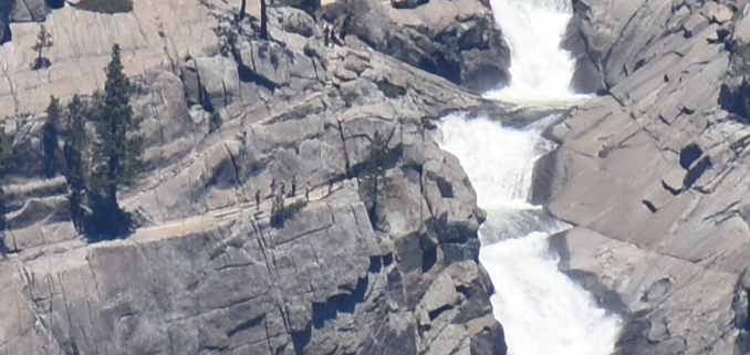
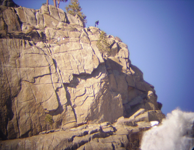
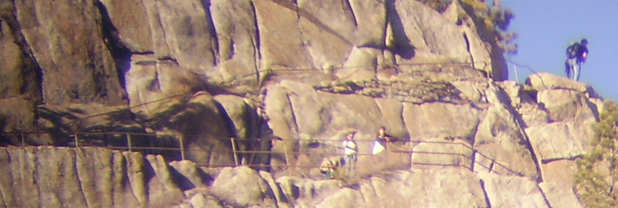
Many people who take the trail to the top of upper Yosemite Fall do not realize there is a railing out across the cliff face at the top.
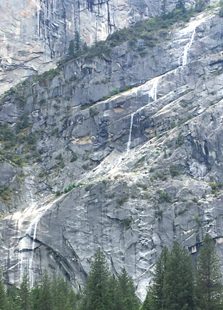
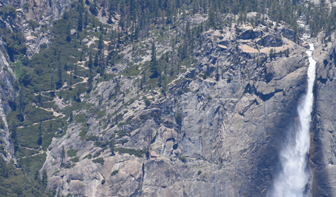
Below are views of the top of upper Yosemite Fall, showing the trail with a railing out on the cliff face that people can walk out on. The top four photos which you can take with your telephoto from many of the locations described at this page, the last was shot at Taft Point.
![]()
![]()
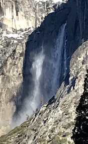
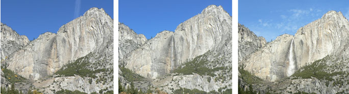
Different times of the year the falls will have different water flow, for example, at the end of this page, photos in February and June. Many years in August and September it is dried up or almost dried up. (Some years with lots of snowpack it does not dry up.)
August:
September:
How much water will there be in the Yosemite waterfalls?
The Yosemite valley waterfalls dry up over the summer and are replenished by fall and early winter rains. A December 4, 2012 volunteer interpreter blog said this:
” . . . Yosemite Falls may have been flowing by Thanksgiving, but it’s not really back until the roar of water announces the return. Strong rainstorms over the past week have brought more than six inches of rain to the lower elevations of Yosemite, making even the smallest drainages fill with the water that flows and tumbles down the Valley walls. The drastic change that Yosemite Falls has undergone in less than one month is amazing, captured in these photographs taken over the past four weeks. . . ”
and offered three photos of November waterfall flow:
________________________________________________
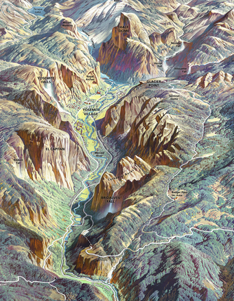
You can download a copy of the Yosemite panorama above
and can enlarge it:
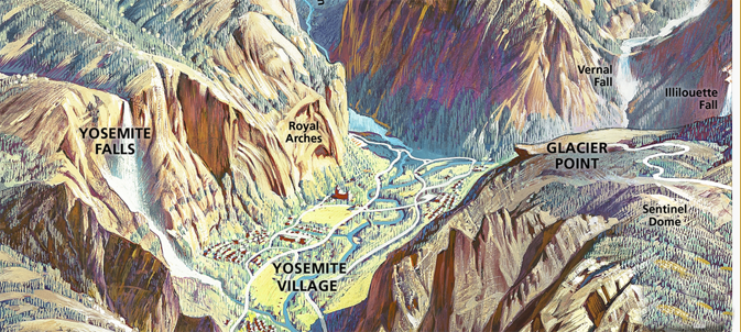
The Ahwahnee hotel is the building in red on the map above just below Royal Arches, in almost the center of the map.
The tiny dots at the bottom of the poster are the Yosemite Lodge Buildings.
The trail to the top of Half Dome goes past Vernal and Nevada Falls and can start down in the valley, or at Glacier Point.
________________________________________________
Can’t make it to the Visitor Center? You can buy a Yosemite Falls tshirt, calendar, poster or art work online from the Yosemite Conservancy
________________________________________________
The Yosemite Assn used to have a page of photo tips from photographer Michael Frye which included:
“The best light on Upper Yosemite Fall occurs around 10 a.m. and about 3 to 4 p.m.”
________________________________________________
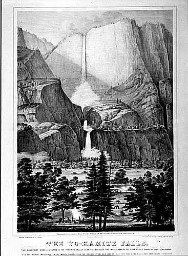
The NPS archive labeled this “Photographic reproduction of first published view of Yosemite Valley.
A lithograph from a sketch by Thomas A. Ayres (titled The YoHamite Falls) – published October 1855 by James Mason Hutchings.”
and see History. Culture Paintings of Yosemite
________________________________________________
Yosemite nature podcasts: http://www.nps.gov/yose/photosmultimedia/ynn.htm episode #2 is Yosemite Falls
and see: places to take photos of Half Dome in Yosemite National Park (with maps)
Places to take photos of Bridalveil Fall in Yosemite National Park (with maps)
Places to take photos of El Capitan in Yosemite National Park, (with maps)
Places to take photos of Staircase Falls in Yosemite National Park
Places to take photos of Clouds Rest in Yosemite National Park with maps
Selfies can be great, OR dangerous. They were just taking a selfie.
Yosemite trail conditions info
![]()
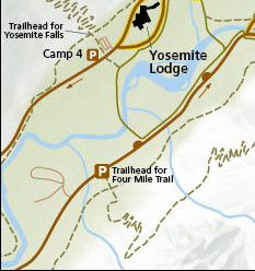
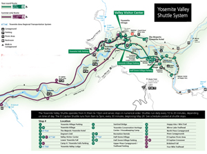
The most current route map for the free Yosemite Valley shuttle bus is in the Yosemite Guide newspaper , which you will be offered a copy of as you enter the park, or can print in advance.
It looks something like this when there is no road construction, rock slides, excess snow affecting the times/routes:
(Map below courtesy of NPS)
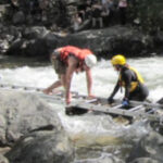
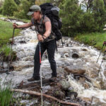
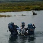
Hiking Advice has HIKING SECRETS and etiquette including hiking in the heat, preventing and/or dealing with blisters, logistics of hiking, a day hike gear list, Half Dome hiking advice, winter hiking and the answer to the question: When is the best time of day to cross a mountain stream?
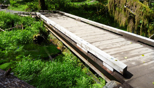
The best place to cross a creek or river is on the bridge built for this endeavor.
Crossing streams safely includes advice from Mount Rainier National Park, Yellowstone National Park, Great Smoky Mountains, and Yosemite National Park
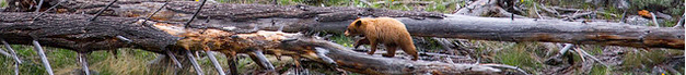
The Yosemite National Park rangers would like you to call them if you see a bear in Yosemite,
no matter where it is or what it is doing.
Since 2003 there has been a note in the Yosemite Guide: “REPORT ALL BEAR SIGHTINGS! To report bear sightings, improper food storage, trash problems, and other bear-related problems, leave a message for the Bear Management team at: 1 (209) 372-0322. Your call can be made anonymously.”
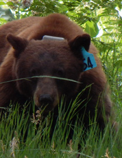
If you can, in all the excitement, try to notice if the bear has a tag (usually on the ear), the color of the tag and if possible, the number on it (the tag is large enough that with a telephoto lens you should be able to read the number).
The NPS notes: “Tagged, or radio collared, bears do not mean the bear is a “bad” bear. Tagging bears is done for better monitoring, and the ear tag color is completely random, used to help quickly identify a bear.”
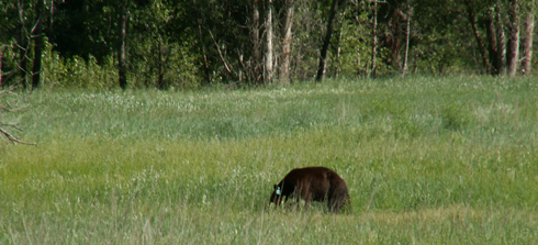
From the Yosemite Daily Report newspaper:
“It is extremely important to remember to yell at bears that are in and around development, even if they are foraging on natural food. Though it is very tempting to get close for a picture, or just to watch these incredible animals, it is important not to give into this urge. Yelling at them if they are in residential areas or near people is critical to keep bears natural fear of humans. Giving bears plenty of space. When bears become too comfortable around people, they will often start causing damage to structures and vehicles, or will even become too bold around people, creating safety concerns.”
And the Yosemite Daily Report also said:
“Scare bears when you see them. . . in developed areas- Yell like you mean it!
Make as much noise as possible, try waving your arms, stomping your feet
or anything to make you look intimidating and to get the bear to run away.
We know it’s fun to see bears and it can feel mean to scare them,
but this is a simple way to truly help save a bear’s life.”

and a view from June with much less water flow:
________________________________________________
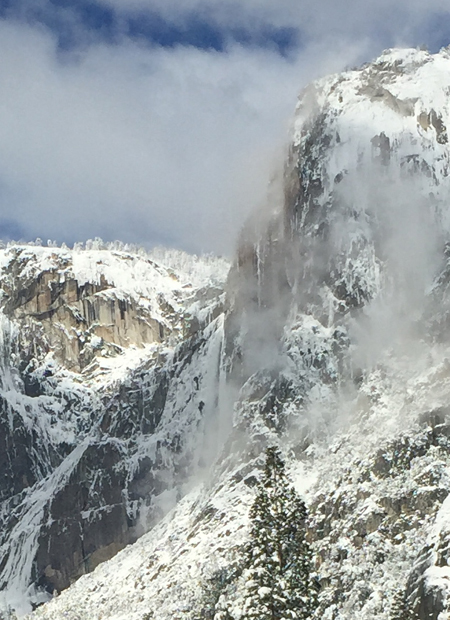
(Note that low clouds can cover the top of upper Yosemite Falls,
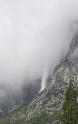
fog can hide the bottom and a winter snow storm can white-out every view up towards the cliffs.)
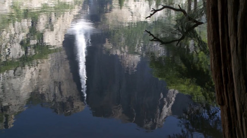
If you can find fairly still water, you can get a reflection photo:
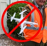
Fireworks and drones (unmanned aircraft) are banned at all times in all National Parks.
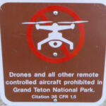
The NPS tells us that the use of unmanned aircraft (e.g., model airplanes, quadcopters, drones) has resulted in noise and nuisance complaints from park visitors, park visitor safety concerns, and incidents in which park wildlife were harassed. Small drones have crashed in geysers in Yellowstone National Park, attempted to land on the features of Mount Rushmore National Memorial, been lost over the edge of the Grand Canyon, and been stopped from flying in Prohibited Airspace over the Mall in Washington DC.
__________________________________________________________
See an index of rules and regulations webpages.
Yosemite trail conditions info
How much water will there be in the Yosemite waterfalls?
Park Service videos about Yosemite
Yosemite National Park webcams
![]()
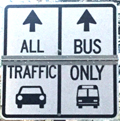
Drivers should note that sometimes there are sections of road in Yosemite Valley with two lanes (usually) in the same direction, with the right lane ONLY for the free shuttle buses, ambulances, ski bus, commercial vehicles with ten or more passengers. The NPS says: “The bus lane ensures emergency vehicles can respond to incidents when traffic is backed up and provides preference for mass transit.”
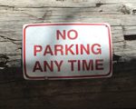
Parking and traffic jams in Yosemite valley tips and tricks has the above advice, with maps of each of the three major day-use parking lots, with advice to help you NOT get a Yosemite National Park traffic or parking ticket, and not contribute to preventable traffic backups. And some details of where you can’t park in Yosemite, or can’t park without a permit.
– – – – – – – – – – – – – – – – – – – – – – – – – – – – – – – – – – –
Hotel, cabin and tent cabin choices in Yosemite valley are at: Yosemite Valley accommodations

Restaurants, cafeterias, coffee bars, pizza, grocery stores in Yosemite valley are at: Yosemite valley restaurants,


swimming in Yosemite including thunderstorms, bacteria in the water, safety issues, favorite beaches, swimming pools with lifeguards, places you should not swim.
The author of this webpage, (written for my students), does not give any warranty, expressed or implied, nor assume any legal liability or responsibility for the accuracy, completeness, or usefulness of any information, product, or process included in this website or at websites linked to or from it. Users of information from this website assume all liability arising from such use.