You can download a Grand Teton National Park map at: http://www.nps.gov/grte/planyourvisit/maps.htm
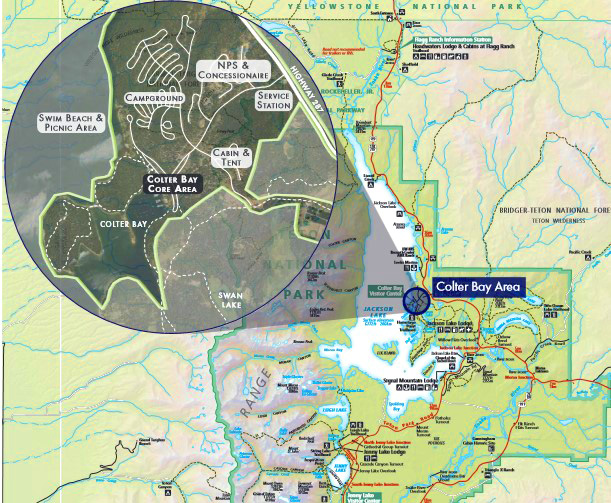
See a map of Colter Bay, with the campground, RV park, cabins, tent cabins area, grocery/laundromat, etc. that you can click on to enlarge: https://www.gtlc.com/media/3223/cbv-property-map_2023-web-res.jpg
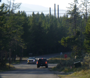
As you turn of first turn off highway 191/89,
(coming north from the edge of Jackson, Wyoming it is 41 miles, coming south from the Yellowstone National Park border it is 13 miles)
go past the gas station and drive into Colter Bay,
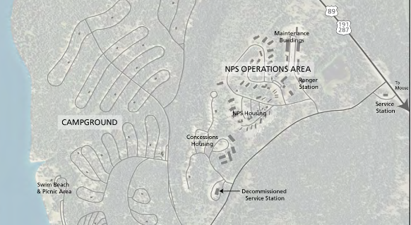
the buildings set back from the Colter Bay road on the right (north) are an NPS Operations area, and NPS/ Concessionaire housing.
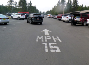
On the Colter Bay road, after you go through the four-way stop at the intersection of the roads to the campground, RV campground and the road to the cabins / tent cabins / stable,
if you go straight ahead,
(Google maps view here)
the road turns into a long one-way loop that goes past to store/laundromat and on to the Visitor Center.
Be prepared for people pulling out of parking spaces and not paying attention to oncoming traffic. (We once watched 2 cars almost back into each other as they exited their parking spaces at opposite sides of the road through the parking lot.)
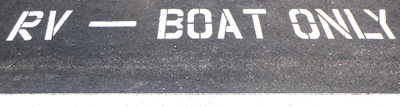
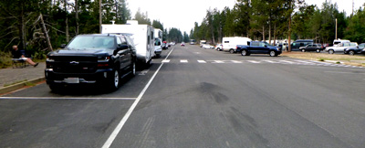
There are parking spaces along parts of this one way loop specifically for oversized vehicles and people towing boats or trailers:
And sometimes there are unusual pedestrians like this mama bear and her two cubs in August 2023:
![]()
This was just outside the Colter Bay visitor center in Grand Teton National park:
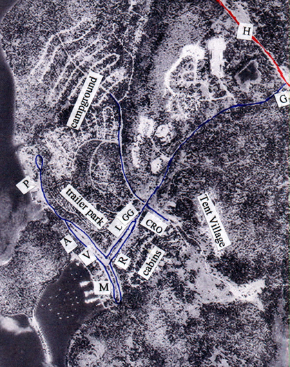
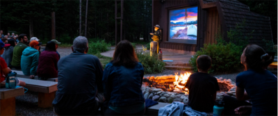
A= amphitheater for early evening Ranger talks, later evening campfire programs
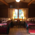
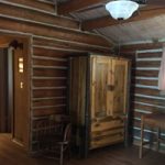
Cabins see details about the logistics of sharing a Colter Bay Village cabin
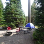
Campground (346 individual campsites, 5 group) = see map and details
CRO = cabin rental office
G = gas station with tiny gift shop / a few food items
![]()
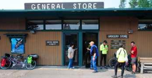
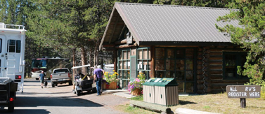
GG = large grocery (postage stamps) and gift shop (sometimes less food selection in the off season), coffee bar.
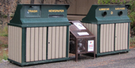 Recycling bins are located outside of the store, including one specifically for used propane tanks, the brown center one in the photo.
H = highway 191/89, edge of the town of Jackson 41 miles, border of Yellowstone National Park 13 miles
L = The coin-op launderette (22 dryers and 21 washers) & public showers (11 each men’s and women’s showers), sometimes there is a wait for these, is next to the General Store.
Shower cost (2025) “$5 and there is no time limit on that. If you have a group of five or less, you can pay the family shower rate of $15 and each additional person after the first 5 will be $3.00 extra.”
Towel rental $3, so bring your own.
To do laundry, if you have a roll of quarters you will not have to depend on the credit card reader or change machine being operable.

You might find a note: “We are experiencing network connectivity issues impacting our payment systems”. . . “If machines do not take your credit card, please use coins.” And the laundry room attendant can often take your credit card for payment and set the machine to run.
They sell laundry products but if you want unscented (scented can attract mosquitos) or hypo-allergic, or a specific brand of detergent or stain remover, it would be wise to bring small containers from home.

There are lots of machines, but if they are all taken and you notice that someone left their machine and it is finished running, you can ask the laundromat attendant to remove the clothes so you can use the machine.
Free (usually reliable) WiFi available at the laundromat:
![]()
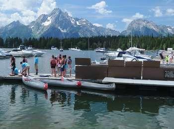
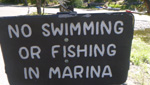
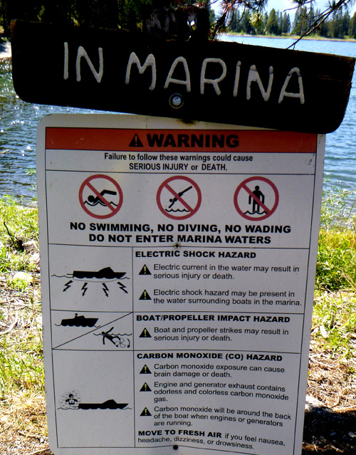
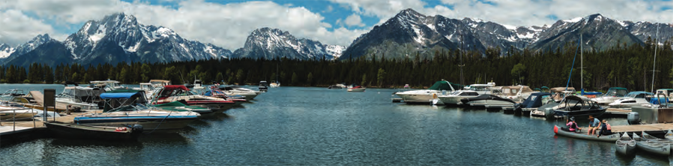
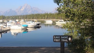
M = marina,
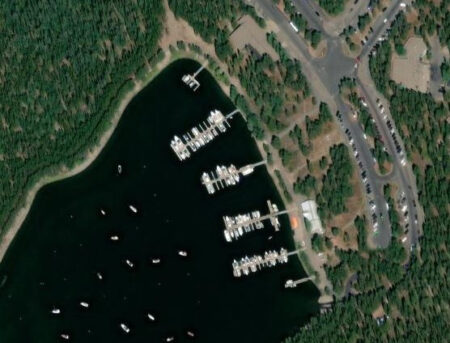
free boat launch ramp (at the lower edge of the photo above), canoe and boat rentals, fishing equipment and licenses, cruises with meals, boat fuel and dump services.
Colter Bay launch ramp (the wide driveway almost in the center) of a photo taken from a dock at the Marina is at this Google maps 360 degree photo.
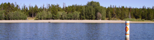
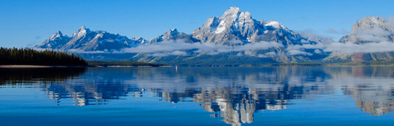
On many of our fall trips the ‘bay’ at Colter Bay is a mud flat due to irrigation water being drained from Jackson Lake.
![]()
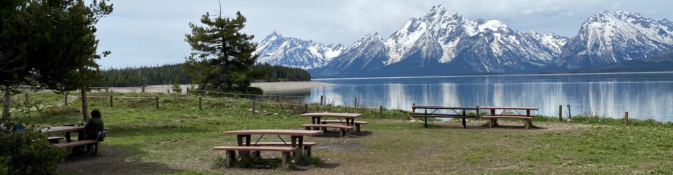
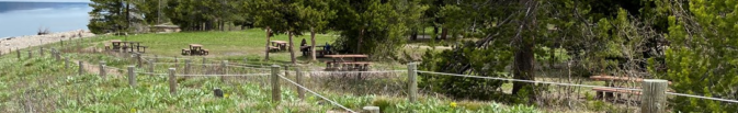
P = lakeside picnic area & swim beach with restrooms, picnic tables
that can be accessed by paths from the outside loops of the RV park or by the road that goes past the Visitor Center.
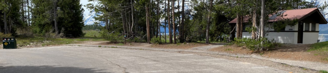
The restroom is at the end of the swim beach road / parking area:
and bring your binoculars:
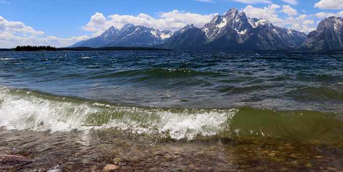
Views of the swim beach from out on the lake:

Below is a park service photo of the road past and to the swim beach, with the edge of the RV park to the right, which has pathways out to the swim beach road.
R = restaurant(s) free WiFi available. Ranch House open all season, Cafe closed early and late season (Coffee bar in the Colter Bay grocery.)
Tour the Ranch House and Cafe Court
Grand Tetons restaurants has links to menus for restaurants, cafeterias in Grand Teton National Park.
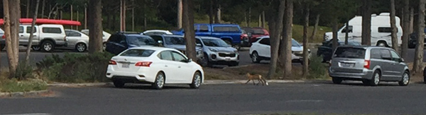
We once saw a mink running up the outside wall of a restaurant, but did not get a picture. We saw a fox (with a beautiful long tail) in the middle of the day, running from the marina area towards the Colter Bay cabins/restaurants:
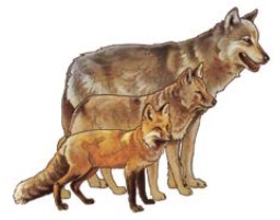
Here, the difference in size between a fox (in the front) coyote (in the middle) and a wolf:
Tent Village (66 Tent Cabins), see tent cabins 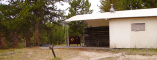
Trailer Park next to the Colter Bay campground, 112 full-hookup RV sites, see R.V. park
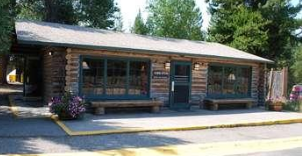
V = Visitor Center with films, talks, info, postcards, books and Indian Arts museum. Public restrooms in the building are at the left hand end of the building as it shows in the photo below.
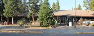
Rangers offer programs, for example: “Lakeshore Stroll Daily at 8:30 a.m. (6/10-9/11, 2025) 2 hours – 2 miles – easy hike. Meet at the flagpole in front of Colter Bay Visitor Center. Take a stroll with a Ranger along Jackson Lake while learning about this remarkable place. Beauty is guaranteed. This loop is inviting for the whole family.”
“Colter Bay evening talk with a ranger, Sunday-Friday at 8 p.m. ( 6/10/2025 – 9/1/2025 Meet at the Colter Bay amphitheater (auditorium if inclement weather).” Different topics, often posted in advance at the visitor center.
Each year the park sponsors a program for visiting Native American artists at the Colter Bay Visitor Center, usually a different artist each week, May to September. Guest artists usually exhibit daily, Monday through Sunday, from 9 a.m. to 7 p.m. adjacent to the Grand Teton Association bookstore. Artists also offer their finished items for purchase, including painting, carving, beadwork, weaving, jewelry, quillwork, drums, flutes, flint knapping, knives &/or pottery.Indigenous Arts and Cultural Demonstration Program
https://www.nps.gov/grte/planyourvisit/iacdp.htm
Info about all the Grand Teton Visitor Centers can be found at: https://www.nps.gov/grte/planyourvisit/visitorcenters.htm
![]()
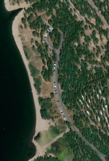
On the map below you can see campground loops F and G, about half of the RV park, and the brown rectangle is the store, the brown square to the side of/below it is the laundromat / shower house, and at the bottom of the map, part of the cabins area:
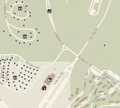
This map has the tent village on the right. The store is the brown rectangle at the middle left, with the showers/laundromat to the side/below it.
The bottom left hand corner is the restaurants.
There is no swimming pool at Colter Bay, but there is a swimming pool at Jackson Lake Lodge and Colter Bay Cabins guests can swim there.
More info about choices for overnight accommodations in Grand Teton National Park is at:
Grand Tetons hotels, cabins, lodging
There is a medical clinic on the grounds of Jackson Lake Lodge, ten miles from Colter Bay, near the gas station, open 7 days a week in the summer, usually 9 a.m. to 5 p.m. (307-543-2514, 307-733-8002 after hours). No appointment needed. See the map at: Jackson Lake Lodge vicinity 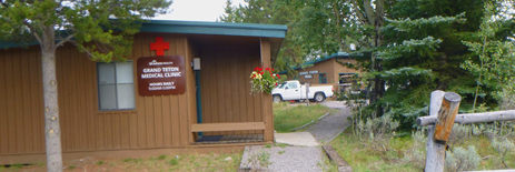
St John’s Medical Center hospital (24 hour emergency room) is at 625 E. Broadway at Redmond, in Jackson
![]()
In late summer 2021, a cell phone tower was put in the Colter Bay campground and you can expect to be able to use your cell phone as a hotspot to get wi-fi on your laptop. (At Colter Bay we got 3-4 bars on Verizon and AT&T. Elsewhere in the park we found some places with 3 bars on Verizon and 0-1 on AT&T. People have told us they have had trouble with T-Mobile and Sprint.)
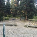
Here are views of Colter Bay campground loop F, on the right, campsite number F132 with the cell phone tower:
and the view of the towers from the road leading from the Colter Bay cabins to the campground:
![]()

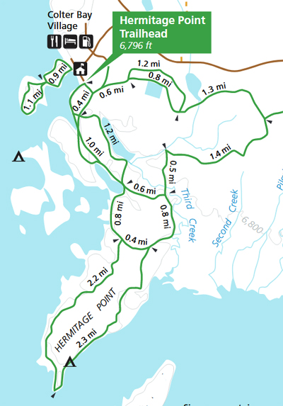
Trails from Colter Bay :
At the north end of Colter Bay there is a 1.5 mile trail with a small causeway out to and around an island. Views from this Lakeshore Trail:
The Lakeshore Trail starts behind the visitor center or at the day use area or even from the marina.
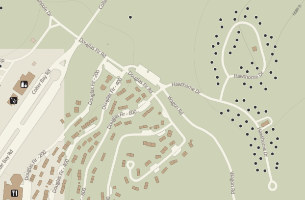
On the map below of the Colter Bay lakeshore trail, the 6800 is the elevation
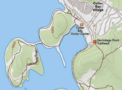
The NPS notes: “The Lakeshore Trail is an easy, 2.2 mi (3.5 km) loop hike with 100 ft (30 m) of elevation gain”
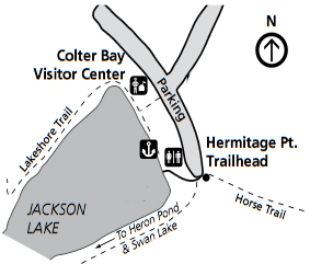
The Hermitage Point Trail goes out to Heron Pond and Swan lake 
For a full day hike, you can follow the Hermitage Point trail along Third Creek, out to a peninsula on the lake and follow the shoreline of Jackson Lake back to the marina
The NPS notes: “The Hermitage Point Trail is a moderately strenuous, 9.5 mi (15.3 km) loop hike with 930 ft (280 m) of elevation gain and an average slope of 4%. While relatively flat, the trail is long and contains obstacles, such as branches, roots, and exposed rock.”
The Swan lake Trail can be “temporarily closed for the safety of visitors and wildlife”
(for nesting birds to have peace and quiet).
https://www.nps.gov/grte/learn/management/wildlife-closures.htm
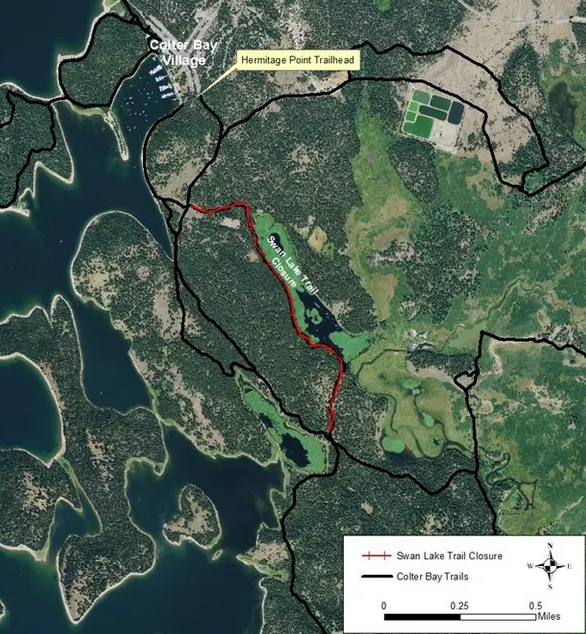
Below, a NPS photo trail map below, with the Colter Bay Campground, Colter Bay Cabins and Colter Bay village streets in the lower right corner, as well as Donoho Point, Hermitage Point, Half Moon Bay, Colter Bay, Little Mackinaw Bay, Willow Flats, Pilgrim Creek, Elk Island, Heron Pond, Swan Lake and Cygnet Pond
![]()
(The trail map above is oriented the usual way with north at the top, the photo map above is not.)
You can download a Grand Teton National Park map at: http://www.nps.gov/grte/planyourvisit/maps.htm
___________________________________
Birding notes from the park service about the Colter Bay area:
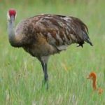
“On Jackson Lake a variety of waterfowl may be seen such as Canada goose (Branta Canadensis), mallard (Anas platyrhynchos), Barrow’s goldeneye (Bucephala islandica), common merganser (Mergus merganser), and sandhill crane (Grus Canadensis).
In the lodgepole forests, common birds include olivesided flycatcher (Contopus cooperi), yellow-rumped warbler (Dendroica coronata), ruby-crowned kinglet (Regulus calendula), mountain chickadee (Poecile gambeli), white-crowned sparrow (Zonotrichia leucophrys), chipping sparrow (Spizella passerine), and dark-eyed junco (Junco hyemalis).
Other common birds in the area include red-tailed hawk (Buteo jamaicensis), Cooper’s hawk (Accipiter cooperii), gray jay (Perisoreus canadensis), common raven (Corvus corax), barn swallow (Hirundo rustica), and mountain bluebird (Sialia currucoides).”
The Cornell Lab of Ornithology offers
Iconic birds of the Grand Teton National Park
and recent (fewer in winter, more in summer) bird sightings (with pictures of each bird) at:
Colter Bay iconic birds and recent sightings
Hermitage Point Trail iconic birds and recent sightings
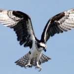
Grand Teton National Park birds has photos and details about the most common ones we can hope to see
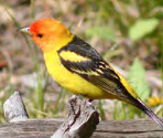
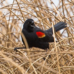
including Bald Eagle, Red-winged Blackbird, Canada Geese, Clark’s Nutcracker, Golden Eagle, Great Blue Heron. Great Gray Owl, Harlequin duck, Loon, Magpie, Merganser, Northern Flicker (woodpecker), Osprey, Ouzel, Pelican, Peregrine Falcon, Ptarmigan, Raven, Sandhill Cranes, Steller’s Jays, Trumpeter Swan , Western Meadowlark, and Western Tanager, with links to calls / songs from most of them to listen to.
and you can Download photos of over a hundred birds of Grand Teton National Park
https://www.audubon.org/climate/national-parks/grand-teton-national-park

___________________________________
You can read about John Colter, Jackson Hole and more stories at:
at: http://www.nps.gov/parkhistory/park_histories.htm#g
scroll down to Grand Teton
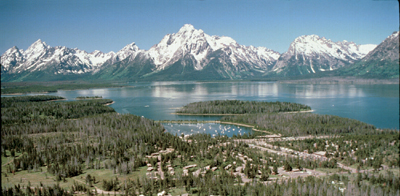
See also: Grand Tetons and Jackson Lake aerial photo
NASA aerial photo of Teton Range
—————————————-
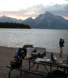
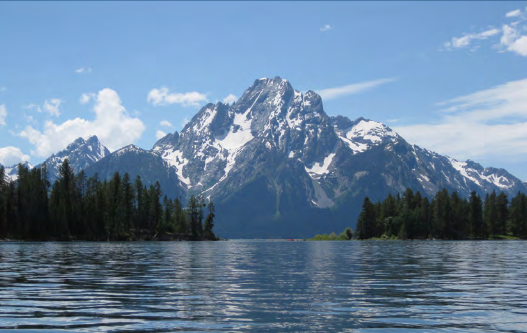
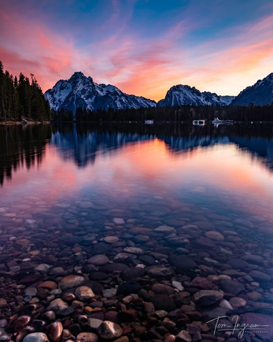
View from your boat as you exit Colter Bay towards Jackson Lake:
Colter Bay marina sunset courtesy of Tom Ingram Photography, all rights reserved.
Colter Bay driving distances:
Colter Bay – Old Faithful, Yellowstone 58.4 miles
Colter Bay – West Thumb, Yellowstone 39 miles
Colter Bay – Signal Mountain Lodge 9.4 miles
Colter Bay – Leek’s marina 2.4 miles
Colter Bay – Jackson Lake Lodge 5.9 miles (one source says 5.4 miles, 9 minutes)
Colter Bay – String Lake 18.1 miles (and often an hour long drive)
Colter Bay – Jenny Lake 19.6 miles
Colter Bay – Jackson airport 30.7 miles
Colter Bay – Dairy Queen Grill & Chill, North Cache Street, Jackson 39.3 miles
Colter Bay – Jackson Visitor Center 39.9 miles
Colter Bay – Albertsons, Buffalo Way, Jackson 42 miles (and often an hour long drive)
Colter Bay – Whole Foods Market, U.S. 89, Jackson, 42.7 miles
![]()
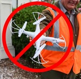
Fireworks and drones (unmanned aircraft) are banned at all times in the park.
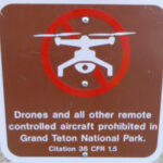
The NPS tells us that the use of unmanned aircraft (e.g., model airplanes, quadcopters, drones) has resulted in noise and nuisance complaints from park visitors, park visitor safety concerns, and incidents in which park wildlife were harassed. Small drones have crashed in geysers in Yellowstone National Park, attempted to land on the features of Mount Rushmore National Memorial, been lost over the edge of the Grand Canyon, and been stopped from flying in Prohibited Airspace over the Mall in Washington DC.
The author of this webpage, (written for my students), does not give any warranty, expressed or implied, nor assume any legal liability or responsibility for the accuracy, completeness, or usefulness of any information, product, or process included in this website or at websites linked to or from it. Users of information from this website assume all liability arising from such use.