For the De Anza College trips to Grand Teton National Park, your trip can start and end when people traveling together mutually want it to,
any or all days, August 12 – 30 2026 (between summer and fall quarter).
Participants can stay for a shorter, longer or much longer trip
Some people may come for the whole time, others may join the trip halfway through. How you get to Grand Teton park is not arranged by the club or the college.
– – – – – – – – – – – –
If you fly or use other public transit, or stuff a lot of people in a car, you will be limited in what you can bring. If we can transport the kayaks (we almost always can) we will also bring lifejackets, paddles and and the club advisor will bring a limited supply of dry bag(s) and binoculars. We usually also can find room for a dining canopy. The club and/or the drivers will not be responsible for the safety of items we transport for you.
– – – – – – – – – – – – – – – – – – – – – – – – – – – – – – – – – – – – – – – – – –
Parks Canada is offering free admission to Canadian National parks. “From June 19 to September 7, 2026 no fees apply for: admission for all visitors to all national historic sites, national parks, and national marine conservation areas operated by Parks Canada.” You should make plans well in advance if you are tempted
by a side trip to Canada on the way home.
The required Canadian Non-Resident Inter-Province Motor Vehicle Liability Card,
sometimes called a “Canadian ID card”
Is FREE from your auto insurance carrier. See how to get one at Logistics for a trip to Canada.
– – – – – – – – – – – – – – – – – – – – – – – – – – – – – – – – – – – – – – – – – –
NO CAR ON OUR TRIP?
During our trip, if your driver has plans for the day that you don’t want to participate in,
or if you arrive by plane before the main group,
or if your driver stayed up late and slept in all morning,
there is plenty to do at or from Colter Bay without access to your own vehicle.
See below at NO CAR ON OUR TRIP?
and see below:
DRIVE
FLY (the section on flying includes using public transportation to get to the park from an airport with potentially lower cost tickets than if you flew round trip to the Jackson, Wyoming airport, which is IN Grand Teton National Park .)
DRIVE
Carpools are arranged among the students going on the trips, not by the club or the college.
How many vehicles and how many people in each vehicle? Carpool FAQs
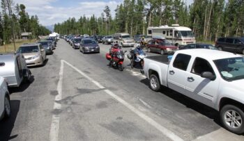
People who travel to the trip by themselves are encouraged to get into carpools for activities during the trip, because parking can be limited at trailheads and launch points.
For road trips, we advise people to check everything that powers, stops, cools, heats, ventilates and lights their vehicle well before they leave on an adventure. People on a budget often put up with not-essential-for-safe-driving problems with their cars. But deferred repairs and maintenance can spoil a road trip. Here is a checklist, including things you can do yourself.
CSAA or other Auto Association memberships usually give you (or maybe your parent?) free maps.
Paper maps can be easier to use for planning. Yes, you can download maps on your phone, but paper maps can be essential for driving through areas without phone service.
You will want at least the state maps of California, Nevada, Idaho, Wyoming and Montana. You might also want, for the drive home through more National Parks, Washington and Oregon or Colorado, Utah, New Mexico and Arizona.
The drive from Silicon Valley to the Tetons, as estimated from AAA tour maps, going through Reno, and across Nevada, up into the south center of Idaho, across to Wyoming and Jackson Wyoming, then north into the park, is about 21 hours without many stops or heavy traffic. In 2002 it took one van 31 hours with lots of stops. In 2009 one guy said it was a 17 hour drive and he swears he didn’t speed (no one believed him).
Most people are happier (and safer) with at least one overnight stop.
Below, the 1,000 mile driving route preferred by previous trip participants
across California, Nevada, part of Idaho and into Wyoming:
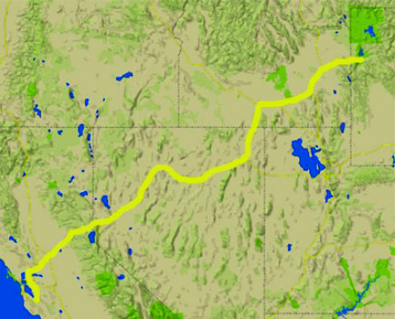
(Many trip members have done the drive with one overnight stop in Elko, Nevada and have recommendations for where to stay that we will share with people as they sign up for the trip.)
If you ride in a carpool taking turns driving pretty much straight through, (or even if you only plan one overnight stop), pack a small bag with the items you will wish you had for 24+ hours so that you don’t need to stop and go through your luggage looking for: your toothbrush/floss, flashlight (electric torch), rain jacket, pillow, book, journal, camera, headphone CD player. Other people in the vehicle will appreciate it if you wear freshly laundered clothing without perfume or cologne and have recently washed yourself. There’s more on packing at Road trip advice and etiquette .
If you are letting passengers take turns driving your vehicle it would be prudent to have each of them drive the vehicle a little in an empty parking lot first. If you are towing this becomes even more imperative, especially having them get up a little speed and try braking to see how long it takes to stop and how it handles when it stops. This advice and more is at, you guessed it, Road trip advice and etiquette .
If you decide to caravan, cars in a caravan should stay at all times in sight of each other. If you decide to drive to Wyoming straight through, remember that it doesn’t matter if you arrive later than expected, and each driver must get enough sleep.
It is worth investing in a spare vehicle key or two or three, in the pockets of various people, since your cell phone does not function everywhere on the way to (or in) the park to get a Auto Club locksmith to unlock you car when you lock the keys in it. If you rent a vehicle for the trip, talk to me about where you might be able to find a spare key in that rental.
If you rent a vehicle, try to get the typical AAA (CSAA) rate with unlimited mileage.
EVEN if you are not planning to rent a car, be sure you can in case something happens to your vehicle.
If you rent a vehicle please learn how to turn off car alarms/disable beeps at the rental business, so you don’t risk waking up people in the middle of the night.
Remember that most rental agencies will not let you tow anything. Most rental agencies at the Jackson, Wyoming airport will not let you put a canoe or kayak on the vehicle if you choose to rent your own boat. Most vehicle rental agreements restrict vehicles to paved roads, but many roads in the park are gravel. Check your contract and be aware that the rental company can charge you for damage to the vehicle outside of the contract agreement specifications.
Some previous trip participants have rented a giant SUV. Be sure each potential driver has adequate personal insurance for the rental car. With some personal policies, the full coverage does extend automatically to a rental car and you don’t need to pay extra to the rental company for their insurance. (A rental car agent told me that for a mini van the insurance costs would be $30.99 + $15.16 + $9.95 + $5 per day for various coverages.)
BUT my insurance company agent warned me that they have “many different products,” and each of you should contact your own auto insurance company to see about your coverage.
An insurance website said:
“ . . . Before renting
Contact your insurance company. Find out how much coverage you have and if it includes rental cars. The coverage and deductibles you have on your auto insurance policy apply in most cases when you rent a car, as long as it’s for personal use and you are driving in the U.S.
Contact your credit card company. If paying for a rental car with a credit card, you may have some level of insurance coverage. Call the number on the back of your credit card to find out what the terms are and what coverage you have. In most cases, credit card benefits are secondary coverage. If an accident occurs, you will still need to file a claim with your insurance company, and your credit card company may pay a portion of the charges that your primary auto insurance company does not.
At the rental counter
The Insurance Information Institute cites four typical rental car coverage options, which can vary from state to state:
Loss damage waiver: Also known as a collision damage waiver, this waives financial responsibility if your rental car is damaged or stolen. It also provides coverage for “loss of use” charges if the rental is being fixed or if it is towed. If you have comprehensive/collision auto coverage, you may already have coverage for damage to a rental car, subject to policy provisions and deductibles.
Liability insurance: This is a state-required minimum amount of liability coverage, however, these coverages may not provide a lot of protection. A standard auto insurance policy typically includes liability coverage.
Personal accident insurance: This will cover the driver and passenger(s) for medical costs caused by a car accident, regardless of fault. The personal injury protection portion of your auto insurance policy, or your health insurance policy, may cover your medical expenses.
Personal effects coverage: This provides protection for personal items kept in a rental car. Your homeowners or renters insurance policy may include off-premises theft coverage. . . “
You can read all the info provided by CSAA insurance.
Electric vehicle? (A student drove to the trip successfully with an electric vehicle in 2025.)
Driving an electric vehicle? Find alternative fueling stations in the United States and Canada. In the box labeled “Enter Location” put in the zip code.
Jackson Wyoming zip codes are 83001 and 83002, Moose is 83012 (includes the Jackson Hole Airport) Moran (and Colter Bay) is 83013. Sometimes you need to scroll down at the page you get and even click NEXT at the bottom to see all of the charging stations.
You need to agree that you will not ride a motorcycle to / on the trip because you are not safe during lightning (the tires and/or your helmet will not protect you). If you intend to drive a convertible and it has an electric power top, be sure you know how to put the top up manually in case the push-button function stops working. Rain storms can come in quickly and heavily. You should have alternate ways to get around if lightning is forecast, because
you are not safe during lightning in a convertible or on a motorcycle.
“The only safe place is inside a substantial building or hard-topped vehicle.”
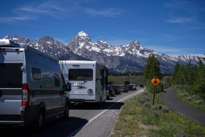
Can you pass the “Winnebago test”? It’s a test discovered by a friend of the Outdoor Club faculty advisor. If you are stuck on a winding mountain road behind a huge, slow moving motorhome and you realize they are not going to pull over and let the dozen plus cars behind them pass, will you wreck your vacation? The test is at: Road trip advice and etiquette. It has decisions to make before the trip, packing advice and more from previous road trip members that could make the long drive more fun.
Grand Tetons trip cost includes mileage and gas costs estimates.
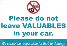
This warning from Canada can apply to any long-distance drive: “Visitors to large cities and popular tourist destinations should be aware that parked cars are regularly targeted for opportunistic smash-and-grab thefts, and they are cautioned to avoid leaving any unattended possessions in a vehicle, even in the trunk. Due to the high incidence of such crimes, motorists in Montreal, Toronto, Vancouver and some other jurisdictions can be fined for leaving their car doors unlocked or for leaving valuables in view. Visitors should exercise precaution to safeguard their property.”
Another source mentioned smashed windows when
car thieves target property left in plain sight
such as luggage, purses, electronics, laptops, tablets,
and they break into cars for even expensive sunglasses.
– – – – – – – – – – – – – – – – – – – – – – – – – – – – – – – – – – –
Locally we do not have “rest areas” off of our freeways, but for a lot of the trip to Wyoming, going across some of California, Nevada and Idaho, there are rest areas with restrooms (usually flush toilets but some pit/vault toilets), picnic tables, trash cans and sometimes historical displays, vending machines and coffee or even food trucks. Some of the larger ones have full-fledged visitor centers with tourism information and resources, free wireless Internet.
They are a quick exit on and off the highway. Some have separate parking lots for commercial sized trucks or passenger vehicles.
If you plan to pull into one and sleep overnight, expect that you might not have peace and quiet. Most big trucks have sleep-in sections at the back of the cab and will be running their generators all night. They may also start up very early (4 a.m.) to do the next leg of their trip.
– – – – – – – – – – – – – – – – – – – – – – – – – – – – – – – – – – –
A Tetons road trip veteran advises to not try the route through Utah and the great Salt Lake:
“add the Great Salt Lake to that, too. That was one of the absolute worst hours of the drive. The sun was scorching; there was absolutely nothing out there but salt to look at; and, as far as I recall, there were absolutely no overpasses, underpasses, trees, or buildings to stop in for shade; it was horrible. I guess it took only about an hour or two to drive through there, but I just remember it as being torture.”
(The Salt Lake route is an hour longer than the southern Idaho route, but if you have relatives who will let you camp in their backyard as students on a previous trip had …)
– – – – – – – – – – – – – – – – – – – – – – – – – – – – – – – – – – –
Whoa, does this make you think you can’t endure a road trip across the US desert?
Will you die of boredom? Go to:Road trip advice and etiquette for ways to save your sanity and save friendships on a long expedition, including decisions to make before the trip, packing advice and more from previous road trip members that could make the long drive more interesting and even more fun.
You can find websites try to keep up on gas prices across the country, such as Gas Buddy
(You do NOT need to get their “card” to look at gas prices.)
It uses less gas to drive with the air conditioning on than to drive with windows open.
The club and the College are not responsible in any way for your transportation on trips, but they expect that everyone will wear seatbelts and obey all traffic laws, drivers will have sufficient insurance, vehicles will be in good repair and no one will pick up hitchhikers. Please have the courtesy to let your driver/ passengers / the club advisor know of any changes to your ride needs or ability to drive. Carpool FAQS
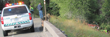
A Wyoming law, subject to change, (with fines of up to $200 and jail terms of up to 20 days, or both), requires that drivers slow to 20 mph under the posted speed limit when passing stopped emergency vehicles with flashing lights, unless directed otherwise by law enforcement.
Please note: “The Superintendent may designate and post lower speed limits than those listed on a temporary basis without further public notice for short term public safety or resource protection.”
The speed limit slows to 15 miles per hour within 100 feet of a park entrance station.
20 MPH Moose Wilson Road – Granite Entrance Station to LSR.
25 MPH
- Teton Park Road from the junction with Highway 89 to within 100 feet of Moose Entrance Station.
- Moose-Wilson Road north from Granite Creek Bridge to the northern edge of Sawmill Ponds.
- Jenny Lake Loop one-way road.
- Signal Mountain Road from the intersection with Teton Park Road to the summit.
30 MPH – parts of Teton Park Road
35 MPH Antelope Flats Road
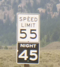
Highway(s) 191, 26/89, from Jackson into and through the park have a nighttime
(30 minutes after sunset to 30 minutes before sunrise) speed limit of 45 m.p.h.
Yes, that slow on what feels like a major highway that would have a higher speed.
If you get pulled over, remember you are driving a vehicle with out-of-state plates for much of this road trip. Even if you are sure you did nothing wrong, be calm and extra polite (but not sarcastically so) when stopped by the police/Highway Patrol/park ranger, and do nothing unexpected.
Don’t exceed the speed limit, and consider going slower. According to the FTC, “The faster you drive, the more fuel you use. For example, driving at 65 miles per hour (mph), rather than 55 mph, increases fuel consumption by 20 percent. Driving at 75 mph, rather than 65 mph, increases fuel consumption by another 25 percent … If you anticipate traffic conditions and don’t tailgate, you can avoid unnecessary braking and acceleration, and improve your fuel economy by 5 to 10 percent.”
On the many one lane in each direction roads on our road trip, if you are doing the speed limit, be assured that some people will want to pass you. You can decide to make it safer by slowing down as they pass you to be more sure they can complete the pass in time.
If there is an emergency in the park or you need to report something along the road, call 911 from a pay phone or (307)739-3300 from a cell phone for park dispatch. (Please verify this phone number in the park newspaper when you get there.)
Please drive the speed limit and be prepared to stop suddenly.
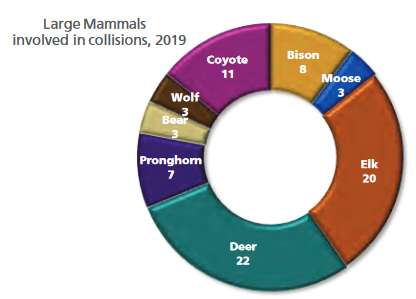
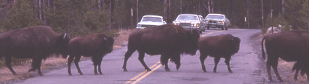
The NPS reported: “A total of 40 species (18 mammals and 22 birds) were involved in collisions in 2019. Large mammals accounted for 77 of the 169 animals involved . . .For the 31% of incidents with a known time of day, 100% of collisions involving bison and moose occurred at night, and 89% involving elk occurred under diminished light (twilight/night).
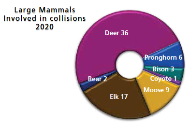
In 2010, vehicles in Grand Teton National park hit and killed two wolves, five bears, 6 pronghorn, 17 bison, five moose, 41 deer and 48 elk. Most of the deaths occurred between dawn and dusk on the main highway between Moose and Moran Junctions.
In 2018, animals killed by drivers in Yellowstone National park included: 25 bison and 20 mule deer, 13 elk, seven pronghorn, three black bears, two moose, two mountain lions, one whitetail deer, one wolf, one coyote and a raccoon.
Speed was the biggest factor,
especially at night when people “overdrive their high beams –
when stopping distance is greater than the headlight illumination distance.”
“Motorists are reminded to drive the posted speed limit and to be prepared to stop suddenly for wildlife along or on park roadways. Driving slower than indicated speed limits, especially at night, can increase the margin of safety for people and wildlife. Collisions between motor vehicles and wildlife may result in severe damage to a vehicle, serious or fatal injuries to the wildlife.”
Car after an impact with a bison:
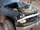
Driving slower than the posted speed limit, especially after dark, can save animal (and human) lives.
Average cost of a collision between a moose and a vehicle $30,760
(according to the Jackson, Wyoming police department).
CSAA (AAA) “Here are some tips for preventing animal collisions on the road:
Scan the road ahead of you. Sweep your eyes front, left and right for signs of deer and other animals. While these kinds of accidents are most frequently caused by animals darting in front of a car,
animals can also run into the side of a vehicle.
Be especially attentive during commute hours.
Deer and many other animals are most active between 5-8 a.m. and 5-8 p.m.
When driving at night, use high beam headlights if there’s no oncoming traffic. The extra light may help you spot animals sooner and give you time to slow down, move over or honk your horn to scare the animal away.
Look out for other deer. Deer rarely travel alone.
If you see one deer, the chances are high there are others nearby.
Brake firmly and remain in your lane if impact is imminent. Many serious crashes occur when drivers swerve to avoid animals and hit oncoming vehicles, or crash into fixed objects on the side of the road, such as lampposts or trees.
Always wear a seatbelt.
Most injuries in animal-vehicle collisions occur when passengers don’t wear their seatbelts.
Stay away from wounded animals. A wounded and frightened animal can be unpredictable and may cause injury. If an animal is in the middle of the road and blocking traffic, call the police or animal control organization.”
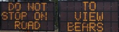
Along some roads, some parts of the year, there may be signs telling you to NOT stop:
====================================
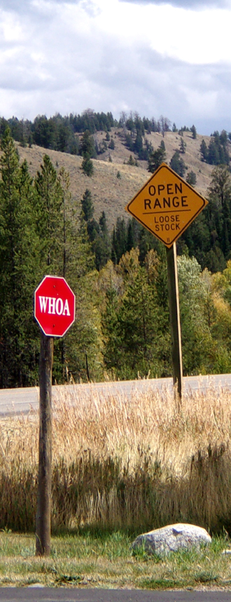
Going cross-country in rural areas, and just outside the park,
be on the watch for signs telling you there might be cattle on the road.
====================================
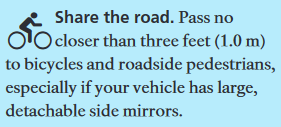
Focus on driving. Actively scan the road for hazards, use your mirrors and watch out for pedestrians and cyclists.
Never text and drive. According to NHTSA, texting is the most concerning distraction. Sending or reading a text takes your eyes off the road for 5 seconds. At 55 mph, that’s like driving the length of an entire football field with your eyes closed. Texting while driving has been banned in 47 states and the District of Columbia.
Pull off the road. If you must make a call, return a text or do anything else that would take your attention off the road, find a safe spot and pull over.
Get set before you go. Plug your destination into your GPS and adjust your seats, mirrors, music and climate control before you step on the gas.
Don’t eat or drink while driving. Eating and drinking can take your hands off the wheel and your eyes off the road. If possible, eat meals or snacks before or after your trip, not while driving.
Let passengers give you a hand. If something is distracting to you, ask a passenger to take care of it, so you can focus on driving.
Settle children and pets before getting underway. If they need your attention, pull off the road safely to care for them. Reaching into the backseat can cause you to lose control of the vehicle.
Don’t dress and drive. Finish personal grooming at home – before you get on the road.”
SAVE MONEY ON GAS
AND TIME ON THE ROAD.
In parts of Idaho and Wyoming they sell 85 octane regular gas. You can get away with 85 octane at high altitude (6,000 plus, verify in your owners manual) because the thinner air is compressed less in the engine, but you would want 87 at lower altitudes. If you live at near sea level (the west coast of the U.S.) and are sure you will use up all the 85 octane before you leave for home, you will be okay, BUT if you don’t, either your engine will start pinging or your engine’s knock sensor will retard the ignition timing to compensate, which will result in lower engine power. (A few cars with turbos require Premium, 91 octane). Use what your owners manual says and no lower. Make your last fill up in Jackson before you head home 87 octane unless you are certain you will use up all the 85 octane gas before you leave the Tetons (Jackson Wyoming elevation 6,000 feet, Grand Teton park flats elevation 6,800 feet, Silicon Valley California elevation 240 feet).
Gas stations don’t always have clean restrooms, but they are at least better than some of the reststops going across Nevada. In 2018 the rest area at the intersection of 80 and 95 had vault toilets with many varieties of flying and crawling insects. In 2019 the bugs were mostly gone.
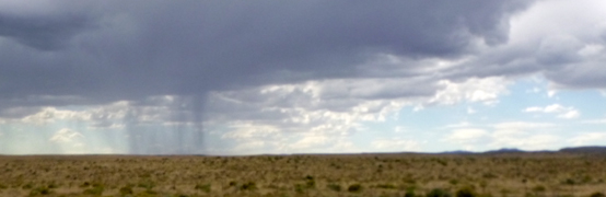
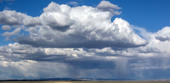
Sometimes crossing Nevada you can see heavy rain falling a distance away, and if you are going directly towards and into it, double check the waterproofedness of what is on the roof or in the truck bed.
A major brand gas station right at a freeway exit in Lovelock had (in 2009/2012/etc.) gas at 33/28 cents a gallon more than the non-name brand station two blocks down a side street in town or the other major name brand station on the opposite side of the freeway exit.
Winnemucca exit 176 had a Flying J with lower cost gas than the station at the next exit.
In Carlin the Pilot station posted their prices on a large overhead sign and the major name brand station next door didn’t even have fully readable ones at the pump, but they were at least ten to twenty cents a gallon higher. The Pilot station also had a Subway sandwich shop and lots of possibly needed fuses, bulbs, hose clamps, etc.
Wells: At the exit you will need for 93 north there’s a Love’s Travel Stop at the intersection of highway 93 and 80, with a 24 hour McDonalds. (Yes, that is cigarette smoke in the restaurant from the casino next door.) Fill up there and you can drive right past the much-higher-cost-every-year-we-have-had-the-trip stations in Jackpot Nevada.
– – – – – – – – – – – – – – – – – – – – – – – – – – – – – – – – – – – – – – – – – –
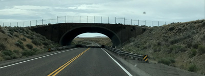
North of Wells on Highway 93, those are fenced animal overcrossings you see that look like overpasses, “built to protect motorists first and foremost . . . vehicle-animal collisions cost billions of dollars in damage each year and are a tremendous problem.” (The three animal overpasses cost a total of 2.2 million.) They have no pavement, only plants and grasses growing on top and the animals have gotten used to using them. A report said: “The Highway 93 overpass near Elko, which was the state’s first project specifically for wildlife, found that more than 35,000 mule deer used the structure in its first four years resulting in significant reductions in wildlife-vehicle collisions.” In Canada some of the animal overpasses have forest trees growing on top and at the center of the sides. California plans many, starting with a wildlife bridge (Liberty Canyon Wildlife Crossing) spanning the 101 Freeway in Agoura Hills.
Research from September 2022 by Nevada Department of Transportation “finds that the total average national cost of a single deer collision is $19,089 an elk collision is $73,196 and a moose collision is $110,397.”
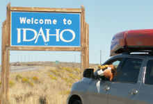
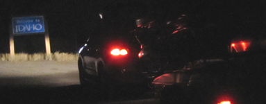
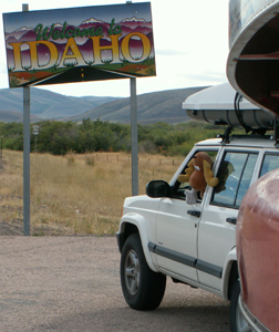
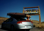
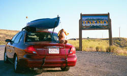
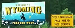
Just out of Jackpot on the right there is a pullout with a Welcome To Idaho sign suitable for photo taking.
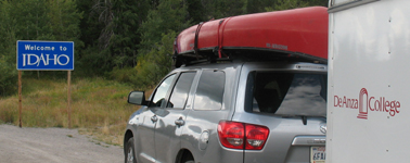
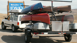
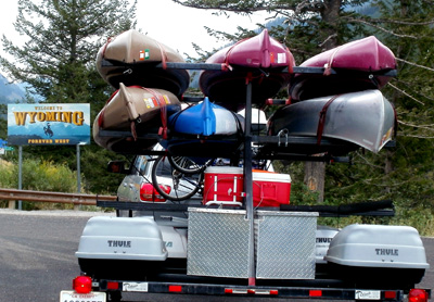
Below: the photos of rental cars with kayaks loaded on top and the stuffed Bullwinkle trip mascot are by Wendy Sato.
It’s faster to drive across southern Idaho than through Salt Lake.
You will need to set alarm clocks (and most car clocks) one hour ahead after you drive into Idaho from Nevada (from the Pacific Time Zone to the Mountain Time Zone).
Going from Nevada into southern Idaho, the gas in Jackpot has often been much higher priced than in Twin Falls, Idaho.
You can get through Twin Falls, Idaho without going through some downtown, but you can spend a great deal of time on slow side roads if you don’t watch out. Coming from Jackpot do not take the Twin Falls city center #74 exit. See google maps.
Continue along as the road widens to a four lane and take the exit that circles around down to town. It follows Addison and turns on to Blue Lakes, then highway 93. If you are going through at all late in the day you will find even the fast food places closed. The gas stations in Twin Falls were (2009) 11 cents to 14 cents more (2010) 10 cents more than just outside of town (listed as in Jerome, Idaho, but at the freeway 84 entrance) Flying J station, which is open 24 hours and at night might be the only restrooms and food you can find. (Flying J mid-grade $3.84 Aug. 2014). But with a Maverik card to swipe at the pump you might beat that price (Maverik 883 Blue Lakes Blvd. and Falls Avenue, open 24 hours.) Please talk to us in advance of the trip on which type of Maverik card to get and how to get one, as you will likely use it multiple times while you are in Grand Teton Park.
When you get to Idaho Falls do not take the first exit that says towards Grand Teton/Jackson, Wyoming, That exit forces you to drive for many narrow downtown blocks (especially not fun when towing a trailer). Instead, get a street map and take exit 119, following route 20 for a bit, go right on an exit to Science Center drive, which becomes Anderson as it crosses Holmes, then bear left onto Yellowstone Highway (route 26). You will save as much as a half hour, perhaps more, as the directional signs have been previously missing on the usually indicated route the city businesses would have you take from the freeway.
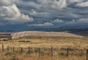
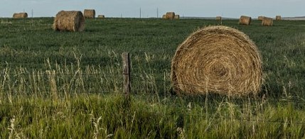
Closer to Jackson and the park, there are many ranches/properties with a livestock fence (bottom of the photo below) and winter snow fences, advertised as: “It’s commonly used to set up drift-free zones around buildings and along roads. Snow fence has a mesh pattern that cuts wind speeds more effectively than traditional slatted fencing, dropping snow more quickly into berms that block drifts. It stretches across posts for secure installation and flexes without snapping to form a snow-protective barrier.”
and others with rolls of hay:
Before the trip let’s take a look at your road maps, and decide if you want to take Highway 22 over Teton Pass, or the lower elevation route.
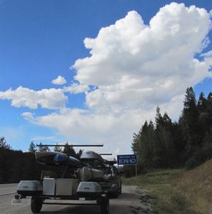
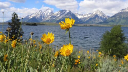
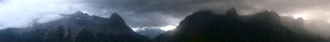
More rain falling from a distance, this photo taken in Wyoming:
====================================
Various roadways / highways within Grand Teton National Park can be closed.
====================================
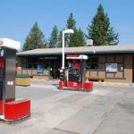
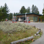
We tell people on our college trips to Grand Teton National Park to plan to fill their gas tank whenever they are in Jackson as the cheapest gas stations are in town and the prices get higher the further you go into Grand Teton park. See a map of gas stations in Grand Teton National Park and gas costs at some of them over the years.
Groceries are also cheaper (and with a much more plentiful selection and often fresher produce) in town, so most trip participants plan trips into town at least once a week. The Jackson page has links to the three most major grocers that you can use to see whether they sell your favorite foods. (At least one of them likely does.)
Going through Jackson, Wyoming into the park the main route takes you past the Town Square with a lot of slow traffic and pedestrians. It can be fun to take that route at least once, but the faster route is the one marked as a truck route (same distance, just using side streets). Get a street map from the club with the alternate route, as well as where to find the hardware store, auto parts store, Dairy Queen, huge brand name grocers, hospital, well-worth-stopping-at free Visitor Center, etc. marked on it.
Here is a map showing the town of Jackson in yellow at the bottom, the Jackson Hole and Greater Yellowstone Visitor Center at the north part of town, then, just above the center of the map, the Gros Ventre road junction, then the airport, and at the top of the map, the Moose Visitor Center ( Craig Thomas Discovery and Visitor Center):
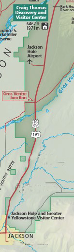
Driving times, according to an Auto Club are:
Jackson town limit to park border 6 minutes (+/_) 4.9 miles,
to airport 12 minutes (+/-) 9.3 miles,
to Moose entrance 17 minutes (+/_) 13 miles.
photo below used with permission from Ron Niebrugge:
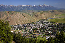
As you go through Jackson downtown, East Gros Ventre Butte (tan “hills” in the photo above)
blocks the view of the Teton range until you are just getting out of town, past the visitor center, but before the Gros Ventre road junction.
Expect drivers to possibly suddenly stop when they first see the view.
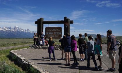
As you leave town and go past the butte, a few miles later, on the right there is a large Grand Teton National Park sign on 12 foot tall posts/beam and a small parking lot you can stop at for picture taking.
Some times of the day you will be standing in line with other visitors to take a turn for that selfie or group photo in front of the sign:
After you go over the Gros Ventre river on a bridge, at the intersection of the Gros Ventre Road there is a round-about that has had a few traffic accidents when people do not slow down and let each other merge in, or even stop in the roadway because they are not sure where they are going. People heading into the park need to go around and through and continue heading north on highway 191, 26, 89.
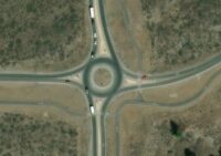
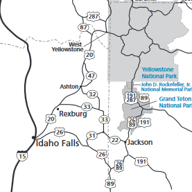
In the map below, highway 191, 26, 89 comes from Jackson to the park at where the red line comes in at the center bottom of the map. The yellow dot is the Moose Entrance Station.
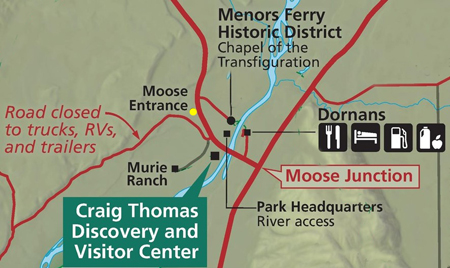
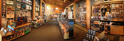
Turn left at Moose Junction after crossing the river and you can go to the Craig Thomas Discovery and Visitor Center, look at many displays, use the free, usually reliable wi-fi, and if you have a Grand Teton Association membership card (or a Yosemite Conservancy membership card), get a discount at the largest park bookstore with t-shirts, posters:
You can pay for your National Parks Pass, before you actually “enter” the park. Some advice about how to save a lot of money by getting National Parks and Federal Recreation Lands annual pass instead of paying the basic park entrance fee is at Grand Teton trip cost.
The Visitor Center offers Ranger programs, for example: Courtyard Talk – daily at 4 p.m. (6/10/25 – 9/01/25) 20 minutes, at the Visitor Center Courtyard “The park is full of wonders and mysteries that often get missed during a casual visit. Stop by for a short ranger program that will help you to see and experience more during your visit. Topics vary.”
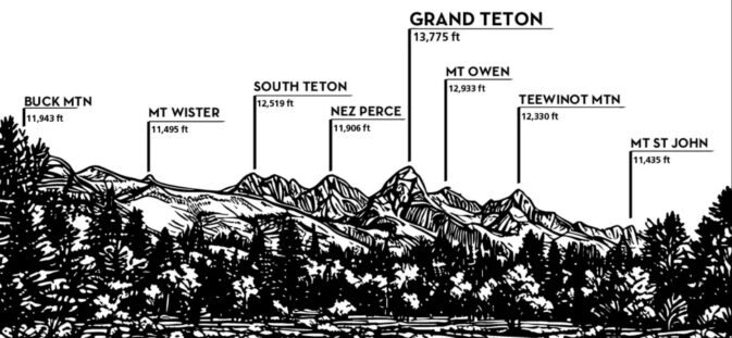
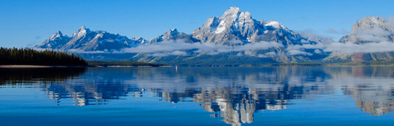
See a webcam looking toward the Teton range at the Moose Visitor Center,
and the names of the peaks as seen in the webcam or thru the visitor center windows or on the road going thru the entrance station:
All vehicles with canoes, kayaks, windsurf boards and stand-up paddle boards on them, or towing a boat, must stop each time they enter the park at whatever inspection station is open, even if they have already been inspected. Watch for signs during regular business hours when the entrance stations are open:
![]()
At the entrance station (yellow dot on map above), please do come to a complete stop next to the window. Note that only one of the entrance station kiosks windows might be staffed and there might or might not be cones marking a closed entrance lane.
If you already have the parks pass and photo ID of the person in your vehicle who owns the pass,
out and ready to go,
you will not hold up the rest of the sometimes long line of vehicles as much.
(And the same advice to have your park pass, etc. out as you approach the entrance station applies when you go into Yellowstone National Park, especially if you do not go early in the day.)
The inner park road (Teton Park Road) you will be on if you come into the park at Moose Junction takes about the same amount of time as the outer park road – highway (plus or minus for road work). Turnouts to stop and check out the scenery, parking lots for trailheads, historical sites, and some side roads on each of these routes are described at Grand Teton National Park sightseeing.
![]()
Just before you leave, or along the way if you find online access, consult:
Tetons area road conditions (Wyoming Department of Transportation)
Grand Teton Park road construction (possible delays) and from that page a link to Yellowstone roads info, is at:
Old Faithful geyser in Yellowstone
– – – – – – – – – – – – – – – – – – – – – – – – – – – – – – – – – – –
If you decide add a visit to Burning Man after one of our trips to Grand Teton, please note that it had an eight-hour traffic jam for people leaving the last day in 2022, and you could take that into consideration for the days you choose. And if you decide to drive home with your vehicle and bikes on the back coated in alkaline dust, as many Burning Man participants do, please at least clean not only your windshield, but also your headlights, tail lights, and rear window. Also, in 2025, according to the New York Times, “a powerful dust storm tore through the Black Rock Desert in Nevada on the opening weekend of Burning Man … winds toppled tents and briefly shut down the entry gates to the Burning Man festival”

FLY
Jackson Hole airport, located between the town of Jackson and the park, is served by Sky West / Delta (through Salt Lake City), United and American Airlines. Alaska Air only gets as close as Idaho Falls. If you look online for tickets, the airport code for San Jose is SJC, Oakland is OAK, for Salt Lake it’s SLC and for Jackson, Wyoming it’s JAC. It is 9.4 miles to downtown Jackson from the Jackson Hole airport, about 13 minutes.
– – – – – – – – – – – – – – – – – – – – – – – – – – – – – – – – – – – – – – – – – –
You can often find low cost plane flights from the bay area (including San Jose, Oakland or San Francisco airports) to Salt Lake City, Utah because Salt Lake is a Delta Airline “hub”.
In 2004 trip participants booked early cheap tickets to Salt Lake City, Utah, rented a tiny car and drove the remaining 6 hours.
Or you could take a bus from the Salt Lake airport to Jackson, Wyoming (the town next to Grand Teton National park)
Some bus routes from Salt Lake go to the Jackson Airport (which is actually in Grand Teton National park), some to the Albertsons grocery in the town of Jackson.)
Please do notice any bus “Tickets are non-refundable within 48 hours of travel time.” rules. And note the limits on number and size of bags you can bring, or the extra charge for extra bags.
– – – – – – – – – – – – – – – – – – – – – – – – – – – – – –
In 2007 a guy who wanted to fly one leg of the trip and ride in a carpool coming back, found that the round trip ticket was less than the one-way, and he had the option of flying back instead of carpooling if the carpool wanted to extend their drive home.
But often it can be cheaper to fly in on one airline (one way) and out on a different airline (again, one way).
Any recent prices for flights we know of are at Grand Tetons trip cost
LOGISTICS OF FLYING
AFAR travel blog said, in May 2023:
“FLYING WITH YOUR BIKE: Alaska and Delta are among the most bike-friendly airlines. Alaska waives the oversize baggage fee and allows bikes to be checked as standard baggage. Delta also counts bikes as standard baggage. Southwest and United, however, charge higher fees: Southwest charges a bike fee of $75 each way, while JetBlue charges $100 each way, and United charges a flat bike fee of $150 each way for domestic flights. Keep in mind that e-bikes, which are powered by lithium batteries, are prohibited on all airlines.”
We recommend that if you fly and rent a car, you head into town and get a spare door key made for convenience and so you can’t wreck part of your trip by locking yourself out of the car far away from the rental location. (OR look for a spare key in the rental vehicle, we can give you ideas on where one might be stored.)
On the trip into/through Jackson you can stock up at one of the huge grocery stores, each with a complete deli, bakery, made-to-order foods and lots of produce. No need to pack all those large sized toiletries for a two week trip in your luggage, most everything you would want is at the huge groceries. Again, you can find links to the major groceries at the Jackson, Wyoming page.
Yes, you should be sure to get a detailed map with businesses from the club before you leave for the trip.
Wear your hiking boots on the flight to save on weight in your luggage AND to be sure your well-broken in, comfy boots actually get to your adventure. When you get there and your luggage has been delayed or lost, buying new boots and trying to get them broken in enough for longer hikes would be a mistake.
The standard bag size for one airline is “must not exceeded 62 inches when you total length + width + height.” One year flying to a trade show we packed clothes and gear in an electric (plug into the car or use an adapter in a cabin) ice chest, which we put in a box we made for it just the right size and it came out to just under the 62 inches. That way you won’t need to buy an ice chest when you get there. It is especially not fun trying to use a styrofoam ice chest for any length of time, and they break up into bazillion little pieces, so they are banned on club trips.
(Sometimes people who drive all the way have made room for an ice chest for someone who is flying. They might be able to fit it better if they fill it with some of their own gear.)
For carry on bags, one airline quoted “Baggage may not exceed 45 linear inches (or 114 cm) in combined length, width and height, including any handles and wheels . . . Baggage must meet carry on size limits (approximately 22″ x 14″ x 9″ or 56 x 35 x 23 cm).” Carry-on bag dimensions vary by airline, so be sure to check your specific airline’s size and weight requirements, including those of any connecting carriers.
Consider whether you want to make your really great extra big day pack for our hikes your carry-on instead of a small suitcase as a carry-on.
You can not carry bear spray in your checked or carry-on luggage, so if you already own some, give it to someone else on the trip to take it there for you. Yup, you should check if it is expired. If it will expire after the trip, but before you could use it again, we can arrange for park officials to give it to someone who could possibly use it after we depart our trip.
Many hikers carry a good quality jackknife or multi-tool, but you should be sure to remove it from your pocket or daypack and get it into the checked bag(s) so it won’t be confiscated as you try to get on the plane.
If you fly in and/or out and are not old enough to rent a car, you could make arrangements in advance to be picked up by a student who is driving on the trip. If you arrive at a time when a trip member can’t get you, you can take an airport shuttle. The airport shuttle requires reservations at least 24 hours in advance. 307-733-3135
Or check at the airport webpage, as they sometimes have shuttles and taxi info.
Please note that if you fly to the Jackson Wyoming airport and rent a vehicle, the rental companies will not let you put a canoe on top of their vehicles.
And note that people have said that usually arriving planes circle and land from the north, so you want a seat on the right hand side of the plane for the best views of the mountains. Departing, the planes fly away from the mountains.
– – – – – – – – – – – – – – – – – – – – – – – – – – – – – – – – – – – – – – – – – –
Airlines sometimes over-book flights to be more certain that each plane will fly with a full load of passengers (and a more profitable flight).
We found out about that the hard way.
One time we found an extra low cost fare, but could not choose which seats when we booked the flight. The airline said that it would give us our seat assignments when we arrived at the airport. It turned out that we got the super low fare because the flight was full and the airline was overbooking. If some passengers did not show up, they would still have a full flight.
USDOT (United States Department of Transportation) has said:
“Overbooking is not illegal, and most airlines overbook their scheduled flights to a certain extent in order to compensate for “no-shows.” Passengers are sometimes left behind or “bumped” as a result. When an oversale occurs, the Department of Transportation (DOT) requires airlines to ask people who aren’t in a hurry to give up their seats voluntarily, in exchange for compensation. . . ”
We suggest that you should be cautious about booking a very-low-cost flight if they won’t give you a seat assignment. And also suggest that you arrive for your flight well before the check-in deadline, as your check-in time is sometimes used as a reason to deny you a seat, rather than choosing someone else to bump.
_______________________________________
We will let people who are interested in using public transit do their own research into finding a bus or train line that serves Jackson Hole. (When we looked in mid 2024, we found two name-brand bus lines that had the route San Jose, California to Jackson, Wyoming listed at their sites, but clicking on various days in August got a
“We’re sorry, there are currently no scheduled trips between San Jose, CA and Jackson, WY departing on August ____” message. (It could be that we were looking too soon and there will be rides available closer to our trip.)
Sometimes we have found bus trips from San Jose thru the Tracy Transit Center and on to either the Jackson Albertsons downtown or the airport. BUT many people have said that a low cost flight to Salt Lake and then the bus to Jackson is not that much more money and is much faster.
_______________________________________
NO CAR ON OUR TRIP?
During our trip, if your driver has plans for the day that you don’t want to participate in,
or if you arrive by plane before the main group,
or if your driver stayed up late and slept in all morning,
there is plenty to do at or from Colter Bay without access to your own vehicle.
A short walk from the cabins or campground, there are a restaurant and store as well as a Visitor Center with Ranger walks, talks and campfire programs.
__________________________________________________________
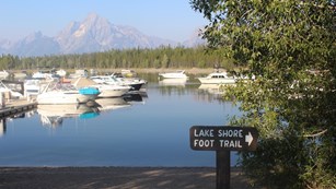
At the Colter Bay Visitor Center
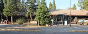
Rangers offer programs, for example: “Colter Bay Lakeshore stroll, every day at 8:30 AM (two hours) from June 11, 2026 to September 07, 2026. 2 miles round trip. Easy hike. Meet at the flagpole in front of the Colter Bay Visitor Center.”
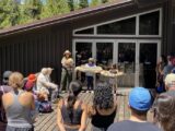 ” Wildlife and You Every day at 11:00 AM from June 11, 2026 to September 07, 2026. Come learn about the amazing wildlife that call Grand Teton home. Discover unexpected human connections with wildlife, and how to see them safely during your trip. Meet at the Colter Bay Visitor Center back deck.”
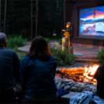
And usually, a Colter Bay “evening talk with a ranger, Sunday-Friday at 8 p.m. Meet at the Colter Bay amphitheater (auditorium if inclement weather).” Different topics, often posted in advance at the visitor center.
__________________________________________________________
![]()
Trails from the Colter Bay cabins and campground :
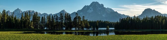
At the north end of Colter Bay there is a 1.5 mile trail with a small causeway out to and around an island. Views from this Lakeshore Trail:
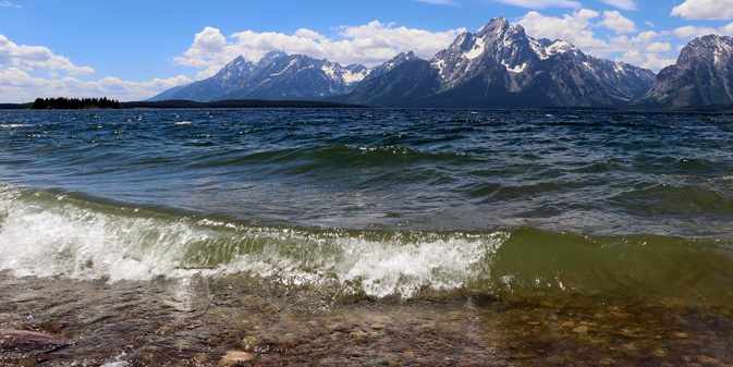
A self-guiding nature trail goes around the island. The Lakeshore Trail starts behind the visitor center or at the day use area or even from the marina.
On the map below of the Colter Bay lakeshore trail, the 6800 is the elevation
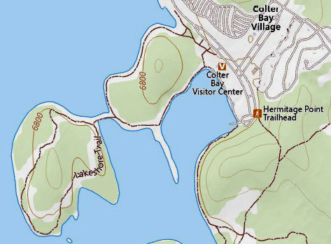
The NPS notes: “The Lakeshore Trail is an easy, 2.2 mi (3.5 km) loop hike with 100 ft (30 m) of elevation gain”
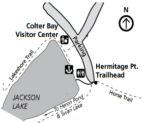
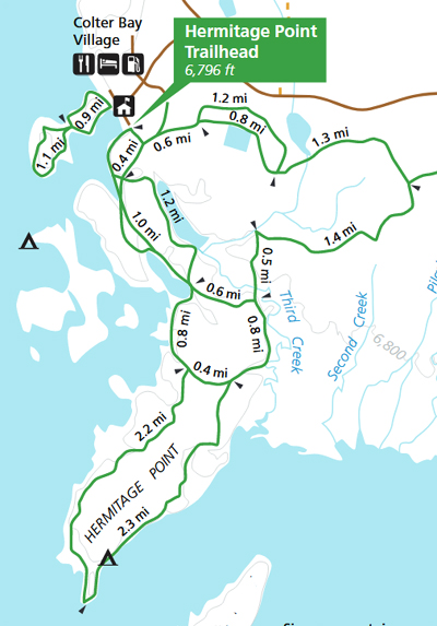
The Hermitage Point Trail goes out to Heron Pond and Swan lake 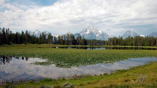
For a full day hike, you can follow the Hermitage Point trail along Third Creek, out to a peninsula on the lake and follow the shoreline of Jackson Lake back to the marina
The NPS notes: “The Hermitage Point Trail is a moderately strenuous, 9.5 mi (15.3 km) loop hike with 930 ft (280 m) of elevation gain and an average slope of 4%. While relatively flat, the trail is long and contains obstacles, such as branches, roots, and exposed rock.”
The Swan lake Trail can be “temporarily closed for the safety of visitors and wildlife”
(for nesting birds to have peace and quiet).
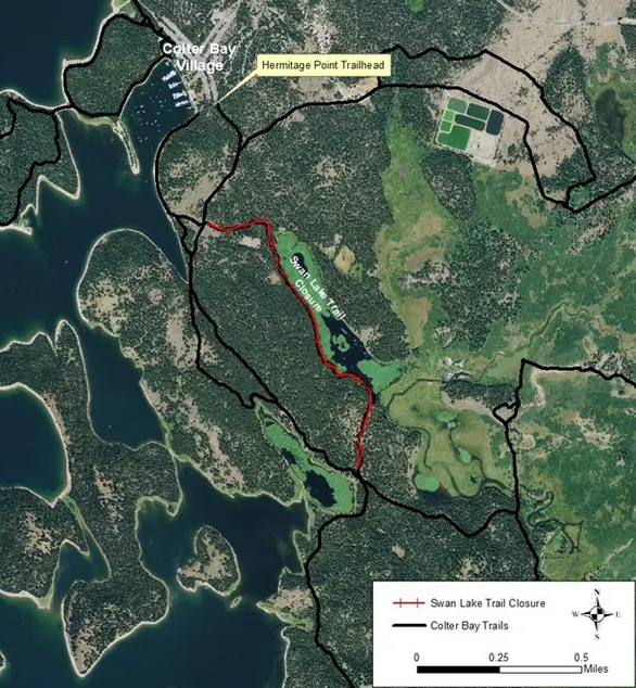
On the NPS photo trail map below, you can find the Colter Bay Campground, Colter Bay Cabins, Colter Bay tent village and Colter Bay village streets in the lower right corner, as well as Donoho Point, Hermitage Point, Half Moon Bay, Colter Bay, Little Mackinaw Bay, Willow Flats, Pilgrim Creek, Elk Island, Heron Pond, Swan Lake and Cygnet Pond
![]()
(The trail map above is oriented the usual way with north at the top, the photo map above is not.
—————————————-
Most years there is a fee or free (for guests at Colter Bay cabins) shuttle bus back and forth a few times a day from Colter Bay to Jackson Lake Lodge, Jenny Lake Visitor Center, and into town, usually with a stop at the biggest grocery. Please note that if you go all the way into town on this shuttle you must come back through a ranger staffed entrance station, and most years you will need to either have a park pass in your name or pay the daily rate to get into the park. Check with the shuttle driver before you use the shuttle. By way of an example (but get the current copy at the hotel front desk)
Most people on our trips who have used this free shuttle have only used it for a round trip to town for a day long exploration, or to get to Jackson Lake Lodge (swimming pool/restaurants/trail rides) if they have a ride back or perhaps to the Jenny Lake area for a hike or for the return after a backpack so a driver does not have to plan their day around your return time and you can take your time coming back.
Please carefully note exactly where you meet the bus and the latest return times from each location.
The bus does not wait around for people.
Once in the town of Jackson there is FREE for anyone shuttle, usually 6 ish a.m. to 10 ish p.m. The route map is worth printing just for the list of things that are at various stops:
Activities besides free hikes, ranger walks/talks and visitor centers
Horseback riding: In the fall the corral at Colter Bay sometimes closes before we are there, Jackson Lake Lodge is often open longer and you can take a horseback trail ride: 307 (543-3100)
If your driver doesn’t want to go on a general sightseeing tour, you can pay for one
1 (307) 543-3100.
Boat Cruises with or without meals (“Early 2026 season closure. Meal cruises will end on July 13th, 2026.”) (“Early 2026 season closure. Scenic cruises will conclude on July 16, 2026.”)
But on some of our fall trips the ‘bay’ at Colter Bay has been a mud flat due to irrigation water being drained from Jackson Lake.
_______________________________________
Side trips
Often in the past people have made the drive home into some variation of a nine-national-parks-plus-Las Vegas-or-Seattle-and-the-Pacfic-Coast-highway-in-six-days-road trip. (One student went to the trip with other current students and after the trip, headed for the college back east he was transferring to.)
Most people also go to Yellowstone National Park, which borders to the north on Grand Teton.
The south border of Yellowstone is only 8 miles from the north border of Grand Teton. It’s possible to do the whole figure eight sightseeing loop of Yellowstone’s main road (the Grand Loop) in one day, but not advised unless that is all the time you have. Cumulative mileages: Upper Loop 70 mi/113 km, Lower Loop 96 mi/155 km, Grand Loop 142 mi/229 km.
See a Yellowstone road work map with roads that you can expect delays and overnight closures.
The Yellowstone Park newspaper, that you get a copy of when you enter the park, offered a map of cell phone coverage (summer 2025), that said “Approximate Cell Phone Coverage: Verizon all shaded areas, AT&T Canyon to Tower, Union Telecom Grant Old Faithful, Mammoth.”
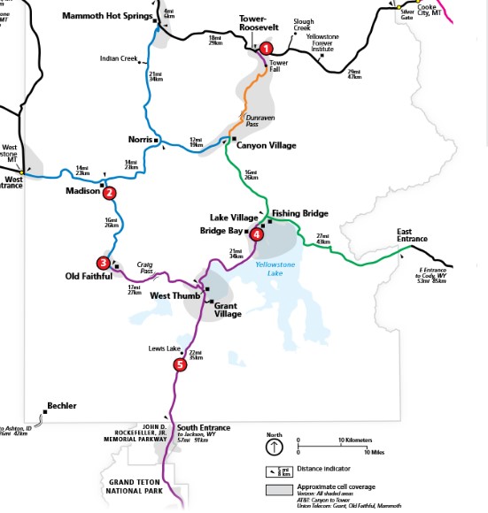
Some advice on a visit to Yellowstone National Park, recommended hikes, link to the app for time Old Faithful geyser is expected to next erupt are at: Yellowstone.
An app for Yellowstone National Park info
(best downloaded before you get there when you can find reliable internet),
with info about visitor centers, historic places, natural features, and services throughout the park.
“Even without cellular service, the app will be able to share your location on the map and bring up all site content.”
Books to download for free instead of buying them at a visitor center, (well worth looking at for info about animals and much more before you go on the trip) are listed at Recommended Reading
![]()
A side trip to the Canadian rocky mountains, for example to Banff National Park, Alberta, could be combined at the end of the trip with a one day (or longer) tour of Yellowstone.
From Colter Bay thru Yellowstone, a tour including West Thumb, Old Faithful , thru Madison and on to West Yellowstone, can be done in one day, with time for stops/picture taking, a little exploring.
From West Yellowstone (many campgrounds, hotels in the vicinity) it is only ten hours (shorter time if you don’t drive thru Calgary, and if the border crossing is short) to Canmore, Canada (just south of Banff, and preferred to Banff for fewer crowds), and this view from a hotel we stayed at:

If there is any chance you will decide to go the Canada on our trip you will need a passport (or NEXUS card). If you do not have one, it can take awhile to get, since you need to bring in a birth certificate when you apply for a United States passport and the birth certificate can take awhile to get.
![]()
And you will need a Canadian Non-Resident Interprovincial Motor Vehicle Liability Card, sometimes called a “Canadian ID card”
(FREE from your insurance carrier). See logistics of driving to Canada.
![]()
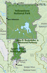
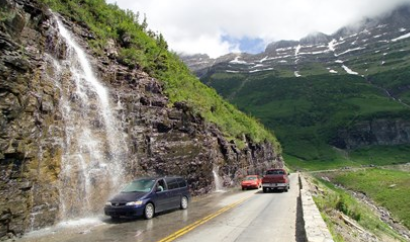
This next side trip could also start with the one day tour of Yellowstone mentioned above, but instead of heading for Canada (or along with going to Canada), another very recommended side trip would be to Glacier National Park.
It is only 6 hours from West Yellowstone to Glacier National Park
From the park:
“NEW IN 2021
Glacier National Park is instituting an online reservation system (ticketed entry) for the Going-to-the-Sun Road corridor between the park’s West and St. Mary Entrances for many summers. Visit the Vehicle Reservations webpage to learn more.
Here a map showing the location of Glacier Park, just south of Canada, in relation to the location of Grand Teton and Yellowstone (the dotted yellowish line diagonally across the map is part of the Continental Divide):
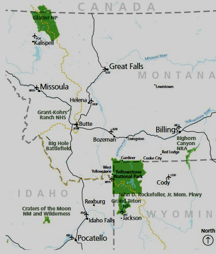
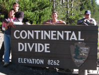
The Continental Divide is “an invisible line that separates the major watersheds flowing to different oceans.”
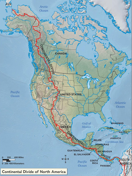
You will likely cross it more than once on our trip if you go to Yellowstone.
![]()
 Some students have said they also want to see Mount Rushmore. George Washington, Thomas Jefferson, Theodore Roosevelt and Abraham Lincoln are carved about 60 feet tall into rock. Please note that it is a 7+ hour drive east from the east border of Yellowstone. (475 miles from our Colter Bay location to Mount Rushmore.)

If you make plans to visit other U.S. National Parks on the way to and from the trip, please be sure to understand any timed entry / reservations systems for an entire park, or a reservation required just to drive a major scenic roadway or just to do a popular hike.
Most carpools and/or people driving by themselves notice
how to save oooodles on money on the park entrance fee(s):
Each carload will pay their own park vehicle entrance fee. Effective June 1, 2018 (and in 2026) the park entrance fee will be $35 per vehicle, or $30 per motorcycle, and an annual (Grand Teton park only) park pass will cost $70.
$35 is for for seven days (only one week and most people go on this trip for more than one week and want to see adjacent Yellowstone National Park as well, which has it’s own weekly fee).
If you stay for more than one week and visit Yellowstone, this would come to $105 if you buy 3 separate $35 passes, so
you save money by investing in a $80 National Parks and Federal Recreation Lands annual pass. Then you will get in free to see other National parks on the way to and from Grand Teton and get in free to Yosemite if you go on a winter adventure with the club.
OR better yet, find someone to carpool with who already has a National Parks and Federal Recreation Lands annual pass
OR find someone who is an active duty U.S. military member or dependent and has their ID Card (CAC card or form 1173) and can get a free national parks pass
OR find someone who is 62 or over to get a lifetime seniors pass for $80.
(You can pay for the pass at the entrance station as you enter the park. The passes can’t be transferred/shared so the person who gets the pass needs to be in the vehicle and show a photo ID.)
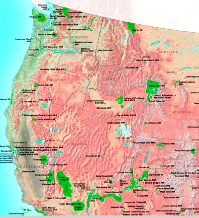
The pass will get you FREE ENTRANCE (for one full year) to any of the 63 U.S. National Parks (and many more National Historic Reserves, Monuments, Seashores). California has nine U.S. National Parks, Utah has five, and Colorado has four, Washington and Wyoming each have two, Montana and Oregon each have one U.S. National Park.
People on previous trips have visited these parks on the way home from Grand Teton:
Natural Bridges National Monument
and free entrance for the winter quarter Outdoor Club trip to Yosemite National Park.
Below a simple map of the places in the western United States (in green) you and everyone else in a car you are in can get free entrance to if you have a National Parks and Federal Recreation Lands annual pass:
_______________________________________
TOTAL COST???
Since different people will have different budgets: drive or fly; some may camp, (but in fall they should expect regular rain, possible snow and cold overnight temperatures and well as warm sunny days), some may get a hotel room, some may get a cheap cabin, the trip cost will vary.
Grand Tetons trip cost has examples of
The cheap trip,
The not-so cheap trip,
The slightly more costly trip, but less driving time, also known as the I-can’t-get-much-time-off-work trip,
and The expensive trip (rent a giant condominium, try parasailing, private stargazing, sunset airplane sightseeing tour . . . )
For details about our next club trip to Grand Teton National Park, go to: Grand Tetons.
Grand Tetons trip pages index has brief descriptions of most of the pages about this trip.
_______________________________________
Grand Teton and Yellowstone driving distances
Idaho Falls- Jackson 86 miles
Jackson – Gros Ventre river 7 miles
downtown Jackson to the Jackson Hole airport, 9.4 miles about 13 minutes.
Jackson to Yellowstone National park southern entrance 57.3 miles, often at least 1 hour 13 minutes +/-
Jackson at south highway 89 to Colter Bay 43 miles
Jackson to Moose on a bike, a bike shop said 29 miles, (more if from a different location in Jackson), total bike time 3 hours.
Gros Ventre river – Moose 6 miles
Moose – Moran 18 miles (30 KM)
Moran Junction (entrance station)- Jackson Lake junction 5 miles (8 KM)
Moose – Colter Bay 28.6 miles
Moose – Jenny 10 miles
Moose – downtown Jackson at the Visitor Center 12 miles
Jenny – Jackson Lake Junction 11 miles
Jenny – Colter Bay 18 miles
Jackson Lake Junction – Colter Bay 10 miles
Jackson Lake Junction – north border of Grand Teton National Park 16 miles (26KM)
Jackson Lake Junction – north Jenny Lake junction ( turnoff to String Lake) 8 miles (13KM)
Colter bay – Old Faithful, Yellowstone 58.4 miles
Colter Bay – West Thumb, Yellowstone 39 miles
Colter Bay – Signal Mountain Lodge 9.4 miles
Colter Bay – Leek’s marina 2.4 miles (one source says 6 minutes)
Colter Bay – Jackson Lake Lodge 5.9 miles (one source says 5.4 miles, 9 minutes)
Colter Bay – String Lake 18.1 miles (and often an hour long drive)
Colter Bay – Jenny Lake 19.6 miles
Colter Bay – Jackson airport 30.7 miles
Colter Bay – Dairy Queen Grill & Chill, North Cache Street, Jackson 39.3 miles
Colter Bay – Jackson Visitor Center 39.9 miles
Colter Bay – Albertsons, Buffalo Way, Jackson 42 miles (and often an hour long drive)
Colter Bay – Whole Foods Market, U.S. 89, Jackson, 42.7 miles
Moran – West Thumb Yellowstone 48 miles
Moran – Old Faithful Yellowstone 66 miles
West Thumb Yellowstone – Madison Junction 33 miles
Madison Junction Yellowstone – Norris Junction 13 miles
Norris Junction Yellowstone – Canyon Junction 12 miles
Canyon Junction Yellowstone – Lake Junction (fishing bridge) 15 miles
Lake Junction ( fishing bridge) – West Thumb Yellowstone 20 miles
Old Faithful Yellowstone – Boseman, Montana 119 miles
Old Faithful Yellowstone – Cody, Wyoming 116 miles
Old Faithful Yellowstone – Idaho Falls 138 miles
in Yellowstone, the cumulative mileage
for the upper loop is 70 miles (113 KM)
for the lower loop is 96 miles (155 KM)
the Grand Loop is 142 miles (229 KM)
_______________________________________
![]()
Top reasons not to speed in a National Park has defensive driving advice.
The author of this webpage, (written as a reading assignment for my students), does not give any warranty, expressed or implied, nor assume any legal liability or responsibility for the accuracy, completeness, or usefulness of any information, product, or process included in this website or at websites linked to or from it. Users of information from this website assume all liability arising from such use.