Half Dome Village was once the temporary name of Curry Village.
Please see the more recently updated (once the original names of Yosemite properties were reinstated),
map of Yosemite day use parking lot at Curry Village
I am leaving this page for reference.
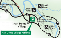
In the map below, the Curry Village (briefly named Half Dome Village) day use and guest use parking lot is the green square with the letter P in white in the center of it.
(When Yosemite National Park reinstated the names of places like Curry Village I moved this webpage to:
map of Yosemite day use parking lot at Curry Village
and I will be more likely to keep the new page updated than to keep this version updated.
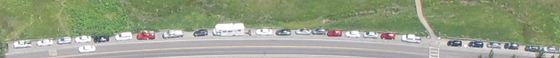
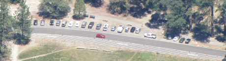
In the aerial photo below you can see the day use and guest parking lots at Curry Village (briefly named Half Dome Village), Yosemite National Park.
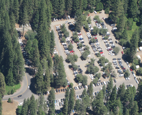
The rows of cars at the bottom, running right to left are in the lot designated for guests of Curry Village (briefly named Half Dome Village) . The rows above that, running top to bottom are for day use, and overflow parking for Half Dome Village guests.
The Campground Office is in the upper right hand corner.
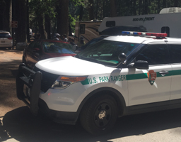
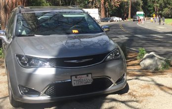
Near the upper left hand corner is parking designated for RVs only. Below a photo of a ranger vehicle parked to talk to the driver of a car that pulled into the RV parking only area and blocked legally parked RVs from being able to pull out.
– – – – – – Whenever you park in an area you are not familiar with, take a photo on your smart-enough phone, standing a bit away from where you parked, so you can find your vehicle.- – – – – –
– – – – – – – – – – – – – – – – – – – – – – – – – – – – – – – – – – – – – – – – – – – – – – – – – – – – – – – – – –
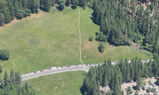
In the photo below, the parking lot is in the lower right corner.
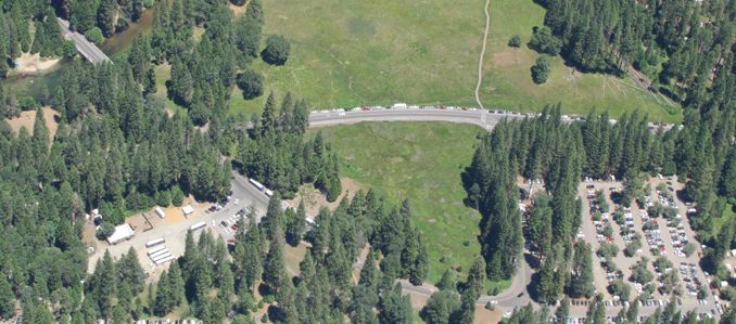
Stoneman Bridge crosses the Merced River in the upper left of the photo above, on the one way, two lane road to:
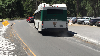
Yosemite Village free day use parking, the Yosemite Village/museum/store, Camp Four and the trailhead for upper Yosemite Falls, Yosemite Lodge, Yosemite Falls, Yosemite Falls day use parking, the Ahwahnee Hotel (briefly named the Majestic Yosemite Hotel) and park exits. This road section is two lanes in one direction, get in the left lane because the right hand lane is for buses/ambulances only, as are some other roads in the valley.
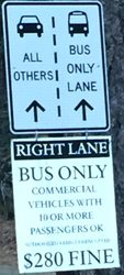
In busy traffic times, if you get tired of waiting for traffic to move, and think you don’t see an officer, so you move into the bus only lane, you might find two law enforcement rangers on bikes stopping you:
![]()
– – – – – – – – – – – – – – – – – – – – – – – – – – – – – – – – – – – – – – – – – – – – – – – – – – – – – – – – – –
Below that road section, one way Southside Drive comes in from the left to an intersection hidden in the trees on the left in the photo below. On some maps the road changes name to Happy Isles Loop Road.
The section of Southside drive (Happy Isles Loop Road) at the center of the photo, showing above the parking lot, runs to the Pines Campgrounds, trailhead parking, and a shuttle bus road around to Happy Isles/trailhead for Vernal mist trail and Nevada falls, a trailhead for Mirror Lake, and the stables. Find locations and details about each of these at the Yosemite free shuttle bus page.
The most current route map for the free Yosemite Valley shuttle bus is in the Yosemite Guide newspaper https://www.nps.gov/yose/planyourvisit/guide.htm
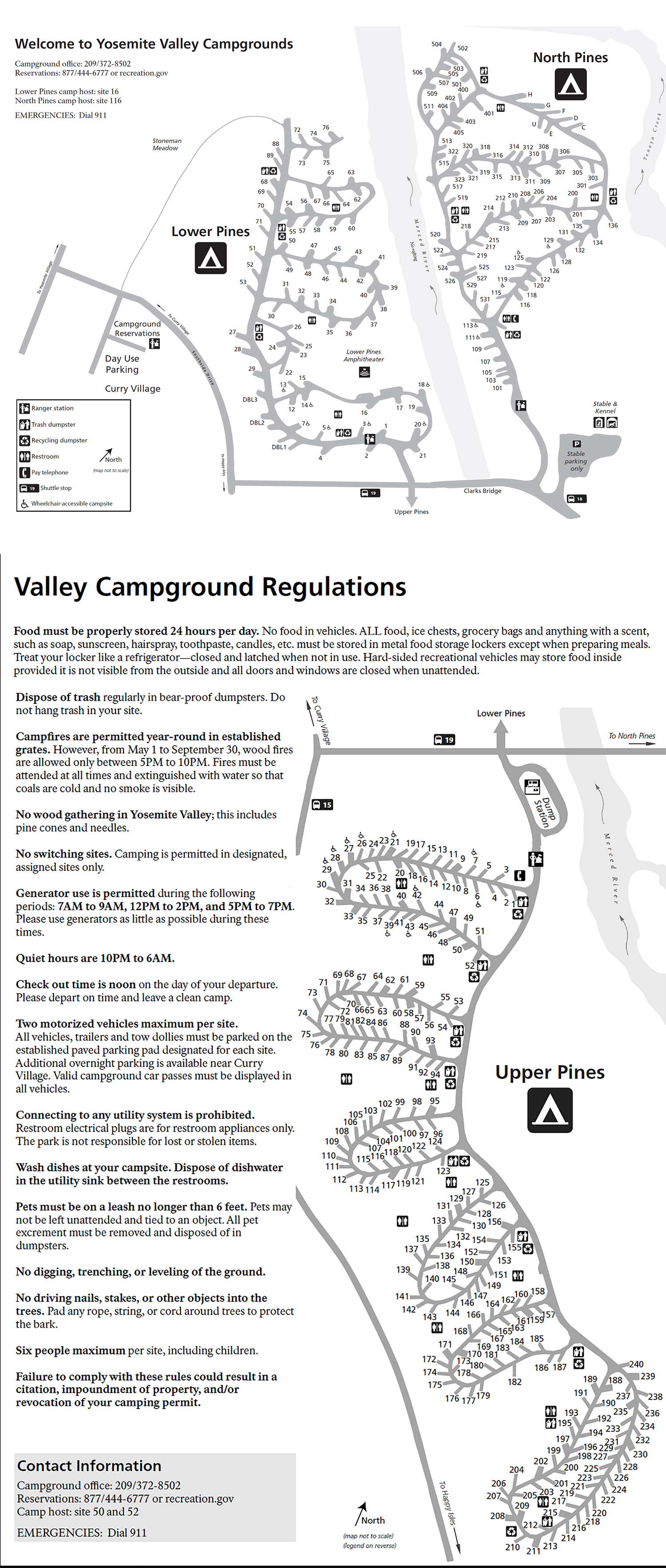
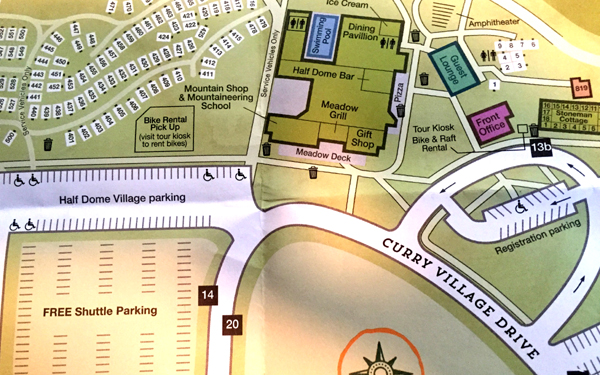
(Most maps people are used to have north at the top and and south at the bottom, but this next one has north and south reversed, so it will seem different than the photos above.) If you stay overnight at Curry Village (briefly named Half Dome Village), in this map note the office you will check in at, the pink almost-square labeled “Front Office” and the free Yosemite Valley shuttle bus stops 13b, 14 and 20.
Find pictures and details about COST and AVAILABILITY of all potential Half Dome Village overnight accommodations, including Curry Village (briefly named Half Dome Village) tent cabins, wood walled cabins without a bath, cabins with a bath, cabin 819, and Stoneman Cottage, as well as the shower house, pool, restaurants, bike and raft rentals, guest lounge with WiFi at Yosemite Valley Overnight Accommodations.
Here is a link to a map at their website, of all the tent cabins / cabins without a bath (in white) and wood walled cabins with a bath (in orange) /shower house/restrooms/pool/restaurants and more.
http://www.travelyosemite.com/media/524862/half-dome-village_property-map_web.jpg
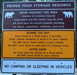
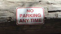
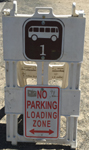
Bears have broken in to vehicles in Yosemite National Park (all year). Bears, Ravens and raccoons get into that ice chest you left in the back of your pickup truck and food storage rules apply all over the park, as in this sign at the Curry Village (briefly named Half Dome Village) day-use parking lot:
__________________________________________
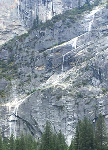
A boardwalk leads across Stoneman Meadow across the road from the day use parking lot (lower right corner of this photo) to Lower Pines Campground:
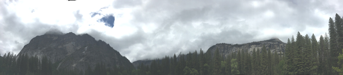
With one of the best views of Staircase Falls, here in full flow in May:
and in this panorama, Staircase Falls on the left and upper Yosemite Fall on the right, both barely visible in this photo, but striking in person:
__________________________________________
The National Park Service warns:
“Each year, Yosemite National Park welcomes over four million visitors. If you are planning to visit Yosemite, plan ahead and arrive early. In summer, expect extended traffic delays and extremely limited parking. Expect delays of an hour or more at entrance stations and two to three hours in Yosemite Valley . . . If you are planning to visit Yosemite valley by car for the day, arrive before 9 am, after which parking is usually full.
Parking is available at Yosemite Village, Curry Village (briefly named Half Dome Village), and near Yosemite Falls. If you find a parking space, plan to leave your car there; you will not be able to find another parking spot. Use the free shuttle to get around Yosemite Valley.
If you have lodging or campground reservations, park your car at your lodge or campground and use the shuttles to get around.
Once all parking in Yosemite Valley is full, you may be redirected to other areas (which will also have limited parking).”
Here is a map of the three main Yosemite Valley day use parking lots:
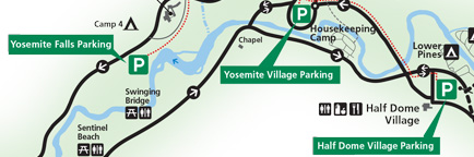
See details about more parking lots in Yosemite for people without an overnight accommodation (day-use parking) at Parking and Traffic Jams in Yosemite Valley Tips and Tricks.
__________________________________________
You can park along sections of some roads,
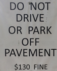
but if you park off the side of the road, not in a parking space, (as in the photo below, off road behind a large rock meant to deter anyone from parking there) you can get a parking ticket with a minimum $130 fine (ticket under the windshield wiper) in this photo:
Putting on your emergency flashers when you pull into a shuttle stop driveway does not turn it into a parking space for you, and when the shuttle bus arrives you will be honked at to move, as the red car below was:
Did they not see the two signs at the side of the shuttle stop driveway/shuttle parking space?
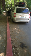
A red painted curb is a no parking zone anywhere in the U.S., (including Georgia, where this mini-van was from), and in national parks, in part because some red curbs mark the space an ambulance or fire truck would need to get by. Yes, no parking is allowed even if one family member stays in the vehicle while the other rushes in to shop:
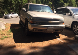
Each space in a parking lot is usually paved, has painted stripes and has a concrete beam your tires would hit to keep you from going too far (see the car on the right). In this photo, the driver of the SUV on the left decided to move into the dirt/plants to the side of a parking space at the end of a row, with tires slightly into the legal space already occupied by someone else. Ooops, tires partially in that space does not make it legal.
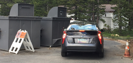
Did this driver from Arizona move the no parking a-frame sign over, or was it already moved over and he choose to ignore the sign, red cone, “No Parking” in large letters on the pavement and two giant trash dumpsters?
When a helicopter needs to land in the Ahwahnee meadow across the road from Church Bowl, to pick up someone who needs to go to a bigger hospital, (or when a helicopter needs to land for Search and Rescue training) people are asked to stay on the restroom/picnic area side of the road, and traffic going through is stopped. Because you won’t know a helicopter is coming and won’t be able to move your vehicle fast enough, the entire meadow side of the road at Church Bowl is closed to any parking at all times, (even to get out and quickly take a picture or use the restroom).
In this photo you can see a few parking spaces in a row alongside the road and the stripes for no parking on the other side of the road:
__________________________________________
Top reasons to not speed in a National Park.