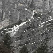
Staircase Fall,
which cascades down a cliff face as if down a flight of stairs,
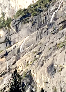
(one of the first Yosemite waterfalls to dry up after spring flow)
comes down into Yosemite Valley from between Glacier Point and Moran Point
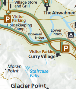
to Curry Village, free shuttle bus stop # 14 & 19, behind the cabins with bath,
and can also be seen at the Curry Village parking, stop 14 & 19,
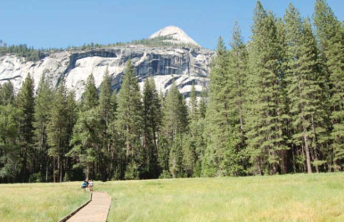
or a better view walking from those bus stops out to the boardwalk across Stoneman meadow.
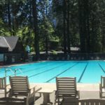
And can be seen from the back lawn of the Ahwahnee and some of the Ahwahnee hotel rooms, stop #3.
and from the Ahwahnee swimming pool, here with the falls partially frozen in February:
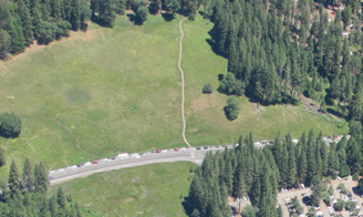
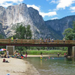
A boardwalk leads across Stoneman Meadow across the road from the Curry Village day use parking lot (lower right corner of this photo) to Lower Pines Campground:
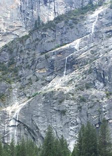
Along this boardwalk is one of the best full views of Staircase Falls, here in full flow in May:
A Google maps 360 degree view shows upper Yosemite Fall, the top of Royal Arch Cascade, the Royal Arches, North Dome, (if you tip the photo up a little) Glacier Point, and Staircase Falls as seen from along the boardwalk.
This photo is from the Merced River Plan (look for page H-21), which has a description of the view the park seeks to improve by removing 94 Ponderosa and 66 Cedar trees that have grown along the edge of Stoneman Meadow. “the Stoneman Meadow boardwalk is located at the intersection of Happy Isles Loop Road and Curry Village Road. The boardwalk gives visitors a panoramic view of the meadow and many other significant Yosemite landmarks such as Glacier Point, North Dome, Royal Arches, and Washington’s Column. Half Dome can be seen in the distance to the east and Yosemite Falls can be seen in the distance to the west. The primary vista to manage at this site is the view to North Dome, Royal Arches and Washington’s Column where conifers have encroached onto the edge of the meadow.”
![]()
and see:
Locations to take pictures of Bridalveil Fall in Yosemite National Park (with maps)
Places to take photos of Half Dome in Yosemite National Park (with maps)
Places to take photos of Yosemite Falls in Yosemite National Park (with maps)
Places to take photos of El Capitan in Yosemite National Park, (with maps)
Places to take photos of Clouds Rest in Yosemite National Park with maps
and see: Paintings of Yosemite https://www.nps.gov/yose/learn/historyculture/paintings-of-yosemite.htm
And see shots of Yosemite valley from Glacier Point. (You can not see Staircase Falls from Glacier Point.)
![]()
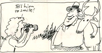
Selfies can be great, OR dangerous. The use of cell phones for photography has made preventable injury or even death by selfie common. They were only taking a selfie
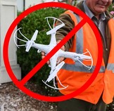
Fireworks and drones (unmanned aircraft) are banned at all times in all National Parks.
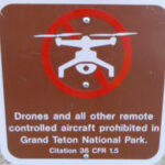
The NPS tells us that the use of unmanned aircraft (e.g., model airplanes, quadcopters, drones) has resulted in noise and nuisance complaints from park visitors, park visitor safety concerns, and incidents in which park wildlife were harassed. Small drones have crashed in geysers in Yellowstone National Park, attempted to land on the features of Mount Rushmore National Memorial, been lost over the edge of the Grand Canyon, and been stopped from flying in Prohibited Airspace over the Mall in Washington DC.
__________________________________________________________
See an index of rules and regulations webpages.
Yosemite trail conditions info
How much water will there be in the Yosemite waterfalls?
Park Service videos about Yosemite
Yosemite National Park webcams
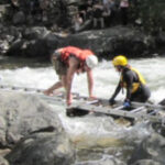
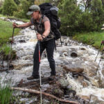
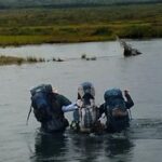
The best place to cross a creek or river is on the bridge built for this endeavor.
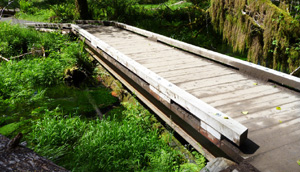
Crossing streams safely includes advice from Mount Rainier National Park, Yellowstone National Park, Great Smoky Mountains, and Yosemite National Park
– – – – – – – – – – – – – – – – – – – – – – – – – – – – – – – – – – –
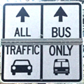
Drivers should note that there have been sections of road in Yosemite Valley, part of the year, with two lanes (usually) in the same direction, with the right lane ONLY for the free shuttle buses, ambulances, ski bus, commercial vehicles with ten or more passengers. The NPS says: “The bus lane ensures emergency vehicles can respond to incidents when traffic is backed up and provides preference for mass transit.”
Parking and traffic jams in Yosemite valley tips and tricks has the above advice, with maps of each of the three major day-use parking lots, with advice to help you NOT get a Yosemite National Park traffic or parking ticket, and not contribute to preventable traffic backups. And some details of where you can’t park in Yosemite, or can’t park without a permit.
– – – – – – – – – – – – – – – – – – – – – – – – – – – – – – – – – – –
Hotel, cabin and tent cabin choices in Yosemite valley are at: Yosemite Valley accommodations

Restaurants, cafeterias, coffee bars, pizza, grocery stores are at: Yosemite valley restaurants


swimming in Yosemite including thunderstorms, bacteria in the water, safety issues, favorite beaches, swimming pools with lifeguards, places you should not swim.
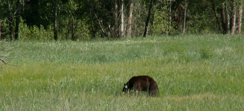
The Yosemite National Park rangers would like you to call them
if you see a bear in Yosemite,
no matter where it is or what it is doing.
Since 2003 there has been a note in the Yosemite Guide: “REPORT ALL BEAR SIGHTINGS! To report bear sightings, improper food storage, trash problems, and other bear-related problems, leave a message for the Bear Management team at: 1 (209) 372-0322. Your call can be made anonymously.”
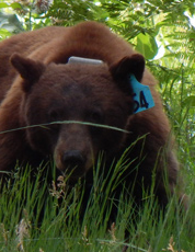
If you can, in all the excitement, try to notice if the bear has a tag (usually on the ear), the color of the tag and if possible, the number on it (the tag is large enough that with a telephoto lens you should be able to read the number).
The NPS notes: “Tagged, or radio collared, bears do not mean the bear is a “bad” bear. Tagging bears is done for better monitoring, and the ear tag color is completely random, used to help quickly identify a bear.”
From the Yosemite Daily Report newspaper:
“It is extremely important to remember to yell at bears that are in and around development, even if they are foraging on natural food. Though it is very tempting to get close for a picture, or just to watch these incredible animals, it is important not to give into this urge. Yelling at them if they are in residential areas or near people is critical to keep bears natural fear of humans. Giving bears plenty of space. When bears become too comfortable around people, they will often start causing damage to structures and vehicles, or will even become too bold around people, creating safety concerns.”
And the Yosemite Daily Report also said:
“Scare bears when you see them. . . in developed areas- Yell like you mean it!
Make as much noise as possible, try waving your arms, stomping your feet
or anything to make you look intimidating and to get the bear to run away.
We know it’s fun to see bears and it can feel mean to scare them,
but this is a simple way to truly help save a bear’s life.”