There are many locations to view and take pictures of Clouds Rest in Yosemite National Park,
many considered the “best” location to photograph Clouds Rest,
that you can
drive to,
take the free Yosemite Valley shuttle bus to,
take a tour bus to ( and click on Glacier Point Tour)
or take a short walk
or, for a few locations, a long hike to.
Most shown at this page have Half Dome in the photo, to the right of Clouds Rest.
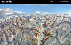
You can download a copy of the Yosemite panorama above
and can crop and enlarge any part of it:
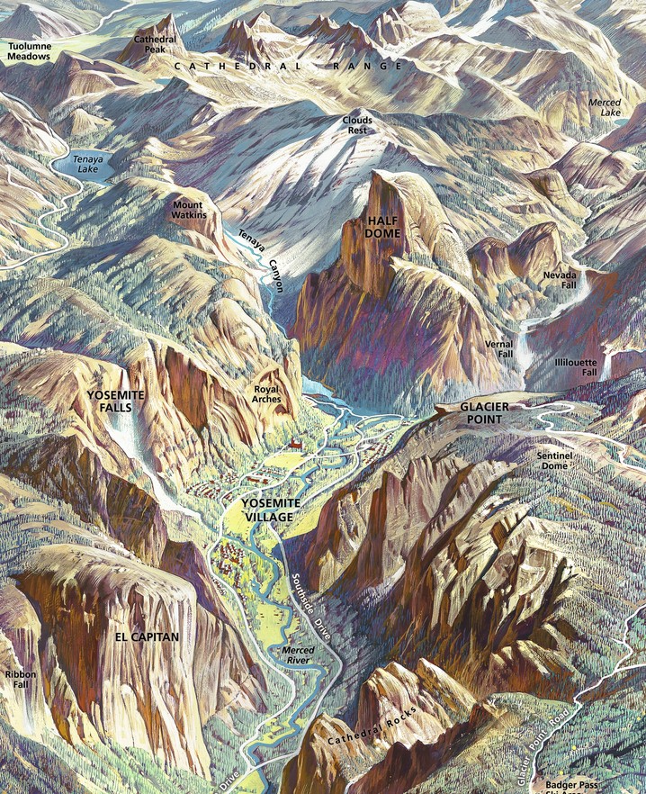
PHOTO LOCATIONS
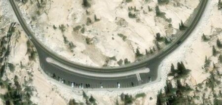
– – – Olmstead Point on the Tioga Road, (closed in winter and sometimes well into the spring in years with lots of snowfall).
Below a photo taken one spring the day after the Tioga Road opened. Clouds Rest is the main set of peaks to the left of center, Half Dome (tiny in this photo) is to the right of it:
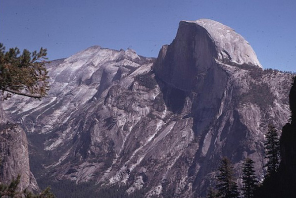
Half Dome from Olmstead Point (without a telephoto):
Once you are past White Wolf, but before Tenaya lake, even if you think you are running late, watch the map and the roadside markers for road marker T24 for Olmstead Point on the right. (Find Olmstead Point on this official park map.)
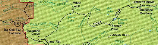
Pull into the big parking lot for at least a short stop to look around.
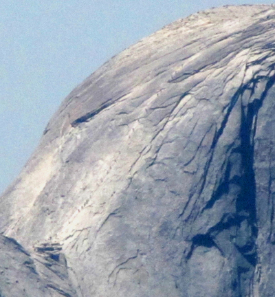
Stop and get out of the car for a look at a different angle at Half Dome than you may have seen, the wide expanse of Clouds Rest and down to Tenaya Lake in the other direction. With a telephoto (photo below) spotter scope or binoculars you can see people (the line of tiny dots in the center of the photo) going up the Half Dome cables.
Google maps 360 degree street view of the Half Dome cables from the subdome.
Google maps 360 degree street view from the top of Half Dome.
__________________________________
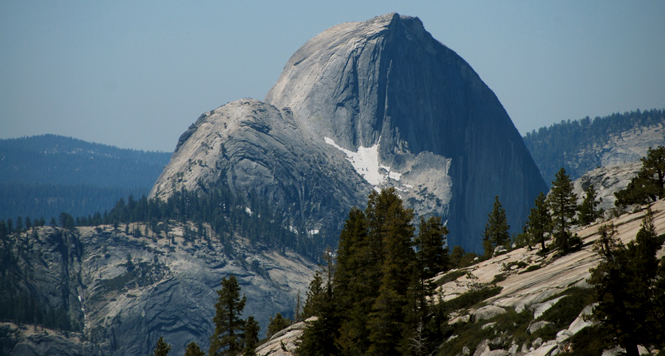
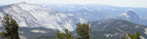
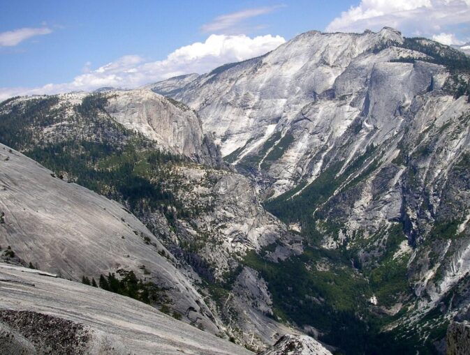
– – – Much the same view of Clouds Rest and Half Dome can also be seen from the trail from May Lake to Mount Hoffman (with binoculars or a good telephoto you can see the hikers on the Half Dome cables),
__________________________________
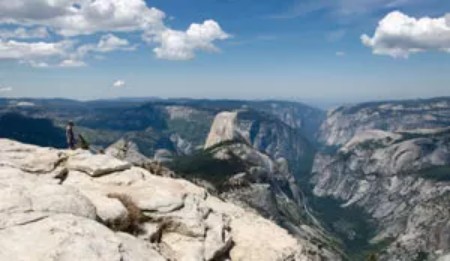
– – – Here, the top of Clouds Rest looking towards Yosemite Valley to the right with Half Dome in about the center of the photo:
__________________________________________
The Yosemite Conservancy offers a webcam view, with Clouds Rest in the center between El Capitan and Half Dome:
https://yosemite.org/webcams/el-capitan/
– – – – – – – – – – – – – – – – – – – – – – – – – – – – – – – – – – –
– – – From Dinner Ledge on Washington Column again, Clouds Rest is to the left of Half Dome:
– – – – – – – – – – – – – – – – – – – – – – – – – – – – – – – – – – –
Here, the view from North Dome, with Clouds Rest on the right top of the photo (you can hike to North Dome, not drive there) :
The hike to North Dome for this view is 10.4 miles (16.7 km) round trip, with an
Elevation Gain: 1,100 feet (335 m)
“The trail descends through pine forests to the top of North Dome on the northern rim of Yosemite Valley.”
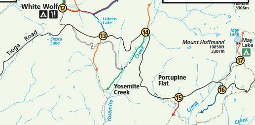
The park service offered this map some of the trailheads along the Tioga Road. The Porcupine Creek trailhead, with an arrow pointing toward North Dome, is number 15
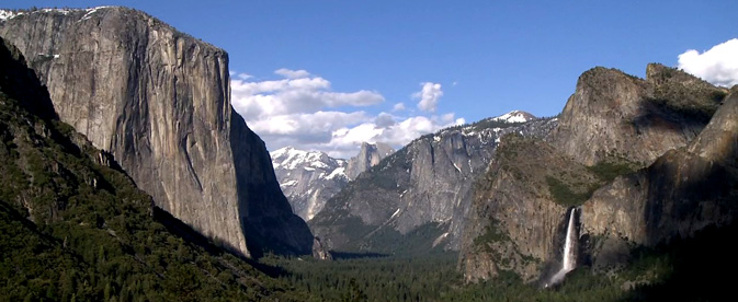
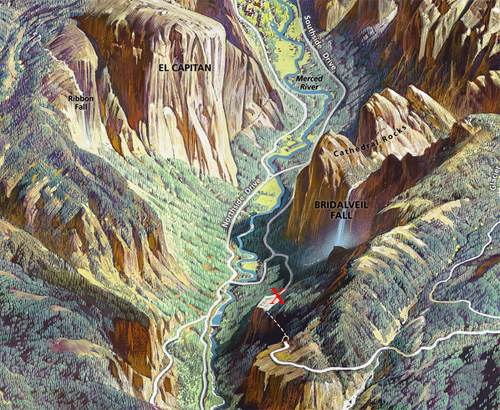
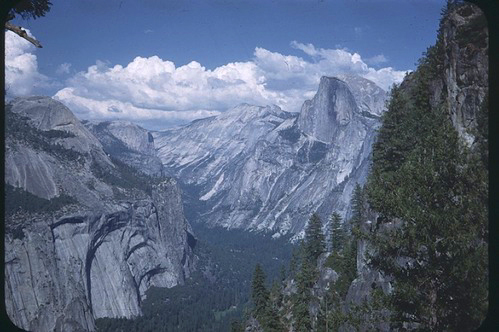
NPS photo of Tunnel View (the massive rock form on the left is El Capitan, in the background in the center is Half Dome, the waterfall on the right is Bridalveil Fall, Clouds Rest is farther down beyond Yosemite valley (in between El Capitan and Half Dome in the photos and paintings below):
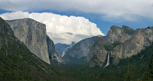
Different times of the year there will be different amounts of snow:
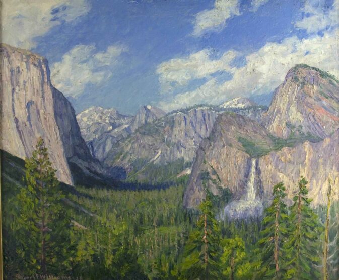
This oil on canvas was painted by Robert F. Williams in 1938:
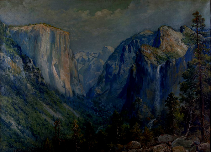
This oil on canvas was painted by Andreas Roth in 1933:
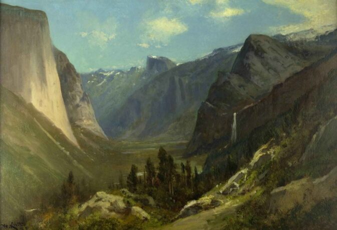
This oil on canvas was painted by William Keith. The NPS notes: “Keith moved to the U.S. from Scotland after 1872. He settled in California, where he became one of San Francisco’s leading artists. Keith made many trips to Yosemite. The artist later befriended fellow Scotsman John Muir, who shared Keith’s lifelong love of Yosemite.”
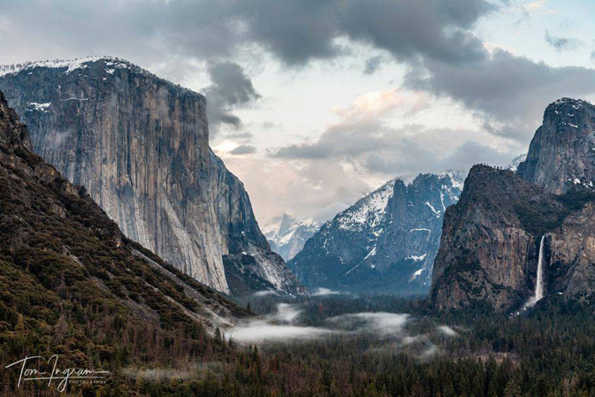
This next photo is courtesy of Tom Ingram Photography, all rights reserved Tom Ingram photography
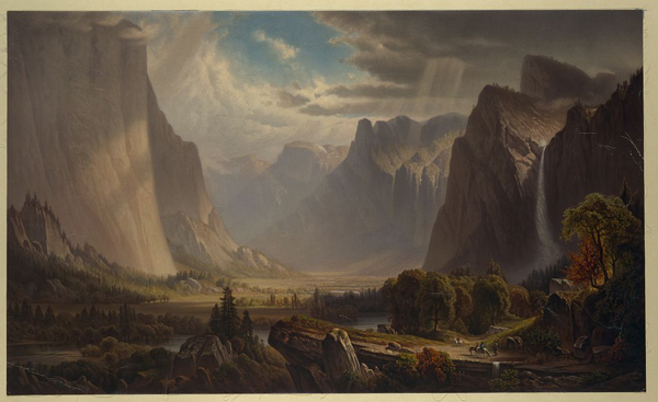
This (1885 +/-) painting by Thomas Hill (photo courtesy of the Library of Congress) is a bit north of the photo above.
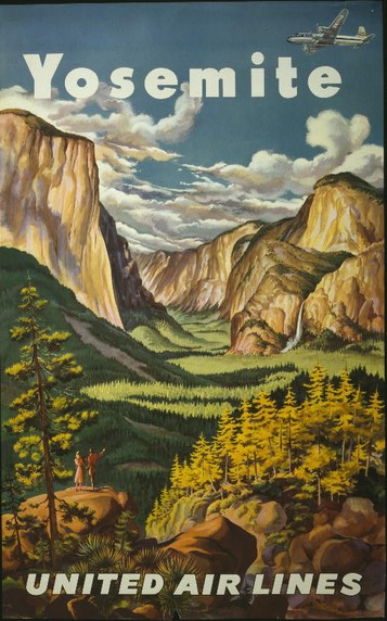
And here, a 1945 drawing from United Airlines:
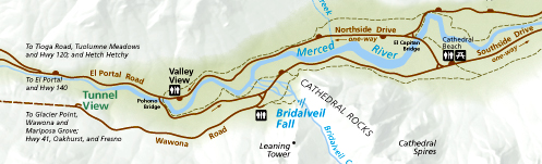
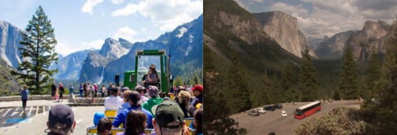
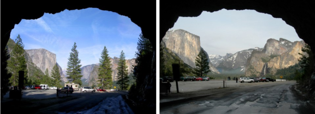
Coming into Yosemite valley on Highway 41, just before the valley, about 7 miles after Wawona, you go through a long tunnel just above the valley floor.
Or you can get to Tunnel View from Yosemite Valley by driving on Northside drive until the Pohono Bridge, then making a left over the river and continuing until a right hand turn (almost U-turn) then up the Wawona Road towards Wawona and Glacier Point road,
(this almost u-turn is the same as you would take entering the valley on Highway 140 to go to Tunnel View) as in the map below
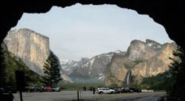 Coming from highway 41, after going through the tunnel, slow down and put on your right blinker at the end of the tunnel and pull carefully into the small parking lot. Walk across the road (watch out for drivers watching the scenery and not seeing you) to the main viewpoint.
Coming from Yosemite Valley, (or via Highway 140) watch for the parking lot on the right before the tunnel.
Many drivers who are watching the scenery do not notice the crosswalk between the two parking lots. If you plan ahead while driving through the area, you can slow down and look for people waiting to cross:
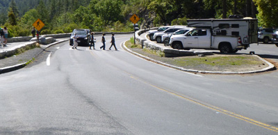
The two parking lots, one on each side of the road, have a small number of parking spaces:
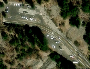
This larger of the two parking lots has a bus parking only section:
At the edge of the large parking lot is a paved section for photographers with a low wall:
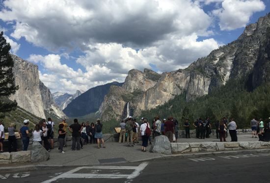
This view is worth stopping for even if you are running late and even if there is rain or snow falling. The Yosemite Fund (now called the Yosemite Conservancy) and the National Park Service funded a remodel in 2008 with educational exhibits, expanded handicap accessible viewing area and improved traffic flow. Thousands of people stop each day in the summer.
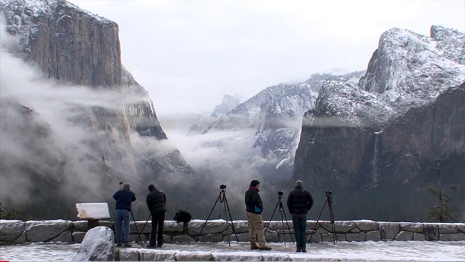
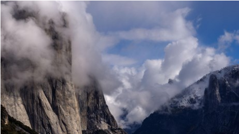
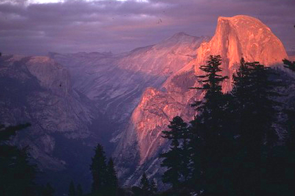
Clouds might hide the full view of Half Dome and Clouds Rest when you arrive, but they usually clear quickly (and can add more drama to your photos):
Here, NPS photos of the Tunnel View before and after trees were cleared that had been blocking the view:
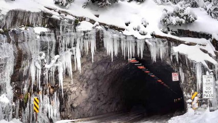
and here, an end of the tunnel in winter (note the Do-Not-Pass-in-the-tunnel sign), and please do expect sometimes icy conditions in the parking lot.
The red X below is where Tunnel View is (the dotted line below the X is the tunnel:
– – – – – – – – – – – – – – – – – – – – – – – – – – – – – – – – – – –
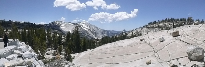
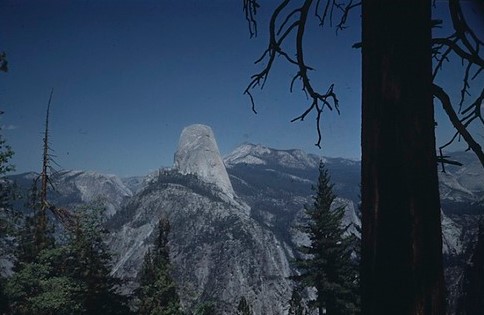
From Sentinel Dome , (a 2.4 mile round trip hike from the Glacier Point road),

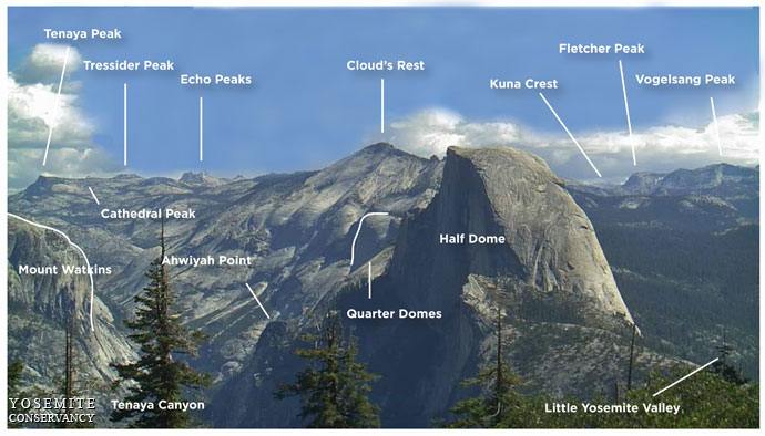
you can also see Mount Watkins, Tressider Peak, Clouds Rest, Kuna Crest, Fletcher Peak, Vogelsang Peak, Mount Watkins, Cathedral peak, Ahwiyah Point, Quarter Domes, Little Yosemite Valley (and Tenaya Canyon. Each of these is identified at:
https://www.nps.gov/yose/learn/photosmultimedia/upload/sentineldome-key.jpg
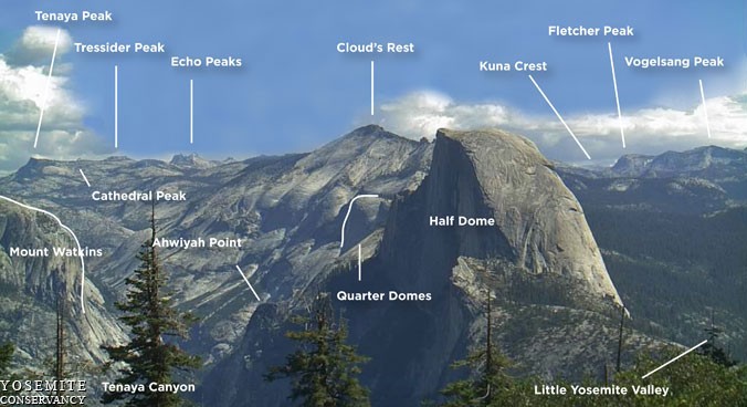
A larger list of what you can see from Sentinel Dome includes, (not all of these are shown or identified in the photo mentioned and shown above ) Mt Hoffman, Mt Conness, Tenaya Canyon, Echo Peaks, Clouds rest, Half Dome, Vogelsang peak, Little Yosemite Valley, Mt Florence, Mt Lyell, Mt Clark, Gray Peak, Mt Starr King, Red Peak, Merced Peak, Merced Pass, Gale Peak, Buena Vista Crest, Illilouette Ridge and Horse Ridge.
– – – – – – – – – – – – – – – – – – – – – – – – – – – – – – – – – – –
Here, the view from the Pohono trail as it approaches Glacier Point (at most of Glacier Point, Half Dome hides the view of Clouds Rest):
– – – – – – – – – – – – – – – – – – – – – – – – – – – – – – – – – – –
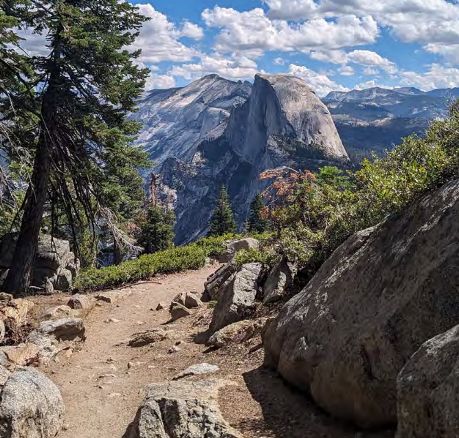
On the Four Mile Trail to Glacier point
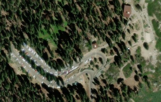
There is limited parking at the Glacier Point parking lot:
People who want to get a bus ride from Yosemite Valley to Glacier Point and back to Yosemite Valley
OR a bus ride up to Glacier Point and hike back down the Four Mile trail or the trail past Illilouette, Nevada and Vernal Falls ,
can do so in months when the Glacier Point road is open. The road has opened anywhere from April 14 to July 1, depending on snow pack. Book a ride on the Glacier Point tour, most years leaving 8:30 a.m. from the Lobby entrance to Yosemite Lodge, http://www.travelyosemite.com/things-to-do/guided-bus-tours/
This photo / map of the Four Mile trail from Yosemite Valley to Glacier Point is on a display in front of the Yosemite Valley Exploration Center (free shuttle bus stop #5:
![]()
– – – – – – – – – – – – – – – – – – – – – – – – – – – – – – – – – – –
– – – on the Illilouette Trail, beyond Glacier Point:
– – – – – – – – – – – – – – – – – – – – – – – – – – – – – – – – – – –
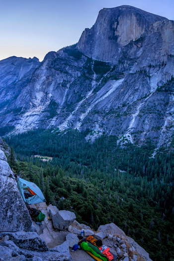
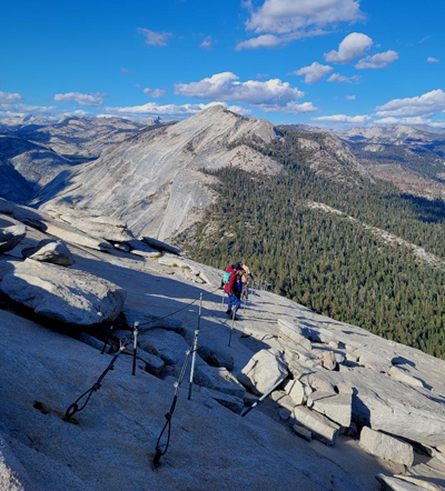
Cloud’s Rest is in the center of the top section of peaks in this photo
from the top of the Half Dome cables,
![]()
Not the right light on your Yosemite trip to get the photo you wanted? You can buy a Yosemite calendar, poster, art work (or t-shirt, hat, coffee mug, magnet, lapel pin) online from the Yosemite Conservancy https://shop.yosemite.org/
and see places to take photos of Yosemite Falls in Yosemite National Park (with maps)
Places to take photos of Bridalveil Fall in Yosemite National Park (with maps)
places to take photos of Half Dome in Yosemite National Park (with maps)
Places to take photos of El Capitan in Yosemite National Park, (with maps)
Places to take photos of Staircase Falls in Yosemite National Park
and see: Paintings of Yosemite https://www.nps.gov/yose/learn/historyculture/paintings-of-yosemite.htm

Selfies can be great, OR dangerous. The use of cell phones for photography has made preventable injury or even death by selfie common. They were only taking a selfie
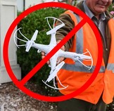
Fireworks and drones (unmanned aircraft) are banned at all times in all National Parks.
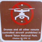
The NPS tells us that the use of unmanned aircraft (e.g., model airplanes, quadcopters, drones) has resulted in noise and nuisance complaints from park visitors, park visitor safety concerns, and incidents in which park wildlife were harassed. Small drones have crashed in geysers in Yellowstone National Park, attempted to land on the features of Mount Rushmore National Memorial, been lost over the edge of the Grand Canyon, and been stopped from flying in Prohibited Airspace over the Mall in Washington DC.
__________________________________________________________
See an index of rules and regulations webpages.
Yosemite trail conditions info
How much water will there be in the Yosemite waterfalls?
Park Service videos about Yosemite
Yosemite National Park webcams
![]()
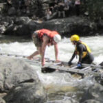
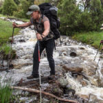
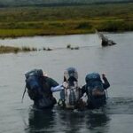
The best place to cross a creek or river is on the bridge built for this endeavor.
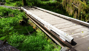
Crossing streams safely includes advice from Mount Rainier National Park, Yellowstone National Park, Great Smoky Mountains, and Yosemite National Park
![]()
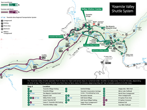
The most current route map for the free Yosemite Valley shuttle bus is in the Yosemite Guide newspaper https://www.nps.gov/yose/planyourvisit/guide.htm , which you will be offered a copy of as you enter the park, or can print in advance.
It looks something like this when there is no road construction, rock slides, excess snow affecting the times/routes:
(Map below courtesy of NPS)
Hiking Advice has HIKING SECRETS and etiquette including hiking in the heat, preventing and/or dealing with blisters, logistics of hiking, a day hike gear list, Half Dome hiking advice, winter hiking and the answer to the question: When is the best time of day to cross a mountain stream?
Videos about Yosemite: https://www.nps.gov/yose/learn/photosmultimedia/index.htm
Yosemite webcams: https://www.nps.gov/yose/learn/photosmultimedia/webcams.htm
![]()
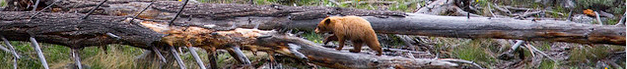
The Yosemite National Park rangers would like you to call them
if you see a bear in Yosemite,
no matter where it is or what it is doing.
Since 2003 there has been a note in the Yosemite Guide: “REPORT ALL BEAR SIGHTINGS! To report bear sightings, improper food storage, trash problems, and other bear-related problems, leave a message for the Bear Management team at: 1 (209) 372-0322. Your call can be made anonymously.”
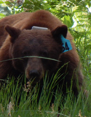
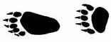
If you can, in all the excitement, try to notice if the bear has a tag (usually on the ear), the color of the tag and if possible, the number on it (the tag is large enough that with a telephoto lens you should be able to read the number).
The NPS notes: “Tagged, or radio collared, bears do not mean the bear is a “bad” bear. Tagging bears is done for better monitoring, and the ear tag color is completely random, used to help quickly identify a bear.”
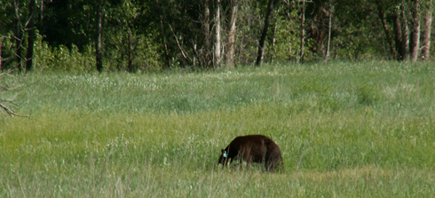
From the Yosemite Daily Report newspaper:
“It is extremely important to remember to yell at bears that are in and around development, even if they are foraging on natural food. Though it is very tempting to get close for a picture, or just to watch these incredible animals, it is important not to give into this urge. Yelling at them if they are in residential areas or near people is critical to keep bears natural fear of humans. Giving bears plenty of space. When bears become too comfortable around people, they will often start causing damage to structures and vehicles, or will even become too bold around people, creating safety concerns.”
And the Yosemite Daily Report also said:
“Scare bears when you see them. . . in developed areas- Yell like you mean it!
Make as much noise as possible, try waving your arms, stomping your feet
or anything to make you look intimidating and to get the bear to run away.
We know it’s fun to see bears and it can feel mean to scare them,
but this is a simple way to truly help save a bear’s life.”
– – – – – – – – – – – – – – – – – – – – – – – – – – – – – – – – – – –
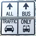
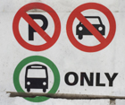
Drivers should note that there have been sections of road in Yosemite Valley, part of the year, with two lanes (usually) in the same direction, with the right lane ONLY for the free shuttle buses, ambulances, ski bus, commercial vehicles with ten or more passengers. The NPS says: “The bus lane ensures emergency vehicles can respond to incidents when traffic is backed up and provides preference for mass transit.”
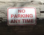
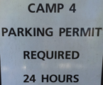
Parking and traffic jams in Yosemite valley tips and tricks has the above advice, with maps of each of the three major day-use parking lots, with advice to help you NOT get a Yosemite National Park traffic or parking ticket, and not contribute to preventable traffic backups. And some details of where you can’t park in Yosemite, or can’t park without a permit.
– – – – – – – – – – – – – – – – – – – – – – – – – – – – – – – – – – –

You can find basic to extravagant, (a few with a dress code),
casual, fast (grab and go)
or with table-side service,
indoor and outdoor food service
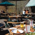
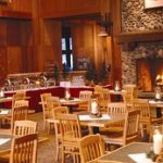
at multiple locations in Yosemite Valley, as well as four grocery stores


all of which are served by the Yosemite valley free shuttle bus.
– – – – – – – – – – – – – – – – – – – – – – – – – – – – – – – – – – –
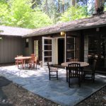
Hotel, cabin and tent cabin choices in Yosemite valley are at: Yosemite Valley accommodations
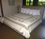
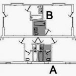
a map of and floor plans for the Ahwahnee cottages is at:
Yosemite Ahwahnee Hotel cottages, (bungalows / cabins) floor plans and map
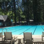
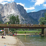
swimming in Yosemite including thunderstorms, bacteria in the water, safety issues, favorite beaches, swimming pools with lifeguards, places in Yosemite you should not swim.