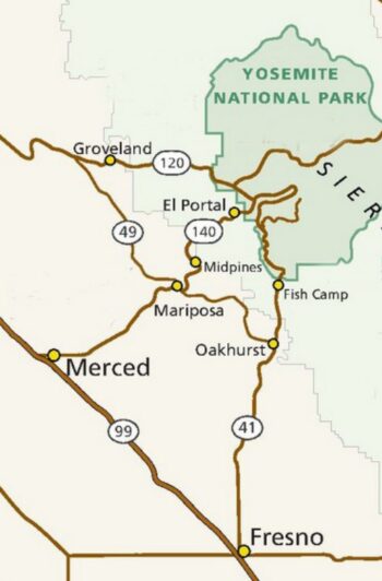
See the park service page with very basic directions to Yosemite National Park from the west, north and south, including highways 140, 120, 41, 49 and 99 (some routes only available June through October, conditions permitting).
Once you are in Yosemite Valley, directions to get to the Ahwahnee hotel from any/all roads/entrances to Yosemite Valley
are after these next notes at this page about
things to do before you leave,
gas availability
and the park entrance fees.
![]()
BEFORE YOU LEAVE:
Possible delays due to road work or completely closed roads are at the NPS roadwork page. “Work is subject to change due to traffic incidents, weather, availability of equipment and/or materials, and/or construction-related issues. Please drive carefully and watch for warning signs, workers and equipment in the roadway.”
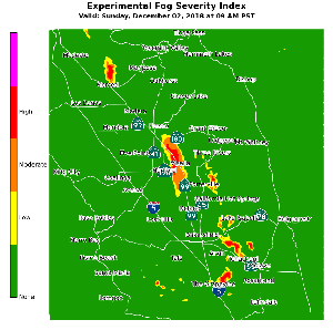
The National Weather Service has a map of predicted fog severity.
This below is not the current one, but just an example and the one at the webpage is much easier to read:
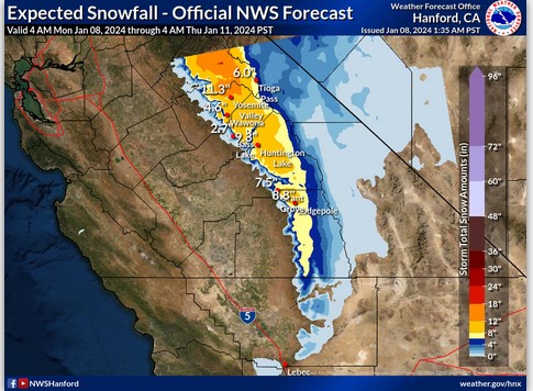
The National Weather Service has an expected snow fall map.
The one below is not current, but is offered as an example:
Just before you leave, call 1 800 427-7623. It is voice activated, so say 140 or 580/205/120 or whatever highway number(s) for road conditions, detours, etc. The Yosemite road and weather phone message is 1 (209) 372-0200.
CALL the road info number before you leave town, and perhaps more than once during your drive!
Besides rock slide closures, hazardous tree removal or road paving may be planned along your route.
Below rockfall during a January storm:
![]()
and the slide on Highway 140 that closed it starting in March 2025. Then it went to one-way with traffic control:
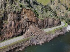
The Park service has noted: “drivers are reminded of the greater likelihood of encountering rock debris on park roads during wet weather. Although rockfalls are always possible along all park roadways, they tend to happen more often during winter storms. . .
If you encounter small rock debris on the road, drive through the area (do not stop within the debris) and promptly report it to Park Dispatch. Do not attempt to remove the debris yourself – leave that task to road crews equipped to do so safely. If you encounter large rock debris on the road, turn around and promptly report it to Park Dispatch.”
Having a at least half full gas tank gives you a better opportunity to change routes, idle, drive slowly or turn back, and especially to turn around and take another route if you do not find out about a road closure before you leave town or if it becomes closed when you are already on your way to the park.
The park can’t put up signs warning of every weather related hazard, so moderate speed driving is always recommended, and it is wise to turn off cruise control when conditions are wet.
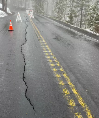
When Big Oak Flat Road in Yosemite National Park was closed in May 2023,
“the road has a crack that is about 200 feet long and up to four feet deep. The road surface has moved two to three inches vertically and horizontally and is continuing to move. The embankment below the road has moved as much as 15 feet downslope and has significant water flow through it. It is not safe to open the road even to limited traffic, and doing so would likely lead to additional road failure.”
And after some repairs, the road had three single-lane sections controlled by traffic lights.
– – – – – – – – – – – – – – – – – – – – – – – – – – – – – – – – – – – – – – – – – –
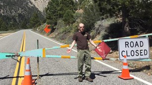
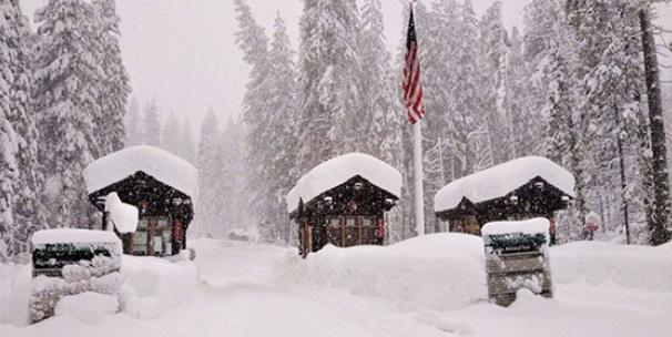
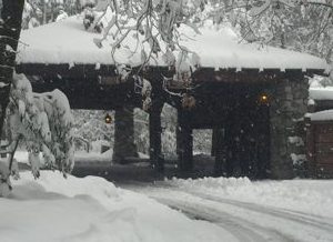
(Very rarely) there can be enough snowfall in one storm
to temporarily close all roads into Yosemite Valley
and it can take one or more days to clear all the roads, (140 is usually cleared before 120.)
During huge snowstorms snow can pile up at 2-4 inches per hour, and snowplow crews are unlikely to keep up with that rate while the storm is active.
Below an entrance station:
![]()
There is an EV Charging Station just outside Yosemite valley on your drive in on Highway 140, in El Portal. The NPS notes it the EV charging station is “located in the parking lot adjacent to the El Portal Market and Gas Station, it features two level 2 chargers. Chargers have a J1772 connector with a power output of 11 kW.”
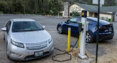
See more Electric Vehicle charging stations in Yosemite valley at the Yosemite Garage webpage
The closest gas stations to the Ahwahnee hotel are in El Portal just outside the park ( 15 miles – 30 minutes from the hotel) or within the park at Crane Flat (16 miles – 30 minutes from Yosemite valley) or Wawona (28 miles – about an hour from Yosemite Valley), each 24 hours with credit or debit card at the pump, IF the pumps are functioning.
(Rarely the gas pumps are not available, for example during a Planned (or unplanned) PG&E Power Outage, or when they are doing an Air Pollution Control Test, or when Mariposa County inspects the fuel tanks a downtime of 2 or 3 or 4 hours can be expected and when Fuel bank systems are being upgraded stations will not be open for business on the day of installation. When repairs are needed, downtime can be days “pending the arrival of replacement parts,” or they might be, for example, “currently out of 87 octane gasoline. 91 octane and diesel are both still available. We are expecting a delivery tomorrow and the gas pumps should resume normal operation.”)
There are no gas stations in Yosemite valley. If you run out of gas or almost run out of gas in Yosemite valley, and would not be able to get to the nearby-but-not-close gas stations listed above, the Yosemite garage often has 5 gallon containers of gas to sell AAA / CSAA members .
The Yosemite garage can handle most minor emergency repairs such as battery charge, radiators, water pumps, brakes and tire repairs, (IF they happen to have a needed part in stock, otherwise they will have to order it or you will need to look for help elsewhere, which could include expensive towing out of the park, so people are advised to check everything that powers, stops, cools, heats, ventilates and lights their vehicle before they leave on an adventure. Check the windshield wipers, defroster, exhaust system, antifreeze level and tire pressure. Perhaps consult Prepare for winter driving which has a link to bad weather driving tips, tips for using tire chains, tricks for dealing with frozen car locks, how to prepare your vehicle for winter driving, how to de-fog the windows, a winter survival kit for your car and what to do if you get stranded. Don’t have tire chains? Yosemite requires them in the winter (and even in the spring or fall). Try: Snow chain rentals and see: Safe driving in rain and fog.
–In the winter, keep at least a half-full gas tank (to prevent gas line freezeup). Why? Any space above the gas in the tank has moist air in it. In the cold, especially overnight, that can condense into water. The water will sink to the bottom of the tank and if enough builds up it can end up going to your fuel line and cause hard starting or even block the fuel line completely.
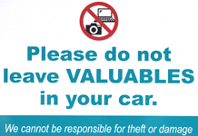
This warning from Canada can apply to any long-distance drive: “Visitors to large cities and popular tourist destinations should be aware that parked cars are regularly targeted for opportunistic smash-and-grab thefts, and they are cautioned to avoid leaving any unattended possessions in a vehicle, even in the trunk. Due to the high incidence of such crimes, motorists in Montreal, Toronto, Vancouver and some other jurisdictions can be fined for leaving their car doors unlocked or for leaving valuables in view. Visitors should exercise precaution to safeguard their property.”
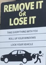
Another source mentioned smashed windows when car thieves target property left in plain sight
such as luggage, purses, electronics, laptops, tablets, and even expensive sunglasses.

Yosemite Park entrance fees:
You will need to pay a park entrance fee. The Yosemite park (valid for seven consecutive days) entrance fee as of early 2025, is $35 per vehicle or $20 per motorcycle.
A Yosemite annual park pass will cost $70.
A National Parks and Federal Recreation Lands Interagency annual pass costs $80 for a year.
OR find someone who is an active duty U.S. military member or dependent and has their ID Card (CAC card or form 1173) and can get a free national parks pass
OR someone who is 62 or over to get a lifetime seniors pass for $80.
See current park entrance fee details.
(The passes can’t be transferred/shared, the pass holder needs to be in your vehicle and show a photo ID.)
Yosemite National Park will not require vehicle reservations to enter the park in 2026 (they did some months of 2025).
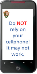 Your cell phone will not function in a lot of Yosemite. You would want a paper road map, rather than trying to get to a map on your cell phone that is not functioning and you need to take a different route than you had planned.
AND there could be times that only people with a reservation in the park for a hotel, campsite, backpack permit, etc. are allowed into the park (due to extreme winter weather and snowfall, trees falling), or past a given intersection due to lack of parking beyond that point, so
– you would have wanted to print the reservation for your hotel (or campsite, etc.) stay and bring it with you, along with your photo ID, to show the ranger who stops vehicles and asks for the info.)
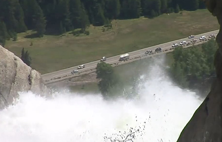
Expect traffic gridlock:
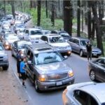
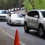
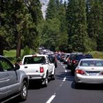
and from a 2017 park service video:

DIRECTIONS to get to the Ahwahnee hotel
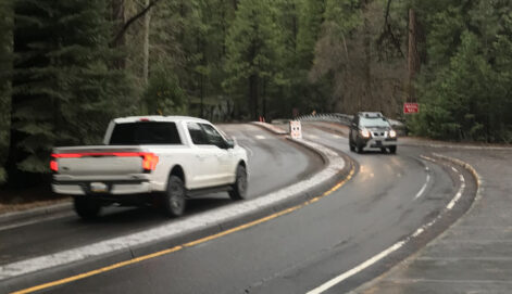
All the signs, roadways, etc. shown below could change without notice, so take a look before you make any turns.
Sometimes one or more roads are closed suddenly due to a rock fall / mud slide that needs to be cleared. Roads that were two lanes in the same one-way direction can need to be designated as two-way. Watch for signage and please be assured that some drivers will not notice the changes, even with multiple signs. (There was a large sign with flashing lights at the beginning of this section of road designating this change and then four of these yellow double arrow signs alongside the road on both sides. We watched multiple vehicles drive in the wrong lane for part or all of this section of road.)
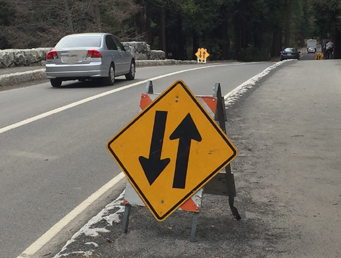
![]()
Roads in Yosemite valley were changed considerably during the Yosemite Valley Circulation Pilot.
In some areas, roads are quite different than previously (example: some two way roads are now only one way), and people could find themselves taking a wrong route in the valley
that could add at least a half-hour to their travel time.
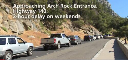
And note what it says at Plan Your Visit: Traffic:
“Any time spring through fall, one- to four-hour delays are possible at entrance stations. It’s best to arrive by 8 am or in the afternoon to avoid delays.”
The Yosemite Conservancy sent an email to donors:
“If you do choose to brave the crowds, be sure to sign up for the park’s new traffic alerts by texting YNPTraffic to 333111.
The system provides real-time updates on parking and traffic diversions in Yosemite Valley.”
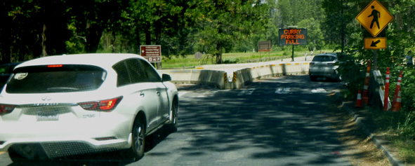
Examples of updates:
“Advisory: YNP Traffic Alert – Curry village parking full. Parking may be available at Yosemite Village or Yosemite Falls parking area. Please park only in designated spaces.
(and 29 minutes later the same day)
“Advisory: YNP Traffic Alert – Yosemite Village parking full.”
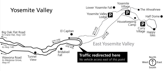
“YOSEMITE: East Yosemite Valley is closed. Vehicles are being turned around near El Capitan. Watch for pedestrians.”
On the Friday afternoon of Thanksgiving weekend: “YOSEMITE: Help us maintain emergency access by parking in designated spots. Vehicles in the roadway will be towed and/or cited”
and not just traffic, but also road closures:
“YOSEMITE: Tioga Rd (Hwy 120 through the park) temporarily closing due snow on Sun, Oct 27, at 6 pm. Please call 209/372-0200 (then 1, 1) for updates.”
“YOSEMITE: Big Oak Flat Rd. (Hwy 120 toward Yosemite Valley) closed overnight due to snow. Chains required on other roads. Updates: 209/372-0200 (1.1).”
” Thu, Feb 19, 2026 at 4:53 PM Advisory: Yosemite Alert!
Yosemite National Park is closed through Friday due to heavy snowfall and falling trees. Visitors with lodging reservations may enter the park via Hwy. 140.”
When Yosemite valley parking lots fill, here is a park service map of how incoming traffic was redirected:
– – – – – – – – – – – – – – – – – – – – – – – – – – – – – – – – – – – – – – – – – –
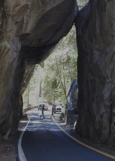
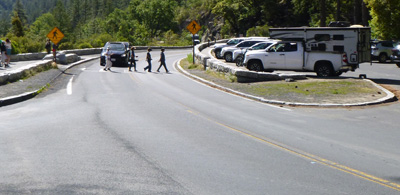
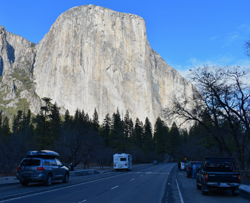
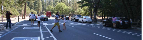
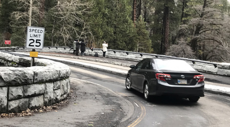
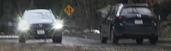
If you decide to come into the park on 140 and through the Arch Rock Entrance Station, please be advised to watch out for pedestrians crossing the road suddenly to get a picture
– – – – – – – – – – – – – – – – – – – – – – – – – – – – – – – – – – – – – – – – – –
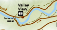
In the map above, after 120 and 140 meet in the valley, along the top road shown on the left, you cross the river on the Pohono bridge and the road becomes a giant one way loop from the west end of the valley to the east end (unless there has been a rockfall on part of it, or if the park is doing road repairs on the outgoing part of the loop, then it could be two-way). Just before the bridge, coming towards you from the left is Northside Drive (usually) one-way. Don’t be one of the people who does not see the signs telling them to not drive on Northside Drive.
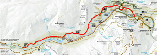
Southside Drive runs almost the length of Yosemite valley, in a one way direction west-to-east, as outlined in red in the map section below:
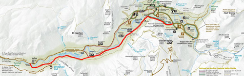
or as seen in this drawing
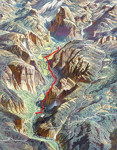
You can see a full sized copy of this drawing.
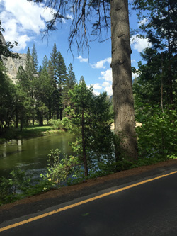
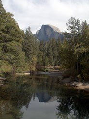
After crossing the bridge, as you go along the next section you will catch glimpses of the Merced River on your left:
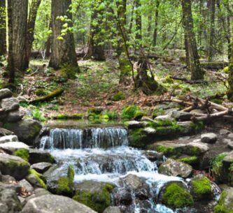
If you are in the right hand lane you might find room for your vehicle in a small turnout on the right to see Fern Spring:
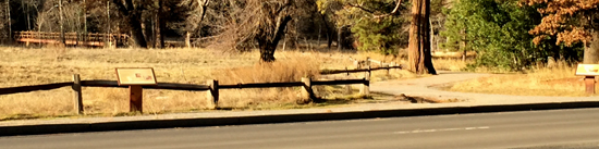
Along the upcoming section of road is a John Muir display many people look for in Yosemite, a sign at a turnout on southside drive where John Muir camped with Theodore Roosevelt. The park service wrote about their camping trip together: “Roosevelt had sent Muir a letter asking to meet him in Yosemite: “I want to drop politics absolutely for four days and just be out in the open with you.” At their meeting, Muir spoke of environmental degradation, like development, and asked for another layer of protection as a national park to improve management. Muir convinced both Roosevelt and California Governor George Pardee, on that excursion, to recede the state grant and make the Valley and the Mariposa Grove part of Yosemite National Park.” This was the start of Yosemite National Park.
This sign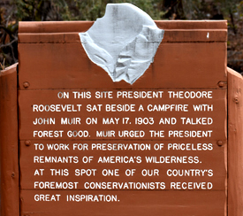 is at a turnout on the right hand side of Southside drive, 0.45 miles east of Pohono Bridge, where Southside Drive first comes away from the river.
and see also how to find the location of John Muir’s cabin (hang nest) and sawmill in Yosemite Valley.
A little later, from the right, the road (highway 41) from Oakhurst/to Badger Pass “Wawona Road” on the map above, joins this route.
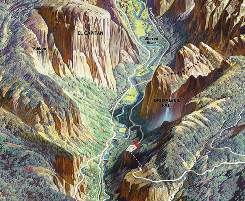
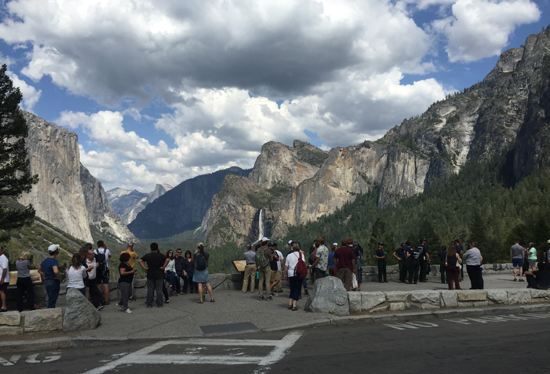
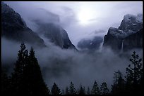
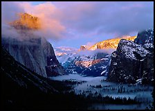
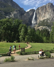
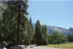
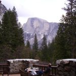
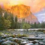
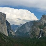
Taking a brief stop on the Wawona road if it is your route, (or taking a side trip up the Wawona Road if you took 120 or 140) to Tunnel View (see pictures below) can be quite worthwhile especially if you are coming into the park in daylight.
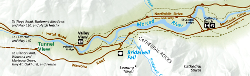
NPS photo of Tunnel View (the massive rock form on the left is El Capitan, in the background in the center is Half Dome, the waterfall on the right is Bridalveil Fall:
This view is worth stopping for even if you are running late and even if there is rain or snow falling. The Yosemite Fund (now called the Yosemite Conservancy) and the National Park Service funded a remodel in 2008 with educational exhibits, expanded handicap accessible viewing area and improved traffic flow. Thousands of people stop each day in the summer.
Google maps 360 degree street view at Tunnel View .
The red X below is where Tunnel View is (the dotted line below the X is the tunnel):
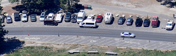
The two parking lots, one on each side of the road, have a small number of parking spaces:
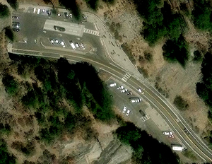
Many drivers who are watching the scenery do not notice the crosswalk between the two parking lots. If you plan ahead while driving through the area, you can slow down and look for people waiting to cross:
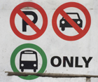
The larger of the two parking lots has a bus parking only section:
At the edge of the larger parking lot is a paved section for photographers with a low wall:
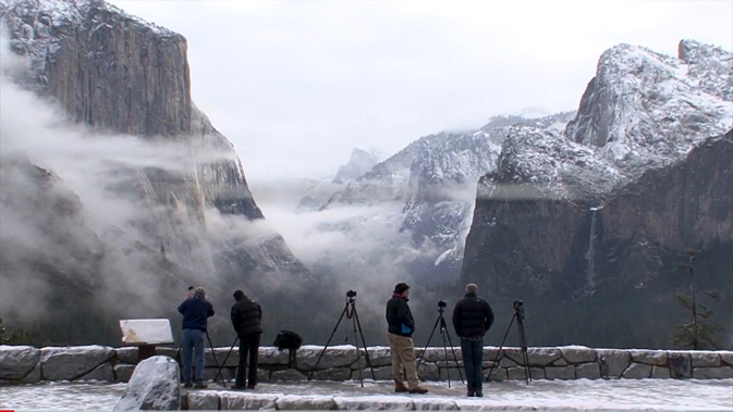
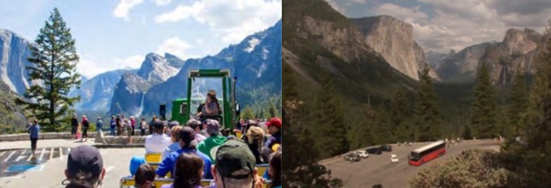
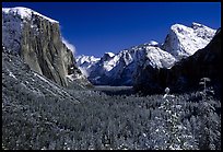
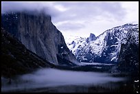
More photos of the view from the parking lot at tunnel view:
photos below by Quang-Tuan Luong/terragalleria.com, all rights reserved.
![]()
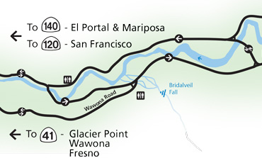
Where all the routes into Yosemite Valley merge is at about the center of the map below, where the lower road labeled Wawona Road comes into the Yosemite Valley Southside Drive:
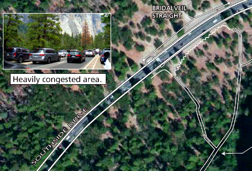
0.25 miles east of the intersection of Southside Drive and Wawona Road there are long paved turnouts at Bridalveil Straight on both sides of the road with a view of El Capitan on the left
and Bridalveil Fall on the right, where a long trail to Bridalveil fall comes out to the road.
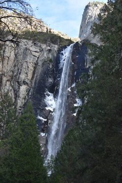
Watch out as you drive through here for people standing in the roadway to look at the view, get a picture, often not looking out for oncoming traffic:
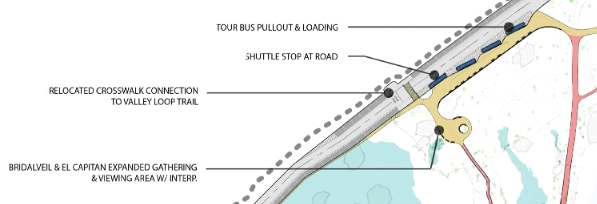
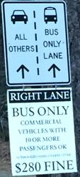
Bridalveil Straight was redesigned in 2022. Note that if you want to stop here, as you approach you should be in the left hand lane to find a parking space, as much of the right hand lane is a no parking zone designated for shuttle buses and tour buses. (The four thin blue rectangles in the map below are to show busses.)
__________________________________________
In the summer this section of road can have a bus/emergency vehicle lane in place and drivers of private vehicles must stay in the left lane. Signage is put up when this is in effect.
Follow signs that say “to all Valley Destinations” for about five miles. The river will be on the left side of the road, although you won’t be able to see it at times.
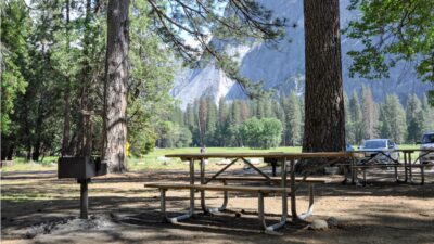
You’ll go past a few turnoffs to picnic areas. There will be a stretch of road with meadows on both sides and a row of parking on the left where you can stop and see Yosemite Falls on the left, or Half Dome a bit farther on the right.
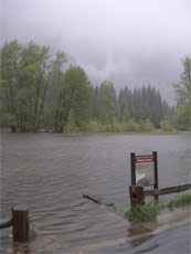
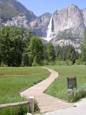
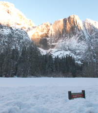
Here is one of the boardwalks next to the parking, across the meadow (picture taken in May):
In the NPS photo below of flooded Sentinel Meadow taken May 16, 2005, you can just make out the sunken edge of the boardwalk across the meadow between the two posts on the fence and can just see Yosemite Falls thru the low clouds in the background. Next to it is the same place in June, 2005 and again in February 2008
– – – – – – – – – – – – – – – – – – – – – – – – – – – – – – – – – – – – – – – – – – – – – – – – – – – – – – – – – –
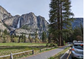
Here is the view of Yosemite falls from the parking on the left hand side of the road
and here is the view from the top of Yosemite falls looking down at this strip of parking spaces on Southside Drive:
If you have a few extra minutes and can find parking on the left hand side of the road,
a short walk takes you to a display about massive flooding when Yosemite valley has turned into a lake. At the end of the left hand side of this Southside Drive long parking strip, directly across from the chapel,
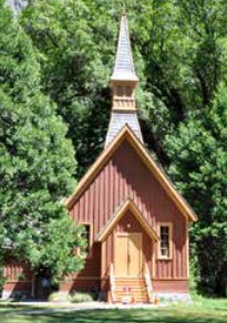
follow a path towards a pedestrian bridge over the river.
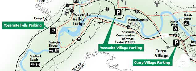
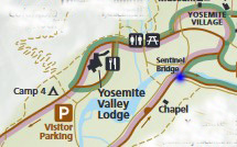
The map below of free day use parking lots shows the chapel in about the middle of the map, and a dotted red line showing the path to the bridge. The bridge is just below the letter “M” in the words Yosemite Valley Lodge in the map below.
The bridge is in the upper left hand side of this photo:
You can stand next to the display
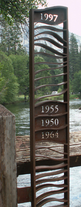 and see that the water flooding over the bridge in 1997 would have been up to the chin of many adults (had they been able to stand on the bridge at all).
A description of the flood display and more photos are at: Yosemite floods display on Superintendent’s Bridge. And find photos of a longer walk in the area at Cook’s Meadow.
![]()
Shortly past the Chapel on the right, you arrive at an intersection before Sentinel bridge to the left across the river.
The blue dot on the map below is this next intersection:
Plan to be in the correct lane for your destination.
And watch out for people who are not sure of which lane to be in who decide to suddenly change lanes in the middle of the intersection, or even stop in the traffic lane to consult a map. OR rarely, but it happens, who drive part way along the right hand lane, past the left hand turn over the bridge they needed to get to the Lodge, and then try to back up in that lane, even for many car lengths.
People going to the Yosemite Lodge, Yosemite Falls free day-use parking lot, trailhead for the Yosemite Falls hike and Camp 4 should be in the left hand lane and turn left and go over the bridge. Yes, you will be driving on the left hand side of the bridge, but there is an inches tall, wide barrier to separate traffic.
Here is the view as a vehicle turns on to Sentinel bridge from Southside Drive in the proper lane:
Here a view from the far side of Sentinel Bridge with a vehicle coming from Southside Drive across Sentinel bridge (right hand lane)
and a truck coming from Northside Drive on Sentinel Drive towards the bridge (left hand lane)
in what feels like the wrong lane to be in, even when you have done it quite a few times
(note the width and height of the barrier between the lanes):
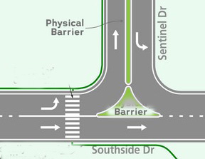
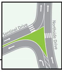
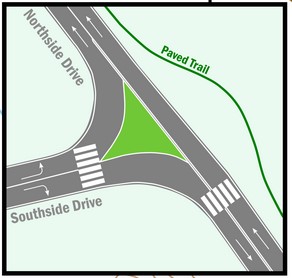
If someone drives past and around the middle-of-the-road barrier (shown in the map below as the word barrier in the green almost-a-triangle)
and starts to drive the wrong way on Sentinel Bridge, they will find multiple signs saying wrong way:
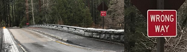
We watched one day as a driver turned left from Southside Drive onto the wrong lane on the bridge. Pedestrians on the bridge sidewalk chased after her, waving their arms and stopped her past the second Wrong Way sign.
She then backed up off the bridge
and instead of turning and continuing on Southside Drive in the proper direction, turned around, went around the large barrier and seemed to be heading for the proper lane to cross the bridge.
But instead she put on her emergency flashers and drove back the way she originally came on Southside Drive, with traffic coming at her,
as she was driving the wrong way on the 2-lanes-in-one-direction road.
(After she drove down into Yosemite valley, from whichever entrance, she had driven 5 to 6 miles on Southside Drive with both lanes in the one-way direction, and now she put on her flashers and drove the wrong way . . .)
As she passed us, we were on a path near her side of the road, facing her and waving our arms widely and frantically (and we saw a cell phone up to her head).
Watch out when approaching this intersection.
and note that this is not the only section of the one way roads that circle Yosemite valley
that you can find wrong-way drivers on.
– – – – – – – – – – – – – – – – – – – – – – – – – – – – – – – – – – – – – – – – – –
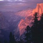
After sunset Sentinel bridge may have lots of photographers trying to get a picture of Half Dome with pink or gold color
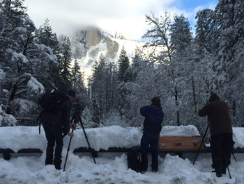
and if the water is flat enough, the reflection in the Merced River, as in the NPS photo below:
– – – – – – – – – – – – – – – – – – – – – – – – – – – – – – – – – – –
If you turn left over the bridge, the road bears right and then bears left on to Northside Drive, where oncoming traffic in the other lane is coming from the east end of Yosemite valley.
People going to Yosemite Valley Lodge can find maps of the hotel and area at Yosemite Valley Lodge.
People going to Camp 4 can find a map at Camp 4 (four) Map.
![]()
– – – – – – – – – – – – – – – – – – – – – – – – – – – – – – – – – – – – – – – – – – – – – – – – – – – – – – –
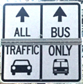
Straight ahead after the intersection at Sentinel Bridge is two lanes in one direction,
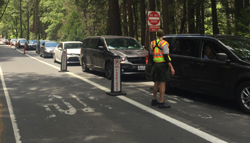
if signs tell you to, get in the left lane because the right hand lane is for buses/ambulances only, as are some other roads in the valley at some times of the year.
In busy traffic times, if you get tired of waiting for traffic to move, and think you don’t see an officer, so you move into the bus only lane, you might find two law enforcement rangers on bikes stopping you:
![]()
– – – – – – – – – – – – – – – – – – – – – – – – – – – – – – – – – – – – – – – – – – – – – – – – – – – – – – – – – –
When you drive straight ahead instead of turning left over Sentinel Bridge,
you then go past Housekeeping Camp on the left with the laundromat (sometimes open all year even in winter when Housekeeping Camp is closed), bear left when you enter the parking lot to get to the laundromat.
Then past some employee housing on the right, 27 “one- and two-story structures providing housing and shared common spaces and a wellness center.”
If you arrive after dark in winter you might see the lights of the ice rink to the right.
Finally this usually one-way section of road comes to an intersection that previously had stop signs and two-way traffic.
Plan ahead which lane to be in as you approach this next intersection.
During high traffic times, especially on busy weekends in the summer, traffic at this intersection can be backed up for many car lengths.
A ranger might be directing people who do not have reservations for Curry Village or a Pines campsite to turn left and not try to park in the full parking lots to the right.
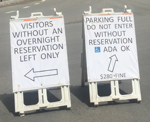
Or there might be different signage,
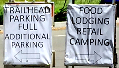
Be in the right hand lane and turn right to go to Curry Village Curry Village free day use parking lot, Curry Village (briefly named Half Dome Village), with the wood floor canvas roofed/walled tent cabins and the Pines campgrounds.
OR get in the left lane and turn left to go to Yosemite Village Day Use parking (which is a short walk to the main Visitor Center, biggest grocery, museum, Post Office, various restaurants) and to the garage, Medical Clinic, and the Ahwahnee hotel, or back out of the park.
People going to the Yosemite Lodge, Yosemite Falls free parking lot, and Camp 4 (Camp Four) who failed to turn at Sentinel bridge should also turn left at the Curry intersection.
– – – – – – – – – – – – – – – – – – – – – – – – – – – – – –
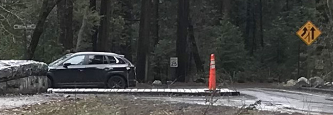
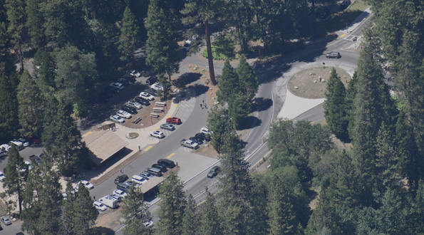
The road you turn left on to eventually bears left again, goes past one side of the Ahwahnee meadow, and brings you to the round about that is no longer used as a circular road as you might be used to.
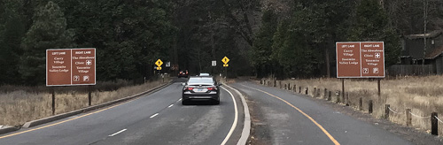
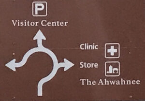
The first set of signs (photo below) tells you:
Left Lane
Curry Village
Yosemite Valley Lodge
Right Lane
The Ahwahnee
Clinic
Yosemite Village
(The photo below has two lanes on the left for vehicles and two lanes on the right for bikes and pedestrians.)
You should anticipate which lane you want to be in, and also anticipate that many people will not realize which lane they should be in and may change lanes suddenly or even come to a full stop in the roadway.
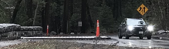
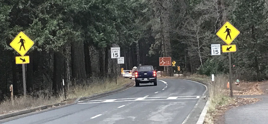
Past these signs, before the round-about, there are signs warning of a pedestrian crosswalk,
15 mile per hour speed limit signs, and another sign tells you that the Left Lane Must Turn Left (and go around one side of the former round-about)
This round-about (tan circle in the right hand side of the photo below) was originally rotary (driven in a circle), but the new traffic plan turned it into two sections of road, both sides of the circle going in the same direction.
Cyclists and pedestrians as well as drivers should be even more careful than usual as some drivers may be distracted, may not yield to traffic already in the circle, or may stop completely instead of driving into it, because they are not sure which lane they should be in or where they should exit the round-about.
If you want to go to the Yosemite Lodge, Camp 4 (Camp Four), Yosemite Falls free day use parking or back out of the park, you circle around the round about from either lane and continue on Northside Drive.
Northside Drive runs almost the length of Yosemite Valley as a one-way road, from east to west, as outlined in red on the map below:
OR if you want to go to the store, garage, medical clinic or the Ahwahnee hotel you briefly enter the round-about and turn right, as shown in this sign showing the right lane route:
If you briefly enter the round-about and turn right, you then drive on a two-way road past the garage and more on your right / the backside parking lot of the main grocery store (which has pubic restrooms and handicapped parking) on your left and make a right at the stop sign.
The next (two-way) road section, Ahwahnee Drive, takes you past the Medical Clinic on your left, then past the Ahwahnee meadow on your right, Church Bowl on your left (a small picnic area with restrooms).
As you pass Church Bowl your view ahead of Half Dome is blocked by 114 Ponderosa and 117 Cedar trees which will be removed to restore the view.
This next photo is from the Merced River Plan which says about the tree removal work. . .”large trees help buffer the impact, and potential damage, of rockfall by absorbing some of the force and rock debris. Most of the trees currently obscuring the view are outside of the rock fall zone, on the south side of the road and not effective in protecting any structure. No trees on the north side of the road within the rockfall hazard zone will be removed.”
Find this photo in the Merced River Plan
Scroll down to Final Documents and click on Volume 3A: appendices A-L, then find page H-27.
When a helicopter needs to land in the Ahwahnee meadow (in the right hand side of the photo above), across the road from Church Bowl, to pick up someone who needs to go to a bigger hospital, (or when a helicopter needs to land for Search and Rescue training) people are asked to stay on the restroom/picnic area side of the road, and traffic going through is briefly stopped.
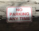
Because you won’t know a helicopter is coming and won’t be able to move your vehicle fast enough, the entire meadow side of the road at Church Bowl is closed to any parking at all times,
(even to get out and quickly take a picture or use the restroom).
In this photo you can see a few parking spaces in a row alongside the restroom/picnic area side of the road and the commonly ignored stripes for no parking with big letters on the pavement that say NO PARKING, on the other side of the road:
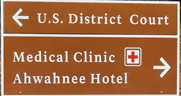
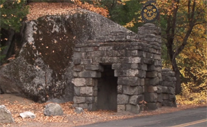
Just past Church Bowl on the left of the road is this stone entrance gate:
When you get near to the Ahwahnee the road you are on will approach a parking lot and have a deliveries road to the right, don’t take it.
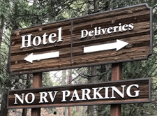
There may be a Do Not Enter sign at this parking lot entrance:
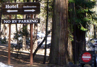
Stay on the the perimeter road that runs between the cliff face on your left and the main parking lot on your right.
and you may see a Welcome to The Ahwahnee sign asking you to “Please proceed to entrance” by staying on the road as it bears right across the far end of the main parking lot.
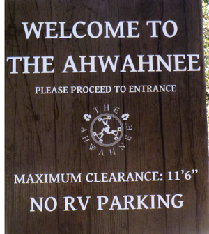
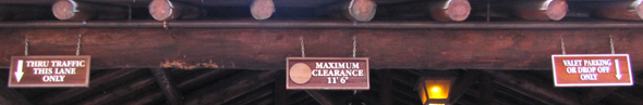
(The reason the sign says “Maximum clearance 11’6.” is because there is a roofed driveway section ahead at the hotel entrance.)
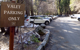
As you drive along an end of the larger paved parking lot to your right there were ( and can be again) signs:
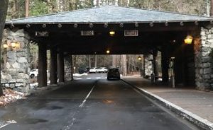
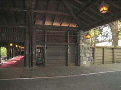
The road then bears left as you pull up under the porte-cochere (roofed two-lane driveway by the hotel main entrance).
Approaching and under the porte-cochere there are two lanes.
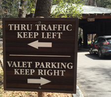
The right lane is for passenger/luggage drop off/pickups and valet parking, the left lane is for thru traffic.
And yes, more than one person got his large RV stuck
when he ignored the “maximum clearance 11 foot 6 inches” sign.
(Many rental RVs require a 12 foot clearance due to roof top air conditioners.)
At the porte-cochere, pull into the line of vehicles on the right and drop off passengers, unload luggage for the bellman to take (or you can bring them in) and have the valet park your car in the paved parking lot you just drove by.
In this photo, the driveway comes in on the right, the door to the bellman’s room is open, and the entry walkway with the red carpet is to the left:
After you walk down the roofed entrance walkway,
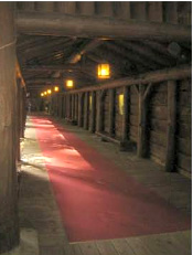
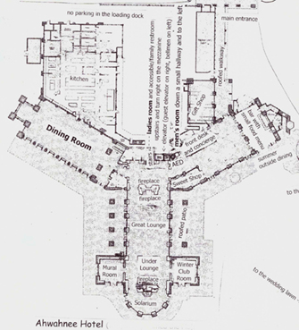
you come into the entrance lobby. The front desk to check in and the concierge will be on your right. You can take a 3D tour of the ground floor of the Ahwahnee Hotel , as shown on the map above, which starts at the front desk / concierge.
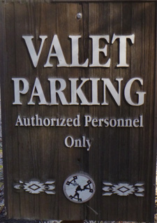
Ahwahnee Hotel Valet Parking fees are listed at a sign at the hotel entrance under the porte-cochere
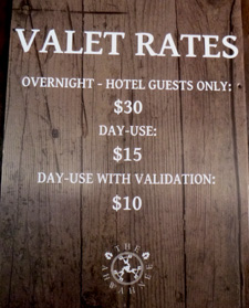
Rates: overnight – hotel guests only $30,
day-use $15,
day-use with validation $10
The website noted: *Validation is given when there is a purchase of product and/or food and beverage from Sweet Shop, Ahwahnee Gift Shop, Bar or Dining Room.”
All other parking in Yosemite National Park at day-use parking lots, picnic areas, other hotels, stores, restaurants, is free (with your paid park entrance fee or pass) or there will be a parking space at most campground campsites included in the rate you pay for the campsite. People not staying overnight at the hotel will find parking easier at almost all other locations in the park. See: Parking and traffic jams in Yosemite valley tips and tricks.
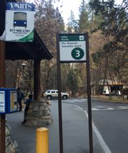
Below, the view from the free shuttle bus stop / (some years) YARTS bus stop, looking toward the Ahwahnee porte-cochere (covered entrance), notice the end of the white bus under the covered entrance towards the right hand side of the photo.
– – – – – – – – – – – – – – – – – – – – – – – – – – – – – – – – – – –
Details about 24 hour towing within the park for some vehicles, propane service, minor emergency repairs, how to use your Auto Association card to get their help, and more are at Yosemite garage, car repairs and towing. At that page you will find a list of locations of Electric Vehicle (EV) charging stations at the various hotels, near campgrounds, the Welcome Center and more. That list includes:
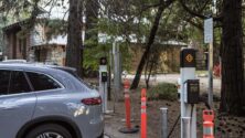
Ahwahnee Electric Vehicle (EV) charging stations (six level 2, 6 kW/h)
The Ahwahnee hotel website noted:
“If you have an electric vehicle, we have six electric vehicle chargers only available through valet parking. Electric vehicle base rate for charging is $0.37/kWh with an idle fee that begins 10 minutes after charging is complete at $0.30/minute. Please note that we do not allow pets to remain in any vehicle while parked.”
Sometimes these charging stations need repairs and will not be operable, perhaps even for days.
– – – – – – – – – – – – – – – – – – – – – – – – – – – – – – – – – – –
This Google maps street view of the Ahwahnee allows you to click on directional arrows and take a tour of the hotel.
from an NPS video you might see at a visitor center:
Not just bears, but also Ravens want to get into your gear, and some have figured out how to get into day packs or . . . a bag tied onto a motorcycle:
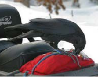
I suggest you stay with gear you tied on to your vehicle or in an open truck bed until it can get stored properly from animals / birds.
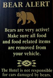
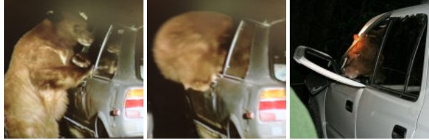
Notes on preventing bears from breaking into your vehicle are at bears.
Ahwahnee hotel map webpage has summer and winter photos of rooms, balconies, parlors, (and the views from some of them), including the Presidential Suite with the huge balcony at the (south) far end of the Ahwahnee from the parking lot, the large third floor parlor with fireplace, two main building ADA Suites, featured room 417 with its own, small, private balcony, 5th floor rooms that share a balcony, the El Dorado Diggins Suite Jacuzzi tub, the 24 cottages / (bungalows / cabins), including the classic cottages that have an alcove between the bedroom and the bathroom with a bed you can fit a child on, and a door between the bedroom and alcove for privacy, sixth floor Mary Curry Tressider bedroom, Library Suite, Underwood room, Sunroom Suite (Sun Porch), Mather, Spencer.
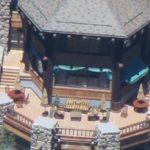
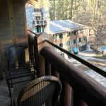
The map of the Ahwahnee hotel includes a larger version of the map below,
Parking and traffic jams in Yosemite valley tips and tricks
Yosemite trail conditions info.
Hiking Advice has HIKING SECRETS and etiquette including hiking in the heat, preventing and/or dealing with blisters, logistics of hiking, a day hike gear list, Half Dome hiking advice, winter hiking and the answer to the question: When is the best time of day to cross a mountain stream?
Yosemite webcams
Where can I take a photo that looks like the one on a Yosemite postcard I just bought?
Places to take photos of Half Dome, Bridalveil Fall, El Capitan, Yosemite Falls and Staircase Falls.
Selfies can be great, OR dangerous. They were just taking a selfie.
Using a drone is illegal in Yosemite National park, including for photography. See an index of rules and regulations webpages.
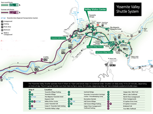
It looks something like this when there is no road construction, rock slides, excess snow affecting the times/routes:
(Map below courtesy of NPS)
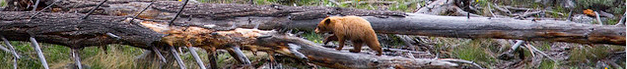
The Yosemite National Park rangers would like you to call them if you see a bear in Yosemite,
no matter where it is or what it is doing,
at 1 (209) 372-0322.
If you can, in all the excitement, try to notice if the bear has a tag (usually on the ear), the color of the tag and if possible, the number on it (the tag is large enough that with a telephoto you should be able to read the number).
The NPS notes: “Tagged, or radio collared, bears do not mean the bear is a “bad” bear. Tagging bears is done for better monitoring, and the ear tag color is completely random, used to help quickly identify a bear.”
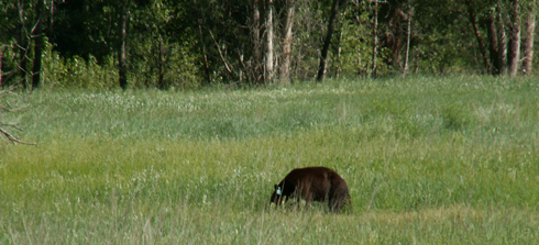
From the Yosemite Daily Report newspaper:
“It is extremely important to remember to yell at bears that are in and around development, even if they are foraging on natural food. Though it is very tempting to get close for a picture, or just to watch these incredible animals, it is important not to give into this urge. Yelling at them if they are in residential areas or near people is critical to keep bears natural fear of humans. Giving bears plenty of space. When bears become too comfortable around people, they will often start causing damage to structures and vehicles, or will even become too bold around people, creating safety concerns.”