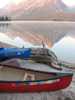
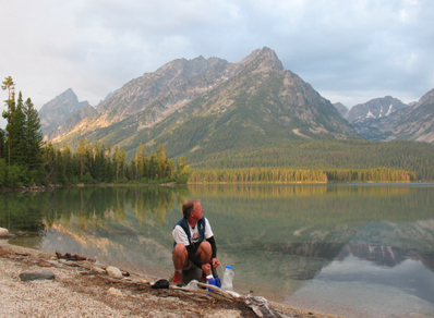
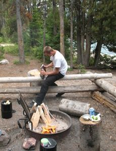
Here are some pictures and details about the kayak/canoe from String Lake to Leigh Lake (about three miles from the launch to the campsite, with a 150 yard portage) and camping the De Anza College Outdoor Club has done on Leigh Lake on our trips to Grand Teton National Park between summer and fall quarters.
(For others viewing this page, a map of all backcountry campsites in Grand Teton park is at: https://www.nps.gov/grte/planyourvisit/upload/grte_backcountry.pdf With a permit, people can camp in the Grand Teton backcountry in a camping zone, for example up Paintbrush Canyon above String Lake) or, at a designated backcountry campsite, for example at Leigh Lake. There is usually more space and privacy than at regular campgrounds as long as all users in the area respect each other’s need for quiet, but there are no restroom facilities.
There are no campsites on String Lake.
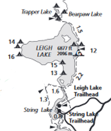
Leigh Lake has 7 campsites and one group site.
On the west side of Leigh Lake 14A, 14B and 16 are boat-in only and along with boat in or hike-in sites 13 and 15 have more privacy than those on the east side of the lake.
Leigh Lake campsites 12 on the east side of the lake (more than one of these) have less privacy as the trail goes next to or even through them and some day hikers “share” the beach right at the campsites, right next to campers tents.
Leigh Lake distances to campsites
.9 mile String Lake picnic area to the portage between String and Leigh Lakes
portage to campsite 13 is 3/4 mile, to #14 is 3 miles, #15 is 1 1/4 mile, #16 is 2 3/4 miles,
#12 is 1 1/2 (+ / -)
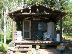
2.8 miles portage to the ranger patrol cabin at the far end of Leigh Lake, often occupied in the summer.
And from the junction at the north end of Leigh Lake, about a 5-7 minute hike to Bearpaw Lake.
Bearpaw Lake, 3 campsites: “most visitors hike in the 3.7 miles from Leigh Lake Trailhead. Boat in is possible for these sites, but you need to beach your boat on the north end of Leigh Lake and walk in a half mile to the campsite.”
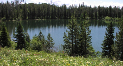
Trapper Lake, with a campsite, is at the far end of Leigh Lake (plus a short hike), 9.2 mile /14.8 km round trip.
Looking down on Leigh Lake (at the left) and Jenny Lake (at the right)
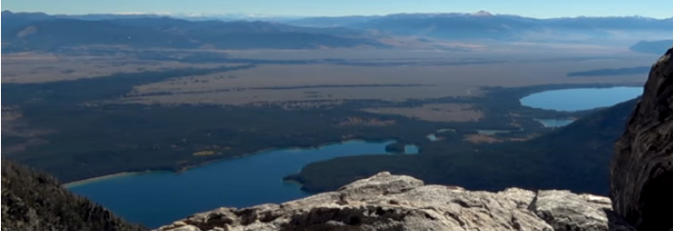
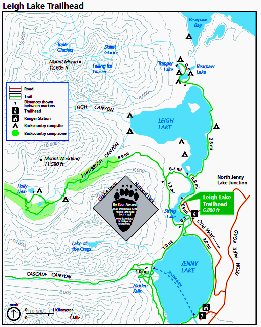
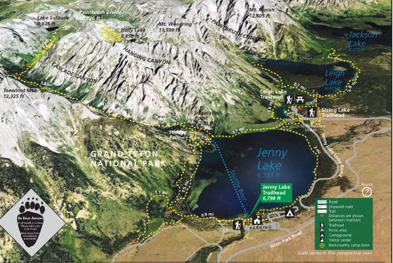
You can print a larger copy of the topographical hiking map below, with Leigh Lake, String Lake, Jenny Lake, Cascade Canyon, Paintbrush Canyon, Holly Lake, Trapper Lake, Bearpaw Lake at: https://www.nps.gov/grte/planyourvisit/upload/Leigh_Lake_topo.pdf
(Jenny Lake Lodge is just above where the letter “O” is on the One Way road designation.)
The NPS photo map below show Jenny Lake, String Lake, Leigh Lake, Paintbrush Divide, Cascade Canyon, Paintbrush Canyon, Hanging Canyon, Mount Woodring, Mount Moran, Teewinot, Holly Lake and Lake Solitude.
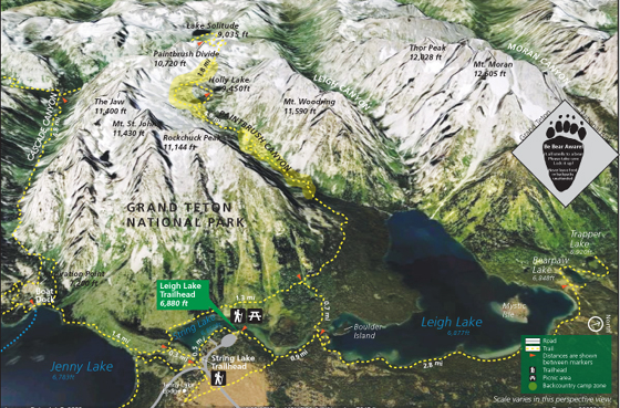
The NPS photo trail map below shows Thor peak, Mount Moran, Mount Woodring, Rockchuck Peak, Mount Moran, Paintbrush Divide, the Jaw, Jenny Lake, Leigh Lake, String Lake, Bearpaw Lake, Trapper lake, Paintbrush Canyon, Leigh Canyon, Cascade Canyon, Moran Canyon, Holly Lake and Lake Solitude.
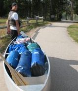
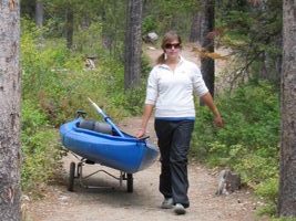
![]() From the launch site on String Lake to the portage trail is it almost a mile and a half. At the launch site on String Lake there is a wide paved path from the parking lot to the lake. (No, Jackson is not dragging that canoe, it has wheels tied on the stern end away from him. They will come off and go into the canoe when he launches and go back on for the portage between String Lake and Leigh Lake. See photos further on at this page for more examples of using kayak / canoe portage trailers.)
From the launch site on String Lake to the portage trail is it almost a mile and a half. At the launch site on String Lake there is a wide paved path from the parking lot to the lake. (No, Jackson is not dragging that canoe, it has wheels tied on the stern end away from him. They will come off and go into the canoe when he launches and go back on for the portage between String Lake and Leigh Lake. See photos further on at this page for more examples of using kayak / canoe portage trailers.)
Overnight parking at the String Lake parking lot is only permitted for those with a backcountry permit and when you pick up your permit you give the ranger the description of the vehicle(s) you will be parking overnight.
For most of our Grand Teton kayaking we kayak two people per craft, but for the overnight we go as single paddlers, with our sleeping bags, clothes, etc. in dry bags and the seats adjusted as needed. Note that the kayaks the college owns are open and more like small canoes than the river kayaks that enclose your legs.
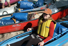
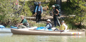
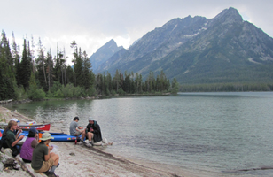
Below, Jessica Hoyer on the 2005 trip. On the 2011 trip some people hiked in (but the paddlers carried the heavy gear) and where the trail came close to the lake, they stopped for a picture together:
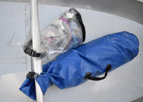
Dry bags can be clipped to the kayak thwarts and or to each other to secure them:
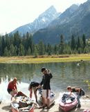
Below: portage sign at the shore at the end of String Lake, landing at the end of String Lake (Jessica Hoyer, Alan Ahlstrand, Daniel Krohn and Shannon Mathey), the portage with a trailer Alan made,

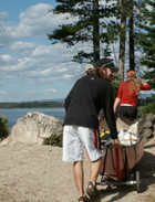
The portage trail was built extra wide to accommodate people with their canoes and kayaks.
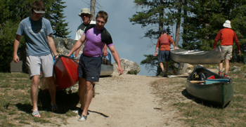
The portage trail sometimes has traffic jams. We’ve seen up to twenty craft in one time period in the afternoon and packers bring through horseback riders. (2007 and 2013 pictures)
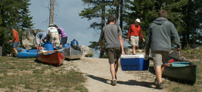
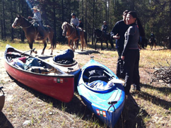
 At both ends of the portage trail there are metal food storage lockers so people who overnight on Leigh Lake can safely store their food from bears while they carry their craft along the portage trail. Since we usually have a big group we can have a person stay with the boats and gear at each end of the portage to prevent thefts by bears or people. (Or even just chase off ravens trying to peck into gear and nibble.)
Originally Grand Teton National park built extra-wide stairs for people to move canoes and kayaks down to Leigh Lake and those are shown in most of the photos at this webpage. More recently they built a ramp:

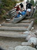
Below: a controlled slide of a fully loaded canoe down the original portage stairs to Leigh Lake. (The photos below shows the steepness of the ramp better than the newer photo above.)
(notice that people MUST be careful to stay on the up-hill end of the canoe or kayak just-in-case they lose control of it, so it will slide away from them, not over them, and only move one craft at a time down the stairs).
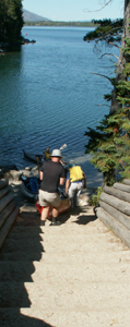
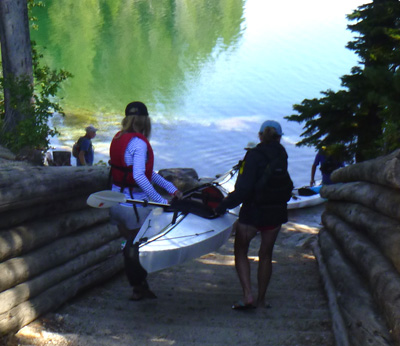
A lightweight kayak without a lot of heavy gear in it can be carried by two people if you don’t want to put scrapes on the bottom, but each person should be on one side of it, rather than at the front and rear ends (just-in-case you lose control of it) :
If you want to make your craft lighter weight while you carry it, you can store the food in the bear-proof-if-you-use-it-properly food storage box at the top of the stairs:
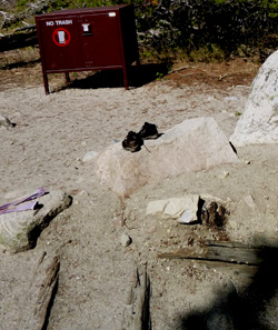
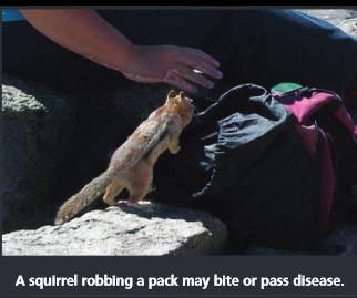
(Please do not leave a daypack with snacks in it unattended at the top or bottom of the stairs, put it and any other food in the critter-proof-if-you-use-it-properly food storage box while you bring your boat down the ramp.)
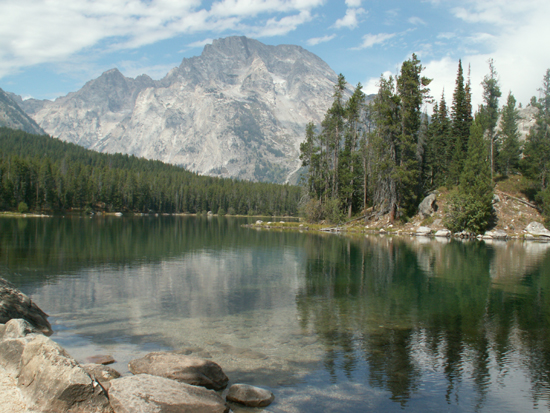
The view on the lake just after launching from the portage stairs, (Boulder Island just across the way on the right, Mount Moran in the far background):
and underway on 2.8 mile long, 250 feet deep, Leigh Lake, with portage stairs showing in background.
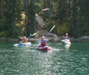
Since Leigh Lake campsites are regularly used, since 2006 we have anticipated a lack of firewood in the vicinity of the campsite area and collected a bunch along the portage trail where no one camps. Our record late start in 2006 meant that we we just beat the start of the afternoon wind, and it was a good thing because the canoe with most of the wood supply was a bit top heavy (see below with the portage stairs behind the canoe).
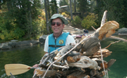
![]()
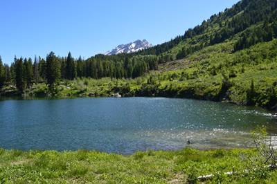
The craft beached at a Leigh Lake campsite:
The park service requires that we “secure all food items immediately upon arrival at your campsite,” so someone needs to stay with the boats as “all food, garbage, drinks, and any item with an odor” are unloaded and moved to the bearboxes. Sometimes people plan to keep their snacks handy in a “IGBC approved bear canister” that they can have out at the beach, campfire area (and keep locked when not actually getting food out of it), so they don’t have to go back and forth to the bearboxes as often.
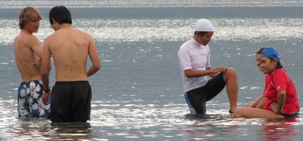
Swimming after we get camp set up
(once all the food stored and all the tents pitched),
and after we purify pump enough water to refill the water bottles and usually after we eat a little more lunch.
first photo (2008) by Mark Nevill:
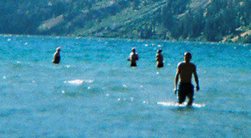
Next 2011:
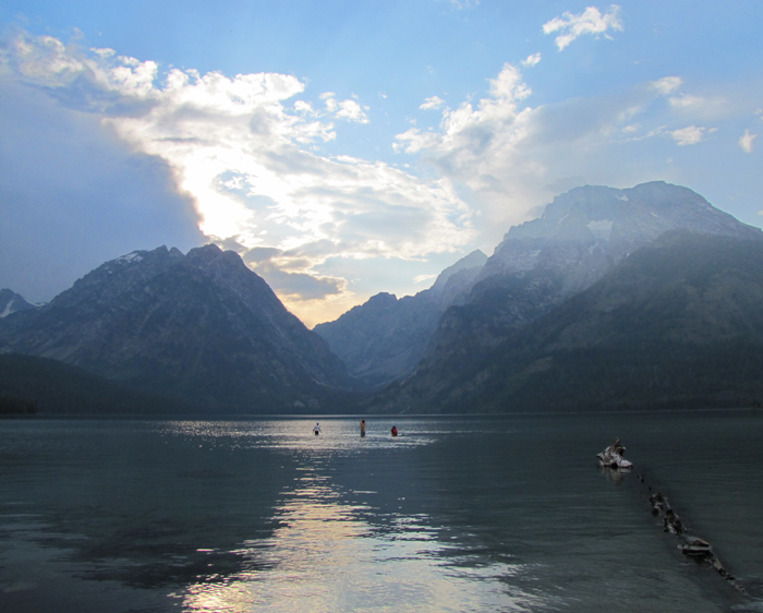
The water is shallow a long ways out into the lake. 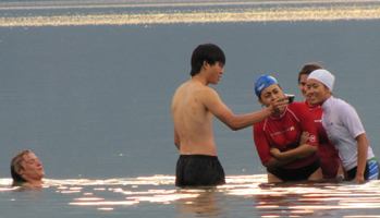
Convenient lake shore rock (with a view) to sit on while purifying lake water for drinking:
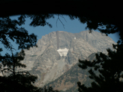
Below: a view of Mount Moran through a tent front door at our campsite.
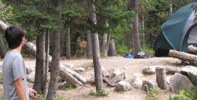
Pack in haste, repent at leisure … pretending to use a hatchet as a can opener:
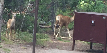
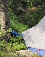
One of the generous sized campsite bearboxes (with deer wandering by):
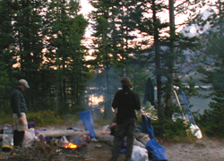
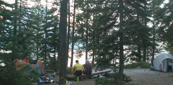
below: a campfire at dusk 2005 and at sunset 2007,
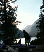
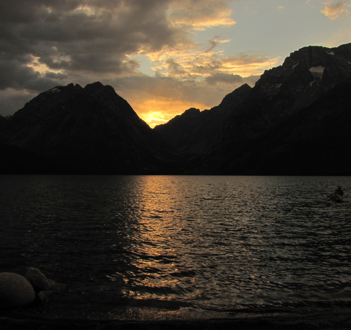
the lake after sunset 2011:
At ten p.m. on the 2006 trip coyotes chorused for us.
Much later that night Debbie Adams heard a moose walk through the campsite very near her tent but was too nervous to confirm it by looking.
Alan and Mary stood out on the beach at about 2 a.m. stargazing and watching the Milky Way reflected in the still lake water, and heard a moose walk out into the lake and back down the shore.
We found bear tracks in the sand on the beach just steps from camp the next morning.
below, morning mist on the lake:
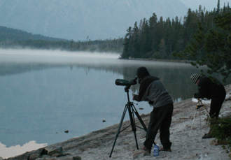
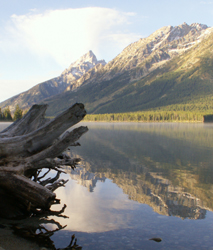
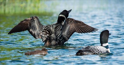
Some years we have been lucky enough to hear (and occasionally see with a spotter scope), Loons:
It was 38 degrees overnight on the 2005 trip and we found frost on the lifejackets in the morning:
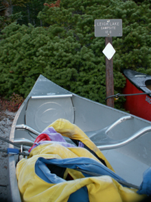
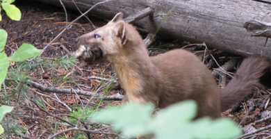 the morning of the 2010 trip
a Pine Martin dug and dug near the campsite then came up with breakfast in his mouth
This picture doesn’t do justice to the wind and choppy water we had in 2005 on the paddle back.
(We always all have real rain gear instead of floppy ponchos, great non-cotton longjohns and we eat regularly to keep the calories coming.)
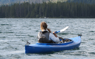 On the paddle back in 2010 we fought strong wind and the lake had small whitecaps. We heard thunder within minutes after we got back to the parking lot trailhead.
On the 2006 portage back from the overnight, club President Shannon Mathey hitched a ride (wink, wink) from Alan and Debbie:
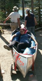
There is a bigger copy of this photo at: Picture: Debbie Adams and Alan Ahlstrand give Shannon Mathey a portage ride at String Lake, Grand TetonsSept. 2006
At the end of the 2005 trip it was too windy and cold for swimming and after the 2006 trip a flat tire needed a repair, but in fall 2002 after paddling back to shallow, relatively warm (less cold?) String Lake people swam with and without spring suits or full size wetsuits.
Below, Eric Marxmiller, Michael Gregg, Alan Ahlstrand, Mouzhan Yousefi, Duong Nguyen and Raquel Garza:

String Lake in Grand Teton National Park is located right up next to the mountains. It isn’t really a lake, it’s actually a wide section of a river. But its slow current makes it feel and look like a lake. It is often called a flat water lake because there are less waves, but when the wind comes up in the afternoon it can have mini-waves or even whitewater. The relatively flat water makes it a better swim area and great for SUPs (stand-up paddleboards) and practice paddling.
_____________________________________________
From a Teton County Search & Rescue report
SWAMPED CANOEISTS
ON LEIGH LAKE
AUGUST 23, 2024 @2:47PM
WHAT HAPPENED: TCSAR was notified of a request by
GTNP for the helicopter and pilot to respond to Lupine
Meadows for a rescue on Leigh Lake. Two females in a
canoe, without life jackets, got caught in a fast-moving
storm and capsized their canoe. One female was able to get
to the north shore and the other female was still in the water, though approaching Mystic Island when the helicopter arrived on scene. The helicopter flew in and loaded the one female from the island and then went back and short-hauled the other off the shore back to Lupine Meadows.
Why you should wear a lifejacket.
_____________________________________________
Grand Tetons is the main page about the De Anza Outdoor Club trips to Grand Teton National Park.
Backpacking Advice has food ideas.
Grand Teton trip 2014 video by Jennifer Chiou
https://www.youtube.com/watch?v=uXiHRYdgo7Q
_____________________________________________
Enhance your hike/paddle by reading:
The day hike gear section at Camping equipment checklist
Grand Teton trip equipment includes this advice: “. . . if you fly to an out of state trip, wear your hiking boots on the flight to save on weight in your luggage AND to be sure your well-broken in, comfy boots actually get to your adventure,”
and a long list of links to info to put on your on your smart-enough-phone to be able to access info more easily, including lightning strikes in the last 24 hours, the app for when Old Faithful in Yellowstone will next erupt, drawing of the Teton range peaks with the names of the peaks, from various locations.
Thunderstorm and lightning safety includes the answer to the question: Why can’t you swim during a lightning storm? A strike on a lake doesn’t kill all the fish in the lake.
Backpacking Advice has these sections: Must bring for each large group (or perhaps for each couple or person), Must bring backpacking for each person, Some (crazy?) people think these are optional for backpacking, Backpacking luxuries(?), Do not bring these backpacking, To keep down on weight backpacking, Don’t rush out and buy, BACKBACKING FOOD, Low-cook backpacking foods, Yosemite National Park WILDERNESS PERMITS and Half Dome hike advice.
Leave no trace camping has these basic principles:
Plan Ahead and Prepare
Travel and Camp on Durable Surfaces
Dispose of Waste Properly
Minimize Campfire Impacts
Respect Wildlife
Be Considerate of Other Visitors
examples and details of how easy this can be are at: Leave no trace
___________________________________
Grand Teton National Park birds has photos and details about the most common ones we can hope to see
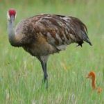
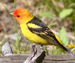
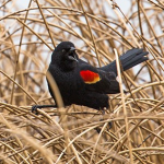
including Bald Eagle, Red-winged Blackbird, Canada Geese, Clark’s Nutcracker, Golden Eagle, Great Blue Heron.Great Gray Owl, Harlequin duck, Loon, Magpie, Merganser, Northern Flicker (woodpecker), Osprey, Ouzel, Pelican, Peregrine Falcon, Ptarmigan, Raven, Sandhill Cranes, Steller’s Jays, Trumpeter Swan, Western Meadowlark and Western Tanager, with links to calls / songs from most of them to listen to.
and you can Download photos of over a hundred birds of Grand Teton National Park
https://www.audubon.org/climate/national-parks/grand-teton-national-park
___________________________________
see also: Cell phones in the wilderness which has advice on how/when to use a cell phone to contact 911 in the wilderness and a warning about interference between cell phones, iPods and avalanche beacons.
 You can’t always expect a helicopter rescue
Can a person who is prescribed an epi-pen risk going into the wilderness? and some sting prevention notes are at: Anaphylaxis quick facts
Hiking Advice has hot weather hiking advice, hiking logistics and the answer to the question: When is the best time of day to cross a mountain stream?
Enhance your drive to the park: Road trip advice and etiquette
Many people also go to Yellowstone National park and try to do some wolf watching.
 Was that a black bear or a grizzly, a coyote or a wolf or a fox we just saw?
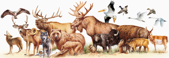 Rocky Mountain mammal size comparisons has photos and comparisons of beavers, squirrels, pika, marmot, elk, moose, bison, fox, coyote, wolf, golden-mantled ground squirrel, chipmunk, Red Squirrel (also known as) Chickaree, Unita Ground squirrels, bobcat, lynx, mountain lion (cougar), pine marten, mountain goats, bighorn sheep, pronghorn, grizzly and black bears, tundra swan, trumpeter swan, adult and juvenile Bald Eagles.
Grizzlies are rare in the Grand Tetons, but growing in number.
your safety in grizzly bear territory tells you what to do if you see a bear in the distance or a bear charges you and has info, including links to park videos about Bear Pepper Sprays.
Camping solutions for women has tips for and answers typical questions from first-time women campers, including the question: Can menstruating women camp or backpack around bears? YES
Bears has links to general info about bears, then practicalities of camping and backpacking around bears, (food storage, what to do if you see a bear) mostly geared towards our trips around black bears in California.
See also Grand Tetons sightseeing,
Grand Teton and Yellowstone National Park photos
NASA aerial photo of Teton Range
Why the record late start on the overnight in 2006? The very flat tire on the kayak trailer tow vehicle…
 Could it have been caused by the four-wheeling people did the day before? That road had been named “we’re gonna bottom out road” by previous trip 4-wheelers.
For details about our next club trip to Grand Teton National Park, go to: Grand Tetons.
Grand Tetons trip pages index has brief descriptions of most of the pages about this trip.
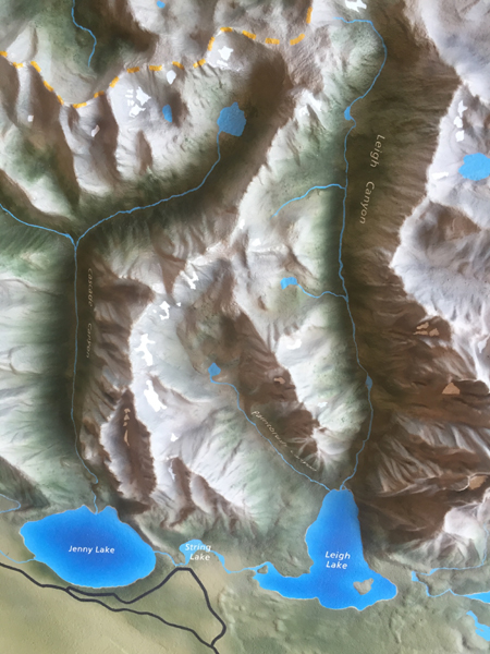
Here is a raised relief map of, at the bottom of the photo, left to right, (north to south) Jenny Lake, String Lake and Leigh Lake. It shows Cascade Canyon coming up from Jenny Lake on the left, (and at the top center of the photo, Lake Solitude), the center canyon is Paintbrush Canyon, coming up from Leigh Lake, and the canyon on the right is Leigh Canyon, also coming up from Leigh Lake.
——————————————————————-
The author of this webpage, (written as a reading assignment for my students), does not give any warranty, expressed or implied, nor assume any legal liability or responsibility for the accuracy, completeness, or usefulness of any information, product, or process included in this website or at websites linked to or from it. Users of information from this website assume all liability arising from such use.
